

WEATHER HEADLINES
- Heat advisory through Saturday
- Highs in the mid-90s, heat index 105-115 over the next few days
- The next cold front arrives on Tuesday
KANSAS CITY'S FORECAST
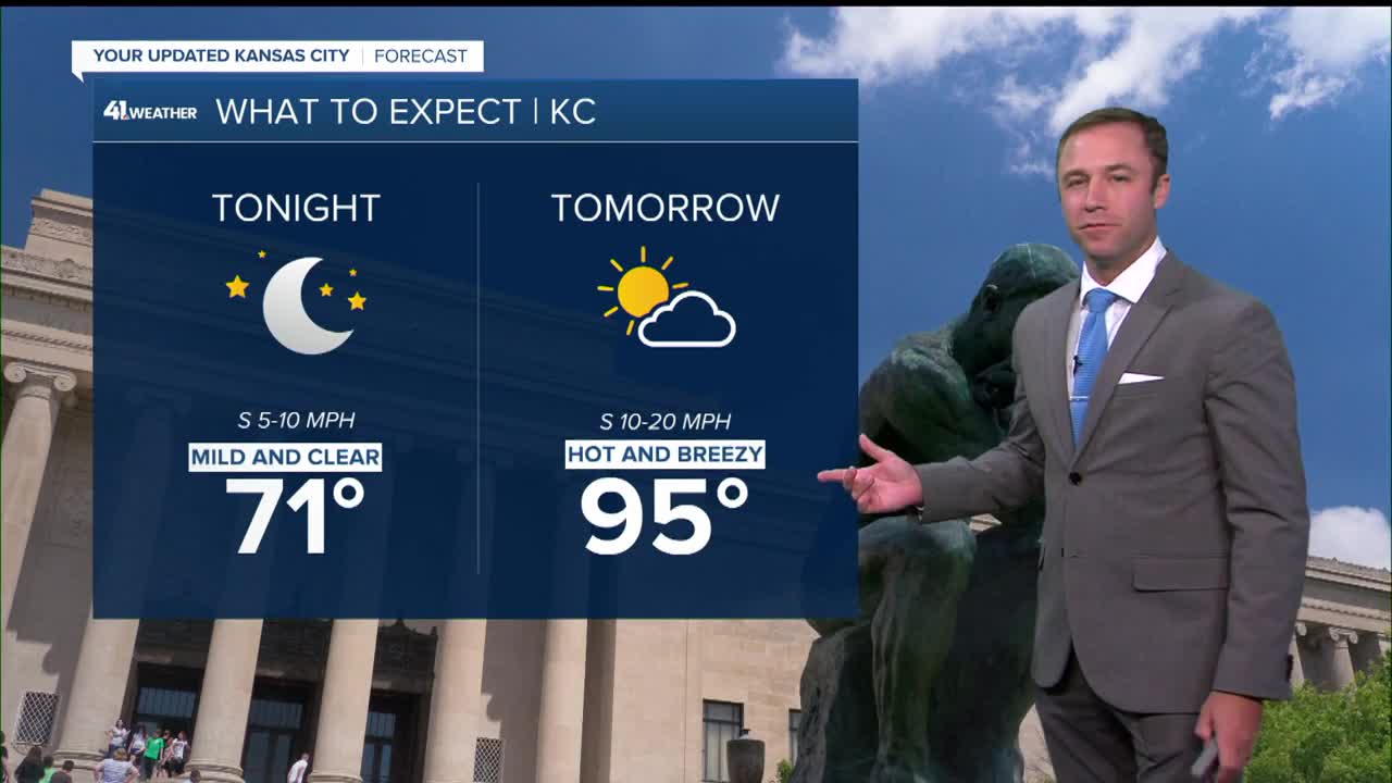
Tonight: A nice summer night under a mostly clear sky.
Wind: SE 5-10 mph
Low: 71º
Friday: High cloudiness, hot with high humidity.
Wind: S 10-15 mph
High: 95º
Heat Index: 105º-115°
Saturday: The high heat continues under a mostly sunny sky with a breeze.
Wind: S 10-20 mph
Low: 75º
High: 95º
Heat Index: 105º-115°
Sunday: The weather is on repeat from the previous few days. Hot, humid, and breezy.
Wind: S 10-20 mph
Low: 75º
High: 94º
Heat Index: 105º-115°
Get more updates from our weather team:
View our interactive radar
Read our Weather Blog
Check out the current conditions in our area
—
