

WEATHER HEADLINES
- More storms are possible tonight and Monday afternoon
- Some minor flooding and gusty winds possible
- The heat and humidity return later this week
KANSAS CITY'S FORECAST
Tonight: Scattered showers and storms possible. Some storms could have heavy rain and gusty wind.
Wind: Gust 20-50 mph in some t-storms
Low: 67º
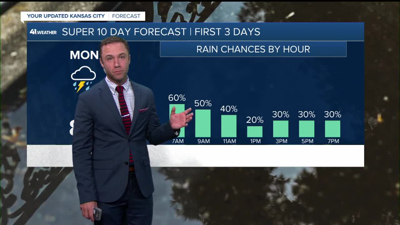
Monday: Showers and storms possible in the morning and again in the afternoon. Storms that develop in the afternoon could be strong to severe with damaging wind.
Wind: Variable 5-15 mph
High: 82º
Tuesday: Partly cloudy, warm and humid. A few showers and thunderstorms are possible.
Wind: Light & variable
Low: 68º
High: 86º
Get more updates from our weather team:
View our interactive radar
Read our Weather Blog
Check out the current conditions in our area
—
