

WEATHER HEADLINES
- Winter Weather Advisory and wind alerts until 1 am Monday
- Passing snow showers could reduce visibility and create icy conditions overnight
- Single-digit wind chills on Monday morning, as low as -10 in northern MO
KANSAS CITY'S FORECAST
Sunday: Periods of snow showers until around 10pm. Roads may become icy around 6pm and after.
Wind: NW 30-40 mph, gusting to 60 mph, windiest after 3 PM
Sunday night: Any snow ends around midnight with amounts up to 1/2"-1" with blowing snow & possibly slick roads with some ice underneath. Very windy and bitterly cold.
Low: 10°, wind chill drops to around -15°
Wind: NW 30-40 gust 50-60 mph, decreasing to NW 20-40 mph after midnight
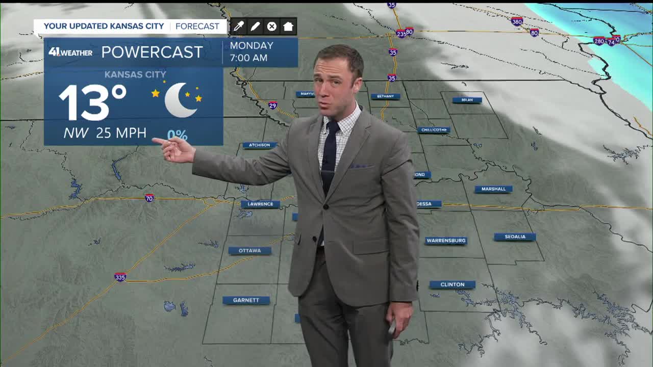
Monday: Morning wind chills below zero. Windy and mostly sunny.
High: 29°
Wind: NW 10-20, gusting to 35 mph
Get more updates from our weather team:
View our interactive radar
