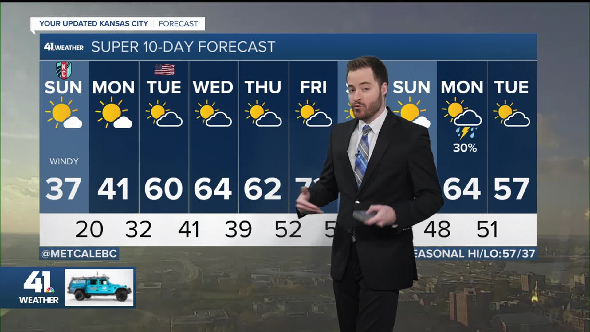


WEATHER HEADLINES
- There may be a few flurries tonight but those will be inconsequential
- Windy through tomorrow as temperatures will feel much more like winter
- Monday will also be quite cold but Tuesday will show some improvement
KANSAS CITY'S FORECAST
Tonight: Mostly cloudy with perhaps a couple snowflakes falling.
Low: 27°
Wind: N 15-20 mph
Sunday: Morning wind chills in the teens and afternoon wind chills in the 20s. Mostly sunny.
High: 37°
Wind: NW 15-20 mph
Monday: A colder morning compared to Monday but just a few degrees warmer in the afternoon. Mostly sunny.
Low: 20°
High: 41°
Wind: W 10 mph
Get more updates from our weather team:
View our interactive radar
Read our Weather Blog
Check out the current conditions in our area
—
