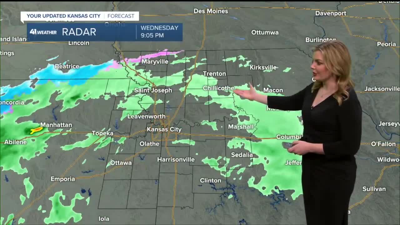


WEATHER HEADLINES
- Fast and weak winter system moves through tonight.
- Light rain changes to snow after 2 a.m. & clears by 8 a.m. A wet, slushy snow and falling temperatures could lead to some slicks roads early Thursday.
- We return to a winter like feel Thursday & Friday but warm up for the weekend.
- Active Pacific is lining up storm chances through the Super 10-Day.
KANSAS CITY'S FORECAST
Tonight: Becoming windy and colder. Light rain develops by 10pm to 12 am as temperatures drop to 40°. Light rain changing to snow after 2 am as temperatures drop below freezing. Watch for slick roads as the cold air surges in. Wind: N-NE 15-30 mph. Low: 28°
Thursday: Snow ends before the morning rush hour but roads may still be slick! Drive carefully in the morning. Accumulations near 1'' are possible south of I-70. Staying cold and windy all day. Wind: N-NW 15-30 mph. High: 34°
Friday: Mostly sunny and staying cold. Wind: N-NW 5-10 mph. Low: 20° High: 38°
Get more updates from our weather team:
View our interactive radar
Read our Weather Blog
Check out the current conditions in our area
The KSHB 41 Weather Storm Shield is a life-saving app that acts like an NOAA Emergency Weather Radio on your iPhone or Android phone. You will receive critical alerts via voice and push notification regarding major, potentially life-threatening weather events.
