

Happy Friday weather blog readers,
Are you tired of the gray skies? Me too, and I am tired of looking at the forecast data indicating overcast conditions with fog!
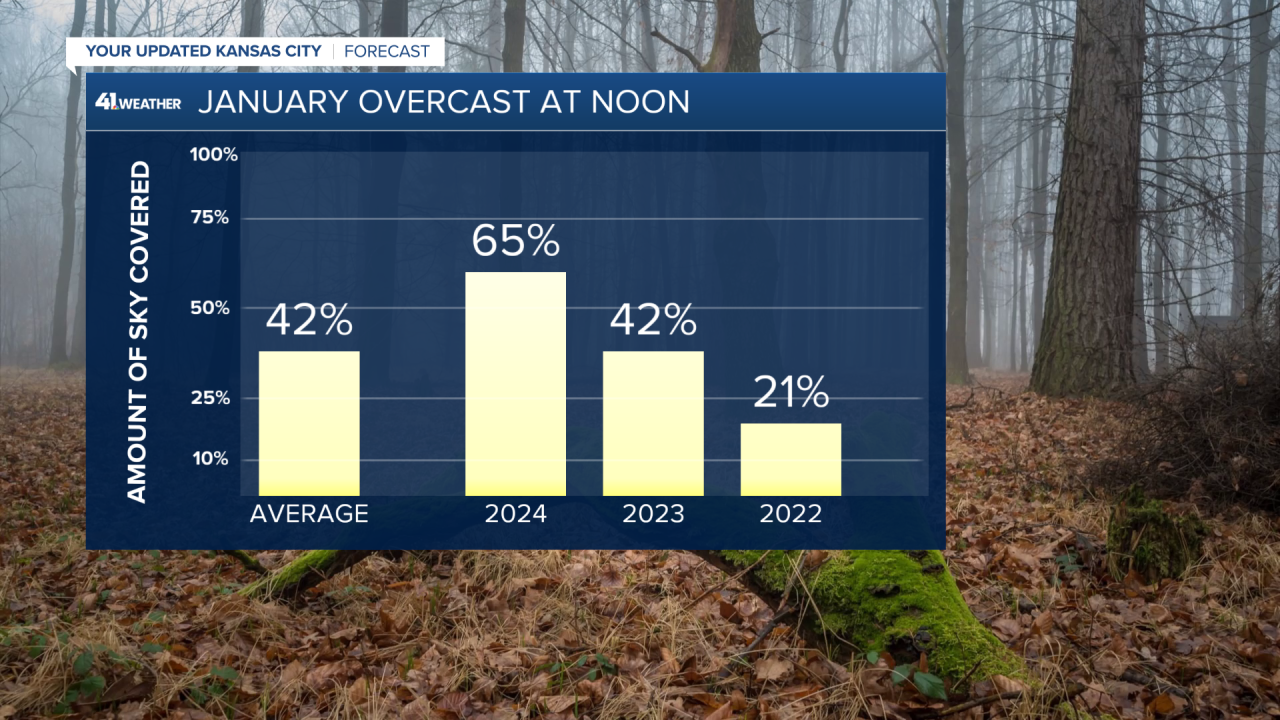
When looking at the noon observations at Kansas City International Airport, 65% of the time this month the sky has been overcast, a little above average.
The last time we had a completely sunny day was Jan. 16 as the morning started with a bitterly cold low of -10.
Our next mostly to partly sunny day may not come until Monday or Tuesday, as I'm not sold we will be able to get rid of the clouds for long on Sunday.
Tonight-Saturday
Fog redevelops tonight as slightly drier air moves in from the north, which I think will somewhat limit how widespread and dense the fog will be, but I am still expecting fog.
The flip side of the drier air is the chance that temperatures get near or below freezing as a storm system passes just to our south.
With the timing of those two, we may wake up to a light mix of rain, freezing rain, or sleet from 3 to 9 am.
A couple of our weather models are hinting at this idea, see the NAM and Canadian weather models below:
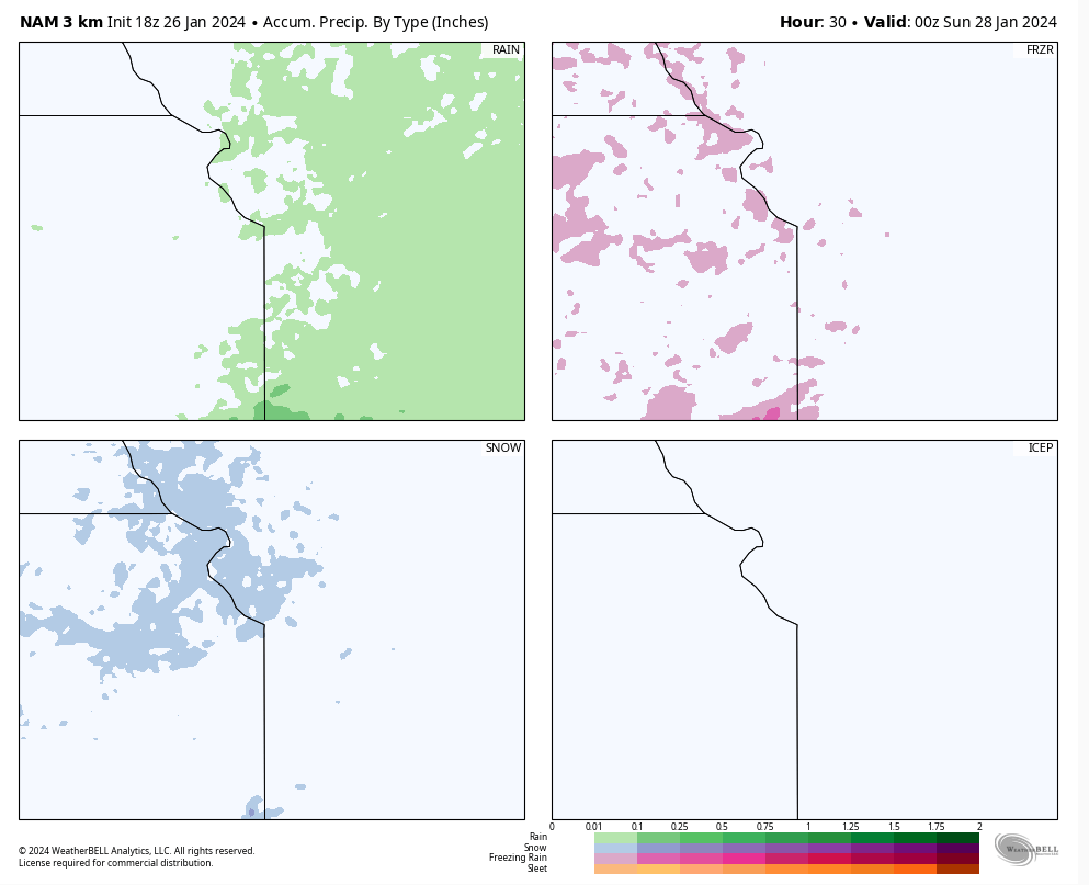
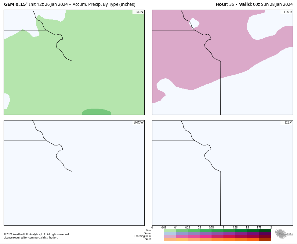
If this does happen, there might be some slick spots on bridges and overpasses until around 9 a.m., when the sun is up high enough to heat the concrete.
Otherwise, Saturday is gray and chilly with highs in the upper 30s. Same stuff just a different day.
Sun-Day?
This is the day we have been excited for, to finally see some sunshine as the sky has been overcast since Monday.
But will we see more than an hour or two of sunshine before sunset? I hope so, but I'm not convinced.
I'm not convinced we even get a mostly sunny day until Wednesday.
The problem? There is just so much moisture on the ground and in the atmosphere. It may take a lot of dry air and strong wind to truly mix out the clouds for the sunshine to return.
And that may not happen until Wednesday following a cold front from the northwest.
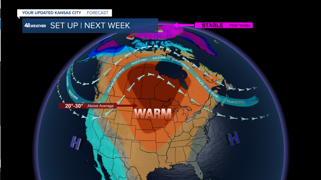
Next Week Warmth
Our jet stream, which determines our weather and divides the cool from warm air will develop into a ridge, allowing for a southerly wind to blow in warm air pushing temperatures into the upper 40s to upper 50s.
Of course, what follows this string of warm days will be some wet weather from a storm system that moves through Saturday and early the following week.
Right now it looks like mainly rain but since it is February snow cannot be ruled out.

Also, don't expect potholes to be going anywhere as we thaw out from last week's deep freeze.
Safe travels and hope you enjoy sunshine!
—
