


Good morning bloggers,
We were predicting a very low chance of any severe weather last night, and there was no severe weather in our region. We did get a few bands of showers and thunderstorms between 3 AM and 7 AM. These bands of rain have shifted east and fallen apart. A strong storm is forming overhead and look where the center of this storm is forecast to be around 18,000 feet above us tonight:

Look closely at the closed circles, two of them, right over Kansas City. This is a forecast for tonight at just after midnight showing the 500 mb level. The top of the atmosphere weighs nothing, and the weight of the atmosphere at the surface is around 1,000 mb. MB stands for milibar, which is a measure of atmopsheric pressure, or a measure of the weight of the atmosphere above us. The 500 mb level is half way through the atmosphere in weight, and around 18,000 feet up. This is the level we look at to find the cycling pattern and the storm systems.
Again, look at that low with two circles around it. As this system passes by, we will likely go in to bands of rain on the back side, or in the comma head of the storm. The satellite pictures will be fascinating to show tonight as this system strengthens. Here is what it will look like at the surface around 4 PM today:

We will be in the dry slot of this storm this afternoon, where the air sinks, and we may see some sunshine. Thunderstorms will form on the eastern edge of this dry slot and a few may become severe mostly east of our local region over eastern Missouri.
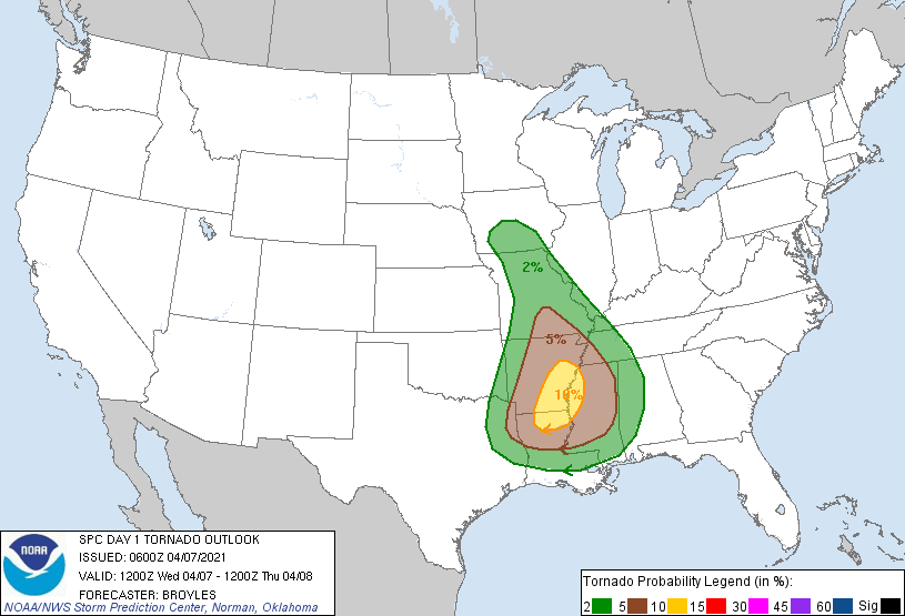
As this front moves east, the most likely area for a risk of tornadoes today is over southeast Arkansas into parts of Mississippi and Louisiana. There is no risk at all in Kansas City, and the eastern edge of our viewing area will have a short risk as the thunderstorms form later this afternoon.
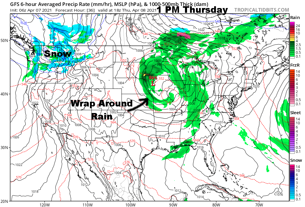
And, then, Thursday may drop into the 40s and stay there. The wrap around forms in the comma head shown below:
Here is the surface map this morning:

It is 60 degrees in KC, and as that surface low moves in, cooler air will spread in from the southwest. It is 33 degrees with some snow around northwestern Kansas this morning.
Speaking of colder air, take a look at what happens to this wild weather pattern next week:

A rather impressive blocking pattern is forecast to develop during the next week. This map above shows the flow at 18,000 feet valid next Tuesday. That H, the upper high, over the south part of Greenland is showing the blocking pattern. The trough forming over the southwestern United States is being influenced by this blocking. The entire pattern over the Northern Hemisphere is being influenced by this blocking. What does this mean for Kansas City? There may be a chance of a late freeze and cooler than normal for a while. Then, later this month the signature part of the cycling LRC pattern will return, and that is when we are expecting a more significant chance of severe weather.
Kansas City Weather Time-Line:
- Today: Periods of clouds mixed with some sunshine. There may be a brief shower or two. Most of the day will be dry. High: 67°
- Tonight: Cloudy with a chance of showers later tonight. Southwest winds shifting to the west, then the northwest by morning at 20-30 mph. Low: 49°
- Thursday: Cloudy with an 80% chance of rain north of Paola, KS, with lower probabilities to the south. Windy with northwest winds 20-30 mph and gusty. Temperatures between 45° and 50°.
- Friday: Mostly sunny with light winds. High: 70°
Thank you for spending a few minutes of your day reading the Gabbing With Gary blog. We will go in-depth as we track the back side of this storm, the comma head, today and tonight on 41 Action News, your streaming device, and on KSHB.com. Stay with 41 Action News & we'll keep you advised.
Gary
