


Hope you are recovering and staying warm after our most recent winter storm, weather blog readers!
We are gearing up for our next winter storm and the brutal, dangerous cold. We need to get as much snow melted as possible on Wednesday and Thursday because whatever is left on the ground won't melt until the sunshine returns.
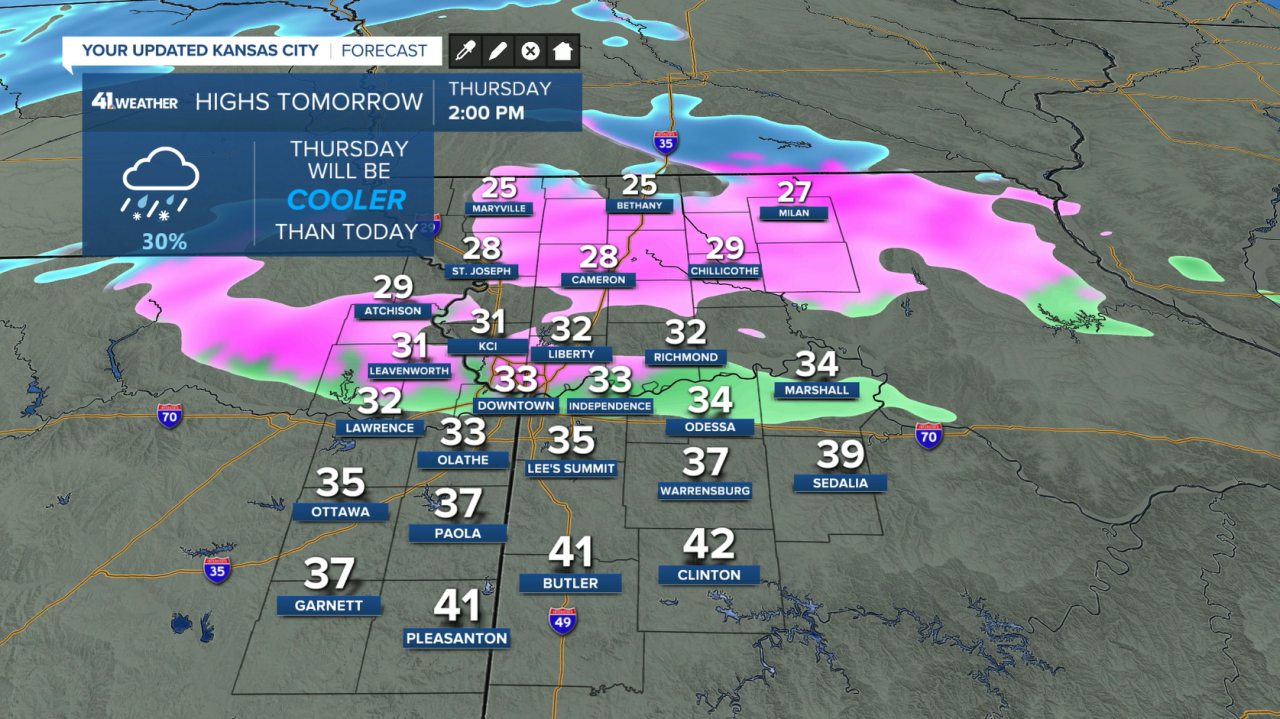
Thursday and Friday
The next storm system approaches from the west with colder air to work with compared to the previous system on Monday and Tuesday.
A wintry mix is possible Thursday afternoon and evening, with roads probably not impacted other than just wet for the morning and evening commute.
However, as we go overnight Thursday into Friday, temperatures will fall into the teens, so whatever is on the roads is frozen.
A word of advice, those big chunks of snow left on the roads in your neighborhood will essentially be rocks/boulders with how cold it will be.
There may be a pause in the precipitation Thursday night, picking back up throughout Friday morning and into the afternoon.
Similar to Tuesday, the snow may be heavy at times, blowing around and causing reduced visibility. Unlike Tuesday, though, this snow will be much lighter and more likely to blow around, so visibility problems may be worse Friday morning than earlier this week.
Overall, there may not be as much snow as our last system.
Below is the forecast as of Wednesday afternoon.

Snow ends Friday evening as temperatures fall into the single digits with wind chills well below zero.
Saturday
It's going to get brutally cold.
Morning lows are near zero, and afternoon highs are only near 10°. This sets up for one of the coldest games in GEHA Field at Arrowhead Stadium history (since the AFL-NFL merger).
Bring a cooler for tailgating on Saturday — but not to keep your drinks cold, to keep them from freezing!
Wind chills throughout the day will be below zero and near -15° by the end of the game. At that point, exposed skin can be frostbitten in 30 minutes or less.

Sunday
Another winter storm slides through with a more southerly track, so we aren't expecting a ton of snow from this system — maybe a couple of inches.
It will continue to be dangerously cold throughout the day with wind chills colder than -15°.
Wind chills will range from -15° to -30° from Saturday night through Tuesday morning. You must take precautions to protect yourself and your pets during this period as these are deadly cold temperatures.

Please prepare for this brutal cold which looks to last for a week!
—
