

Good Monday bloggers,
We are seeing some changes before summer begins next Sunday. There have been 2 rain events that covered most locations since the 27th of May. Even in those 2 rain events there were many locations that got missed. So, there are many locations that need rain. The areas that got clobbered on Friday with 2-3" of rain in an hour will also need rain in a few days as the topsoil dries out fast this time of year.
Let's go through this.
TODAY:
A disturbance that produced thunderstorms in western and central Nebraska last night is now moving southeast towards our area. The thunderstorms have mostly dissipated and we do not expect them to redevelop. So, as this disturbance moves overhead 4-7 PM, we will see lots of clouds and perhaps a sprinkle.

You can see the thicker, mostly high and mid level clouds, moving through at 5 PM. Highs will still reach the low 90s. Temperatures may drop to the upper 80s when the clouds move overhead.

TUESDAY:
A weak backdoor (moving in from the northeast) cold front will try to push through. This may drop temperatures a few degrees, but the humidity will be higher and no rain is expected. The much cooler air will be way back across the Great Lakes while highs reach to around 100 in the western Plains.

WEDNESDAY-THURSDAY:
Wednesday will be another hot and dry day with highs in the low 90s.
Thursday will become windy and perhaps be the hottest day of the week ahead of a cold front which signals a change in the weather pattern. A brief period of thunderstorms is possible Thursday morning ahead of the front. Regardless of any morning thunderstorms highs will still reach the low to mid 90s Thursday.

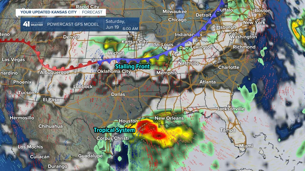
Friday into the weekend and next week will see increasing chances of thunderstorms and decreasing temperatures. The Friday cold front will stall and be wavering north and south for several days as a series of disturbances track in from the west and northwest. This is the set up for a wetter weather pattern.
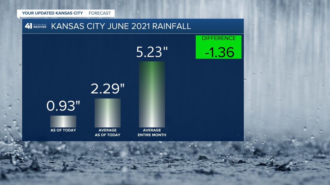
Keep in mind, May and June are, on average, the wettest months of the year in our area. The average rainfall each month is 5.23". Officially, at KCI, which is the official reporting station for KC, there has been 0.93" this June which is 1.36" below average by June 14th. We are 4.30" below average for the entire year so far.
Many areas of Olathe have seen just a trace to .10" this month.
So, rain is needed in most locations.
RAINFALL FORECAST TODAY-FRIDAY (JUNE 14-18):
The front on Thursday night-Friday will be another scattered thunderstorm event which means some will see around 1" of rain, others not a drop. The chance of thunderstorms Thursday morning does not look like a widespread event either.

RAINFALL FORECAST (JUNE 19-25):
You can see all kinds of heavier rain. Some locations will still get missed, but many locations have a chance to see 1"-3" of rain. The pattern even looks active June 26-30.
Also, the more active weather pattern will come with highs mostly in the 80s with lows in the 60s.

Have a great week and stay healthy.
