


KANSAS CITY, Mo. — Good morning bloggers,
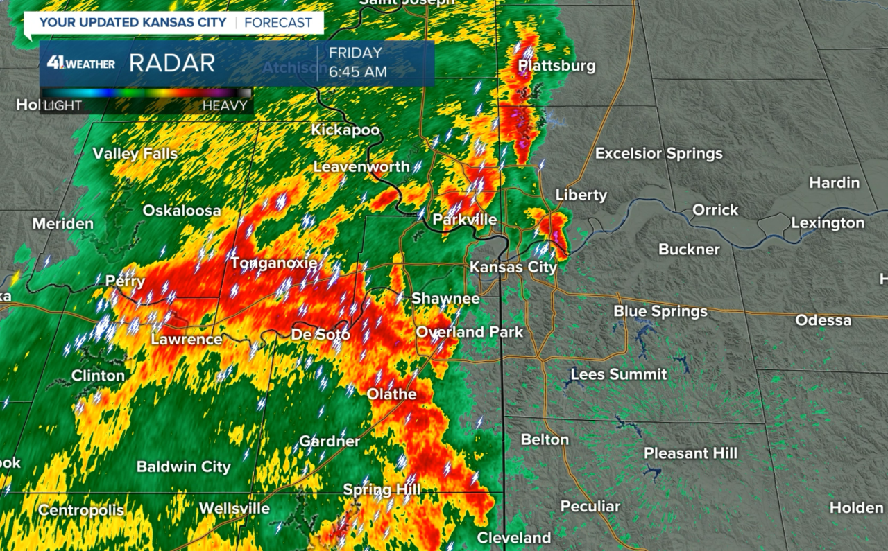
Thunderstorms were tracking across the Kansas City metro area this morning. Some very heavy rain is falling in those red and orange radar echoes. These will weaken during the next two hours, but if you are in one of these now an inch of rain may fall. Areas east of an Excelsior Springs to Peculiar line may be on the edge of these cells.
After these morning thunderstorms move by, it will be cloudy for a while. A weak front is moving through and temperatures will likely be around 10 degrees colder than yesterday. There is a slight chance of thunderstorms redeveloping later this afternoon and evening. If any thunderstorms do form, they could be severe between around 5 and 9 p.m.
Here is the area of thunderstorms just 17 minutes later:

I added up all of the numbers for this week and subtracted the numbers from last week. The total comes out to 177. So, in some respects, we can say it was 177 degrees warmer this week than last week if my forecast highs verify. Either way, what a change from the first week of May to the second week of May.

It will be at least a week before we make another run at 90 degrees. We will be monitoring the weather situation closely so stay with KSHB 41 News and we'll keep you advised.
Thank you for spending a few minutes of your day reading the weather blog and sharing this weather experience. Have a great Friday.
Gary
