


I hope you enjoyed the beautiful weather on Tuesday, as sunshine and light winds accompanied a high of nearly 75 around Kansas City.
Our stormy period begins overnight, probably not getting truly stormy until late Thursday morning into the afternoon.
Some scattered showers may be around during the morning commute, but the heavy, steady rain may hold off until lunch.
Many of our weather models, like the one below, have heavy rain on top of us by early afternoon.
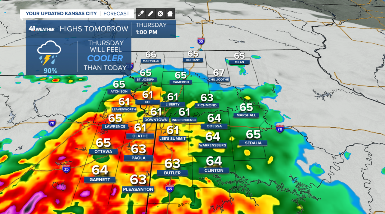
They all keep the heaviest rainfall across the southern half of the Kansas City area and generally south of KC where the total just from Thursday may be one to two inches.
There may be a heavy period of rain during the day with a break during the evening, followed by another round of storms Thursday night into Friday morning.
This is where the forecast gets extra tricky.
We need to wait and see if the atmosphere can recover.
The sun comes out, and rainfall evaporates back into the air, making it feel muggy. Friday will also come with windy conditions, with gusts near 45 miles per hour!
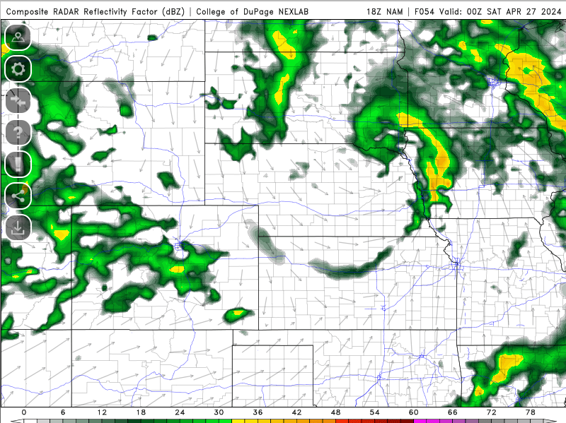
If the atmosphere can recover, then all types of severe weather are possible. Even with good severe weather ingredients in place, can storms develop to use them?


We may have a good amount of instability and moderate tornado ingredients, but storms may not even pop up. The model above shows a good severe weather environment but doesn't develop storms.
I'm not saying this model will be correct, but it sews uncertainty into the forecast, and this outcome isn't far-fetched.
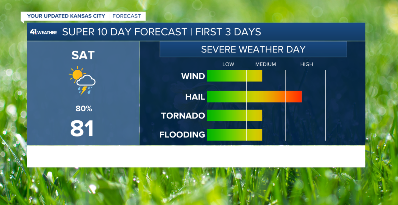
Storms or not on Friday, Saturday may end up being the best day for severe weather.
It does look like the atmosphere can recover, but when do the storms form, in the afternoon or evening?
If they develop in the afternoon, we could deal with some very big hail and strong tornadoes.
If they wait until evening, the hail may not be as big and the tornadoes not as widespread, but damaging wind gusts would be a big problem then too.
Oh, and if we get multiple rounds of storms, flash flooding may be a possibility.
So, let's say storms develop at some point Saturday, and then we have another chance of severe weather Sunday.
By this point, I’m not so sure the atmosphere can recover. Some weather models think we can, but others say no.
This one below combines 51 different weather model types and gives us a low chance of that recovery happening.
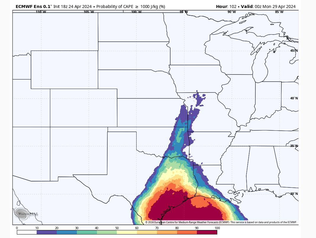
Let’s hope that’s correct because no one wants three days of severe weather.
Overall, we could end up seeing some really big hail with all these days considered, like March 13 tennis ball-size hail.
The tornado threat is certainly there, but more puzzle pieces need to fit together unlike hail and damaging wind to be experienced by more people.
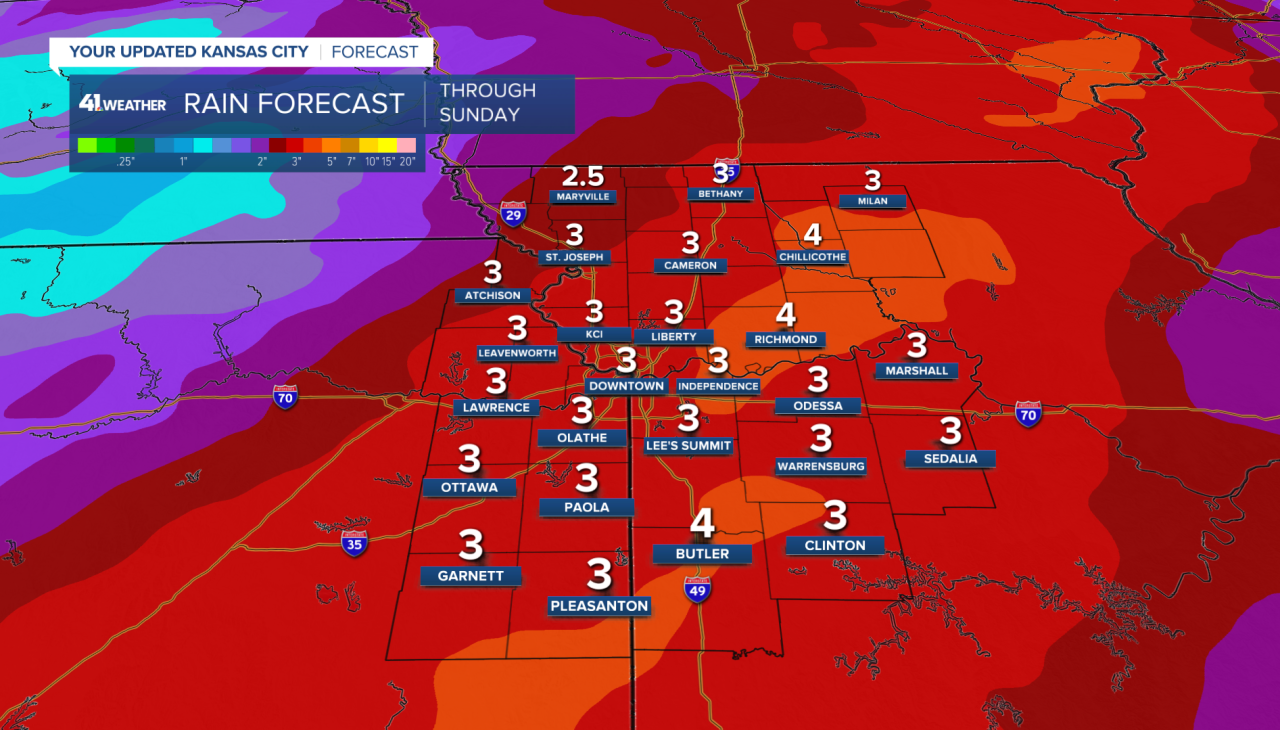
Two to six inches of rainfall is possible across the entire area with some spots maybe getting more than that.
Please be looking out for watches and warnings this weekend.
—
