


KANSAS CITY, Mo. — Good Wednesday bloggers,
It is no secret we need rain. There are many locations south of Interstate 70 that are 10"-15" below average rainfall since April 1.
Below is a map of total rainfall during the last 45 days, July 30. Average rainfall for most locations is around 6.35". You can see that north central to central Missouri has seen a ton of rain with amounts 10"-20"! A lot of that rainfall occurred on two of the last 45 days, July 31- Aug. 1.
Locations are mostly 50% to 100% of average rainfall. Keep in mind, most of the rain occurred before Aug. 14, so it is really dry out there as we have been talking about.

Well, maybe just maybe we are seeing a shift toward at least a period of wetter weather. It looks like this wetter change arrives during the middle and end of next week.
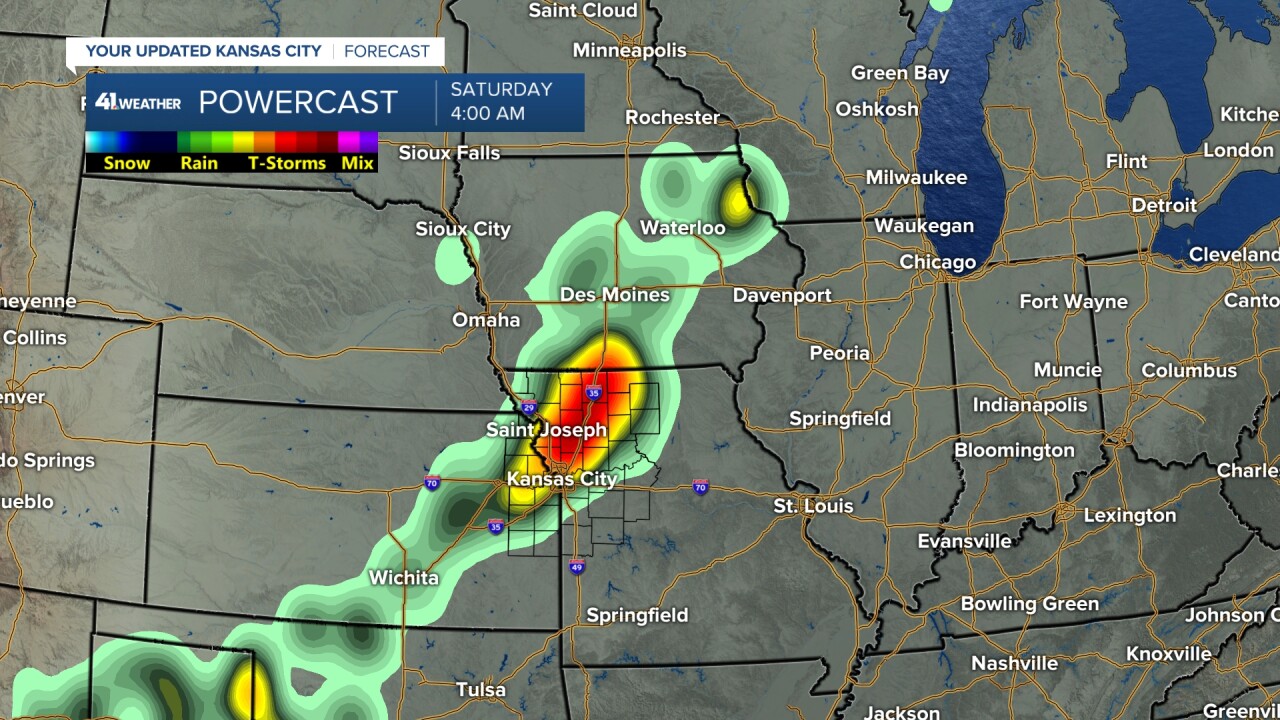
TODAY-SEPT. 19:
There is one main rain chance. The timing is later Friday into Saturday morning. It does not look like much rain as most locations will see .10"-.50" with the most north of I-70, where it is less dry. There may be some 1" rainfall amounts in far northern Missouri in locations that are much less dry, but drying out.

This one chance of rain would be a band of showers and a few thunderstorms around 4 AMish Saturday. Some data is much less, bringing a band of sprinkles and a few light showers.
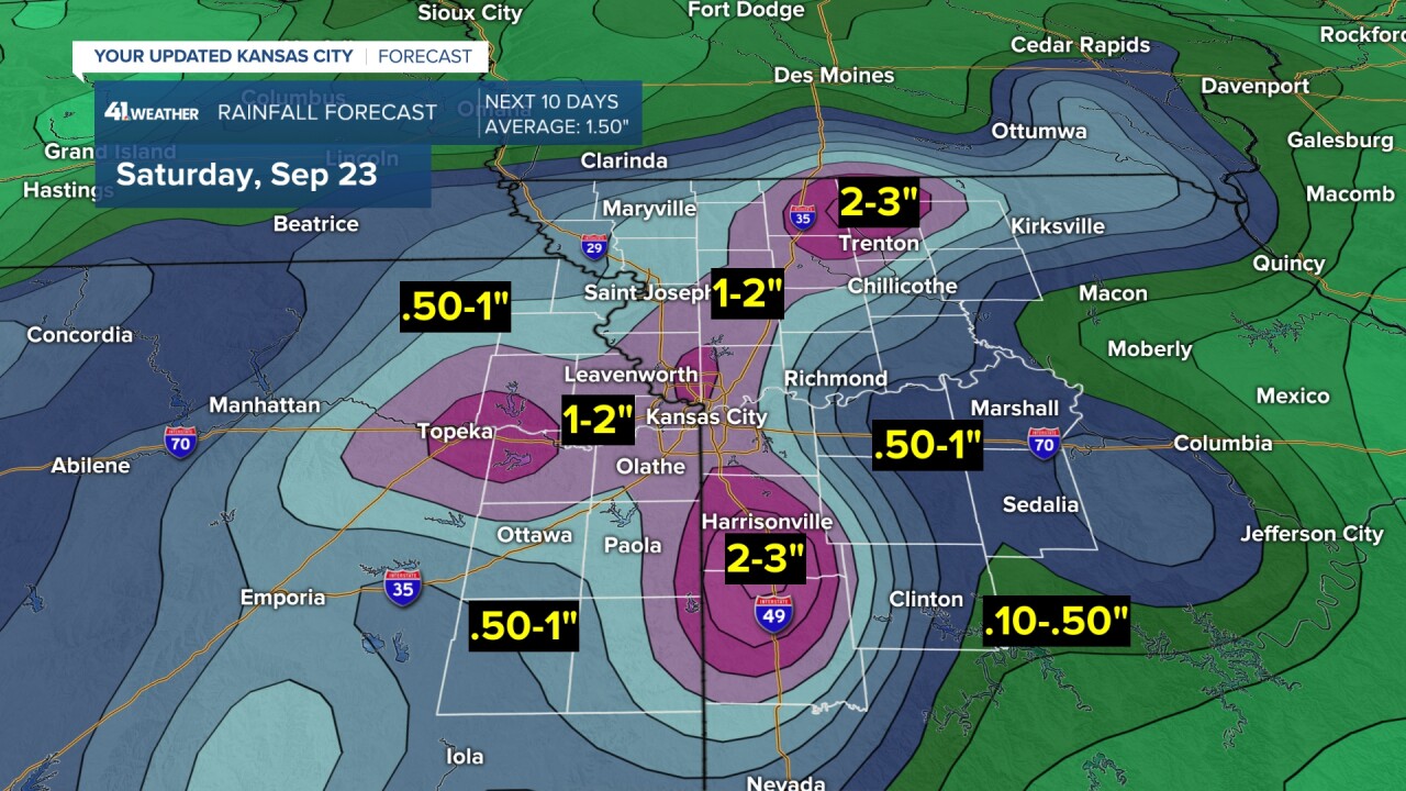
SEPT. 20-25:
There is the chance to see 1"-2" of rain in most locations. So, when you look at the next 10 days, that would be about average for a 10 day period, but 200% of average for a five day period. This would be great and we will have more in the coming days.
HURRICANE LEE:
Before we wrap up the blog, we want to discuss Hurricane Lee. It has been out in the Atlantic Ocean for about a week. It looks like it is going to affect New England this weekend.
A hurricane needs water 80° or warmer to maintain strength. The water cools to the 70s south of New England, so hopefully, Lee will weaken some as it heads north. Right now Lee has 110 mph winds, a high end Category 2.

It may make landfall anywhere from Boston to northern Maine on Saturday as a Category 1 hurricane or high end tropical storm. The wind has to be at least 74 mph sustained for it to be classified as a hurricane.

This could be quite an issue in this part of the country. If it bends any farther west then NYC will have bigger impacts.

If you are headed to Columbia, Missouri, Saturday for the K-State-Mizzou game there may be scattered rain showers from the one system to watch between today and Sept. 19. At this time it looks like the best chance of scattered showers will be prior to kickoff.

Have a great rest of your week
Stay healthy
