


Good morning bloggers,
The sun will return today with a few clouds at times. As we enjoy a calm and cooler spring day, let's take a look at what is going on in this weather pattern.
On Saturday night, a Tornado Watch was issued over a small area of eastern Kansas. There were no tornadoes, but Kansas City did have 1.60" of rain. The Kansas City metro area was not included in the Tornado Watch and we have almost gone two full years without even one Tornado Watch. The last one was issued on the day of the EF-4 tornado in Linwood, KS on May 28, 2019. Take a look at the Tornado Watches so far this year and last year:
Tornado Watches So Far In 2021:

Tornado Watches In 2020:
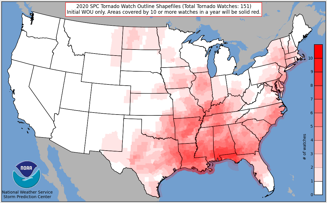
As you can see in the above two maps, there is a large part of Kansas and Oklahoma that share this Tornado Watch drought with us. Dodge City, Wichita, and Kansas City have all gone almost two years without a Tornado Watch, and this will continue at least another few days.
Alabama has had 71 tornado reports so far this season, and Kansas has had 2, as you can see below. Missouri and Oklahoma are also leading Alabama, uh, well if you use the golf analogy. The lower the score the better. That's how I see it!


Tornado Alley has not shifted to Alabama, or what is called Dixie Alley over the southeast. It is just a tornado drought that is two years long and counting that will likely end in the next year or two. There is a reason why Tornado Alley exists, and those reasons do not move. The reason why Tornado Alley extends from Texas and Oklahoma northeast across Kansas, Nebraska, into Iowa, is because of two geographic boundaries. The north-south mountain chain known as the Rocky Mountains and the Gulf of Mexico are these two boundaries. The air comes over the Rocky Mountains, and descends out over the plains and meets up with the warm and moist air from the Gulf of Mexico. The results of these clashing air masses results in more tornadoes per square mile than anywhere else in the world. Two thirds of the worlds tornadoes occur in the United States.

The 30-year average for tornado probabilities shows that central Oklahoma is at peak tornado season right now, and Kansas City is close to peak as well. This will return in the next few years, but for now the LRC has set up in such a way that it makes it seem as if Tornado Alley has shifted. It has not! It will shift back west in the next few years!
This cool weather pattern continues for another few days. We are in the part of the LRC that produced the brutally cold weather in February. This cooler pattern will begin to fade away next week and warmer days are ahead of us. The average high temperature is now 74 degrees in Kansas City and the average warms to 79 degrees by the end of the month.
High pressure is in control today. Let's take a look:
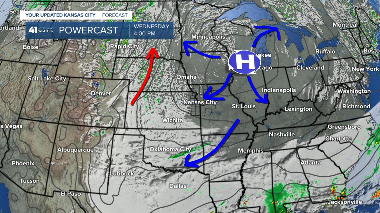
High pressure is building over Illinois and Wisconsin today. Air blows away from high pressure and towards low pressure, and the air sinks near these high pressure areas. This sinking air will help clear out our clouds today, but the cool pattern continues. We are in the part of the LRC that produced the 20 day brutally cold outbreak in February. So, expect another week of cooler than average temperatures. And, there is a storm heading our way. The dew points have been low across the plains states this season, and it is one of the reasons why severe weather season has been so quiet in Tornado Alley. The dew points will be rising as you can see below:

There is a warm front forecast to develop as an upper level storm forms and tracks across the southwestern states. The dew points show the higher moisture that will move in from the Gulf of Mexico. This warm and humid air will be the fuel for thunderstorms. A series of upper level disturbances will begin affecting the plains as an upper level storm, and closed low forms near the Nevada/California border this weekend:
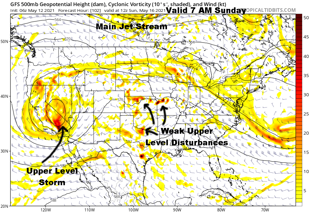
These disturbances will produce areas of showers and thunderstorms beginning late Thursday, and last for many days. The rainfall amounts will be adding up and take a look at the overnight GFS model totals that just came in:

Wide spread high rainfall totals are likely with this pattern. With the main jet stream energy over Canada, the risks of severe weather will be fairly low. There still may be a few severe thunderstorms, so we will monitor each days set-ups closely. To have serious tornado set-ups, however, we would need more of that jet stream energy to shift south and that will not be happening for a week or two. So, Tornado Alley will remain somewhat quiet while at the same time the flooding risk will be increasing substantially. Floods kill more people each year than tornadoes do, so let's pay close attention to these set up.
For today, the sun is coming back out and our cooler weather pattern will continue with a high in the lower to middle 60s.
Thank you for spending a few minutes reading the Gabbing With Gary blog. Have a great Wednesday.
Gary
