


Good morning bloggers,
Last night I announced that I am retiring from my TV career on December 1, 2022. It was a very heavy, deeply emotional day. After the 10 p.m. newscast we were tracking a raging line of thunderstorm crossing the Nebraska/Kansas border north of Manhattan, Kansas. A Severe T-Storm Watch was issued for the KC metro area during the 10 p.m. newscast on KSHB-41. A line of thunderstorms approached KC at 1 a.m. Let's take a look:
The Radar Time-Line:

At 12:40 a.m. the line had weakened a little bit as it was moving into Leavenworth county. Watch what happens next.

Look closely at this 12:50 a.m. radar map above. Look out at near the Kansas Speedway, at the Legends where Children's Mercy Park is located. Look at that little lead thunderstorm near the Interstate 435 loop. It popped up, and I was monitoring it. The main line was to the west.
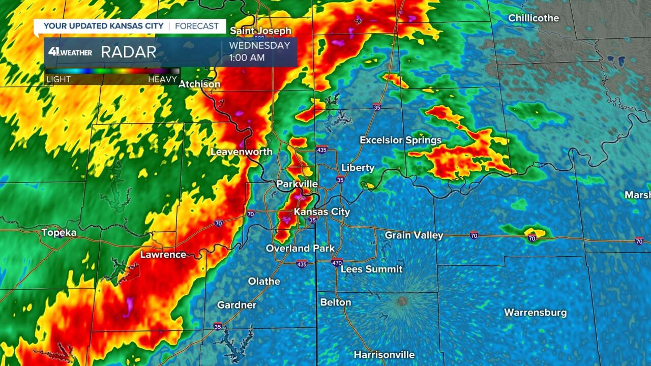
Just 10 minutes later, at 1:00 a.m., the Legend's thunderstorm had grown into a line with very heavy rain and a lot of lightning over Kansas City, Kansas, crossing the river to Parkville, Missouri. The main line looked weaker to the west, but there was a strong cell west of Olathe.

The Legend's cell had become a strengthening thunderstorm, while the main line was still approaching.
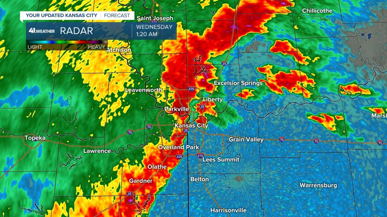
This lead thunderstorm gets overtaken and merges with the main line, and the line of thunderstorms moving across Kansas City, extending down to Overland Park increases in strength as you can see below:

In just minutes, we had a possible tornado from over Johnson County, with another tornado warned cell near Excelsior Springs, Missouri. The entire line had increased in strength as a gravity wave of energy moved through the line.
Tornado Sirens: The Tornado Sirens went off over most of the city. I came on Facebook Live and Lindsey Anderson raced into KSHB and went on the air.

Just 10 minutes later, shown above, the confirmed tornado had bounced up and down a couple times causing some minor damage with trees down and some roof's damaged as well.

At 1:50 a.m. the two tornado warnings were extended east near the Missouri River. And, then the thunderstorms pulsed back down and weakened just a bit. The line tracked all the way to St. Louis by 6 a.m.
"Oh What A Night". I saw Frankie Valli and the Four Seasons Saturday night at Kauffman Center. It was a great concert to watch an 88-year-old superstar sing and perform on stage. That song describes yesterday and last night. It went from me explaining why I am retiring, to Mother Nature producing a rare 1:30 a.m. tornado in KC. I say rare, but our tornadoes, in recent years, are few and far between, but seemingly at off times from what would be considered normal tornado formation times. Oh what a night indeed.
There are many reports of minor damage, including a small path of damage near 95th Street in Overland Park. There are other sporadic reports of damage and a few power lines down.

I didn't get more than two hours of sleep. Today will be a much calmer day. One of the big reasons I have decided to retire is to work on my entrepreneurial efforts at Weather 20/20. The LRC predicted yesterday and today's severe risks and I should have paid closer attention to it.
The LRC In Action:
The weather pattern is right on schedule. I should have been even more in tune with this last night. The LRC literally predicted last night's severe weather over two months ago. Look at the storm reports from the last LRC cycle:

This is April 4 above. Below, you can see last night's reports:

As summer approaches, the jet stream lifts north. So, the severe weather risk in the previous LRC cycle produced signficant severe weather due south of KC. Fast forward to last night, and the severe reports are shifted north. This is predictable months ago to happen last night. This is actually another incredible validation and verification of what I will be bringing to the world in the next few years.
We will get a calm day today, and then the next chance of thunderstorms arrives tomorrow.
Thank you for spending a few minutes of your day reading the weather blog and sharing in this weather experience. Have a great Wednesday.
Gary
