


I hope you have enjoyed the warm weather this weekend, weather blog readers!
Warm spring temperatures inevitably mean storms will follow, and we have multiple chances of strong to severe weather Monday and Tuesday.
What complicates the situation is that each round of storms will have the chance to impact the following round.

Monday
Monday's weather will pick up where the weekend left off. Temperatures will warm into the 80s with a southerly breeze, but you will probably notice the humidity is much higher.
This is because a warm front is lifting through in the afternoon and evening. As this happens, storms may form near it and produce large hail and damaging wind gusts.

It is not guaranteed this will happen as our models are split on the idea of this happening.
However, the more showers and storms form during this period, the less likely our next round of storms (Tuesday morning) will be severe. To reduce the severe chances, we need it to rain and cool off the atmosphere.
Tuesday
Storms will develop early in the morning in central Oklahoma and Kansas and then move east. These storms may not arrive until 6-10 a.m. with the threat of damaging wind gusts and hail.

This is where it starts to get really tricky. Every preceding storm round will impact the following. And unfortunately, it's tough to predict what each round will do.
The later the storms arrive in the morning, the better chance they could be severe and could help diminish another round of severe storms in the afternoon.
If these storms don't even show up in the morning, then an afternoon of severe weather is possible with all modes (wind, hail, tornado) of severe weather possible.
Or storms could come through early in the morning, the sun comes and another round of storms develops with all types of severe weather possible. Our in-house computer model favors that scenario.

The over-arching theme for all these scenarios is ... can the sun come out and re-energize the atmosphere for storms before a cold front comes through?
For the severe weather threat to be low, we want it to just rain for hours in the morning and get no sunshine.
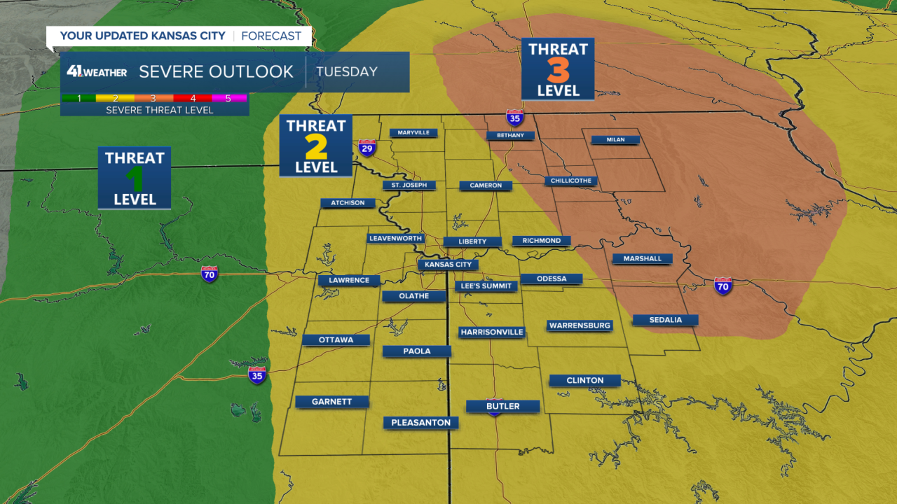
The best setup for tornadoes and big hail is Tuesday afternoon and evening, so the Storm Prediction has a level 3 of 5 risk nearby.
Please keep an eye out for watches and warnings, especially on Tuesday!
—
