


KANSAS CITY, Mo. — Kansas City is one of the hardest places to predict the weather, especially during the winter, and these forecasts affect each of us and our families.
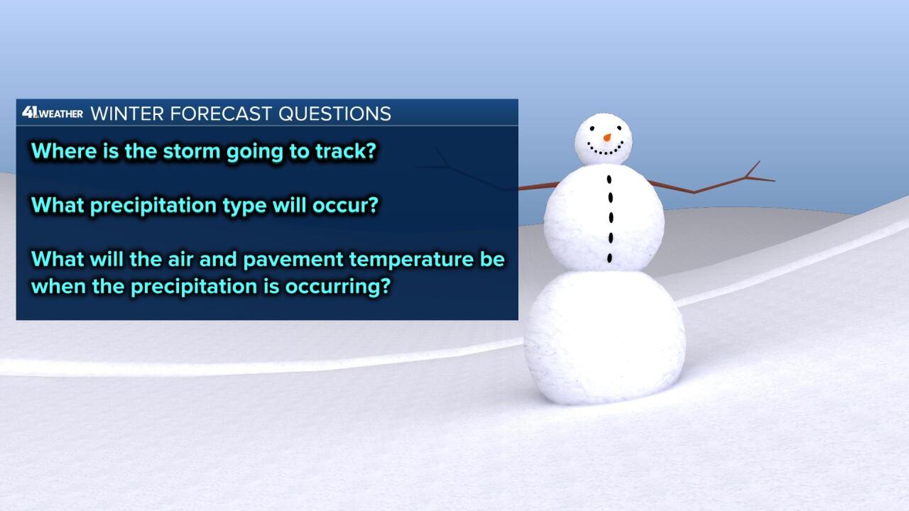
We are often faced with multiple forecast questions:
- Where is the storm going to track?
- What precipitation type will occur?
- What will the air and pavement temperature be when the precipitation is occurring?
We try to answer these questions every time a winter storm is about to affect our region.
Every degree makes a difference.
There are four main precipitation types that occur during the cold season:
- Rain
- Freezing rain
- Sleet
- Snow

Rain is liquid water while freezing rain can be liquid water, or rain that freezes on contact with a surface that is 32 degrees or lower - creating an icy glaze on surfaces like trees, power lines and streets.
Sleet is frozen rain. The raindrops freeze into ice pellets and often bounce on impact with a surface
Snow is pure ice crystals that form into flakes and accumulate.
These precipitation types affect us more as the temperature drops.
As the temperature drops from 35 to 33 degrees, it is most likely to just be wet. If it is sleeting or snowing heavily, then there may be some slick spots.

When it drops to 32 degrees, water and ice will likely exist at the same time. So, when it rains, it can freeze on contact with surfaces like trees, handrails, bridges and overpasses.
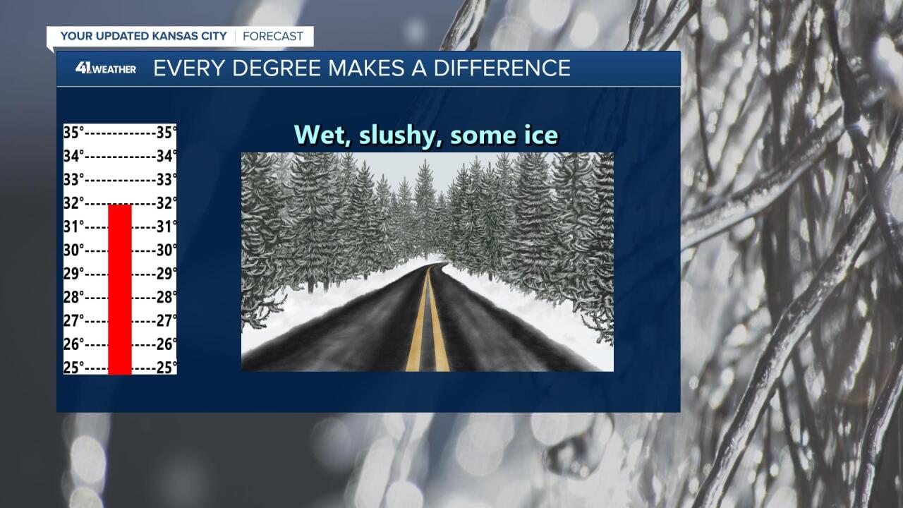
Those surfaces are usually the first ones to start becoming icy as these surfaces are exposed to the 32-degree air from above and below.

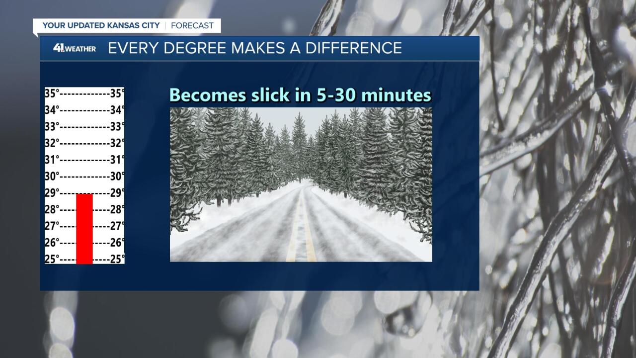
As the temperature drops to 31 degrees, 30 degrees and then 29 degrees, freezing rain will freeze on all surfaces, unless the rain is falling very heavily. That would keep it as liquid water. Sleet and snow will more effectively start accumulating within 5-30 minutes.
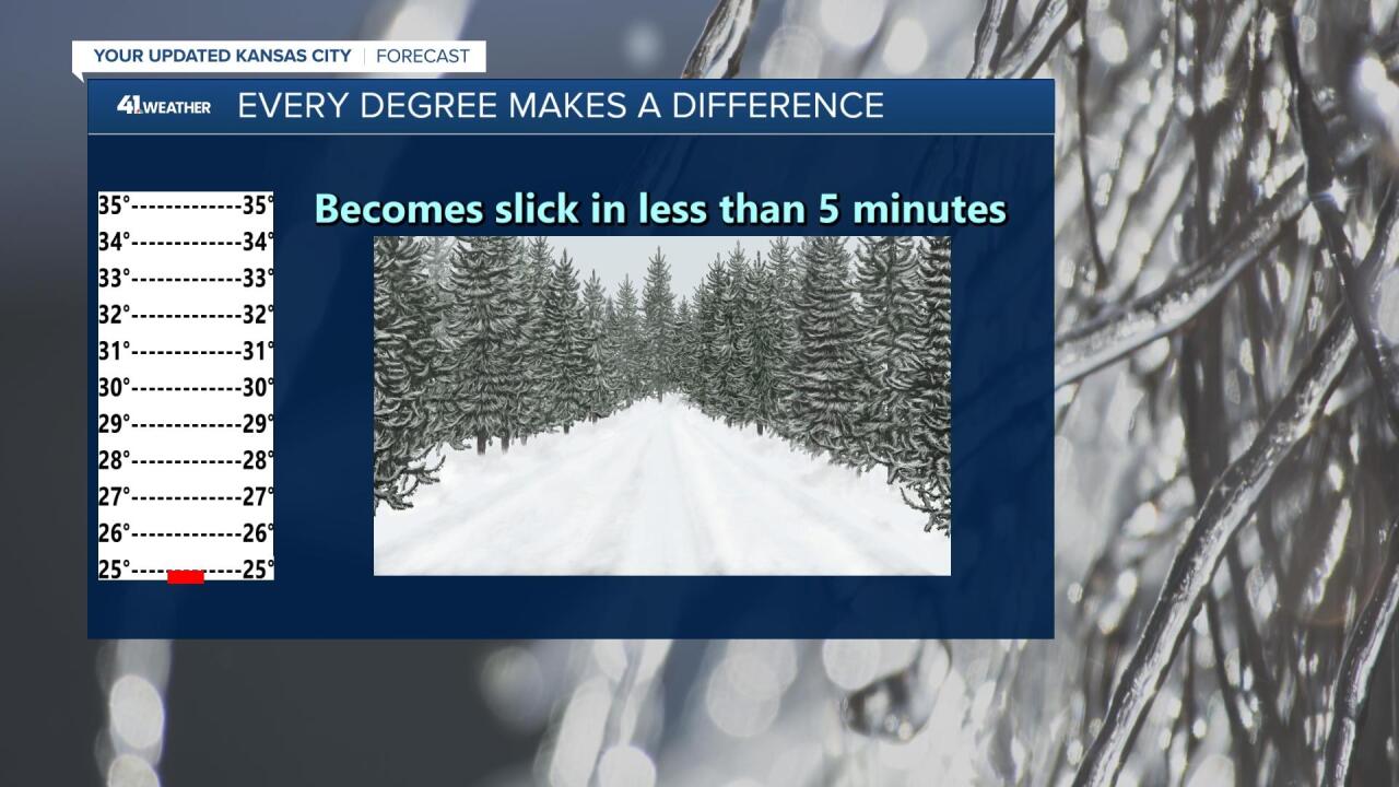
As the temperatures get lower, down to 28 degrees and then 27 degrees, ice will accumulate and snow will create snow-packed roads quickly.

At 26 degrees and then 25 degrees, all forms of precipitation freeze, creating slick and hazardous conditions. The roads can become a skating rink in less than five minutes, and the sudden freezing can catch drivers off guard.
We will keep you updated on conditions all winter long, as every degree makes a difference.
