


KANSAS CITY, Mo. — The National Weather Service plans to survey damage at six locations around the Kansas City area Tuesday after overnight storms.
One team has been selected to visit areas where mesovortex returns were notable on radar.
RELATED | Overnight storms bring damage, debris to Kansas City area
KSHB 41 meteorologist Cassie Wilson said it is still unknown if the damage was caused by straight-line winds or tornadic activity, which would likely be EF0-1.
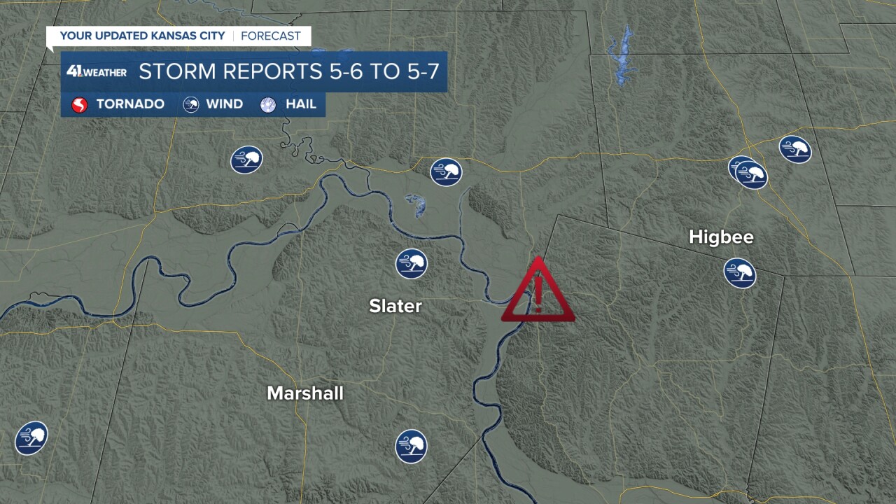
The six locations where some of the most notable mesovortex tracks were seen include:
1. Just W/NW of Smithville

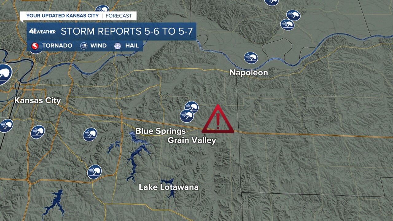
2. Just north of Lake Lotawana to Napoleon
NWS: This includes potential tornado damage along I-70 just west of Grain Valley.
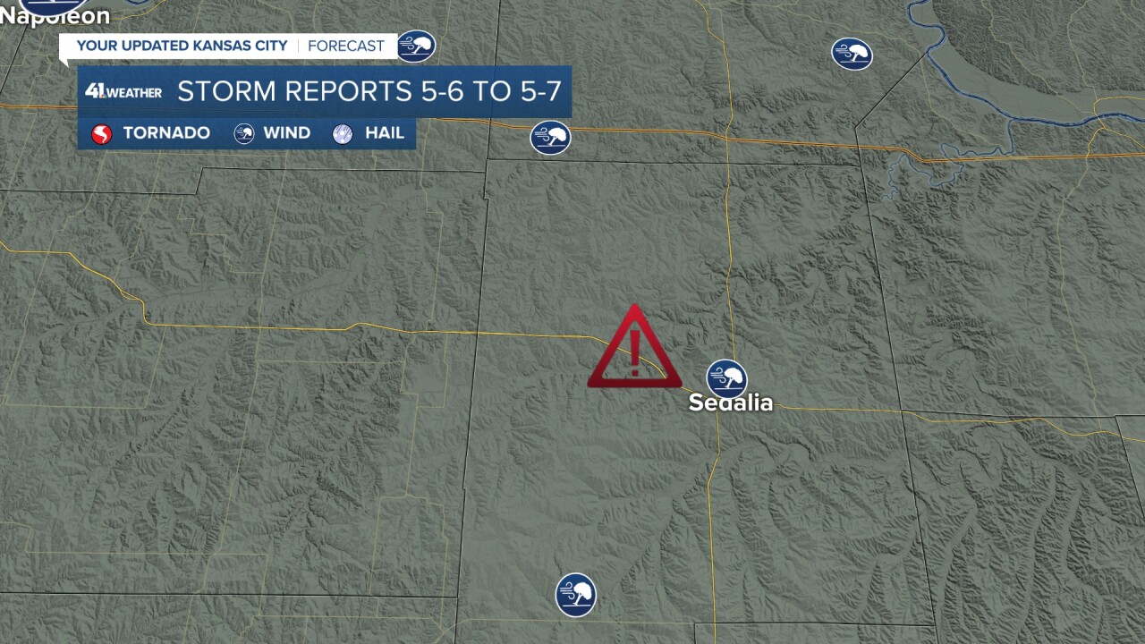
3. West of Sedalia to Pilot Grove
NWS: Reports were received of relatively widespread tree damage just west and north of Sedalia from Pettis County's emergency manager.
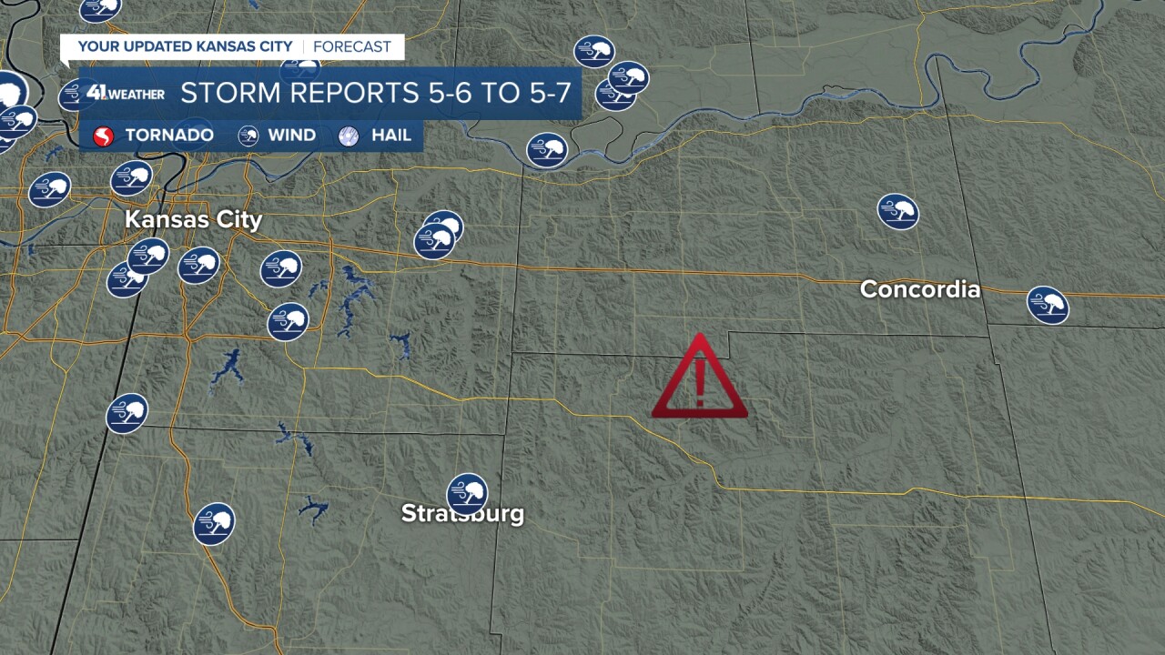
4. Strasburg to Concordia
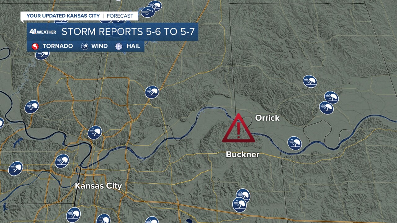
5. Buckner to Orrick
6. Slater to Higbee
—
