


KANSAS CITY, Mo. — Counties south of the Kansas City metro were included in a tornado watch until 1 a.m. Thursday, and the immediate metro was placed under a flood watch until Thursday afternoon.
LINK | KSHB 41 Weather Radar
LINK | KSHB 41 Traffic
LINK | KSHB 41 Weather forecast
LINK | KSHB 41 Weather Blog
LINK | KSHB 41 Severe Alerts
The KSHB 41 Weather team is keeping tabs on the potential for severe weather to develop.
—
Thursday, April 2
6:45 a.m. | The National Weather Service says multiple Johnson County, Missouri, roads are closed due to flooding. Highway 23 at Blackwater, Y Highway from SE 601 and SE 710, and the 100 block of NW Division are all impassible.
Late last night, water was over the road at 2 Highway and 00.
—
Wednesday, April 1
11:35 p.m. | The National Weather Service isssued a flash flood warning until 3 a.m. Thursday for Linn County in Kansas and Bates, southeastern Cass, Henry, and southern Johnson counties in Missouri. There are also flood warnings for Cooper, Lafayette, Pettis and Saline counties in Missouri.
10:21 p.m. | The National Weather Service continued a tornado watch for Henry and Pettis counties in Missouri.
9:57 p.m. | The National Weather Service reports heavy rain is spreading into eastern Henry and Pettis counties. Pettis County received a lot of rain last evening and is particularly susceptible to flash flooding tonight. Monitoring this area closely.
9:35 p.m. | The National Weather Service has issued a flash flood warning for Linn County in Kansas and Bates, Cass, Henry, and Johnson counties in Missouri until 3 a.m. Thursday.
9:10 p.m. | The National Weather Service issued a severe thunderstorm warning for Henry County until 9:45 p.m. A storm 7 miles southwest of Clinton was producing 60 MPH gusts and penny-size hail.
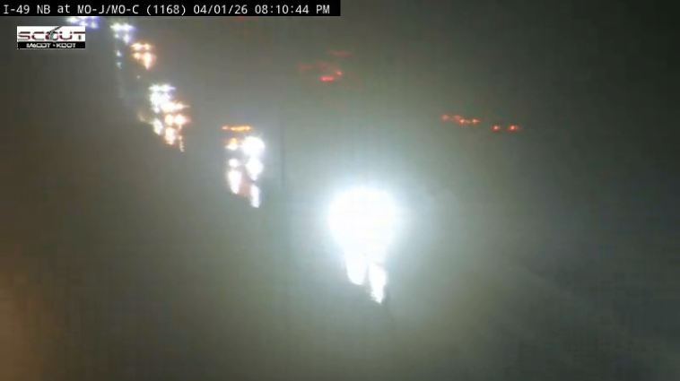
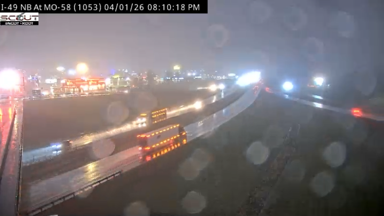
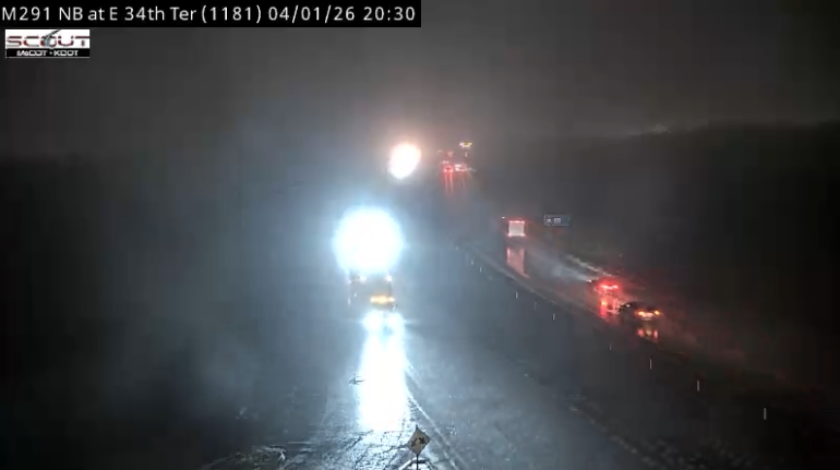
8:15 p.m. | Drivers on Interstate 49, near Belton and Peculiar, are seeing foggy conditions on their evening commute. Drivers along Missouri Route 291, east of Independence, are also experiencing dense fog.
8:05 p.m. | A flood advisory is in effect until 11 p.m. Wednesday, per the National Weather Service.
The advisory is in place for Bates, Cass, Henry and Johnson counties in Missouri. Linn County in Kansas is also included.
7:20 p.m. | Meteorologist Wes Peery answered your questions about tonight's threat of severe weather during a livestream.
You can watch the video below.
6:01 p.m. | The National Weather Service has issued a tornado watch in effect for counties south of the Kansas City metro.

The watch includes Bates, Cass, Henry, Johnson and Pettis counties in Missouri, and Linn and Miami counties in Kansas.
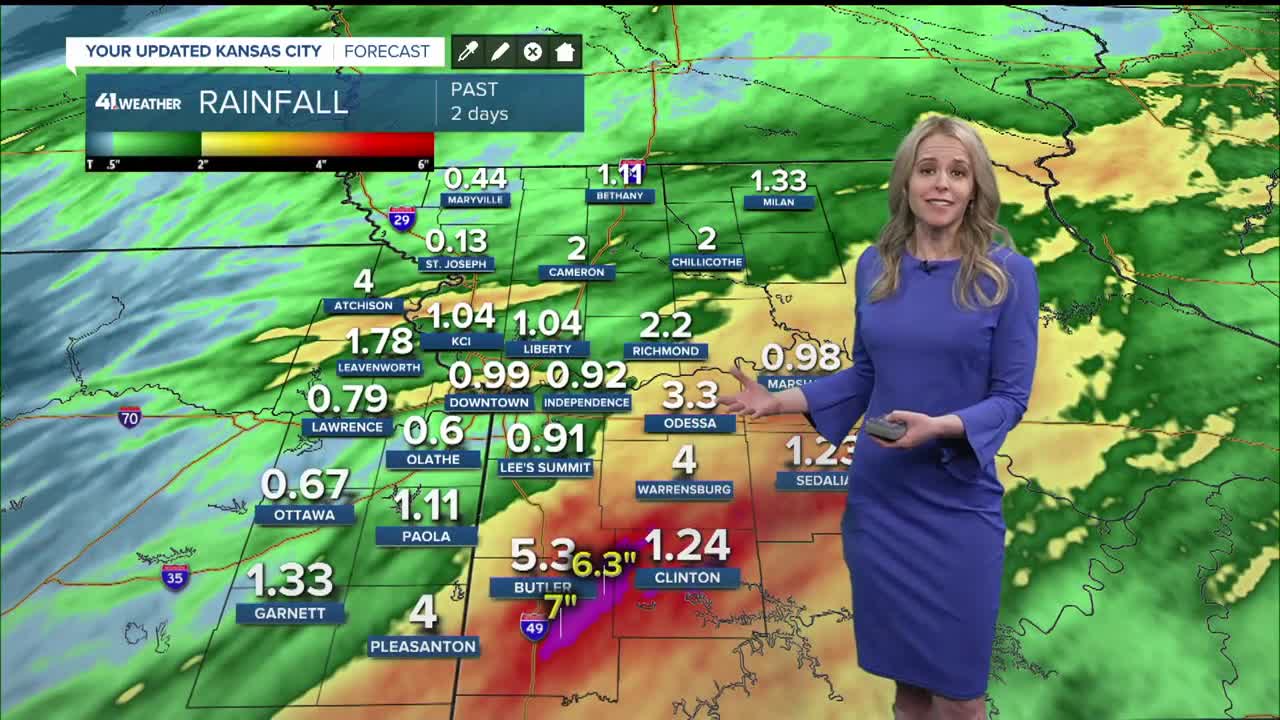
5:40 p.m. | KSHB 41's Wes Peery says tonight's rainfall projections are "concerning," as areas near and south of Kansas City could see 2–6 inches of rain by Thursday morning.
3:50 p.m. | A flood watch will go into effect at 7 p.m. Wednesday and last through Thursday afternoon for the Kansas City area, per the National Weather Service.
KSHB 41 meteorologist Wes Peery says Wednesday night will be active, with increased rain chances after 5 p.m.
Heads up — tonight will get active!
— Wes Peery (@WesWeather) April 1, 2026
Rain increases after 5 PM, and we’re looking at very heavy rain overnight.
From 5pm-Midnight storms may bring hail and strong winds
Later tonight, the focus shifts to flash flooding with 2-4+" possible near and south of KC pic.twitter.com/TXsrhQmKp5
The flash flooding risk is due to the possibility of receiving 2” to 4” of rainfall near and south of KC, per Peery.
—
