


Good Tuesday, bloggers,
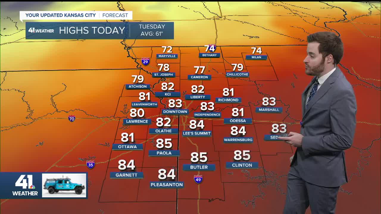
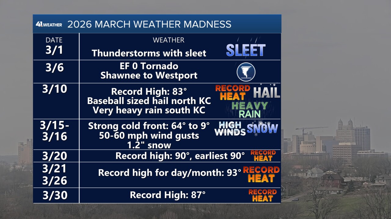
We had a record-high temperature Monday, which completes the wild March.
Before we get to April, here is a look at some of the March highlights. If you thought March was a wild one, you were right.
April is going to pick up right where March left off with a good chance of thunderstorms April 1-4.

This active weather is being caused by three main players: a front and two storm systems.
As of noon today, the front was moving through KC. This front will track to southern Missouri tonight, stall and then begin to head north Wednesday as a warm front.
It will basically waver back and forth as the two storm systems track along it.
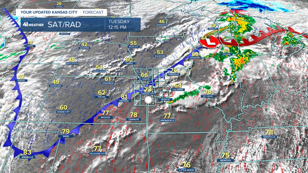
The first storm system is about to enter California, while the second is moving through the Gulf of Alaska.
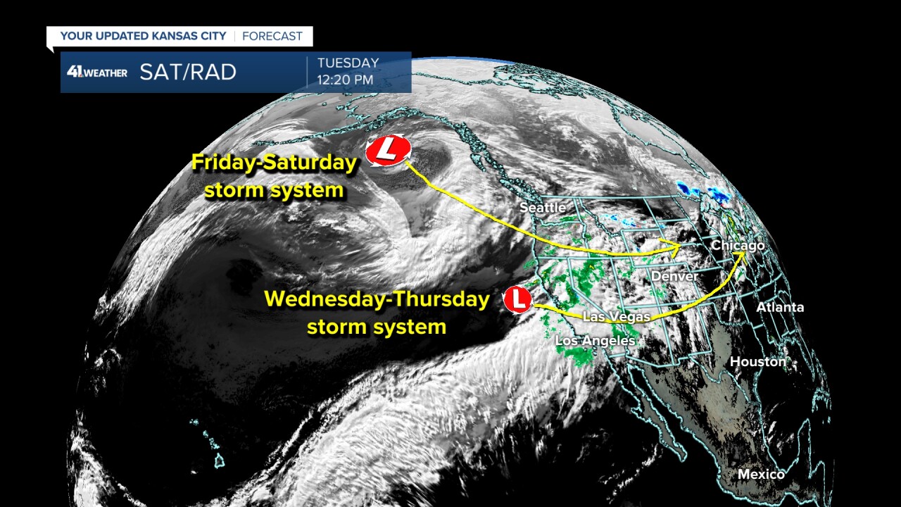
Let's go through tonight–Saturday and see what the three players have in mind.
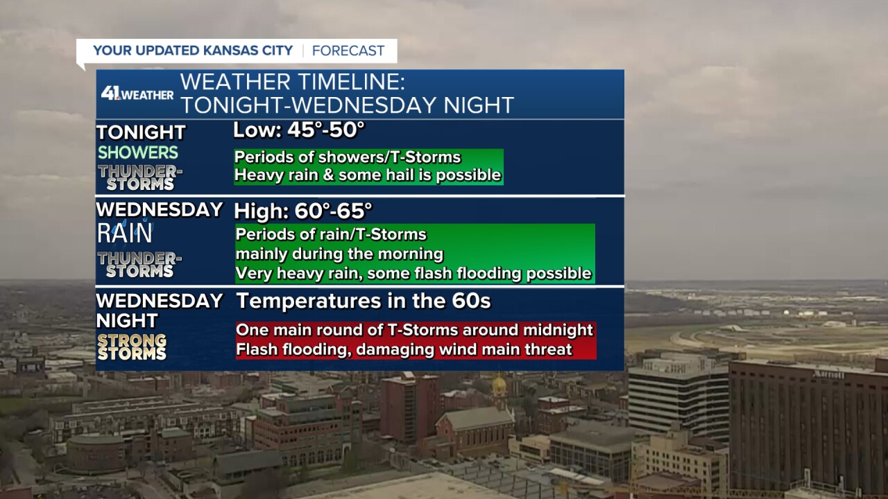
TONIGHT:
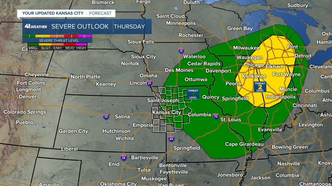
There is a Level 1 threat of severe weather — mainly for hail — as we will see showers and thunderstorms form mostly north of the front tonight.

The exact location of the zone that sees the most thunderstorms is still a question, but it will be around 20-100 miles north of the front.
Lows tonight may drop to the mid and upper 40s.
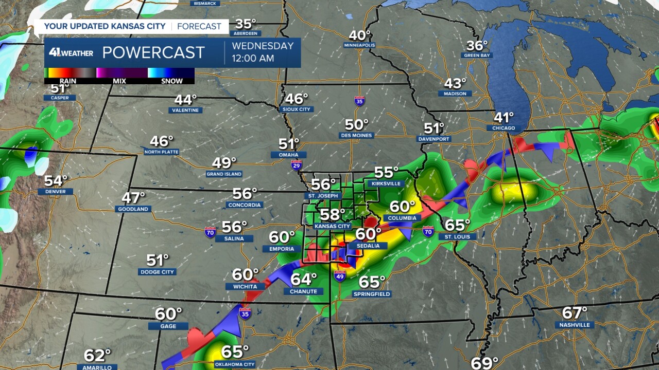
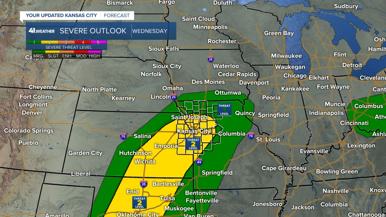
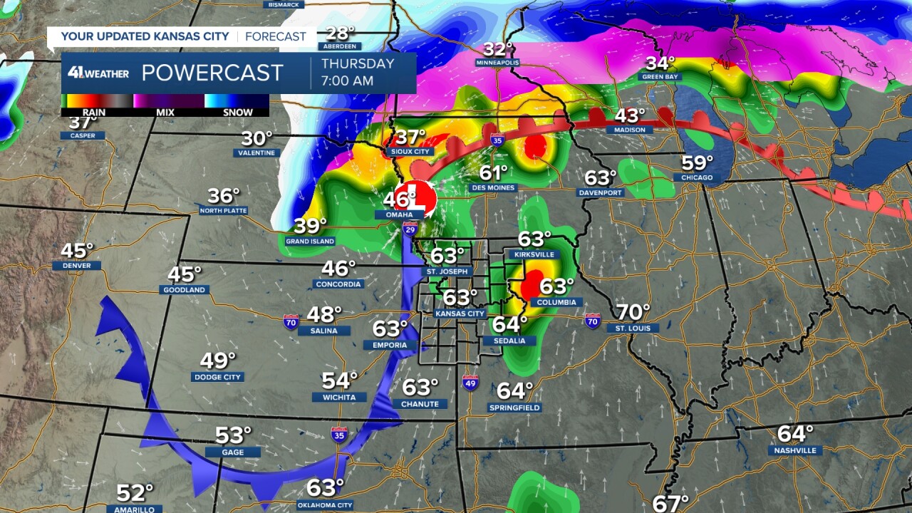
WEDNESDAY:
The front will lift north as a warm front to northern Missouri. Highs will be mostly in the 60s as clouds and periods of showers and thunderstorms will keep temps from getting to the 70s and 80s.
This is good news when you want to limit severe weather. We are on the northern edge of a Level 2 of 5.
It looks like the best chance to see thunderstorms is during the morning, and then again during the evening and night. If there are more thunderstorms all day tomorrow, it may keep the warm front from tracking as far north as shown below.
Some thunderstorms along the warm front could be severe with all modes possible, if it warms up enough.
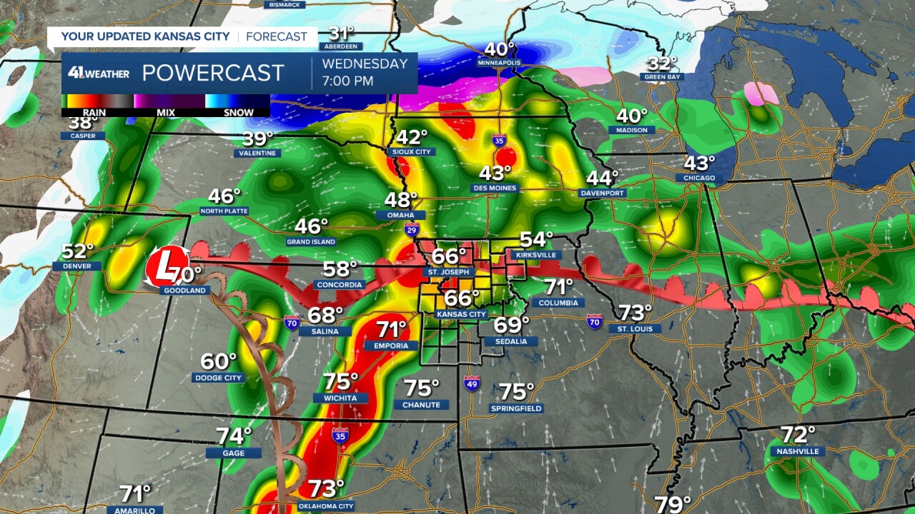
WEDNESDAY NIGHT:
The evening and night stuff will come from a line of thunderstorms, most likely severe, that forms out west and heads our way. Our severe threat will depend on how severe the line is once it arrives around midnight.
The fact that it is arriving at night, during cooler times, reduces the severe threat, but it does not take the threat to zero. Damaging winds and flash flooding are the main threats, but a brief, small tornado can't be ruled out.
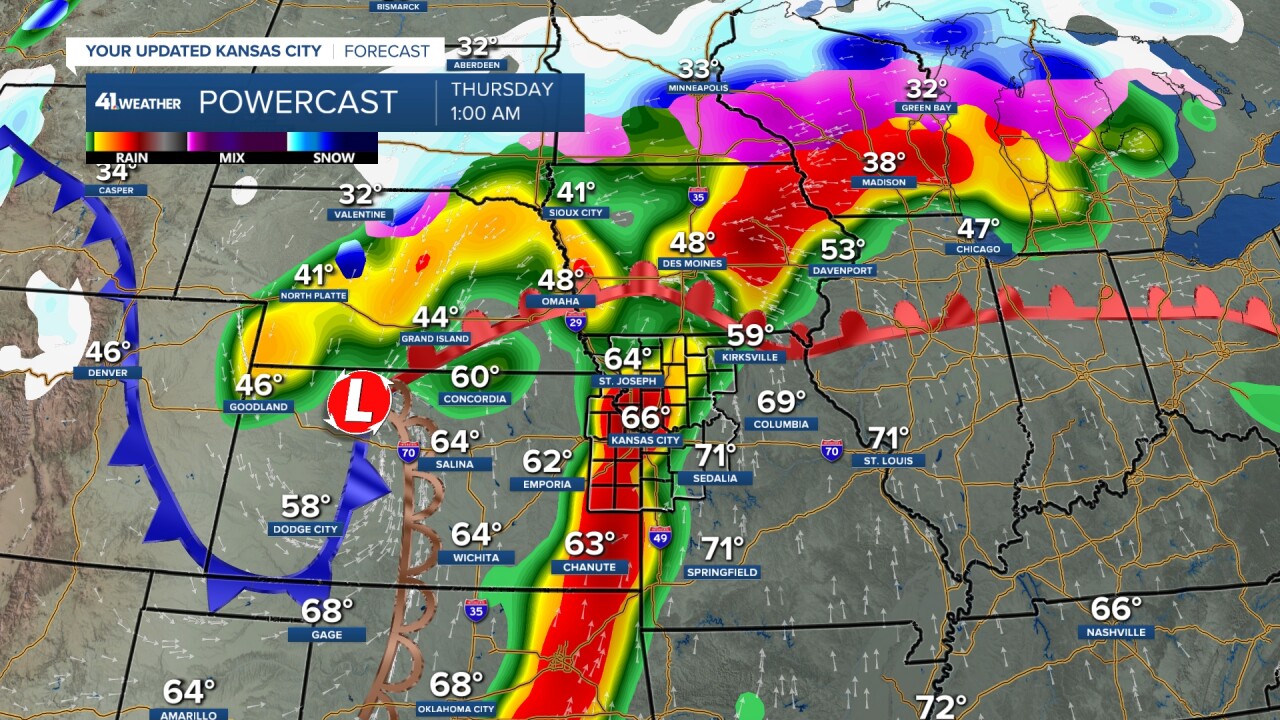
THURSDAY:
Any rain and thunderstorms will end during the morning, making for a nice afternoon with some sun and highs in the 60s.
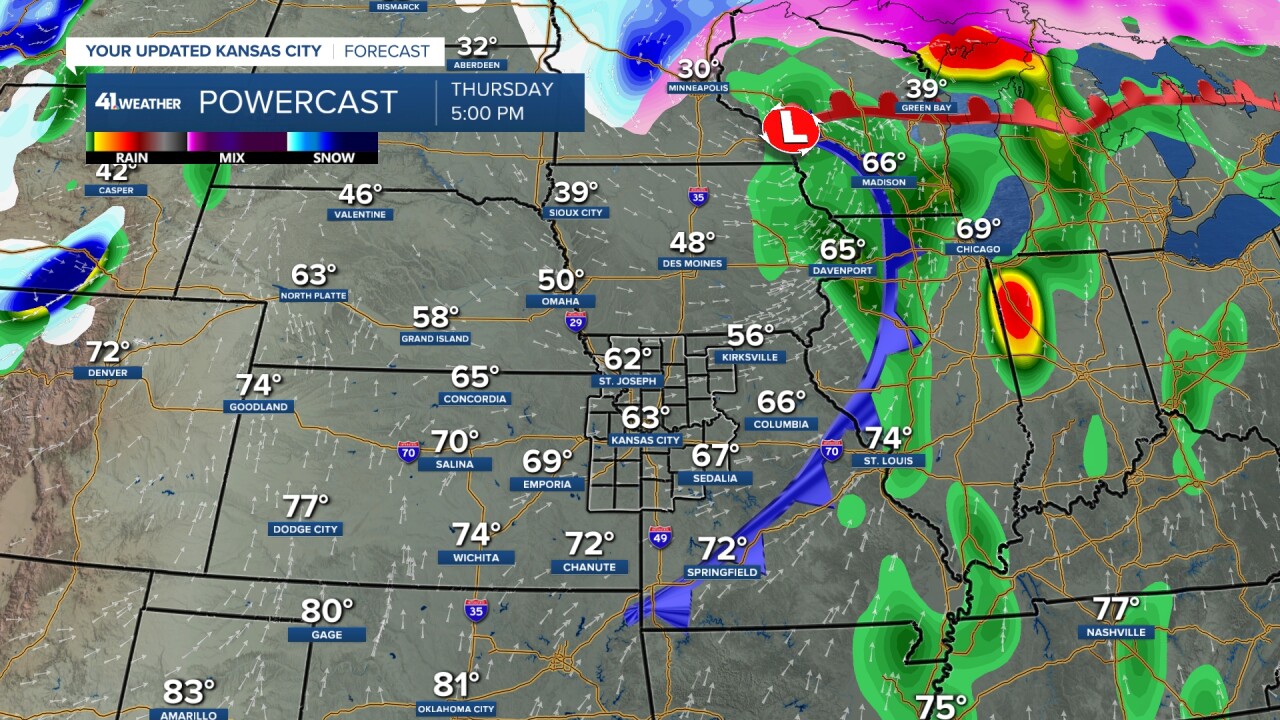
The severe threat shifts east. We are in a Level 1 of 5 for any morning stuff that could be severe.
FRIDAY:
Lows will be 45-55. Then, warm and moist air will surge north by afternoon. Our highs will likely be in the 70s ahead of a cold front.
This setup looks to be the best chance of severe weather in our area.
Thunderstorms will likely start to form along the front to our west 2-4 p.m.
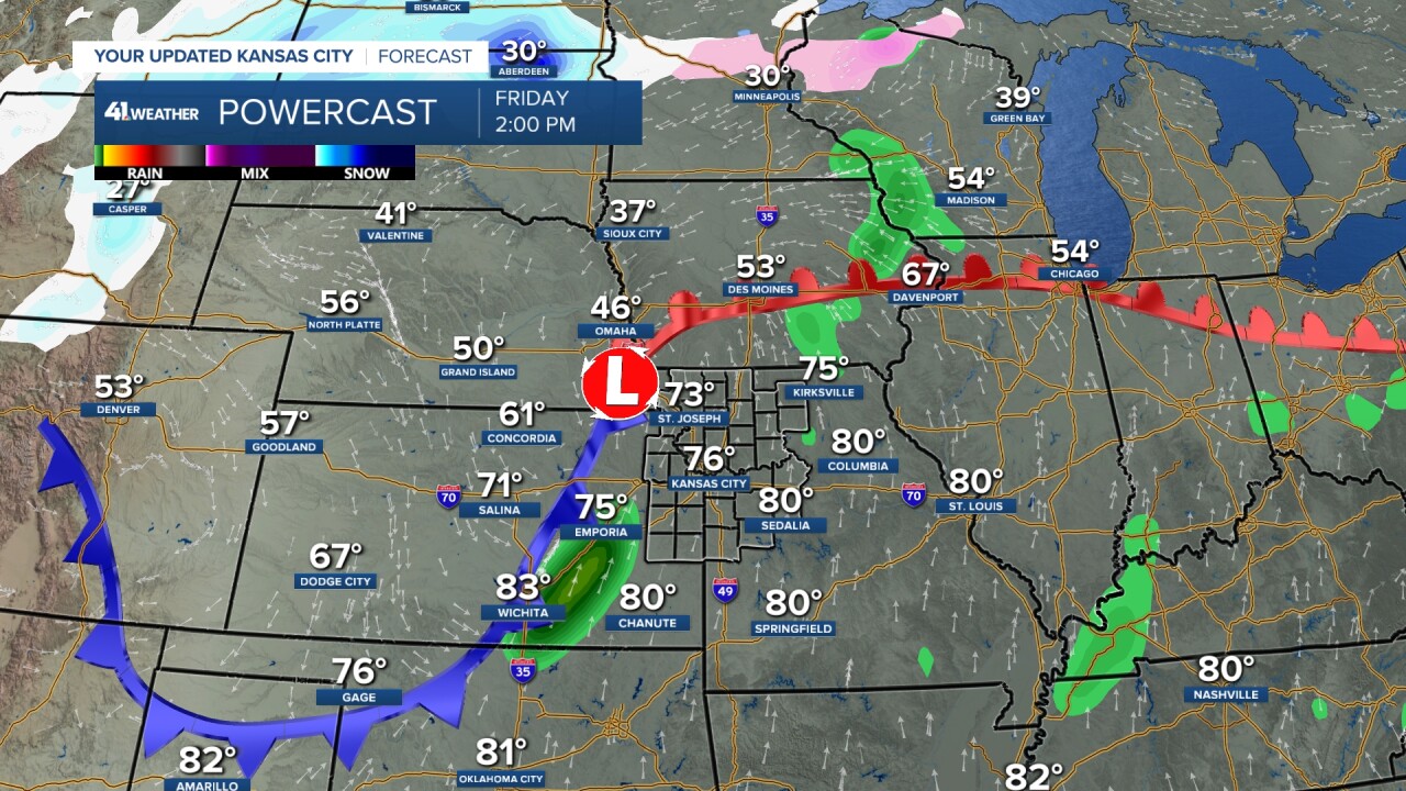
The line will roll through sometime between 5 p.m. and midnight, with all forms of severe weather possible.
Now, there is a chance the cold front outruns the line of thunderstorms, putting the thunderstorms mostly behind the front once it gets here.
That would help to reduce the severe threat. But this is not set yet.

We are in a broad Level 2 of 5 severe threat as of Tuesday. We know a lot can change in 3-4 days.

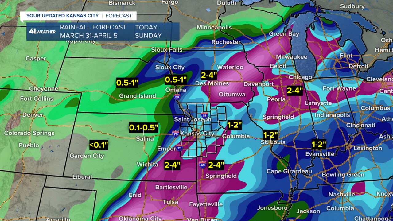
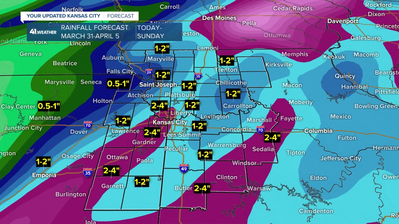
RAINFALL FORECAST TODAY-SATURDAY:
There is not a lot of change here as most locations will see 1"-2" of rain. There will be areas of 2"-4" of rain, which depends on where the thunderstorms set up the longest.
Tonight–Wednesday is likely the best chance to see a zone of thunderstorms that could make the difference between 1"-2" and 2"-4" of rain on your yard or farm.
There may be some locations that see flash flooding in these zones.
Bottom line, today is a good day to put out grass seed and fertilizer.
Here is a weather summary for tonight through Wednesday night.
Have a great rest of your week.
Stay healthy.
—
