

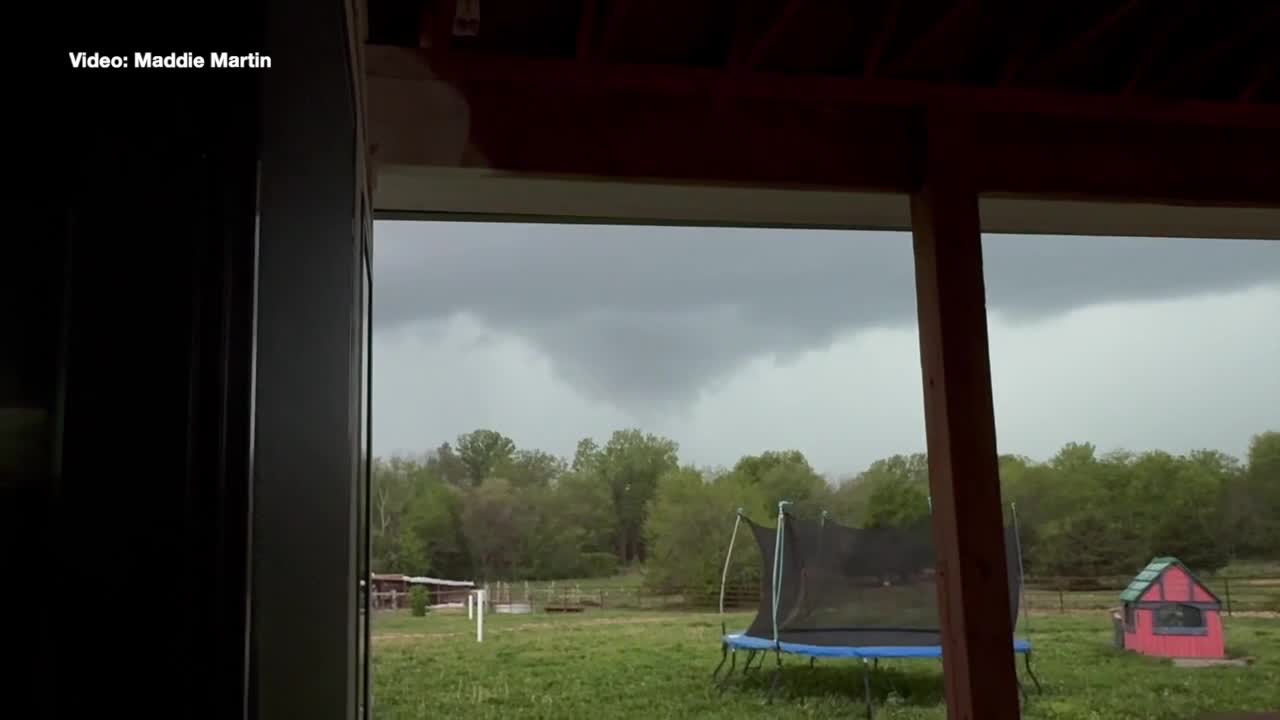


KANSAS CITY, Mo. — A series of severe thunderstorms and a possible tornado blasted through the Kansas City area Friday night.
LINK | KSHB 41 Weather Radar
LINK | KSHB 41 Traffic
LINK | KSHB 41 Weather forecast
LINK | KSHB 41 Weather Blog
LINK | KSHB 41 Severe Alerts
Check back throughout the day for updates.
UPDATE, 9 p.m. | Viewers are continuing to share photos with KSHB 41 News of severe storms that moved through the area.


UPDATE, 8 p.m. | A viewer shares a video of the possible tornado that hit parts of Belton, Missouri, on Friday.
UPDATE, 7:50 p.m. | Officials provide an update on damage in Belton, Missouri.
UPDATE, 7:44 p.m. | The Cass County Sheriff's Office posted on social media around 7 p.m. Friday about a stretch of road closed due to downed power lines.
The area of South Mullen Road near Highway 58 is closed down to Cambridge Road and Kent Drive.
UPDATE, 7:30 p.m. | At the height of storms in the KSHB 41 News viewing area, Evergy was reporting 13,000 outages.
As of 7:30 p.m. Friday, 10,953 customers are experiencing outages.
Kansas statewide: 2,418
Missouri statewide: 8,535
Outage updates: https://outagemap.evergy.com/
UPDATE, 7:20 p.m. | These photos were sent to KSHB 41 from Belton, Missouri, where a likely tornado touched down.
![123_1[66].jpeg](https://ewscripps.brightspotcdn.com/dims4/default/fb4b1c8/2147483647/strip/true/crop/2560x1441+0+0/resize/1280x721!/quality/90/?url=http%3A%2F%2Fewscripps-brightspot.s3.amazonaws.com%2Fab%2F54%2Fdd85a79d4b60be2041380b25f818%2F123-166.jpeg)
![123_1[1].jpeg](https://ewscripps.brightspotcdn.com/dims4/default/4427da8/2147483647/strip/true/crop/2048x1536+0+0/resize/1280x960!/quality/90/?url=http%3A%2F%2Fewscripps-brightspot.s3.amazonaws.com%2Ff2%2F25%2F518c15d24b1db078e0851001110a%2F123-11.jpeg)
UPDATE, 7:08 p.m. | The National Weather Service has issued a tornado warning until 7:30 p.m. for Henry County in Missouri.
Tornado Warning including Deepwater MO, Brownington MO and Tightwad MO until 7:30 PM CDT pic.twitter.com/OrcyKw6Z7z
— NWS Kansas City (@NWSKansasCity) April 18, 2026
UPDATE, 6:40 p.m. | KSHB 41 reporter Fernanda Silva gives an update on storm damage in Belton, Missouri.
UPDATE, 6:21 p.m. | A tornado warning has been issued until 6:45 p.m. for Bates County in Missouri.
UPDATE, 6:15 p.m. | KSHB 41 News crews are in Belton, Missouri, following a reported tornado.
KSHB 41's Braden Bates provides an update on storm damage:
UPDATE, 6:04 p.m. | The City of Belton, Missouri, is responding to storm damage after a reported tornado Friday.
Officials are asking residents to stay off the roads and avoid impacted areas.
UPDATE, 6:01 p.m. | A severe thunderstorm warning has been issued until 6:45 p.m. for Pettis, Saline, Lafayette and Johnson counties in Missouri, according to the National Weather Service.
UPDATE, 5:56 p.m. | Viewers in Raymore, Missouri, shared these photos of storm clouds on Friday evening.
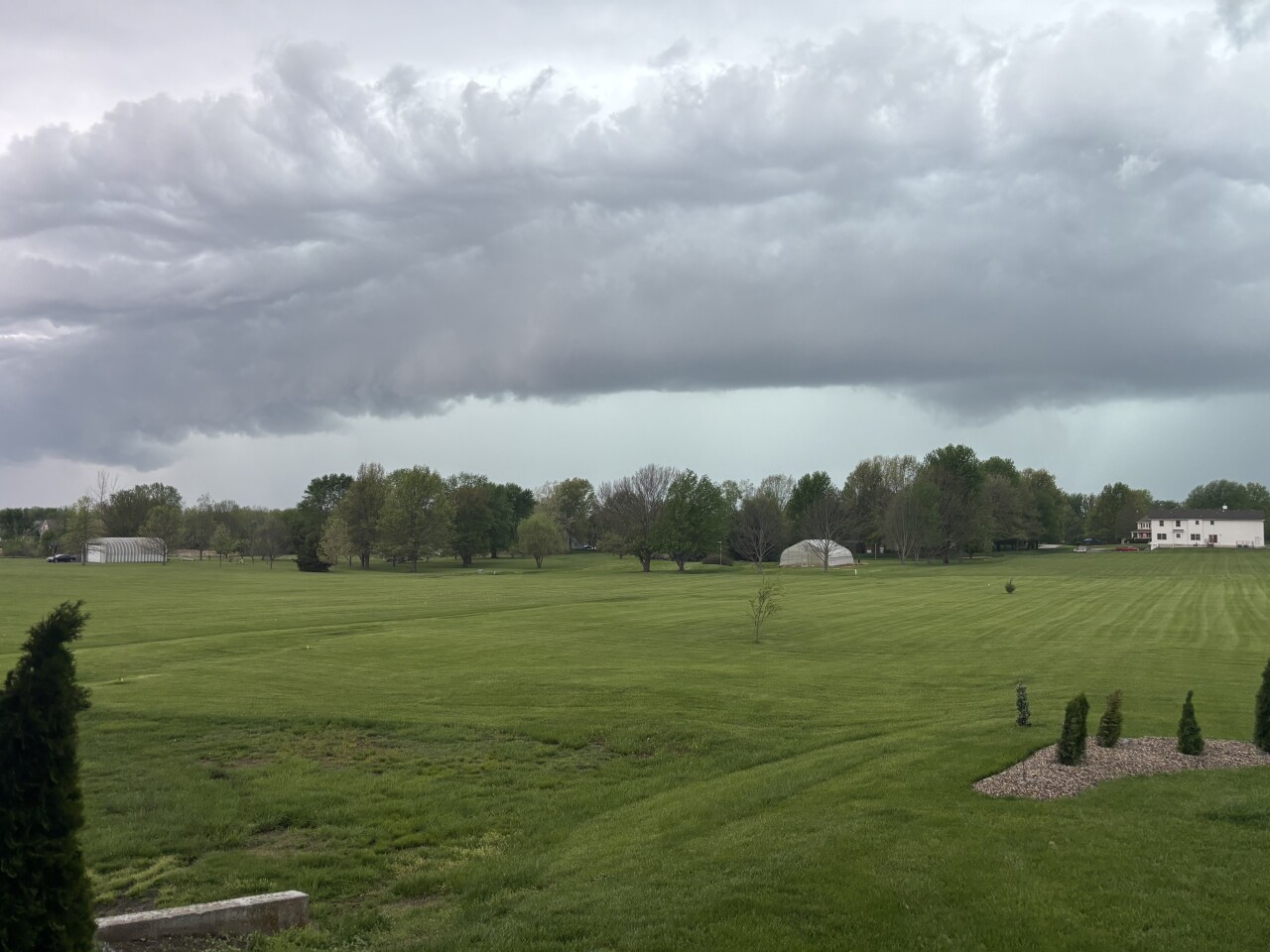

UPDATE, 5:46 p.m. | A severe thunderstorm warning has been issued until 6:30 p.m. for Miami and Linn counties in Kansas, and Cass and Bates counties in Missouri.
There is also one in place until 6:30 p.m. for Chariton, Ray, Carroll, Caldwell, Saline, Lafayette and Livingston counties in Missouri.
UPDATE, 5:42 p.m. | The emergency manager for the City of Belton says crews are responding to reports of downed trees and power lines in Belton.
UPDATE, 5:39 p.m. | A severe thunderstorm warning is in place until 6:45 p.m. for Henry and Bates counties in Missouri, per NWS.
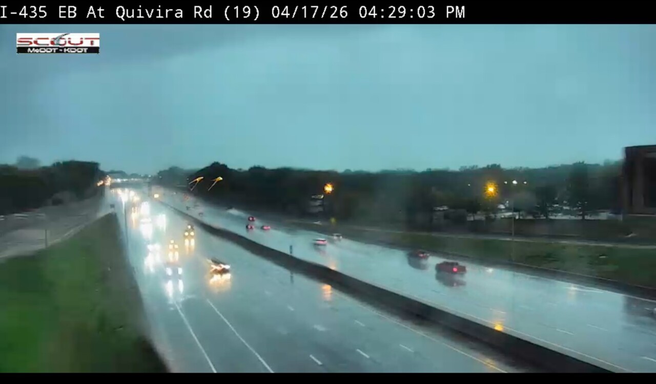
UPDATE, 5:38 p.m. | Traffic is backed up for miles on 169 due to flooding on the roadway.
KSHB 41 reporter Isabella Ledonne shared this picture:

UPDATE, 5:27 p.m. | Tornado sighted in Belton, Missouri, near I-49 and 58 Highway, according to NWS.
UPDATE, 5:25 p.m. | Evergy customers are experiencing outages across Kansas and Missouri.
Kansas statewide: 6,378
Missouri statewide: 1,044
Outage updates: https://outagemap.evergy.com/
UPDATE, 5:18 p.m. | Tornado warning canceled for northeastern Miami and southeastern Johnson counties in Kansas.
UPDATE, 5:13 p.m. | Tornado warning issued until 5:45 p.m. for Miami and Johnson counties in Kansas, and Cass and Jackson counties in Missouri, per NWS.
UPDATE, 5:09 p.m. | Evergy customers are experiencing outages across Kansas and Missouri.
Kansas statewide: 3,871
Missouri statewide: 331
Outage updates: https://outagemap.evergy.com/
UPDATE, 5:03 p.m. | A severe thunderstorm warning has been issued until 6 p.m. for Cass, Bates and Jackson counties in Missouri, per NWS.
UPDATE, 5:02 p.m. | A flash flood warning is in place until 9 p.m. for Johnson and Wyandotte counties in Kansas, and Clay, Jackson and Platte counties in Missouri.
Water is starting to pool on roads in Kansas City following heavy rainfall.


UPDATE, 4:53 p.m. | A viewer in Lawrence, Kansas, shared a photo of lightning as storms hit the area.
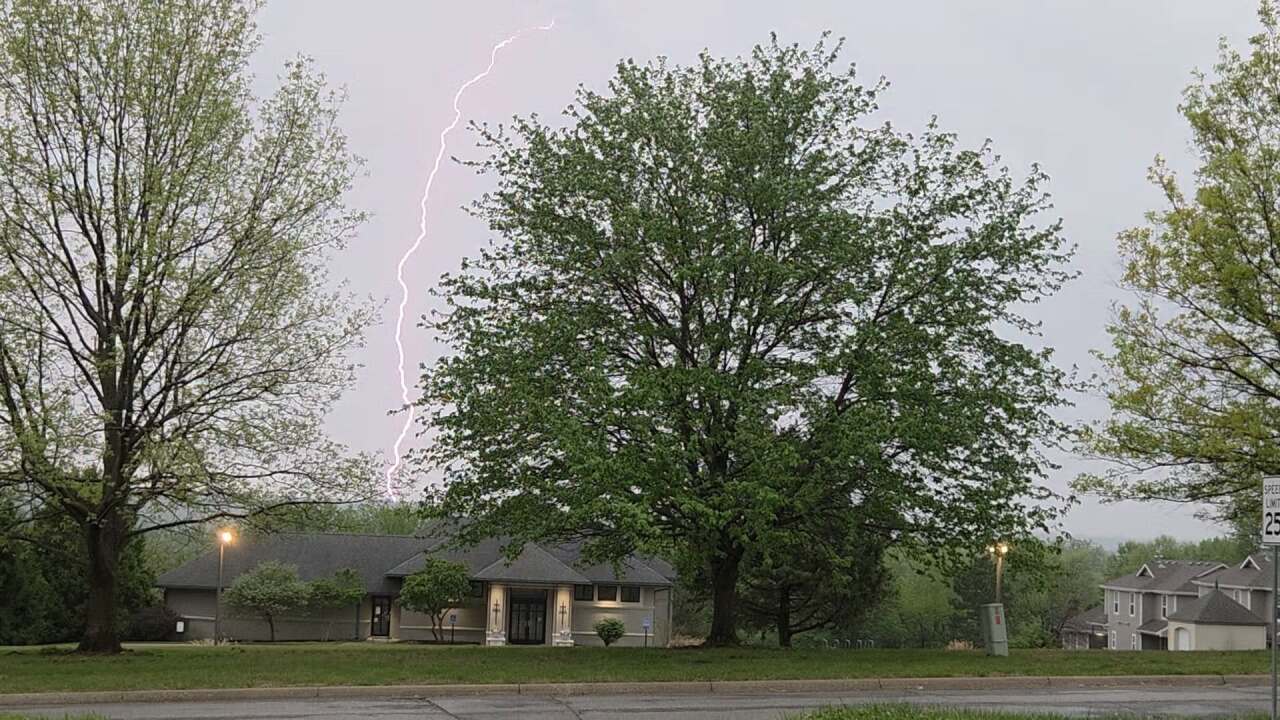
UPDATE, 4:52 p.m. | According to Evergy, roughly 3,027 customers are without power in Kansas, with 980 impacted in Linn County, Kansas, and 539 experiencing outages in Miami County, Kansas.
There are 212 without power in Missouri.
Outage updates: https://outagemap.evergy.com/
UPDATE, 4:44 p.m. | NWS issued a severe thunderstorm warning until 5:30 p.m. for Wyandotte, Leavenworth and Johnson counties in Kansas, and Clay, Ray, Platte and Jackson counties in Missouri.
UPDATE, 4:35 p.m. | A severe thunderstorm warning is in place until 5:15 p.m. for Miami, Linn and Johnson counites in Kansas, and Cass County in Missouri.
UPDATE, 4:27 p.m. | NWS has issued a severe thunderstorm warning until 5:15 p.m. for Johnson County in Kansas.
UPDATE, 4:20 p.m. | A severe thunderstorm warning was issued until 5 p.m. for parts of Missouri including Daviess, Grundy, Clinton, Caldwell, DeKalb and Livingston counties, per NWS.
UPDATE, 4:17 p.m. | NWS cancels the tornado warning for south central Sullivan County.
UPDATE, 4:11 p.m. | The National Weather Service cancels the tornado warning for Livingston and Grundy counties. It remains in effect for Linn and Sullivan counties until 4:30 p.m.
UPDATE, 4:09 p.m. | A severe thunderstorm warning was issued until 5 p.m. for Adair, Sullivan, Mercer, Putnam and Schuyler counties in Missouri.
UPDATE, 4 p.m. | A severe thunderstorm warning has been issued until 5 p.m. in parts of Linn, Grundy, Sullivan and Mercer counties in Missouri, per NWS.
UPDATE, 3:45 p.m. | A tornado warning is in place until 4:30 p.m. for parts of Linn, Grundy, Sullivan and Livingston counties in Missouri.
UPDATE, 3:25 p.m. | Parts of Buchanan, Clinton and Platte counties in Missouri are in a tornado warning until 4 p.m., per NWS.
UPDATE, 3:14 p.m. | NWS issued a severe thunderstorm warning until 3:45 p.m. for parts of Mercer and Putnam counties in Missouri.
UPDATE, 3:11 p.m. | A severe thunderstorm warning is in place until 4:15 p.m. for parts of Buchanan, Daviess, Clinton, Gentry, Harrison, Andrew and DeKalb counties in Missouri, per NWS.
UPDATE, 2:57 p.m. | A tornado warning has been issued until 3:30 p.m. for Atchison County in Kansas, and Buchanan and Platte counties in Missouri.
UPDATE, 2:51 p.m. | A severe thunderstorm warning has been issued by NWS until 3:30 p.m. for east central Daviess, northwestern Linn, Grundy, Sullivan, Mercer, southwestern Putnam and northwestern Livingston counties in Missouri.
UPDATE, 2:47 p.m. | East central Doniphan County in Kansas, and southern Gentry, eastern Andrew and northern DeKalb counties in Missouri are in a severe thunderstorm warning until 3:15 p.m.
Ray County in Missouri is in a severe thunderstorm warning until 3:15 p.m., per NWS.
UPDATE, 2:35 p.m. | The National Weather Service issued a severe thunderstorm warning until 3:15 p.m. for eastern Worth, northeastern Gentry and northern Harrison counties in Missouri.
UPDATE, 2:27 p.m. | A severe thunderstorm warning is in place until 3:15 p.m. for Daviess, Grundy, Ray, Carroll, Caldwell and Livingston counties in Missouri, per the National Weather Service.
A severe thunderstorm warning was also issued until 3:15 p.m. for Doniphan and Atchison counties in Kansas, and Buchanan and Platte counties in Missouri.
UPDATE, 2:15 p.m. | Clay County, Missouri, offices will close at 3 p.m. due to the threat of severe weather.
"We appreciate your understanding and encourage everyone to stay safe and take necessary precautions," Clay County said in a press release.
UPDATE, 2:03 p.m. | The National Weather Service issued a severe thunderstorm warning until 2:45 p.m. for northern Gentry and southeastern Nodaway counties in Missouri.
UPDATE, 2 p.m. | City offices in Leawood, Kansas, closed at 2 p.m. Friday due to expected severe storms.
UPDATE, 1:45 p.m. | The National Weather Service has issued a tornado watch that includes the greater Kansas City until 9 p.m. Friday.
1:30pm FRI--A TORNADO WATCH including the Kansas City metro is in effect until 9PM
— Wes Peery (@WesWeather) April 17, 2026
Storms capable of 60-90 MPH wind gusts, softball size hail, and tornadoes will move through between 2pm-8pm
PLEASE be prepared to act quickly when warnings are issued #mowx #kswx #kcwx pic.twitter.com/It06lvgnh1
UPDATE, 1:16 p.m. | A severe thunderstorm warning has been issued until 2 p.m. for Worth, Gentry and Nodaway counties in Missouri, per the National Weather Service.
Severe Thunderstorm Warning including Maryville MO, Grant City MO and Hopkins MO until 2:00 PM CDT pic.twitter.com/LUTaREfcg2
— NWS Kansas City (@NWSKansasCity) April 17, 2026
UPDATE 1:00 p.m. | All Mid-Continent Public Library locations will close at 2:30 p.m.
The Park Hill School District will also dismiss early.
UPDATE, 12:50p.m.| Jackson County has announced that it will close its facilities at 3:00 p.m. due to the severe weather threat. Public safety and emergency services will remain fully operational. Residents are encouraged t complete business before the closure. Many services remain available online at JacksonGov.org.
UPDATE, noon | "It's about to get rough out there, KC," said Kansas City, Missouri, Mayor Quinton Lucas on social media regarding the expected severe storms.
Lucas is reminding residents to stay safe.
It's about to get rough out there, KC.
— Mayor Quinton Lucas (@MayorLucasKC) April 17, 2026
Severe storms expected this afternoon into evening. Damaging winds, hail, and possible tornadoes. Check in with your people. Have a way to get warnings. Stay safe this weekend. pic.twitter.com/YYZym1m1K3
UPDATE, 11:55 a.m. | Additional schools are adding to the list of early dismissals. Those include Liberty, Academie Lafayette, Cristo Ray KC, Hickman Mills, Kearney and Raytown.
UPDATE, 11:50 a.m. | KSHB 41 meteorologist Wes Peery gives an update on social media regarding the viewing areas severe risk. Threats include possible tornadoes, large hail and wind gusts over 80 mph.
12 PM Friday UPDATE
— Wes Peery (@WesWeather) April 17, 2026
Our severe risk has increased; now a 4 out of 5—confidence is growing in widespread severe storms after 2pm into the evening
Threats include tornadoes, very large hail, and wind gusts over 80 mph
Make sure you’re ready to act on warnings! #mowx #kswx #kcwx pic.twitter.com/efYM50htlM
UPDATE, 11:35 a.m. | KSHB 41's Wes Peery provides an update on the timing of storms. For Kansas City, it will generally be between 2 to 10 p.m.
STORM TIMING
— Wes Peery (@WesWeather) April 17, 2026
Here are some useful graphics that show the timing of the storms and when each threat is more likely
For Kansas City, it’s generally 2-10pm pic.twitter.com/m1IjbmZV8p
UPDATE, 10:45 a.m. | A few more schools join the list of early dismissal including KCPS, Grandview and Belton.
UPDATE, 10:15 a.m. | Additional school districts dismissing early Friday: Concordia, Ray-Pec, Sherwood, Cass, Strasburg, Metropolitan Community College, Fort Osage, Independence, Odessa, Lone Jack, Mound City and Pleasanton.
UPDATE, 9:30 a.m. | Several school districts have announced or are considering an early dismissal Friday.
The Lee's Summit, Blue Springs and Independence school districts announced early dismissals on Friday.
UPDATE, 9 a.m. | Here's the latest thoughts on today's forecast from the KSHB 41 Weather team:
You don’t need a meteorology degree for this one…
— Wes Peery (@WesWeather) April 17, 2026
That radar look? Yeah… not great
After 2pm be ready for watches and warnings! #mowx #kswx #Kcwx pic.twitter.com/V4ng0zJeCS
—
![020626_KSHB_Image_NXA_Web_Standard Cube[88].jpg](https://ewscripps.brightspotcdn.com/dims4/default/0ead409/2147483647/strip/true/crop/300x225+0+13/resize/960x720!/format/webp/quality/90/?url=http%3A%2F%2Fewscripps-brightspot.s3.amazonaws.com%2F8f%2F6c%2Ffad8bd2346c5a4d4ead793017d4a%2F020626-kshb-image-nxa-web-standard-cube88.jpg)