


KANSAS CITY, Mo. — Check back with KSHB 41 News throughout Friday afternoon and evening for the latest severe weather updates.
LINK | KSHB 41 Radar
LINK | KSHB 41 Weather
UPDATE, 8:09 p.m. | The National Weather Service has canceled the part of the tornado watch that included the Kansas City area.
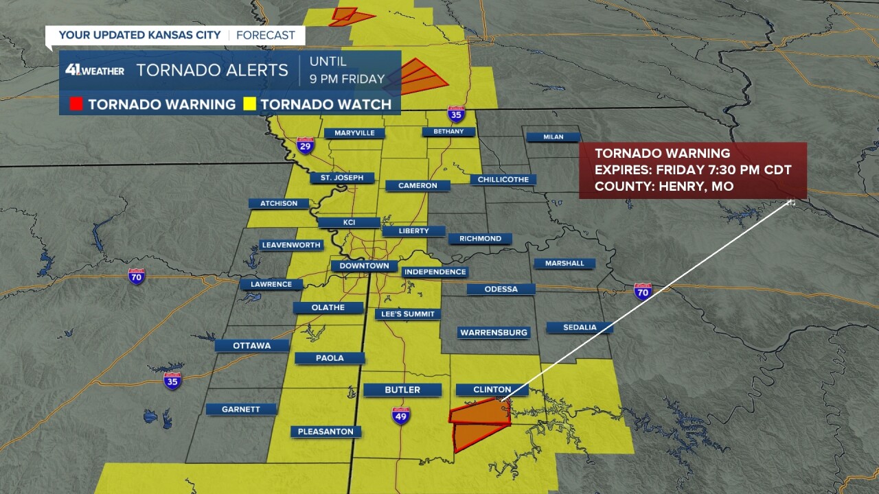
UPDATE, 7:30 pm. | Henry County Tornado Warning has been dropped. At this time there are no active tornado warnings in the area. A few strong to severe thunderstorms continue south of Kansas City producing large hail.

UPDATE, 7:05 pm. | Tornado Watch has been lifted for our far western Counties. The Metro should be cleared from this concern soon as well. Tornado concerns continue to lift into Iowa and south of KC. We are still tracking an active Tornado Warning in Henry Co., MO until 7:30 pm.
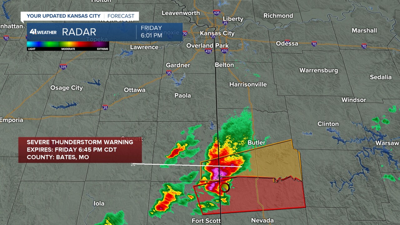
UPDATE, 6:45 pm. | Severe thunderstorm warning issued on the backside of this tornadic supercell for Bates County. Ping pong ball size hail and 60 mph wind gusts are possible. These storms are training through Butler County with flooding concerns now on the rise.
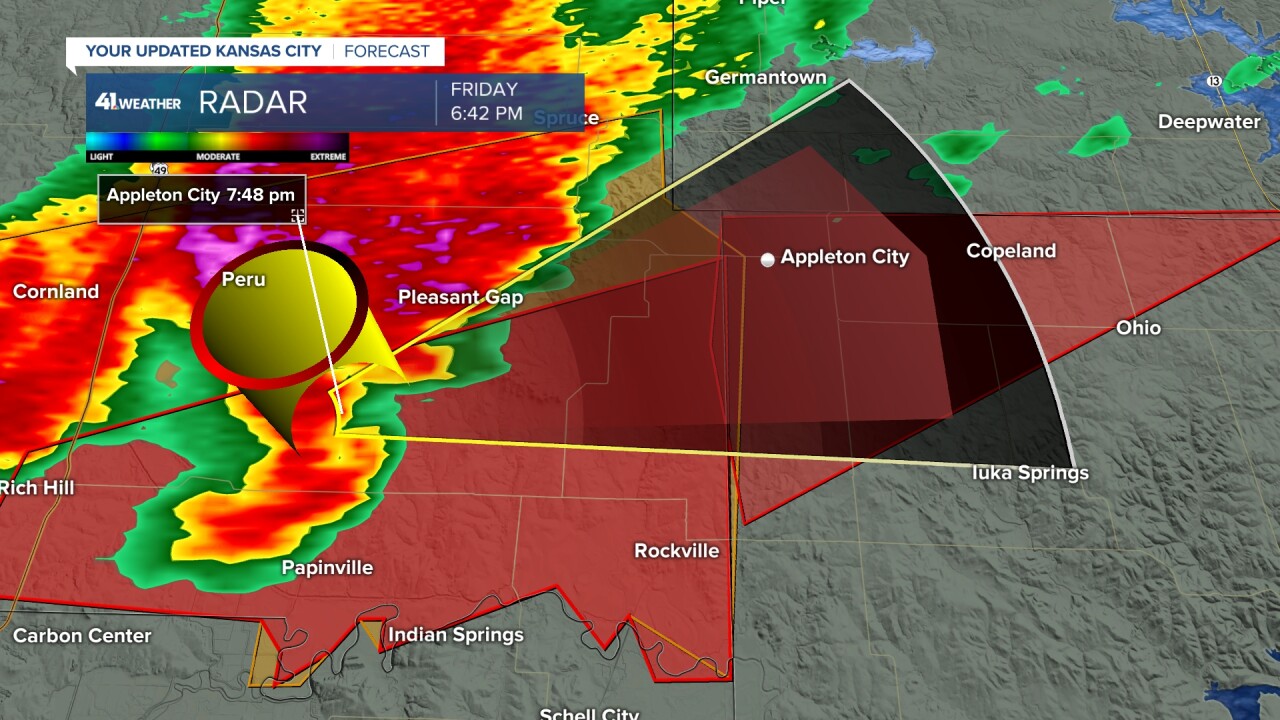
UPDATE, 6:42 pm. | Tornado warning issued for Henry & St. Claire Co.'s with possible impact to Appleton City by 7:48 pm.
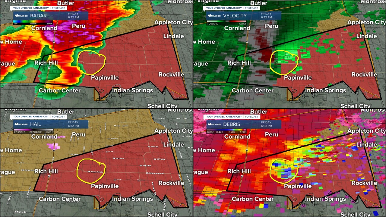
UPDATE, 6:29p.m. | Rich Hill Fire Department confirmed tornado moving east of Rich Hill at 35 mph.
UPDATE, 6:14 p.m. | A tornado SW of Skidmore, MO reported by the Fire Department in far northeastern Holt County.
UPDATE, 6:12 p.m. | A tornado warning has been issued for Butler Co. Missouri. A tornado and golf ball size hail possible. Storm motion is east at 40 mph.

UPDATE, 6:04 p.m. | A tornado warning has been issued for Holt Co. & Nodaway Co. in Missouri. A tornado and ping pong ball size hail possible. Storm motion is northeast at 55 mph. Take Shelter if in this red polygon.

UPDATE, 6:03 p.m. | A severe thunderstorm capable of producing golf ball size hail is impacting southern Butler County. The tornado concern associated with this storm is staying south of the county line.
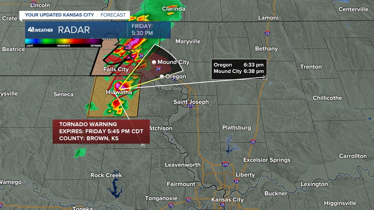
UPDATE, 5:34 p.m. | A rapidly intensifying storm in Brown County, KS has now prompted a Tornado Warning. We are watching this cell clip northeast Doniphan Co., KS and possibly impact Holt Co., MO.
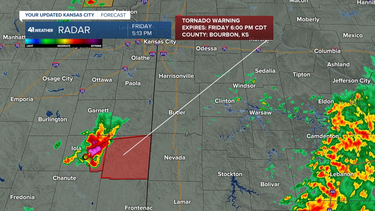
UPDATE, 5:15 p.m. | A tornadic supercell well south of Kansas City continues to generate warnings. All storms south have turned and are moving East instead of Northeast now.
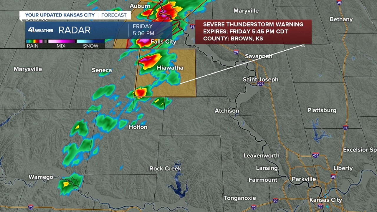
UPDATE, 5:08 p.m. | Quick development happening through northeast Kansas with a Severe Thunderstorm Warning issues for Brown, County. Half dollar size hail and 60 mph wind gusts with a very fast moving storm chugging northeast at 55 mph. The storms building southwest of this will continue to blossom quickly as well.
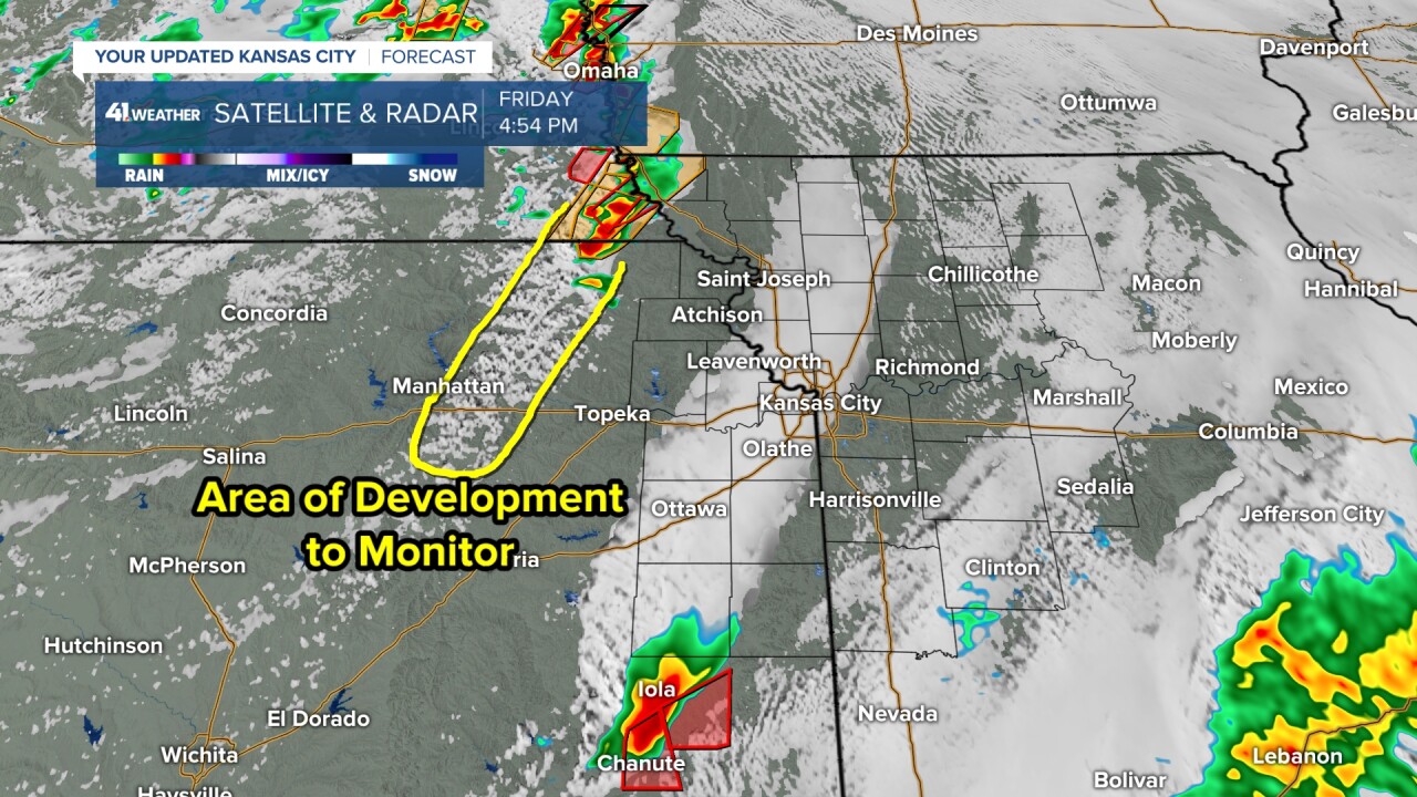
UPDATE, 5:00 p.m. | There is an area of development to watch into northern Kansas outside Topeka. Supercell storms in southeast Nebraska continue to build and the southern extent of this flow could see a few more storms build south in the coming hours.
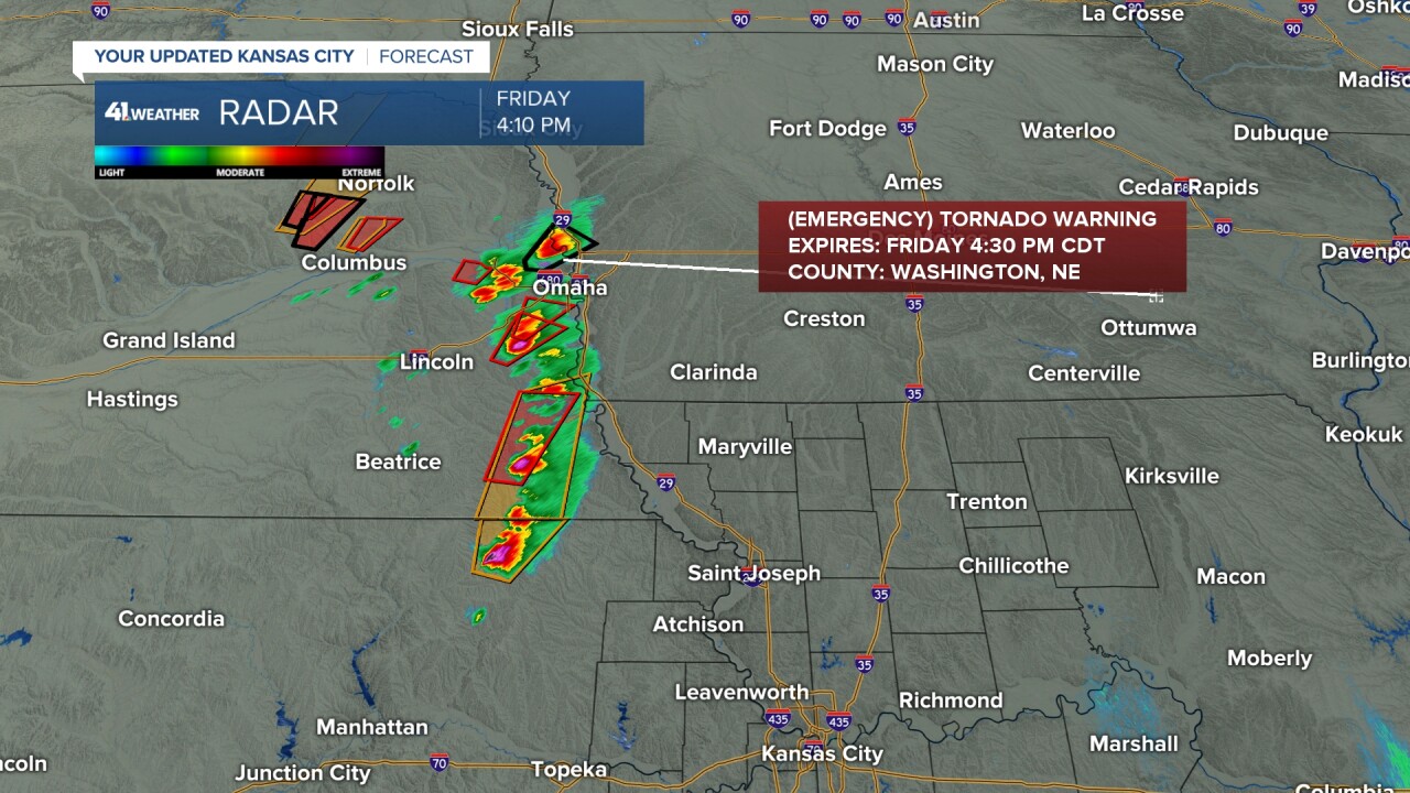
UPDATE, 4:33 p.m. | Tornadic supercell in SE Nebraska eyes the Missouri River and will cross into Atchinson County and areas like Tarkio, MO in the next hour. This could be the first tornado warning for the state of Missouri tonight.

UPDATE, 4:15 p.m. | Tornadic activity continue just north of Kansas City. A confirmed destructive tornado just north into Nebraska has prompted a 'Tornado Emergency' warning for Blair, Nebraska. An additional 7 tornado warnings are active northeast of Maryville, MO.
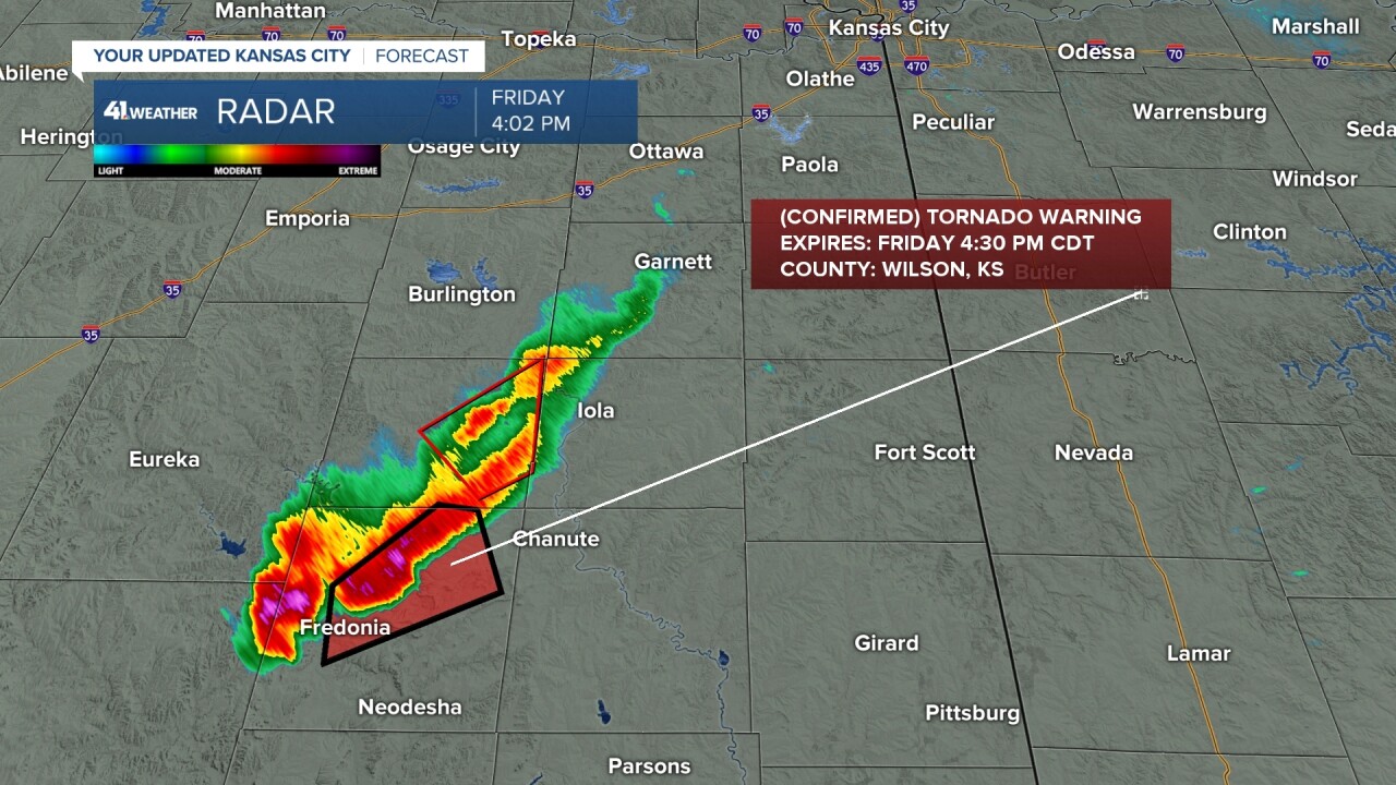
UPDATE, 4:05 p.m. | A confirmed tornado is affecting parts of Wilson County in southeast Kansas, prompting a tornado warning there until 4:30 p.m.
UPDATE, 3:50 p.m. | The Kansas City area is included in a tornado watch until 9 p.m. Friday.
3:45PM-- Tornado watch in effect for the KC Metro until 9pm.
— Wes Peery (@WesWeather) April 26, 2024
Storms capable of very large hail, tornadoes, and damaging wind will move through 5-9pm#mowx #kswx #kcwx pic.twitter.com/wDrvwADg5B
UPDATE, 3:30 p.m. | Supercell thunderstorms have started to fire in several places around the Midwest, targeting areas northwest and southwest of Kansas City as of Friday afternoon.
The National Weather Service has a tornado watch until 7 p.m. for a sliver of the KSHB 41 viewing area in northwest Missouri.
The entire KSHB 41 viewing area is included in a flash flood watch until 1 p.m. Sunday.
—
![020626_KSHB_Image_NXA_Web_Standard Cube[88].jpg](https://ewscripps.brightspotcdn.com/dims4/default/0ead409/2147483647/strip/true/crop/300x225+0+13/resize/960x720!/format/webp/quality/90/?url=http%3A%2F%2Fewscripps-brightspot.s3.amazonaws.com%2F8f%2F6c%2Ffad8bd2346c5a4d4ead793017d4a%2F020626-kshb-image-nxa-web-standard-cube88.jpg)