


KANSAS CITY, Mo. — The KSHB 41 Weather team is monitoring severe weather in the Kansas City area, just two days after tornadoes affected communities in Franklin, Miami, Linn and Bates counties.
Remember to stay weather aware.
LINK | KSHB 41 Weather Radar
LINK | KSHB 41 Traffic
LINK | KSHB 41 Weather forecast
LINK | KSHB 41 Weather Blog
LINK | KSHB 41 Severe Alerts
Follow along with all of our updates below.
—
8:50 p.m. | The Clinton School District announced that school will be closed Thursday due to damage caused by Wednesday's storm, including roof damage and electrical issues.
Students will participate in an AMI day instead.
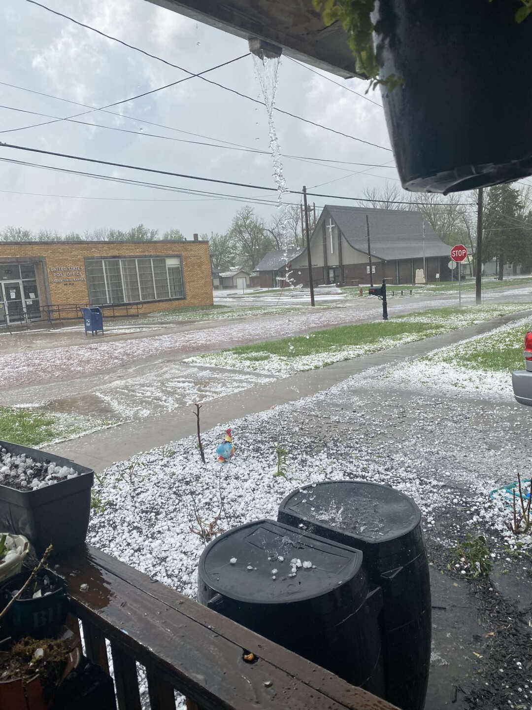
8:05 p.m. | Miami County, along with the City of Osawatomie and the City of Paola, has declared a state of emergency following Wednesday's hail storm due to "extensive damage" to structures and vehicles.
7:28 p.m. | Several viewers are beginning to send in videos of the storm in Clinton, Missouri.
Thank you to Jason Kincaid, Cindi Lynn, Just Binks and all others who have shared.
7:10 p.m. | Henry County Emergency Manager Mark Hardin reports no injuries or deaths. However, damage is spread throughout the city.
He said about 2,000 residents in the town of around 9,000 are without power.
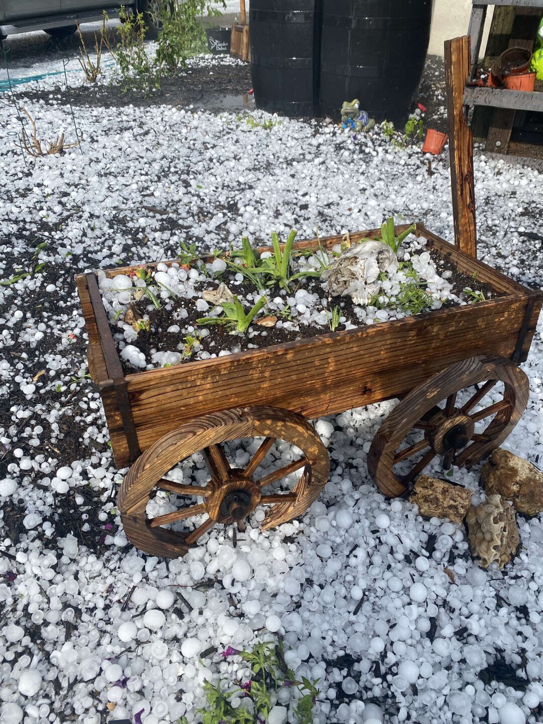
6:55 p.m. | A viewer in Osawatomie shared hail damage photos with KSHB 41 Miami County reporter Ryan Gamboa.


6:53 p.m. | The Osawatomie School District posted on social media that there will be no school Thursday due to damage from Wednesday's storms.
6:45 p.m. | The Missouri State Highway Patrol told KSHB 41 that they are sending three troopers to Clinton to help where needed.
6:23 p.m. | The emergency manager in Henry County says reports from the Clinton Fire Department indicate power lines are down and structures have been destroyed.
6:14 p.m. | A new tornado warning has been issued for Henry and Pettis counties in Missouri until 6:45 p.m.
TORNADO WARNING FOR HENRY COUNTY.
— Jeff Penner (@JeffPennerKSHB) April 15, 2026
A tornado has been observed and had done considerable damage in Clinton, MO. It continues to move northeast at 35 mph. @KSHB41 pic.twitter.com/4d6GsQdBzK
6:05 p.m. | The Henry County, Missouri, emergency manager reports a tornado is on the ground at Calvird Drive crossing 13 Highway on the south side of Clinton.
5:55 p.m. | The National Weather Service has issued a tornado warning for central Henry County until 6:15 p.m.
TORNADO WARNING FOR HENRY COUNTY UNTIL 6:15 PM.
— Jeff Penner (@JeffPennerKSHB) April 15, 2026
Right now it is radar indicated, but there is a lowering. If you line in Clinton, MO and all cities on the list, take your tornado precautions NOW! @KSHB41 pic.twitter.com/zVDFhsHFyF
5:47 p.m. | KSHB 41 meteorologist Jeff Penner says the threat of thunderstorms should clear Clay and Jackson counties by 7 p.m.
WEATHER UPDATE 5:45 PM:
— Jeff Penner (@JeffPennerKSHB) April 15, 2026
The back edge of the main forming line is moving east at 20 mph. This means the threat of thunderstorms will clear Jackson & Clay counties by 7 PM. @KSHB41 pic.twitter.com/5inS1c1OhX
5:41 p.m. | KSHB 41's Wes Peery says the storms are being initiated from dry air moving into moist air.
These storms are all being initiated from dry air moving into moist air...and if you look west, you can see that with clear sky.#mowx #kswx #kcwx pic.twitter.com/n0WtVw9Lo2
— Wes Peery (@WesWeather) April 15, 2026
5:29 p.m. | A severe thunderstorm warning has been issued until 6 p.m. for east central Johnson County in Kansas and southwestern Jackson County in Missouri, per the National Weather Service.
A severe thunderstorm warning is in place until 6:15 p.m. for southeastern Clinton, northeastern Clay, northwestern Ray, southern Caldwell and northeastern Jackson counties in Missouri.
There is also a severe thunderstorm warning issued until 6:15 p.m. for northwestern Chariton, southwestern Linn, northwestern Carroll and southern Livingston counties in Missouri.
5:27 p.m. | KSHB 41 meteorologist Caleb Chevalier is keeping tabs on the storms from Stormtracker.
5:22 p.m. | A severe thunderstorm warning remains in place for parts of Grundy, Sullivan, Mercer and Putnam counties in Missouri until 6 p.m.
WEATHER UPDATE 5:20 PM:
— Jeff Penner (@JeffPennerKSHB) April 15, 2026
A cluster of severe thunderstorms is tracking across Jackson county. These have had a history of large hail. This is the main threat from them as the move northeast at 55-60 mph. You can see the cities in the path. @KSHB41 pic.twitter.com/qIPZbVaczy
5:15 p.m. | The National Weather Service has issued a severe thunderstorm warning until 6 p.m. for Ray, Lafayette and Jackson counties in Missouri.
5:04 p.m. | A severe thunderstorm warning is in place until 5:45 p.m. for Grundy, Mercer and Harrison counties in Missouri, per the National Weather Service.
Clay and Jackson counties in Missouri are in a severe thunderstorm warning until 5:45 p.m.
5:03 p.m. | Pea-sized hail and heavy rain are falling near the Country Club Plaza in Kansas City, Missouri, according to KSHB 41's Jeff Penner.
4:53 p.m. | The National Weather Service has issued a severe thunderstorm warning for Cass, Lafayette, Jackson and Johnson counties in Missouri until 5:30 p.m.
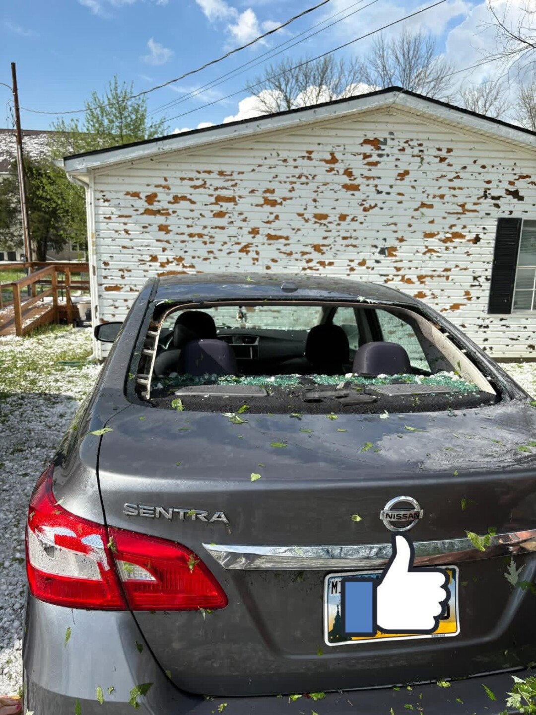
4:51 p.m. | Osawatomie viewer Karissa Perez shared these hail images with KSHB 41 Miami County reporter Ryan Gamboa.

4:49 p.m. | Early reports from the National Weather Service say up to ping pong ball-sized hail fell in Osawatomie, and about 2" hail hit Paola.
KSHB 41's Ryan Gamboa shared an image of golf ball-sized hail in Paola.

4:40 p.m. | KSHB 41's Jeff Penenr says the thunderstorm threat has shifted to mostly east of Interstate 35.
WEATHER UPDATE (4:40 PM):
— Jeff Penner (@JeffPennerKSHB) April 15, 2026
The thunderstorm threat has shifted to mostly east of I-35. Some thunderstorms will produce 1" hail & 60 mph wind gusts, but as of this moment there are no severe thunderstorm warnings in the KC metro. @KSHB41 pic.twitter.com/LJ7xHNoxyy
4:20 p.m. | A severe thunderstorm warning has been issued for southeastern and southwestern Miami County and northeastern and northwestern Linn County in Kansas, as well as northern Bates County and Cass County in Missouri until 5 p.m.
4:15pm--Severe Thunderstorm Warning including Harrisonville MO, Adrian MO and Garden City MO until 5:00 PM #mowx #kswx #kcwx pic.twitter.com/GxSC9ftlfx
— Wes Peery (@WesWeather) April 15, 2026
4 p.m. | A severe thunderstorm warning has been issued for parts of the Kansas City metro until 4:30 p.m.
KSHB 41's Wes Peery says half-dollar-sized hail and 60 mph wind gusts are possible with this storm over Kansas City.

3:45 p.m. | The National Weather Service said a tornado watch has been issued for the immediate Kansas City area through 9 p.m.
KSHB 41's Wes Peery says storms will quickly move through and are capable of large hail, strong wind gusts and tornadoes.
3:35pm WED--A TORNADO WATCH including the Kansas City metro is in effect until 9pm
— Wes Peery (@WesWeather) April 15, 2026
Storms will quickly move through capable of large hail, strong wind gusts, and tornadoes.
Please be ready to act on warnings! #mowx #kswx #kcwx pic.twitter.com/XLrtrdNOdJ
1:30 p.m. | KSHB 41's Jeff Penner says we are tracking severe threats today and Friday before we get into a calmer period.
Today has the potential to be a significantly severe weather day, but, as usual, there are some limiting factors.
Details on the weather threats are in the 6 1/2-minute video below.
—
![020626_KSHB_Image_NXA_Web_Standard Cube[88].jpg](https://ewscripps.brightspotcdn.com/dims4/default/0ead409/2147483647/strip/true/crop/300x225+0+13/resize/960x720!/format/webp/quality/90/?url=http%3A%2F%2Fewscripps-brightspot.s3.amazonaws.com%2F8f%2F6c%2Ffad8bd2346c5a4d4ead793017d4a%2F020626-kshb-image-nxa-web-standard-cube88.jpg)