


Good Sunday bloggers,
The widespread rain and thunderstorms we have been talking about have arrived. Periods of rain and thunderstorms will be likely today and tonight. How much rain will fall? What is the timing of the thunderstorms? Any severe weather?
Let's answer these questions and more.
SUNDAY NOW-5 PM:
The morning area of rain and thunderstorms will be over northeast Missouri by 4 PM. It will leave a pocket of cooler air over northern Missouri where highs will be in the 60s. Highs will reach the 70s around and south of KC as a boundary (warm front) takes shape. Scattered showers and thunderstorms will be around this afternoon along the boundary all the way west to a new and increasing area of rain and thunderstorms west of Topeka. This new area is being caused by a disturbance running along the front.
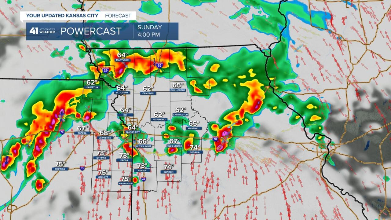
SUNDAY 5PM-MIDNIGHT:
The new area of thunderstorms will track east across eastern Kansas and western Missouri with the scattered thunderstorms preceding the main area increasing as well.
9 May's out of 10, the set up for this afternoon would lead to severe weather. The set up is a warm front along and south of I-70 with a disturbance running along it during peak heating. But, today, the flow aloft is too weak to support much, if any severe weather. A few of the thunderstorms may contain 30-60 mph wind gusts. A severe wind is 58 mph or greater.
The main threat today is flash flooding as rainfall rates will be 1" to 2" per hour. Flooding is the number one weather killer when it comes to thunderstorms. 6" of flowing water can float an SUV. "Turn Around Don't Drown."

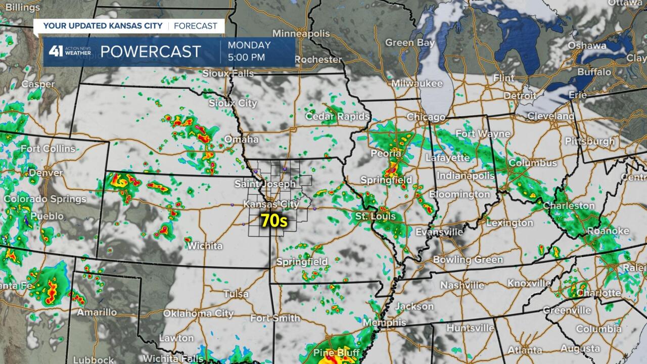
MIDNIGHT TONIGHT-MONDAY 7 AM:
The rain and thunderstorms will exit, so the morning rush hour will see damp to wet roads with temperatures around 60. A few showers or thunderstorms may linger.

MONDAY:
Scattered showers and thunderstorms are possible, but we are not expecting anything organized. It will be partly to mostly cloudy with highs in the 70s.
RADAR ESTIMATED RAINFALL TOTAL FROM MAY 13-7 AM SUNDAY (16TH):
There has been some extreme rainfall across central Kansas. Some locations around Salina have seen nearly 10" of rain! Needless to say, they are in a Flash Flood Warning.

RAINFALL FORECAST TODAY-MONDAY:
The heavier rain has shifted north to locations that need it, northern Missouri. .50" to 2" rainfall amounts will be widespread.

RAINFALL CHANCE RECAP:
The rain chance drops from 100% to 50% between noon and 5 PM as we see scattered showers and thunderstorms. The chance rises back to 90% 5 PM to midnight as the second round moves through. After midnight, the chance drops to 50% and then down to 40% Monday. We may be able to drop the chance to 30% Monday.
Rainfall chances increase Wednesday-Friday as we go into a south flow aloft from the Gulf of Mexico. We will have more on this in the coming days.

Have a great week and stay healthy.
