

WEATHER HEADLINES
- Watch for a wintry mix of freezing rain and sleet starting around 9-11pm, changing to snow overnight
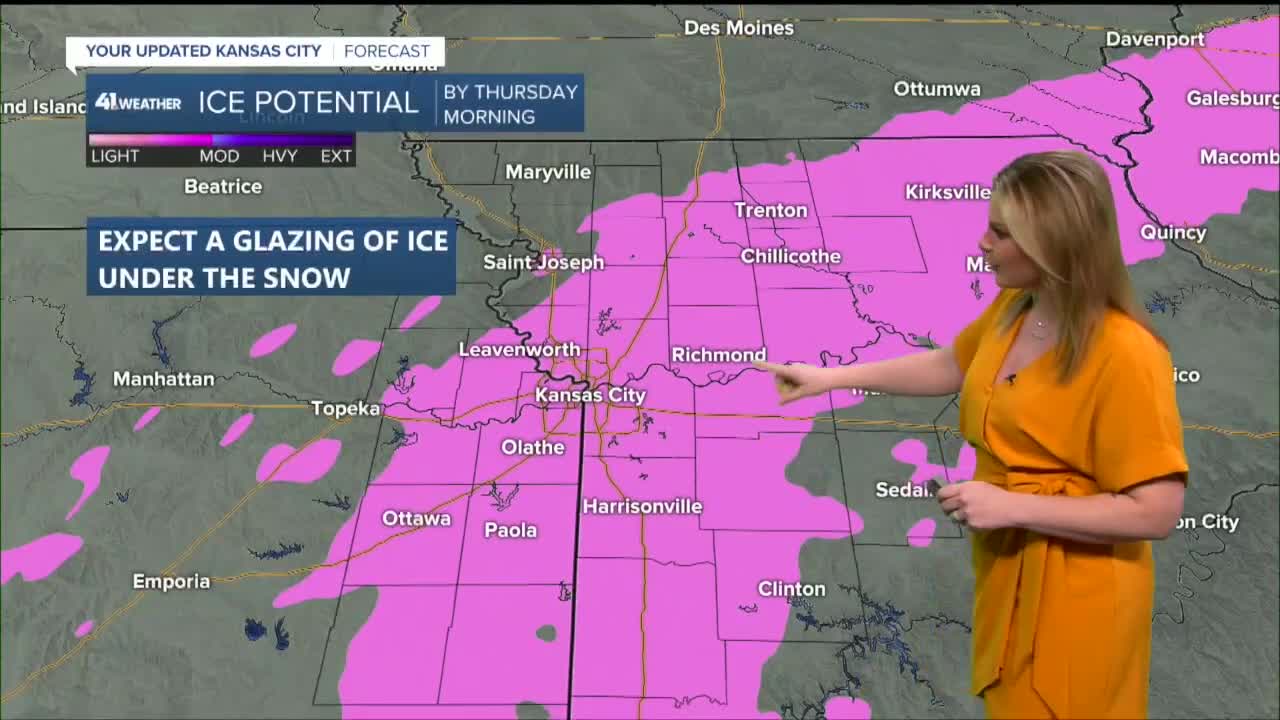
- The heaviest snow will stay in northern Missouri/Kansas with accumulations of 5-8", lesser amounts closer closer to KC of around a dusting to 2"
- Glazing of ice possible underneath some of the snow so add some extra time to your Thursday morning commute
KANSAS CITY'S FORECAST
Tonight: Rain and some mixed showers begin around 10 pm. Expect freezing rain and sleet through the overnight with a transition to snow by 4-6 am. We will have some light ice glazed on roads with snow across the Metro.
Low: 23°
Wind: NE 10-20 G25
Thursday: A slick morning rush hour is likely. Snow ends during the morning. The wind stays strong with bitter cold temperatures. Snowfall forecast in KC of a dusting to 2", with higher amounts of 5-8" in northern Missouri.
High: 28°
Wind Chill: Teens
Wind: N/NW 10-20 G30
Friday: It will be a chilly morning, but quick recovery is expected with temperatures warming back near normal through the afternoon with abundant sunshine.
Low: 15°
High: 44°
Wind: SW 5-15 G20
Get more updates from our weather team:
View our interactive radar
Read our Weather Blog
Check out the current conditions in our area
The KSHB 41 Weather Storm Shield is a life-saving app that acts like an NOAA Emergency Weather Radio on your iPhone or Android phone. You will receive critical alerts via voice and push notification regarding major, potentially life-threatening weather events.
