


Good Labor day bloggers,
Before we look ahead, let's look back at August, it is "August Statistics Day."
After a very wet July we followed that with the 13th driest August in recorded history which is 137 years ago back in 1888. We saw just 0.84" officially. It ended up being 1.5° below average as we really saw just one hot stretch between August 15th and 20th.

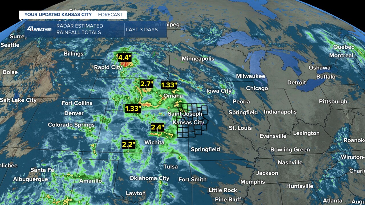
Now, the last day of August tried to play catch up on the rain in some locations. 1"-2" of rain occurred from northwest Missouri to eastern Kansas about 40 miles west of KC. There were small areas of 3"-5" rainfall within the 1"-3" rain area. North of St. Joseph, MO was the big winner with 5.30" of rain. .10"-.50" rainfall occurred south, east and northeast of KC. Now, these are radar estimated totals, so your rain gauge may read different. If you live in KC, there was not much to read in the rain gauge as KC saw the least rain on Sunday.

The heavy rain covered most locations from South Dakota to Kansas where many locations received 1"-3" of rain with some embedded 3"-5" rainfall.
What is next as we enter the 1st week of September?
We are tracking this storm system that will be followed by a strong cold front.
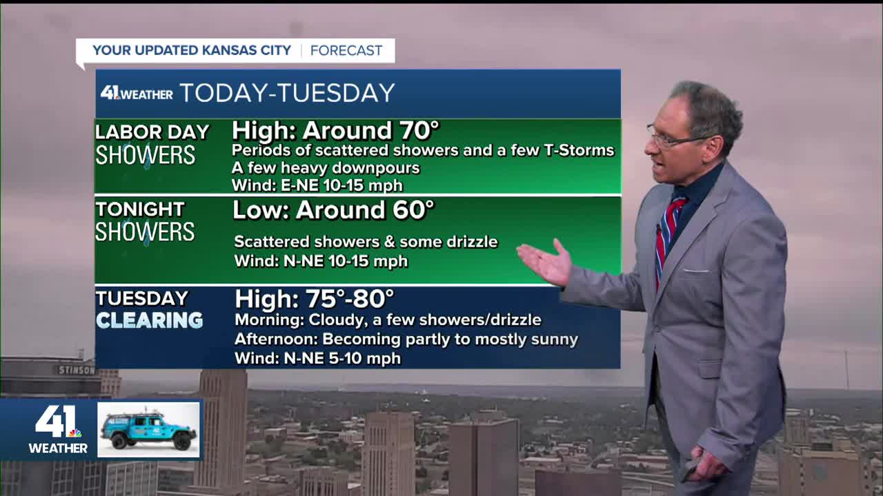
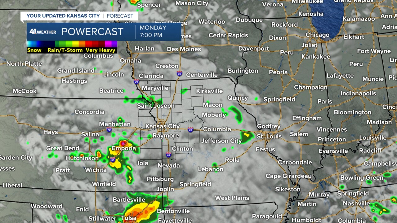
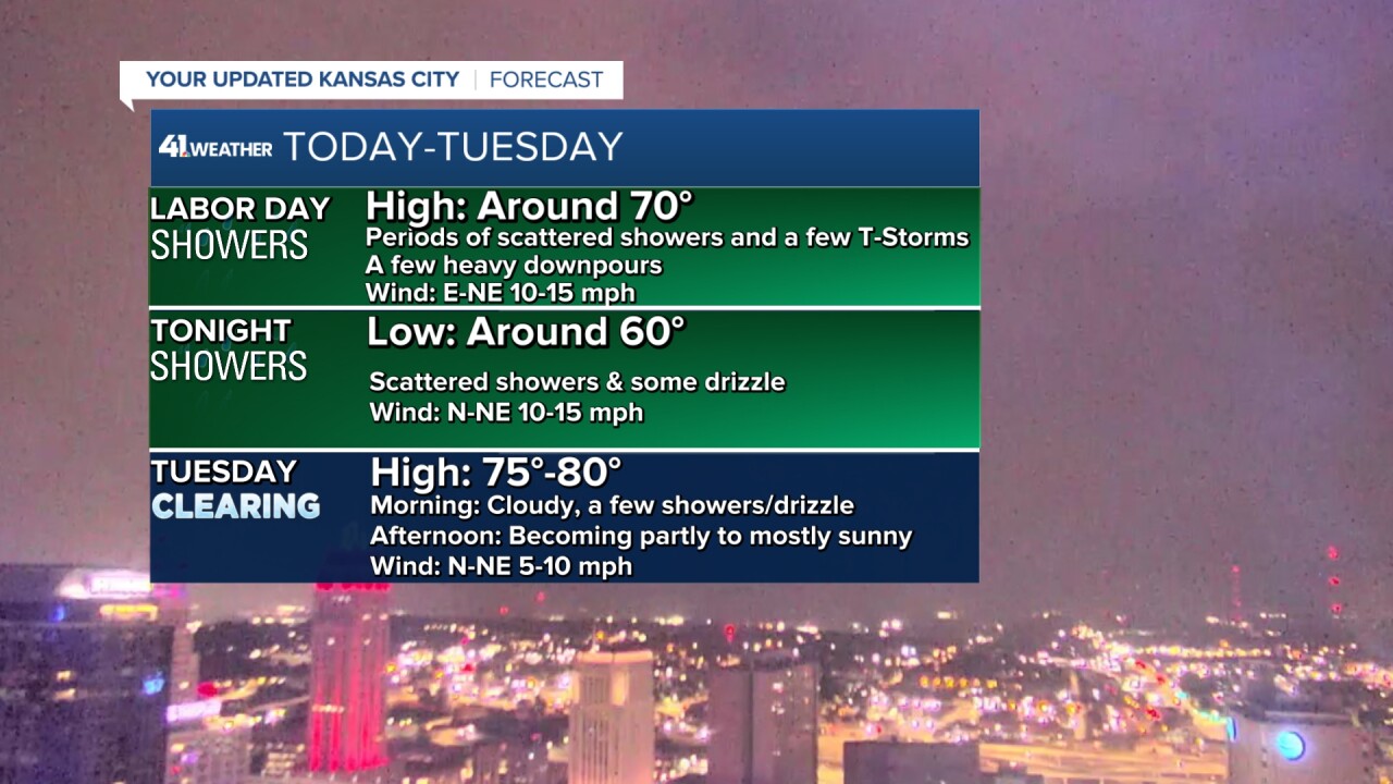
THE STORM SYSTEM (TODAY-TUESDAY):
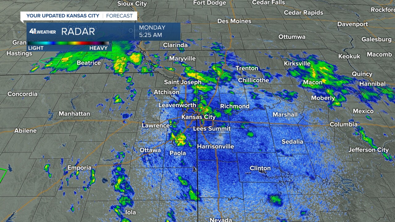
The storm system was located across eastern Nebraska early Labor day morning. It was producing widespread heavy rain there.
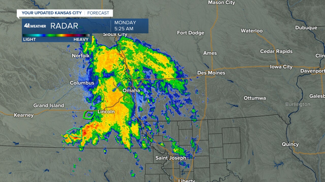
Our area was seeing scattered showers with some heavy downpours. They will increase through the morning as the storm system heads this way.
TODAY (NOW-NOON):
The storm system will track south down I-29 today. But, as it does it will weaken, so the widespread heavier rain may make it to northwest Missouri. Locations to the south will see scattered showers and a few thunderstorms all day.

TODAY (NOON-7 PM):
We will see the scattered showers and a few thunderstorms slowly decrease in coverage. Highs will be around 70 with a light wind.
TONIGHT:
A few showers and some drizzle will linger with lows around 60°.
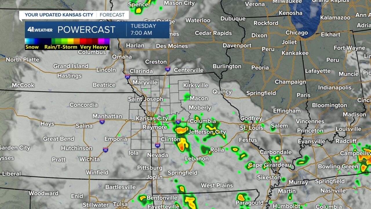
TUESDAY:
The day will start with clouds, a few showers and drizzle. The afternoon will be nice with increasing sunshine. Highs will reach 75° to 80°.
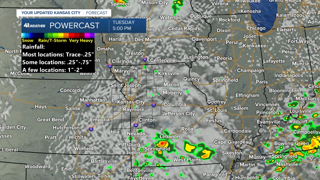
THE STRONG COLD FRONT (WEDNESDAY):
The front is timed for the afternoon. So, we should reach the low 80s by 12-1 PM. Then, during the afternoon we will see a chance of showers and thunderstorms followed by a fast temperature drop to the 60s by evening. Rainfall will be a trace-.50" with a few locations seeing .50"-1".
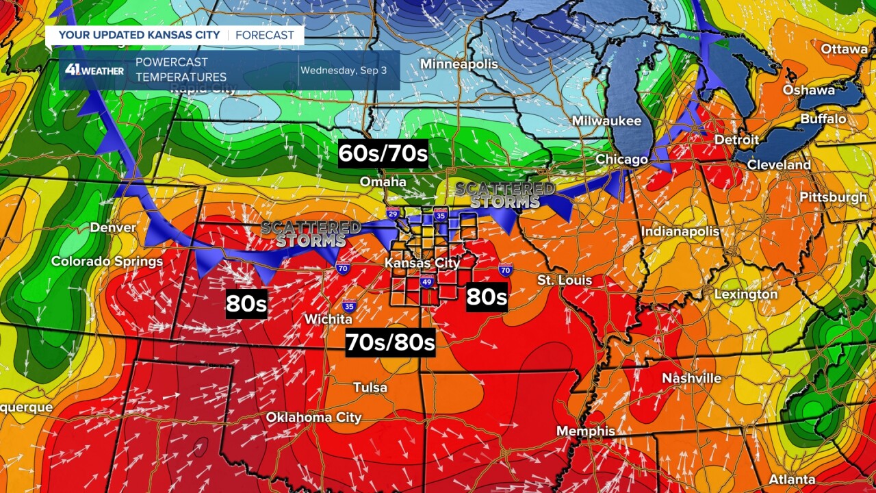
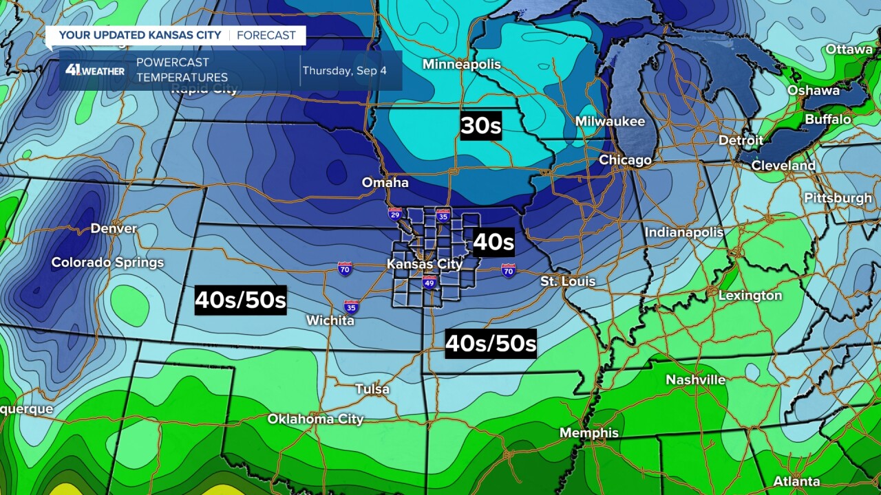
THURSDAY:
Lows will drop to the mid and upper 40s across Missouri with 30s in northern Iowa. It will be just warm enough most likely to prevent frost up there. This is 10-20 degrees below average.
A 2nd strong front arrives Friday, but it will basically keep highs in the 70s with lows in the 50s with a day or two in the 40s. The coolest morning looks to be Saturday morning.
WEATHER SUMMARY:
Have a great Labor day and week ahead.
Stay healthy
