


I hope everyone has enjoyed the quiet, serene non-severe weather on Wednesday.
The National Weather Service found evidence of an EF-0 tornado from Tuesday afternoon storms that blew through eastern Kansas and western Missouri.
Storms were moving at 70 mph, which is faster than the wind some storms were putting out!

There are two more chances of severe weather coming Friday morning and Saturday night.
If you're thinking this has been an incredibly, usually exhausting severe weather season, you're right.
The NWS office in Pleasant Hill hasn't issued this many tornado and severe storm warnings in 21 years.

Yes, the last time this many severe weather warnings was in 2003.
Friday morning
Our next chance of severe weather is coming late Thursday night into Friday.
It looks like a squall line will form in Nebraska Thursday night and move into northwest Missouri and northeast Kansas after 3 a.m. Friday.
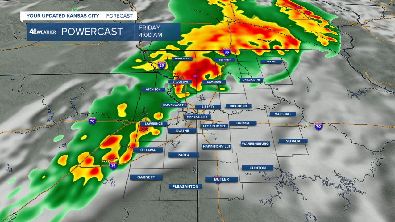
The line of storms will be capable of damaging wind gusts and brief tornadoes.
The angle at which the line of storms is moving, going NW to SE, isn't overly conducive for tornadoes to form.
However, it only takes one piece of the line to align itself better, more north to south, and quick tornadoes can develop, and for whatever reason this year it seems every squall line has produced tornadoes.
Storms may weaken as they approach the Kansas City area, especially if the cold front can catch up and overtake the line, eliminating the threat of tornado formation.
The general timing for the line is 3 to 9 a.m.
Some storms are possible on Thursday evening which could lessen the severe weather threat for this squall line.
Saturday evening - early Sunday
Another squall line, and perhaps some individual storms before and after the line, is poised to move through Saturday night.
Since it's Memorial Day weekend, people may be camping and more susceptible to severe weather.
Storms will form in central Kansas on Saturday evening and move east with time.
The line will be capable of all types of severe weather (wind, hail, tornadoes). This movement of west to east of the line is much more conducive to tornado generation.
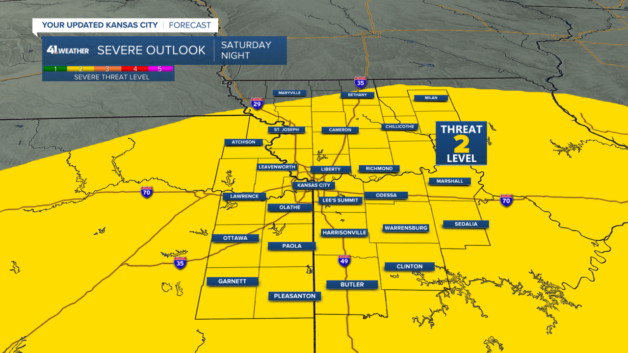
We are under a level 2 of 5 threat for severe weather.
Our weather models have at times shown that the atmosphere may quickly recover after the squall line and have more storms develop into early Sunday morning.
The timing for these storms looks like after 6 pm for movement in eastern Kansas.
Please continue to monitor the weather as we go through the rest of this week.
—
