


KANSAS CITY, Mo. — Good Tuesday, bloggers,
The first of three to four strong cold fronts will move through Tuesday night, bringing rain showers, gusty winds and a January reality check.
As of noon Tuesday, the front was near the U.S.-Canadian border. It will take about 12 hours to get here, so about midnight is when it will arrive in our area.
There is a disturbance ahead of the front that is bringing an area of mostly light rain from western South Dakota to northern Nebraska. That will cross the area tonight, mostly ahead of the front.
Let's go through this.

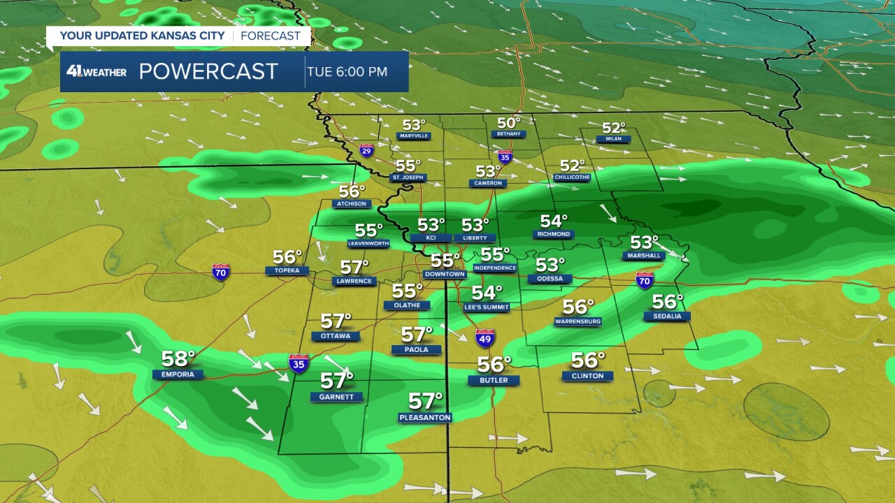
TUESDAY 6 PM:
The area of rain will likely split into several areas as it tracks southeast into Kansas and Missouri. We will see periods of showers between 5 p.m. and 3 a.m., with temperatures dropping from the 50s to 30s.
Rainfall will be a trace to .10".
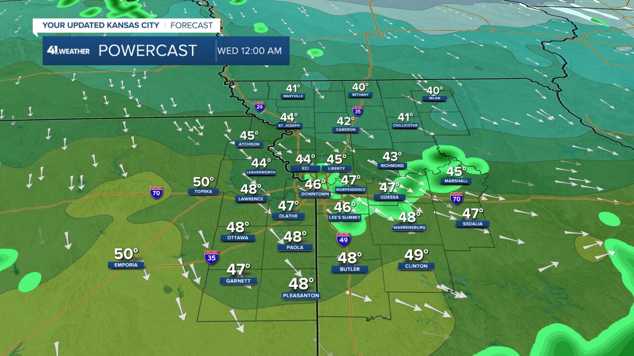
TONIGHT AT MIDNIGHT:
The rain showers will end by 3 a.m. as temperatures drop to the mid-40s by midnight and upper 30s by 3 a.m. The high for Wednesday will occur around midnight.
We do not expect any black ice issues, as there is not nearly enough rain and it is not going to get below freezing fast enough to be an issue. The wind will pick up at midnight.
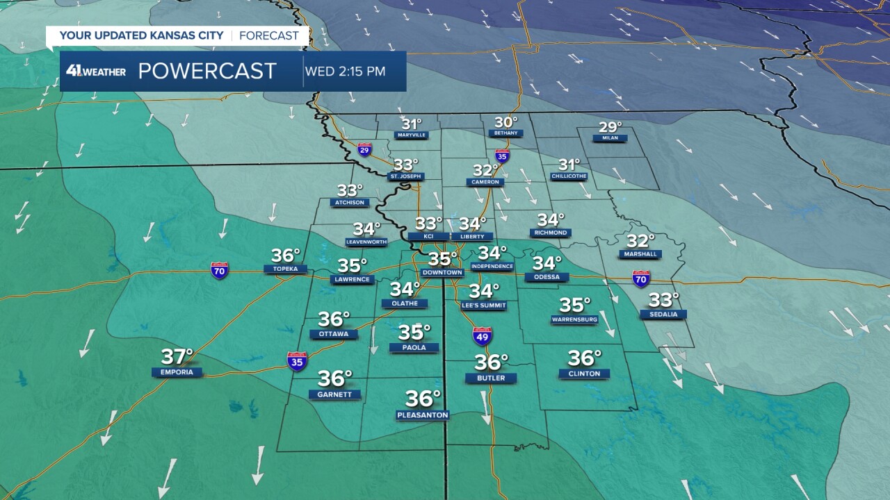
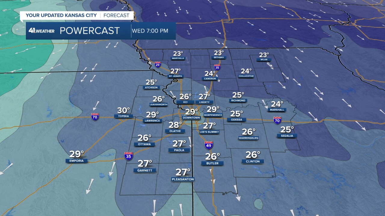
WEDNESDAY 7-9 AM:
Temperatures will have dropped to the upper 20s and low 30s with wind chill values in the teens.
The wind will be from the north-northwest at 15-30 mph.

WEDNESDAY AFTERNOON:
Temperatures will rebound a tad to the low and mid-30s as there will be quite a bit of sunshine. The sun will offset the cold air rushing in for a few hours.
The wind will be gusting to 30-35 mph, keeping wind chills mostly in the teens.
WEDNESDAY EVENING:
After sunset, the temperature drop will resume as the winds decrease to 5-15 mph from the north. It will be in the 20s with a wind chill in the teens.
TONIGHT-WEDNESDAY SUMMARY:

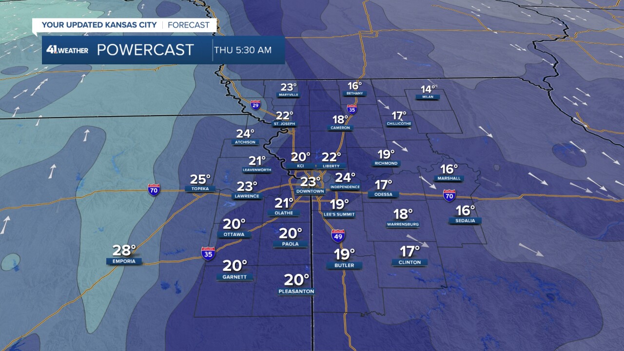
THURSDAY MORNING:
We will drop to around 20°. And yes, this is 1-2 degrees above the average low. The wind will be light.
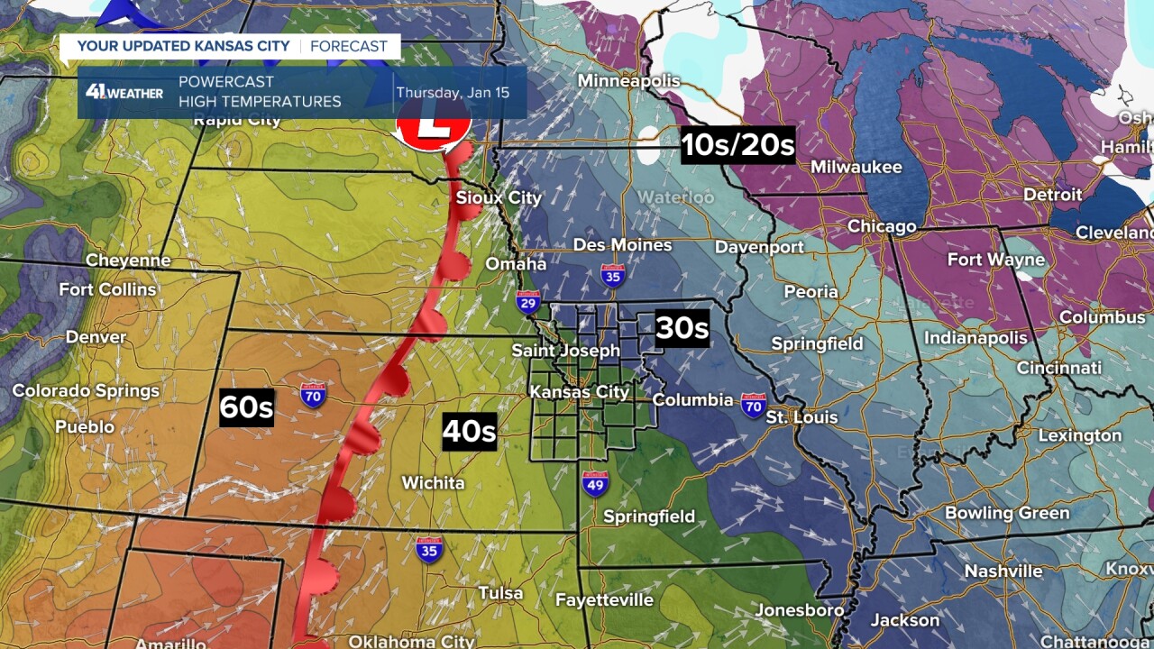
THURSDAY AFTERNOON:
We will see highs in the low 40s with low 50s in south/southeast Kansas to barely 30° in northeast Missouri. What is going on?

A warm front will be approaching from the west as the next cold front/system races southeast.
So, the 50s and 60s out west will not reach here as the next cold front will push the warmer air south before it can get this far east.
FRIDAY:
The next cold front will be racing south, keeping highs Friday in the upper 30s to low 40s.
We may see a few snow/rain showers, but we do not expect any accumulation or road issues.

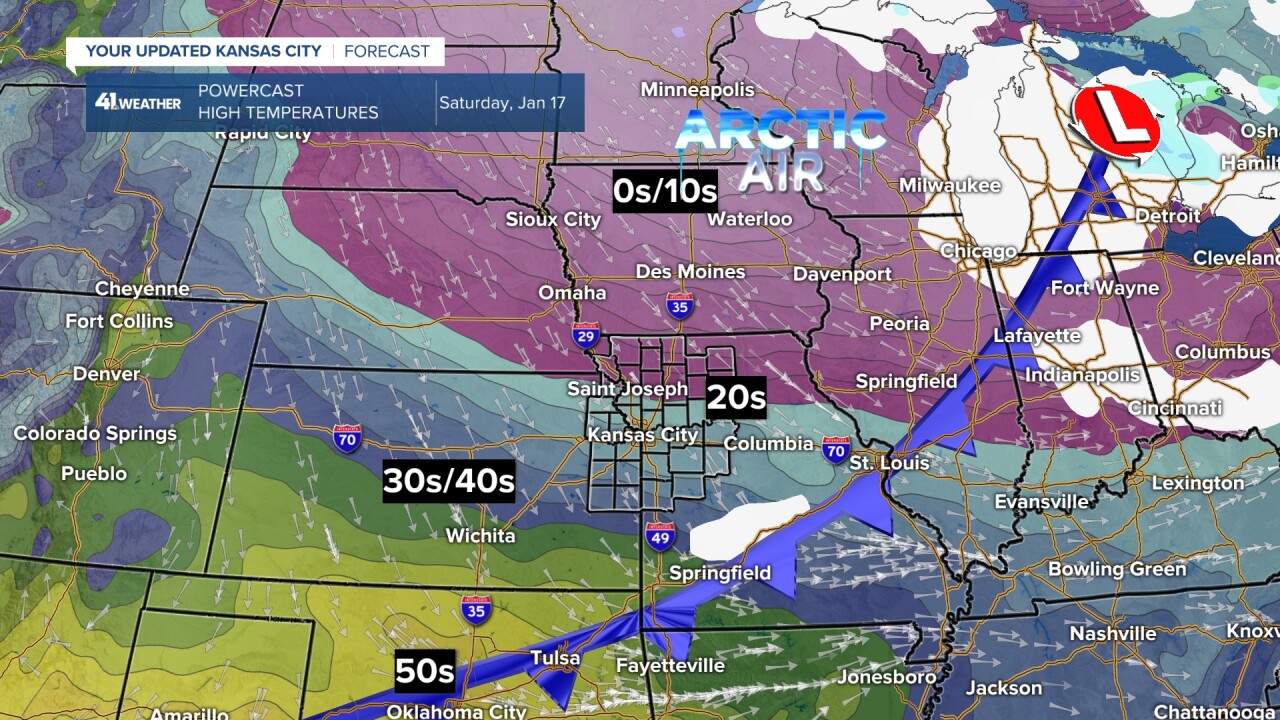
SATURDAY:
The Friday front will move through Friday afternoon, and there is actually a second front that races through Saturday morning. The second — actually fourth — front will give this next cold shot more octane than the cold shot the next 24 hours.
Highs will be in the 20s if the fourth front moves through early and in the low 30s if it moves through closer to noon. Regardless, it will be a breezy and cold day with lots of clouds and a few flurries.
SUNDAY:
This will be a similar, but colder, version of what occurs Thursday. A warm front will be approaching as the fifth cold front/system races in from the northwest.
The third and fourth cold fronts will have delivered Arctic air as close as northeast Missouri. Lows will be in the single digits.
Since the warm front will be approaching so fast, it will likely keep the Arctic air just northeast of the Kansas City area.
Now, after the fifth front, we may not be able to avoid the Arctic air.
The amazing thing with these next 4-5 fronts is that we will not see any measurable snow.

Have a great rest of your week.
Stay healthy.
—
