


Good Tuesday blog readers-
Today and tomorrow will be nice Spring days, so make sure to enjoy it while you can. Come Thursday the pattern takes a turn and the storm door is open for a four-five day period. Here's what we are tracking:
Today
While we had a cold front try and move through this morning. It stalled out just north of Kansas City. Bringing rain and thunder to areas north of Smithville Lake. This system is drying out and will move south of KC today leaving us with clearing skies and mild weather for the rest of the day.
Wednesday
This low and stationary front will then hang south of us, generating some areas of low-end severe weather concerns for Oklahoma Wednesday evening. We will watch much of this activity stay to our south Wednesday but through the evening the northern edge of the rain shield could move into the KC area south of I-70 by Thursday daybreak.


Thursday
Morning showers south of I-70, otherwise mostly cloudy to overcast conditions expected through the day as we stay capped. This low will fade away but there is a secondary low that will eject from the Rockies Thursday afternoon. This low will pick up the energy left from Thursday morning and bring some new life to the storm potential through the evening. This is when we could see a warm front start to move through the area Thursday night into Friday morning. Expect some elevated thunderstorms to form Thursday night along this boundary with some small hail possible.

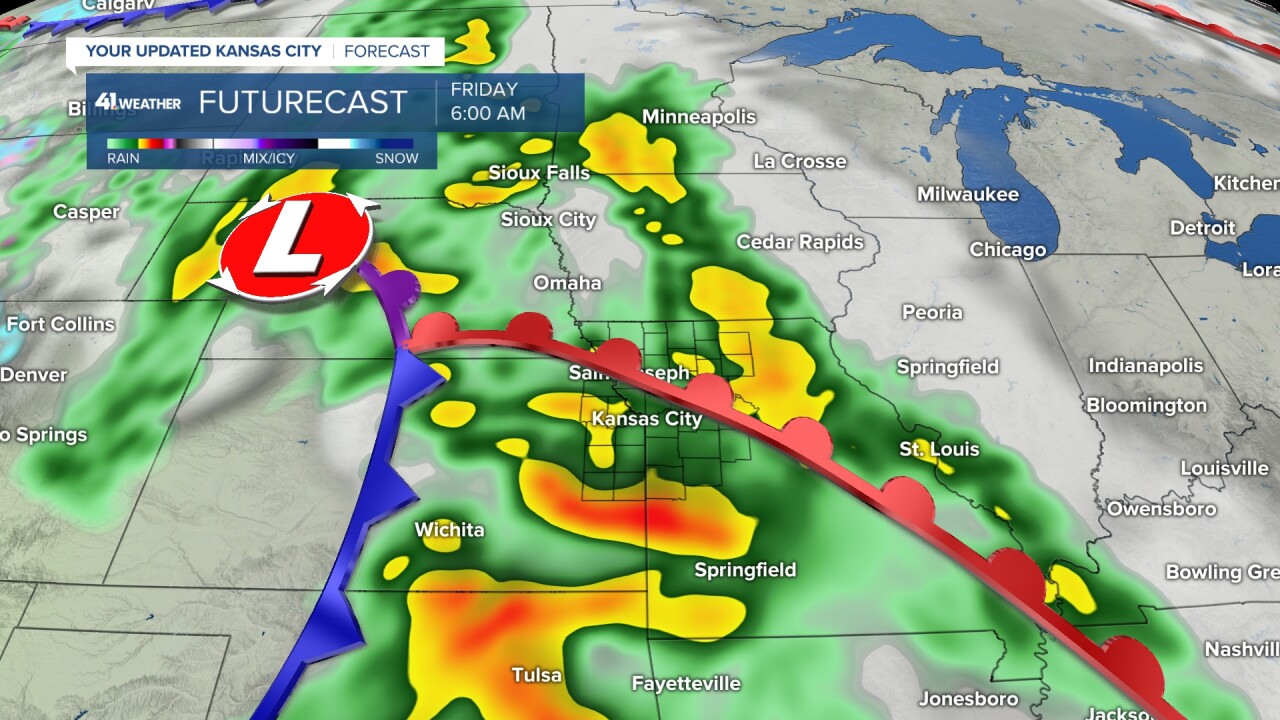
Friday
Friday morning looks to have more widespread thunderstorm and severe weather potential. Risks Friday morning will be hail and wind focused (baseline winds will be gusty all day). Expect impact into your Friday morning commute as thunderstorms take over and lift northeast. By Friday night the cold front looks to slowly approach the KC metro and right now the SPC has us in a level two risk. The dynamics are there for all modes of severe weather Friday night including large hail, damaging wind and tornadoes. But here's where the uncertainty is, how will the warm front behave Thursday? Will the warm front leave enough instability and juice behind? Details on how organized this cold front will get are still up in the air.

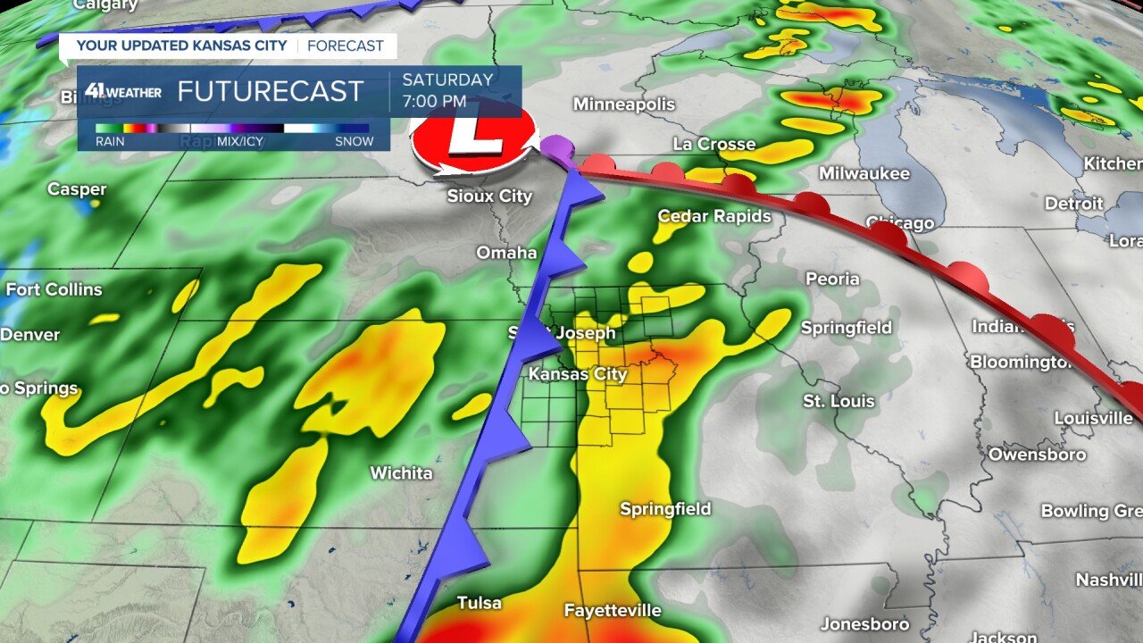
Saturday
Here's where things get a little muddy. Have you started to catch on that each round of storms is dependent on how well or poorly the wave before behaves... yup... we've got a domino effect to monitor. The main low will finally move over the Great Lakes Saturday... but wait there's more. Another low looks to eject from the Rockies, this time further south near the Oklahoma and Texas panhandle. Will this severe set up shift south? Maybe. I think Saturday will be a wait and see kind of day for sure. Regardless this kind of set up would favor all modes of severe weather.

Sunday
The final domino will be where and when storms fire back up Sunday afternoon-evening as the front moves toward the Mississippi River. How will the system to our south hang onto the main system? Will that keep a lag in the system and allow storms to fire closer to Kansas City ... or will be see them fire closer to St. Louis. This set up has flooding concerns written all over it. So we will see how fast we can kick these storms out through the weekend.

My Main Take Aways
- Multiple days of rain and thunder: Thursday - Sunday
- Friday morning commute storms and severe weather possible
- Biggest widespread severe weather concerns are focused on the cold front passing Friday through Saturday
- 2-4" of rain regionally possible
- Each storm creates a domino into the next system and we will have updates constantly through this event so make sure you have a way to stay up to date

