


KANSAS CITY, Mo. — Our stretch of warm weather comes to an end Saturday night as a strong cold front arrives. Showers and thunderstorms are expected overnight with much cooler temperatures by the end of the weekend.
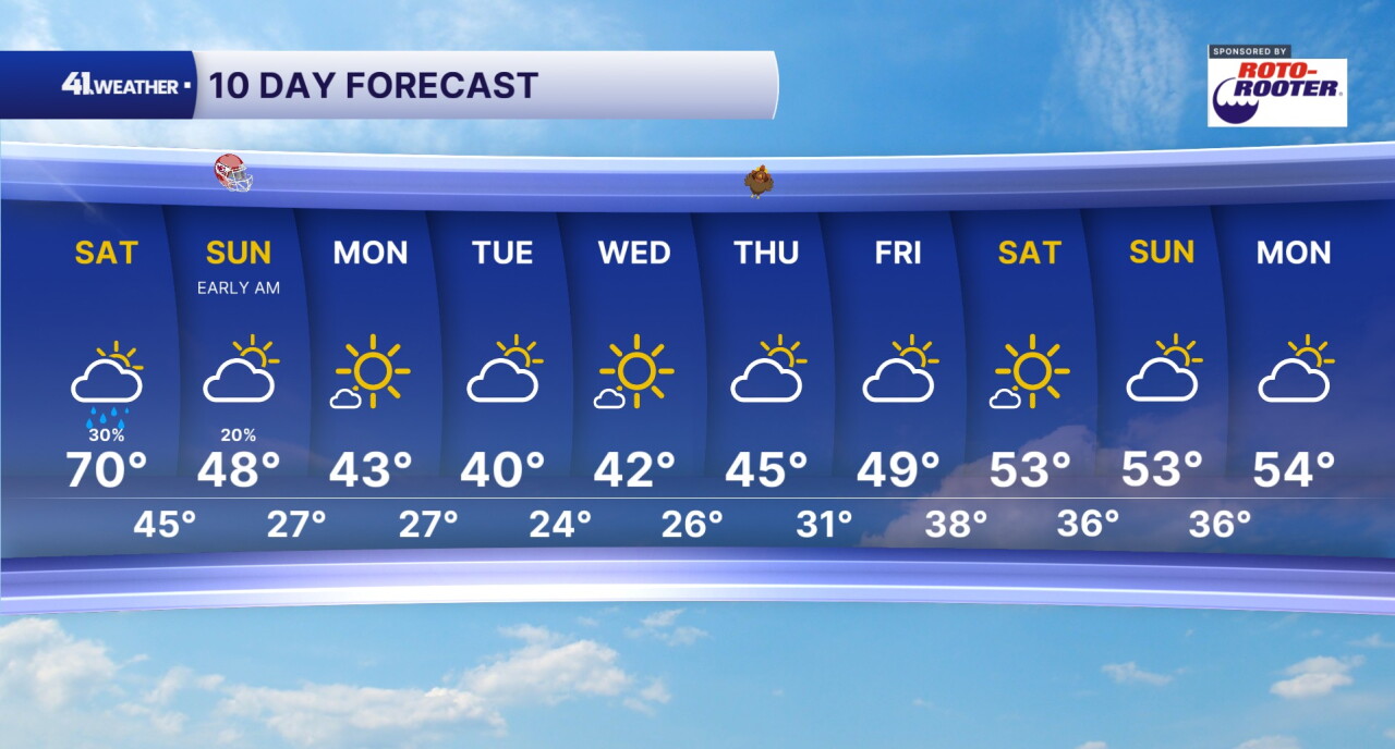
Saturday will feel very similar to the past few days — warm and breezy. Highs will reach near 70° by the afternoon with increasing clouds throughout the day. Although most of the day will be dry, rain chances will increase heading into tonight.
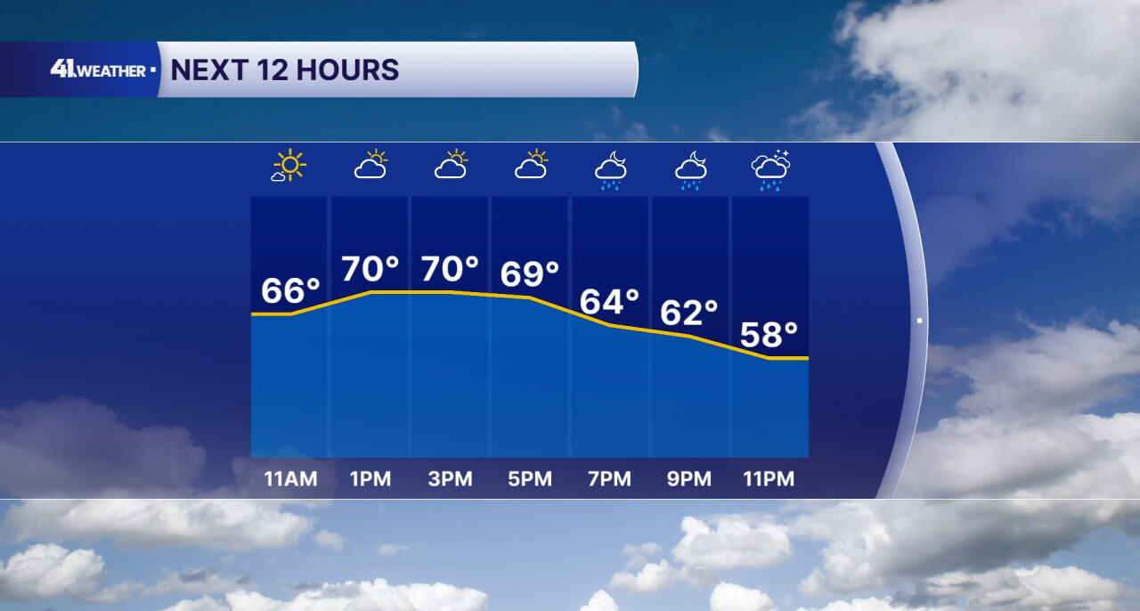
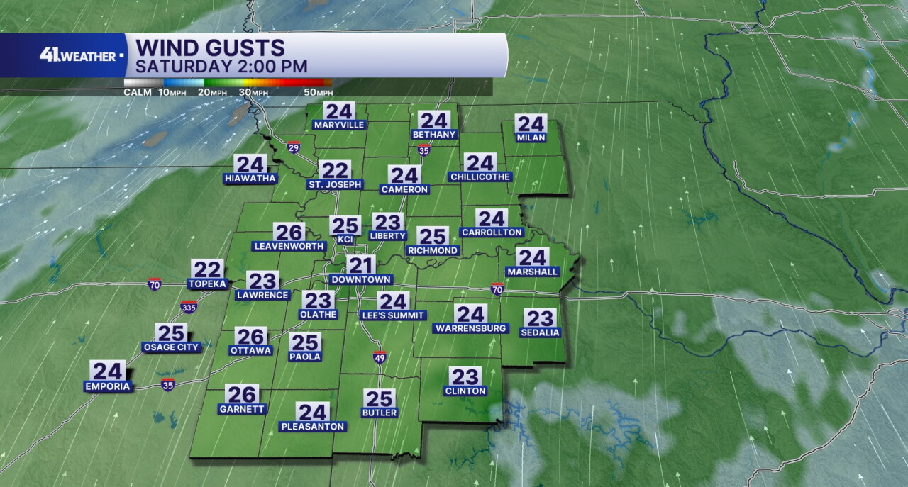
Southerly winds will gust up to 25 mph throughout the day. The warmer air moving in from the south will help fuel our warm up into the 70s today.
A few spotty showers and thunderstorms may develop during the late afternoon and evening, but our best chance of rain will hold off until tonight.
I expect to see showers and storms in the area by midnight, with rain chances dropping off throughout Sunday morning.
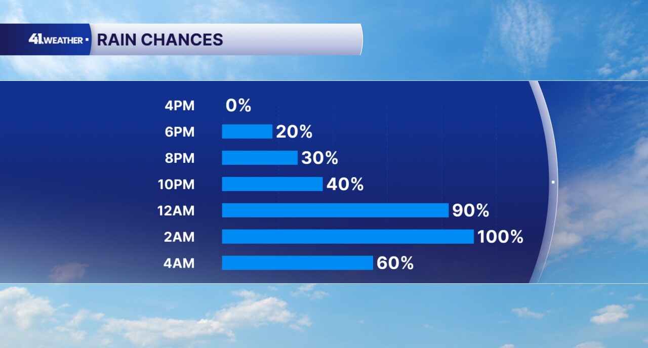
A few storms may produce gusty winds, however, the chance of severe weather is very low with any storms that develop Saturday night. You may hear a few rumbles of thunder while you're sleeping.
Rain totals could reach up to 1" by Sunday morning.
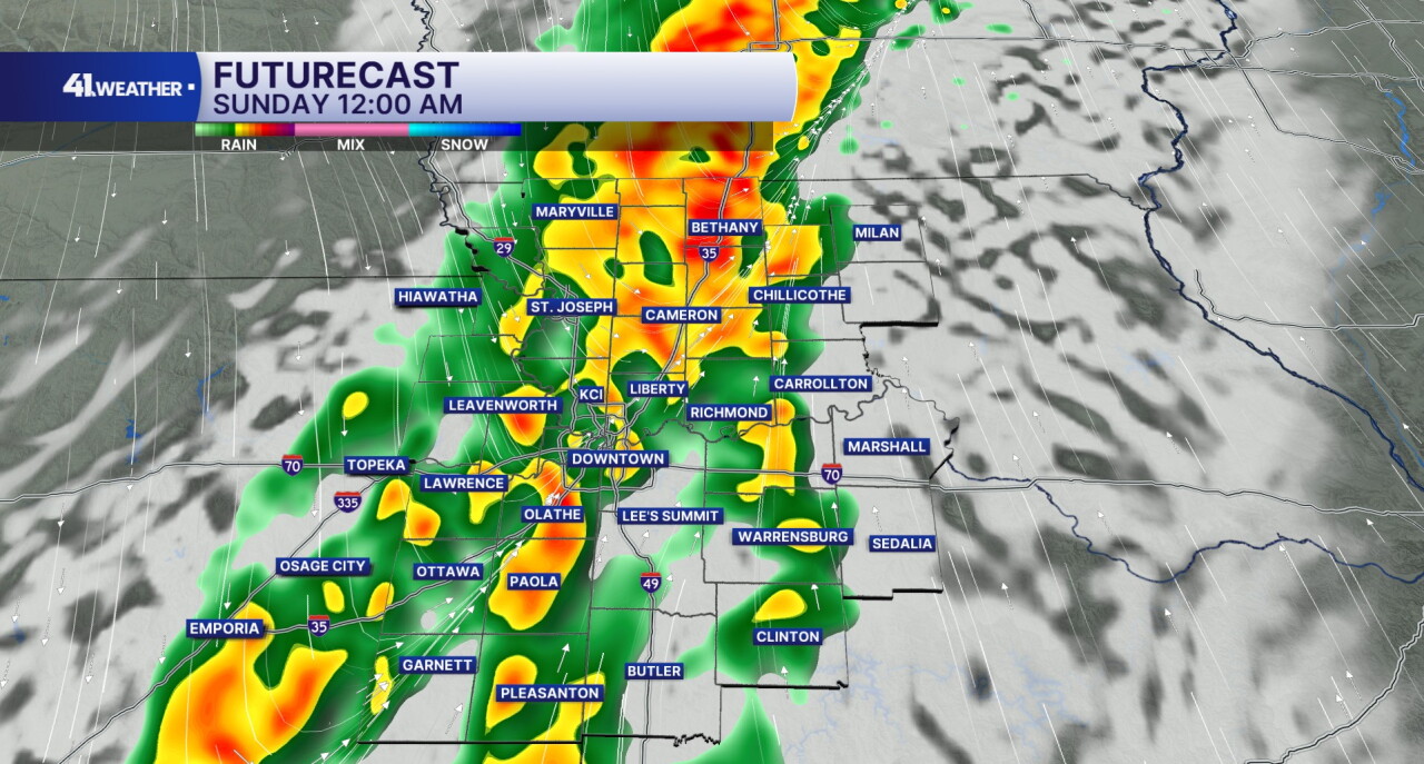
By Sunday morning, we could see a few remaining showers, although most of the rain should be gone by the time you wake up.
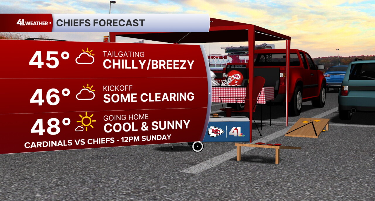
If you're headed out to Arrowhead on Sunday, bundle up! It's going to be a cold one for the Chiefs as they face off against the Arizona Cardinals at noon.
It will feel like the 30s while you're tailgating with a brisk wind and chilly temperatures. We'll start off the day with a few clouds, gradually clearing by kickoff. Highs will reach the upper 40s as the game wraps up.
Lows will fall into the 20s to start off next week, with a freeze likely for the area most mornings. Afternoon highs will remain in the low 40s through Wednesday.
Thanksgiving will be mild and cool, but should remain dry. Slightly warmer weather arrives by next weekend.
Have a question about the forecast? I'd love to hear it! Reach out to me, and I'll answer your questions in this weather blog.

Have a fantastic weekend!
