


KANSAS CITY, Mo. — Good Monday bloggers,
We are into the first week of November, and it is starting with systems moving quickly from west to east. This means they are moving too fast to bring any rain to our area, as they don't pick up Gulf moisture until they are well east of our area. Also, since they are moving quickly from west to east, they keep the cold air bottled up in Canada.
UPPER LEVEL FLOW TODAY-FRIDAY:
You can see the flow is mostly flat with little dips in the jet stream moving by. Each one of these systems will bring wind and a weak front.


UPPER LEVEL FLOW SATURDAY-NEXT MONDAY:
There is a bit more amplification, but the trough - or storm system - is east of here. This means we will get a shot of colder air but little to no precipitation. A ridge to our west will follow the trough quickly, bringing warm air back in.

RAINFALL FORECAST NEXT 7 DAYS:
Well, there is not much in the forecast. Any rainfall will be less than .10" and mostly north and east of our area. The chances are Thursday night and this weekend with fast-moving fronts.

November through February, on average, are the driest months of the year as cold air does not hold much water. So, when you are in a dry pattern, during the driest time of year, the chance of breaking a drought is very, very low.
When is the next chance of any meaningful precipitation? There are signs in about 10-15 days of a more active weather pattern. We will look at that more in the coming days.

As we look at the forecast the next seven days, you will see mostly dry weather and a small roller coaster ride of temperatures.
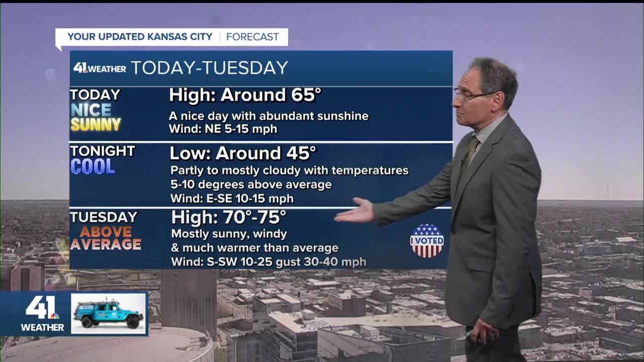
TODAY:
A weak front has slipped through, but highs will still be in the 60s with a light northeast breeze.

TUESDAY:
The wind will be up from the south-southwest, gusting to 30-40 mph. This will bring highs to the low and mid-70s as the next front approaches.

WEDNESDAY:
Highs will be back to the 60s with a lighter north-northeast breeze.

THURSDAY:
Highs will return to the low and mid 70s with gusty south winds to 20-30 mph. A few showers and thunderstorms may form from central Iowa to central and eastern Missouri as the front to the north zips by.

FRIDAY:
Highs will be back to the 60s with a north breeze at 10-20 mph.

SATURDAY:
This front will be stronger, as remember from above, this is when the jet stream buckles a bit and forms a bigger storm system to our east.
So, we will warm up to the 60s ahead of the stronger front. There may be an area of rain/snow across Iowa to northern Illinois as the system goes by.

SUNDAY:
This will be one of the colder days out of the next 10. Highs will struggle to 40° with north winds gusting to 30-40 mph. Yes, the KC Current play Sunday morning. If you are headed to the game, bundle up as wind chill values will be in the low 20s. But, it does look dry.

Have a great week ahead
Stay healthy
