


KANSAS CITY, Mo — Good Friday bloggers,
I hope you had a Merry Christmas.
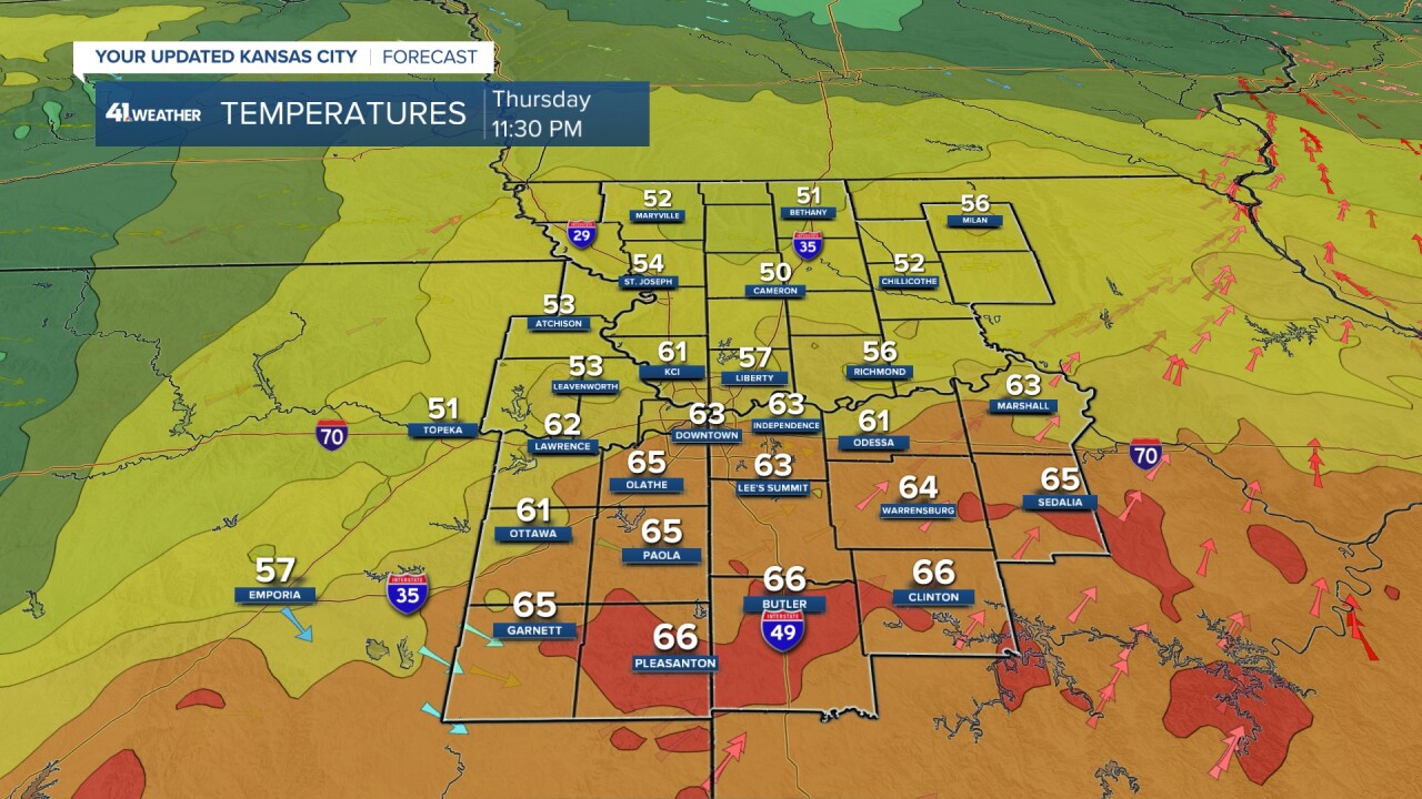
We had been talking about how it could be the warmest Christmas on record. 67° was the record set in 1922. Well, in part of the city it was the warmest recorded as Olathe reached 67° at 9:30 p.m.. But, at the official reporting station for Kansas City, which is Kansas City International Airport, we fell short at 61°. A warm front that would have brought 70-degree weather made it only to the southern sections of Johnson and Jackson counties.

If the warm front had made it to Olathe during the afternoon, highs would have been well into the 70s to near 80, like it was at 3:30 p.m. from Garnett, Kansas, to Clinton, Missouri.

The official high for the day was reached around 11:22 p.m. when KCI jumped to 61°. Again, had the warm front made it to KCI by evening it would have been 67° at 9:30 p.m. And, if the warm front had made it by 3:30 p.m. it would have been 77°. Regardless, we are seeing temperatures 20 to 30 degrees above average.
What is next? Well, we have a reality check arriving Sunday. Let's go through this.
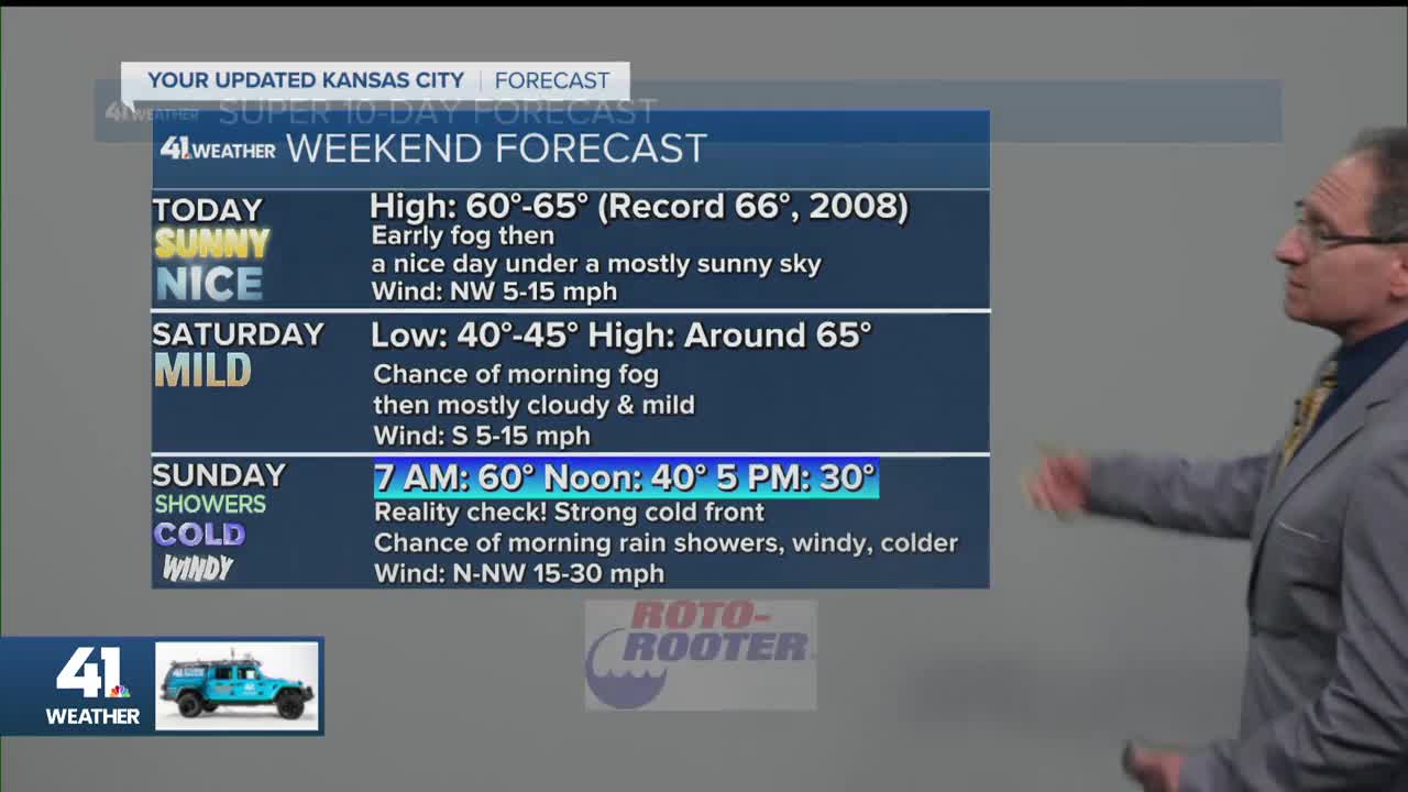
TODAY:
We will see much more sunshine after morning low clouds exit to the east. Highs will reach the low to mid-60s. The record for today is 66° and we will come close if not break it. The wind will be NW at 5-15 mph.

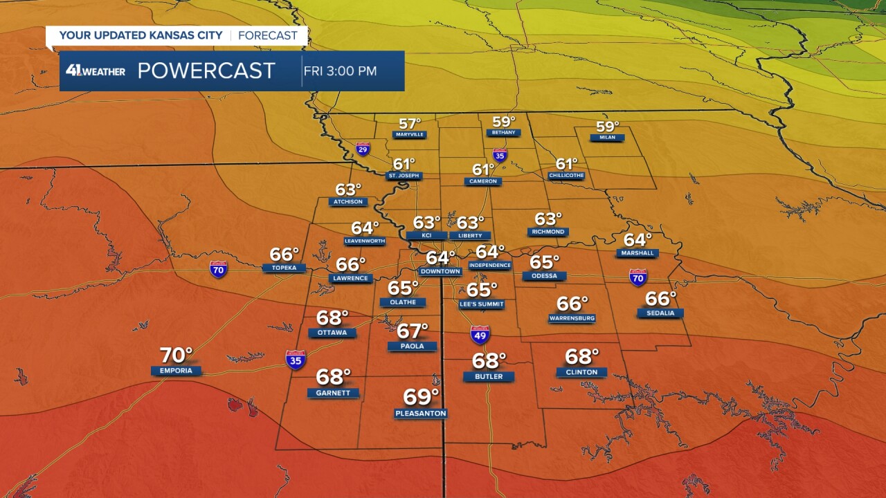
SATURDAY:
We may see some fog again during the morning, then we will see filtered sunshine as the sun shines through a lot of high clouds. Highs will reach the mid to upper 60s. The record is 73°. If we see more sun, that record could get a challenge. The wind will be south at 10-15 mph.
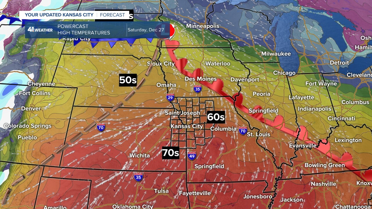
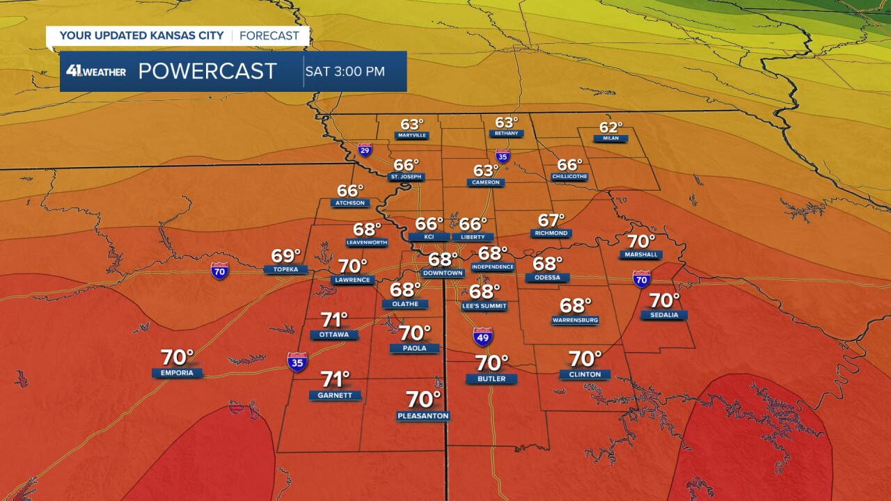
A strong cold front will be surging south through the Dakotas.

SUNDAY:
The strong cold front arrives early in the morning with some rain showers possible and temperatures around 60°. After the front, the wind will increase to 15-30 mph from the north-northwest and temperatures will plummet to the 30s by afternoon. We may even see a few snowflakes. We do not expect any slick roads Sunday, but if you are driving up I-29 or I-35 to Nebraska and Iowa, there will be 1"-5" of snow and slick roads.

Here is a closer look at these changes.
SATURDAY NIGHT:
Temperatures will be around 60° and we may see a few showers, perhaps a thunderstorm.

SUNDAY MORNING (8-9 AM):
Temperatures will still be around 60° and we may see a few showers, perhaps a thunderstorm. The strong cold front will be barreling across northwest Missouri and northeast Kansas.

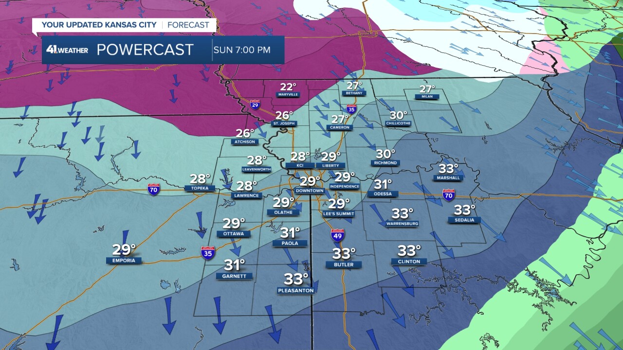
SUNDAY (3-4 PM):
Temperatures will be plunging through the 30s with wind chill values in the teens as north winds gust over 30 mph. We may see some snowflakes as well. We do not expect the snow to cause issues and the trace-.25" of rain we see earlier will likely evaporate before "black ice" can form.

SUNDAY (7 PM):
Temperatures will be in the 20s with wind chill values down to near 10°.
MONDAY MORNING:
Temperatures will be in the teens with wind chill values in the single digits as the wind will still be coming in from the north at 10-20 mph.

New Years Eve/day look dry with highs mostly in the 40s and lows in the 20s and 30s as the cold airmass shifts east.
Here is a weekend weather summary:

Have a great weekend
Happy New Year!
Please do NOT drink/text and drive.
Stay healthy
