



KANSAS CITY, Mo. — Fall-like weather continues to escape us. It feels pretty nice outside, though! Highs will stay in the 70s this week with a few rain chances.
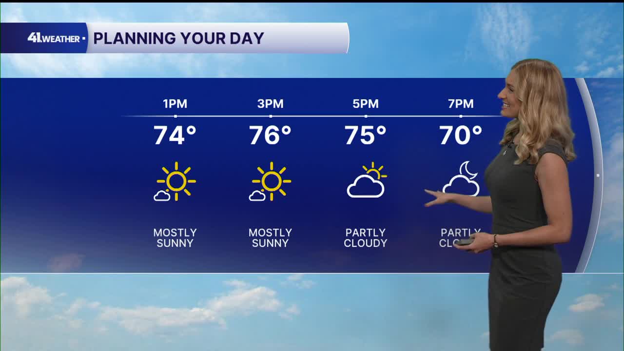
Sunshine returns for Monday afternoon as high temperatures reach the mid to upper 70s once again. It should feel very similar to the weather we've had over the last few days.
You can expect low humidity and light winds. More clouds will start to build back in by this evening. A great evening to spend time outdoors if you get the opportunity.
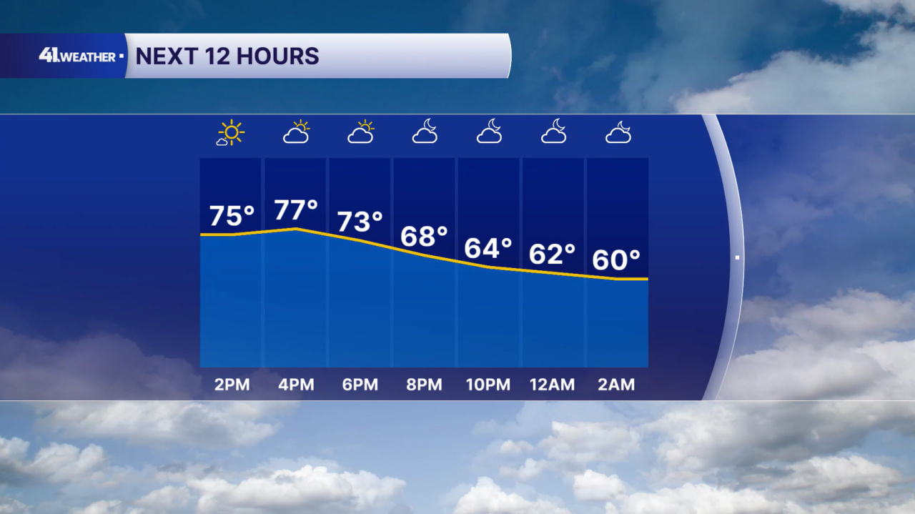
Overnight, temperatures will drop into the mid to upper 50s with mostly cloudy skies.
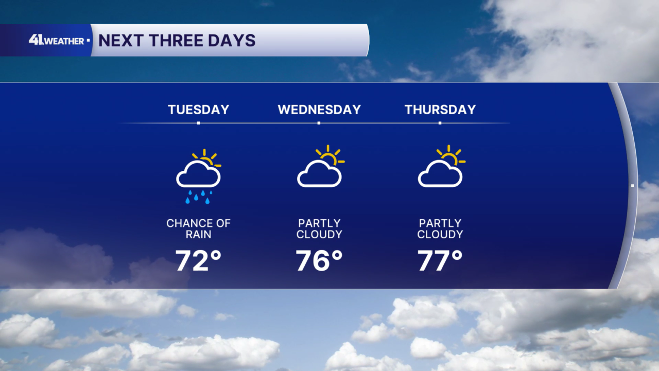
Clouds will stick around throughout the day on Tuesday with a gradual warm up into the low 70s. It will be noticeably cooler compared to previous days, but still about 10° above average for this time of year.
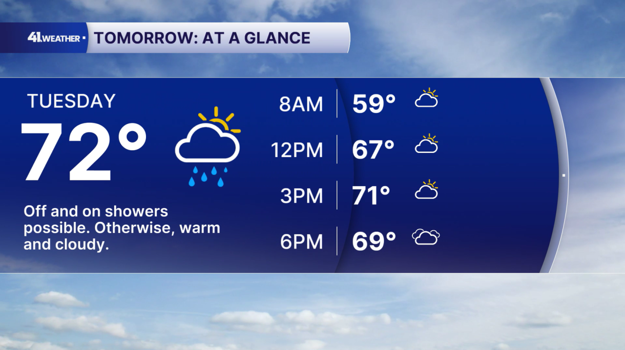
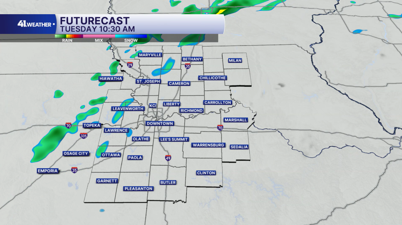
A few scattered showers are possible throughout the day on Tuesday. These will be very spotty in coverage, and likely pretty light.
Dry conditions return for Wednesday and Thursday, with temperatures rebounding back into the mid to upper 70s.
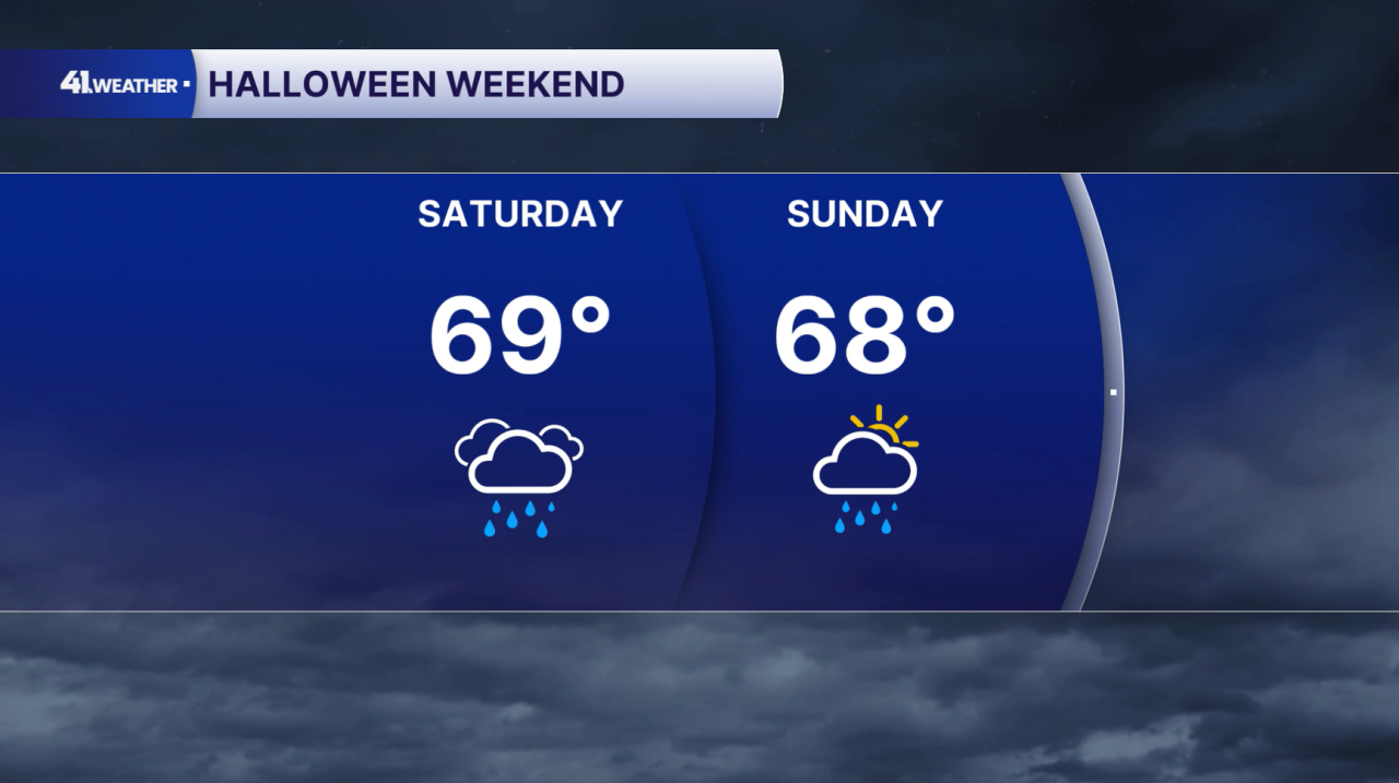
Rain chances continue to increase for Halloween weekend, especially on Saturday. We'll have a better idea on exact timing as we get closer, but I do think there is a very good chance that we will have rain in the area at some point over the weekend.
Temperatures will be a bit cooler, in the upper 60s. Still, this is considered warmer than average for late October!
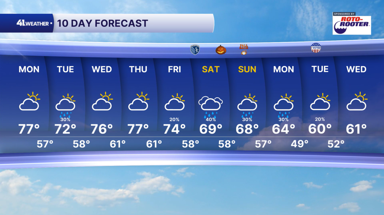
Rain chances continue into next week with showers possible on Monday and Tuesday. Low 60s may make a return by midweek.
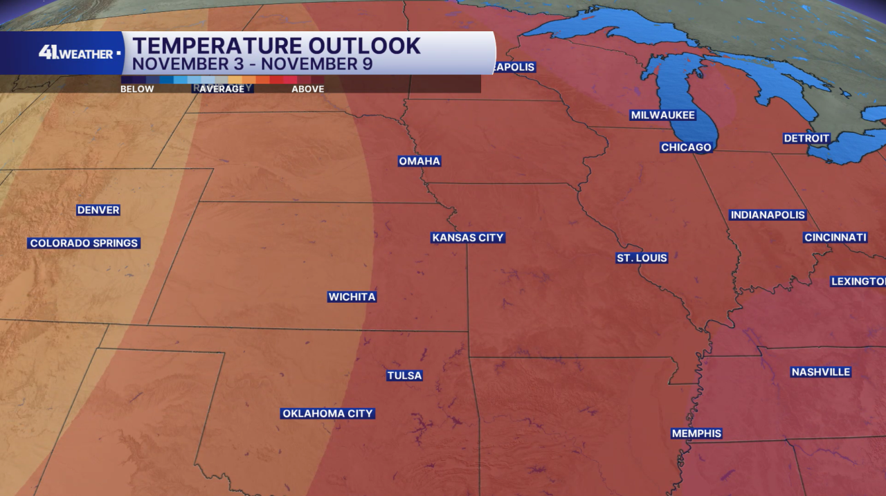
Don't hold your breath while waiting for chilly fall weather. I don't think it will be here for awhile! At least for the first nine days of November, temperatures are expected to be warmer than average.
Mid to upper 50s are considered normal for Nov. 3-9. Anything above that would be above average for this time of year.
Have a question about the forecast? I'd love to hear it! Reach out, and I'll answer your questions in this weather blog.

Have a fantastic week!
