


Good Wednesday bloggers,
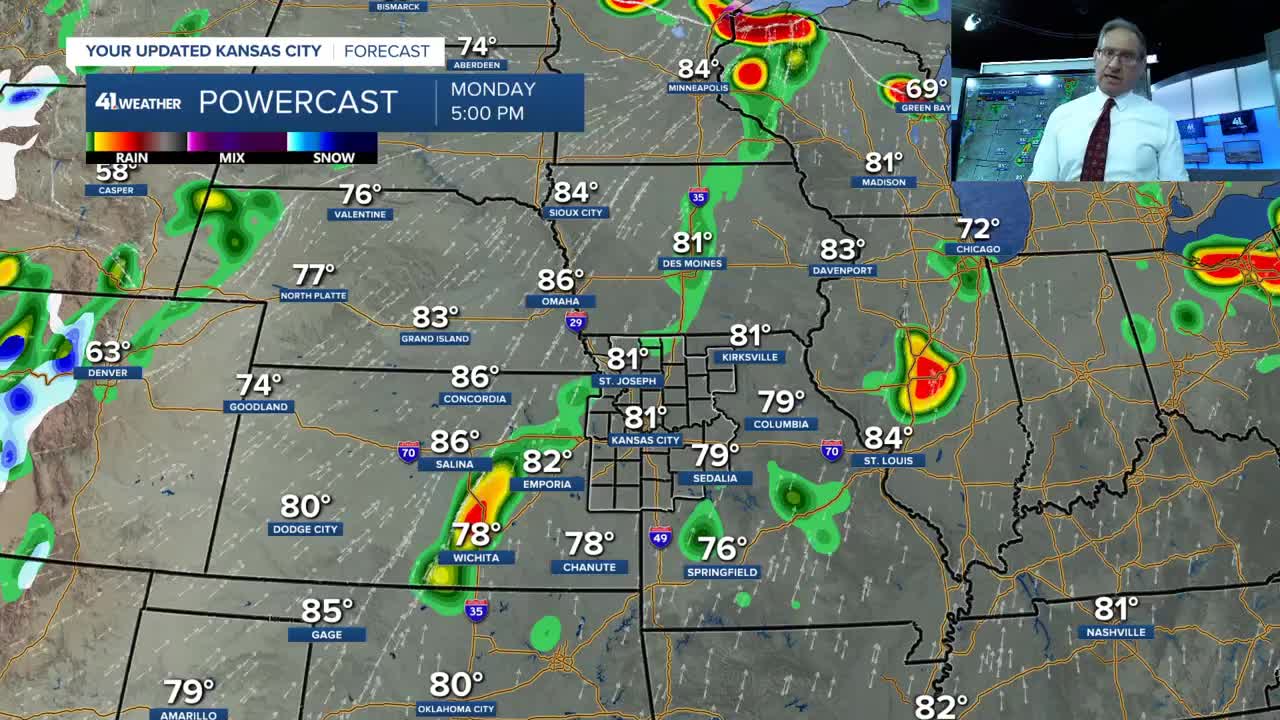
The cold front that we are tracking is now moving through northwest Kansas, southeast Nebraska and northwest Iowa. This front arrives in northern Missouri tonight and will be with us, wavering back and forth through the weekend.

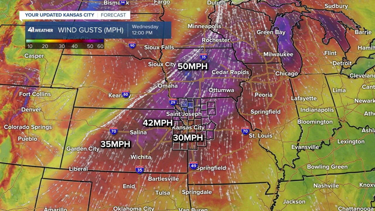
The winds of change, ahead of this front, are gusting 35-50 mph, strongest in Iowa.
This front will interact with a series of systems now entering the west coast to bring several chances of rain and thunderstorms to our area through the weekend.
Here is a summary of the best chance of thunderstorms, as of data from Wednesday afternoon.
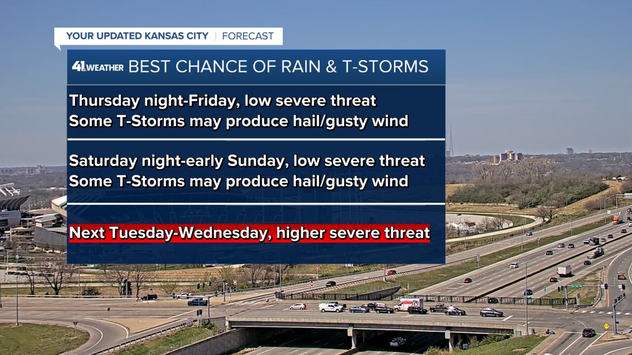
There is a level 1 and 2 risk of severe weather Thursday in our area for mainly the large hail potential. The level 2 is centered across North Central Kansas extending into northwest Missouri.

Details are in the 6 minute video below.
Have a great rest of your week and weekend.
Stay healthy
