

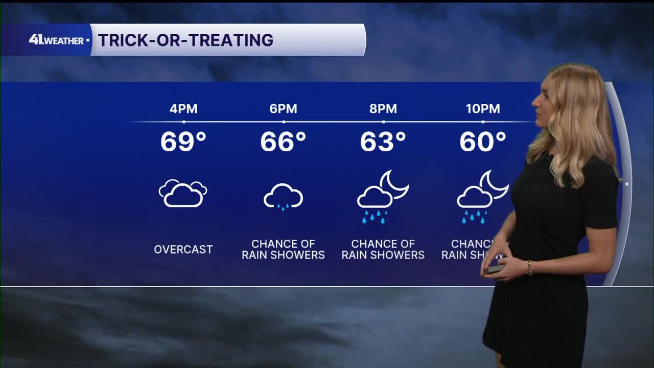


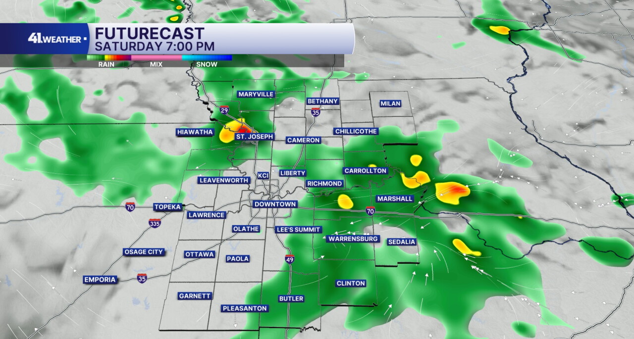
KANSAS CITY, Mo. — Trick-or-treaters may be collecting a few raindrops in addition to candy this year. Although we'll have a lot of dry time today, a few isolated showers are possible this evening.
It will be feeling spooky — and perhaps a bit gloomy this Halloween with overcast skies and temperatures in the 60s. It likely won't rain all evening, but a few showers will be lurking.
Umbrellas and light jackets are recommended if you're heading outside tonight.
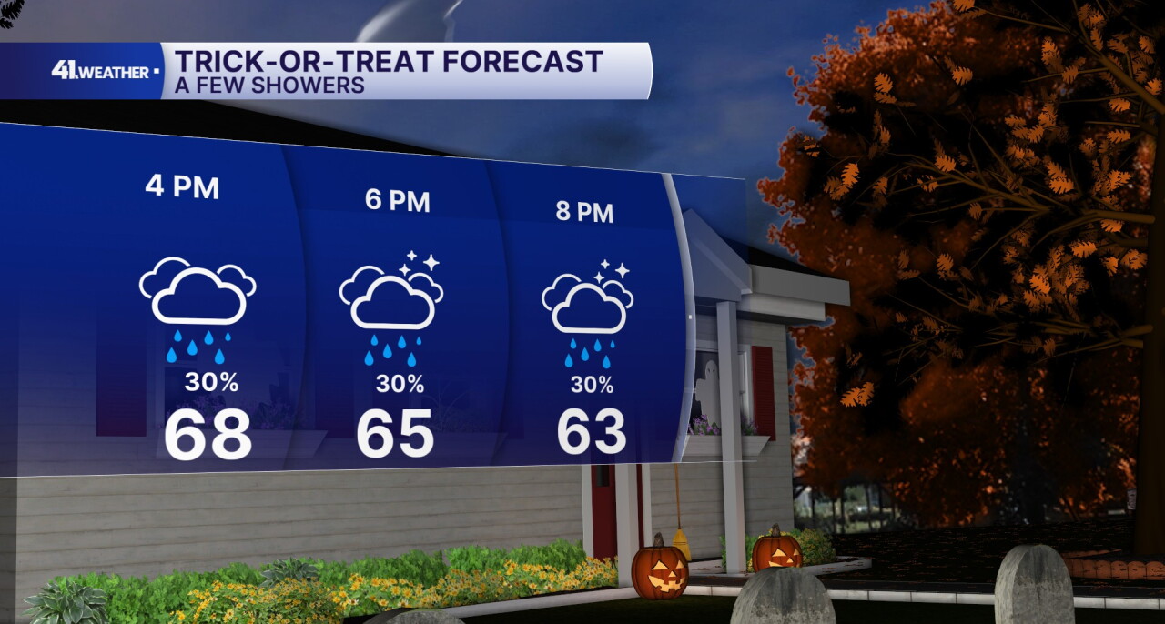
Showers will continue off and on into the overnight hours with overcast skies. Rain chances will decrease heading into Sunday morning.
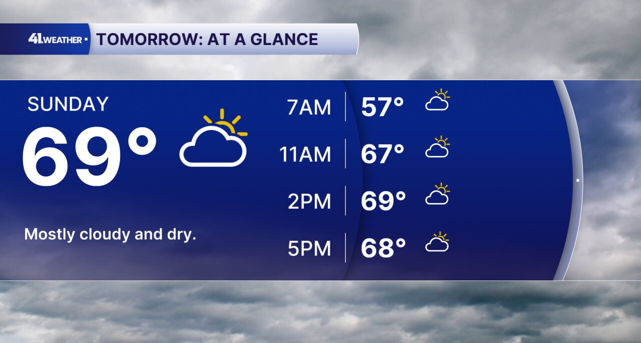
On Sunday, you can expect a very similar forecast...just without the rain! It will be cool and cloudy with morning temperatures in the 50s and highs in the mid to upper 60s.
Another great fall day, and it should feel pretty comfortable outside.
Rain chances return on Monday with our next cold front. This make spark a few thunderstorms as it moves in.
Right now the best chance of storms is in the afternoon and evening on Monday.
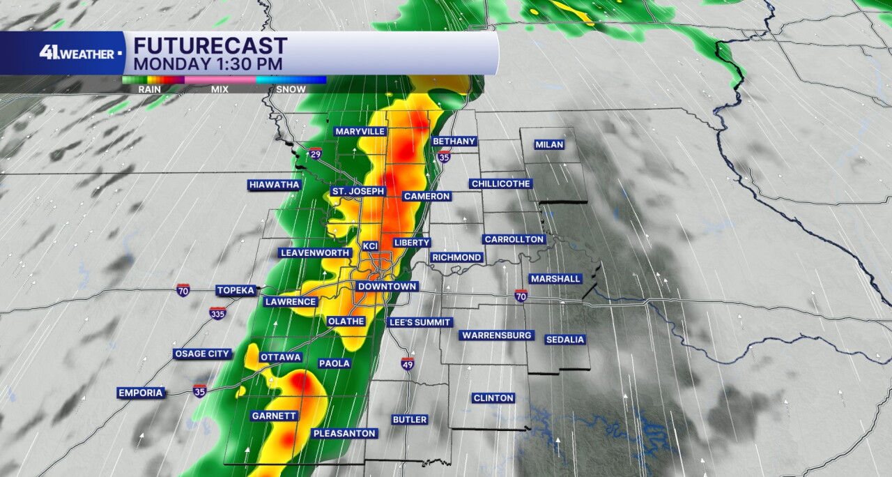
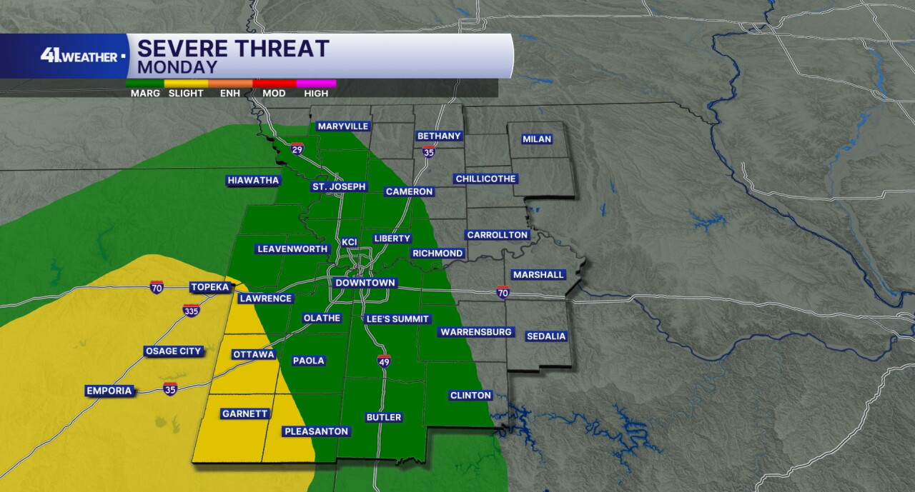
Some of the storms on Monday may be strong to severe. There is a 1/5 marginal risk of severe weather everywhere shaded in green, with a 2/5 slight risk of severe weather everywhere shaded in yellow.
The main threat with the storms is damaging winds, although a tornado cannot be ruled out. We could also see hail and flash flooding with any of the storms that develop.
Rain chances will linger overnight, and into the day on Tuesday.
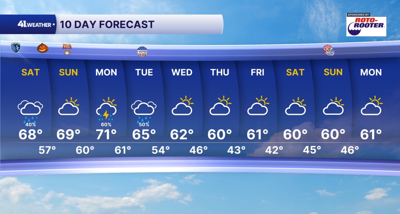
The cold front will bring temperatures down for the rest of the week. After recent warm temperatures, it should really feel like fall!
You can expect highs in the mid 60s on Tuesday, followed by low 60s for the rest of the week. Morning lows will generally be in the 40s with dry conditions continuing into next weekend.
Have a question about the forecast? I'd love to hear it! Reach out, and I'll answer your questions in this weather blog.

Happy Halloween!
