


Good rainy Friday bloggers,
We are finally seeing widespread rain as we track a storm system that is across southwest Kansas this morning. It will track east through the day and weaken. We will update the weather for the Thanksgiving week and weekend as we are tracking two main storm systems.
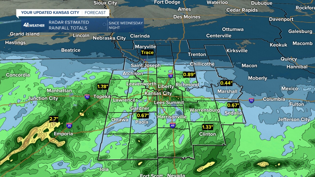
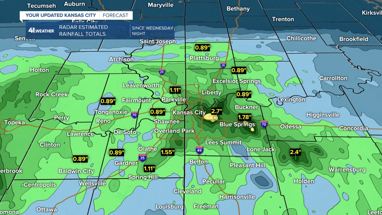
RAINFALL SO FAR (AS OF 545 AM):
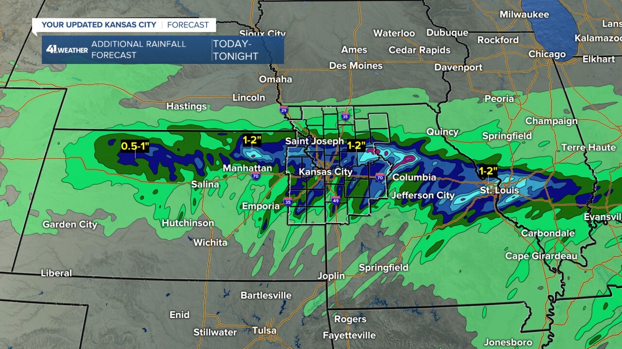
These are radar-estimated totals, so your rain gauge may read different, but these are pretty accurate. The highest seems to be in Jackson County from Blue Springs, Missouri, to east of downtown Kansas City, where amounts are over 2.50". Spring Hill, Kansas, to Overland Park have seen 1.00"-1.50". The least has been across northern Missouri, as amounts have been a trace.
The lower rainfall totals in our area, not northern Missouri, are in the .50"-1" range.
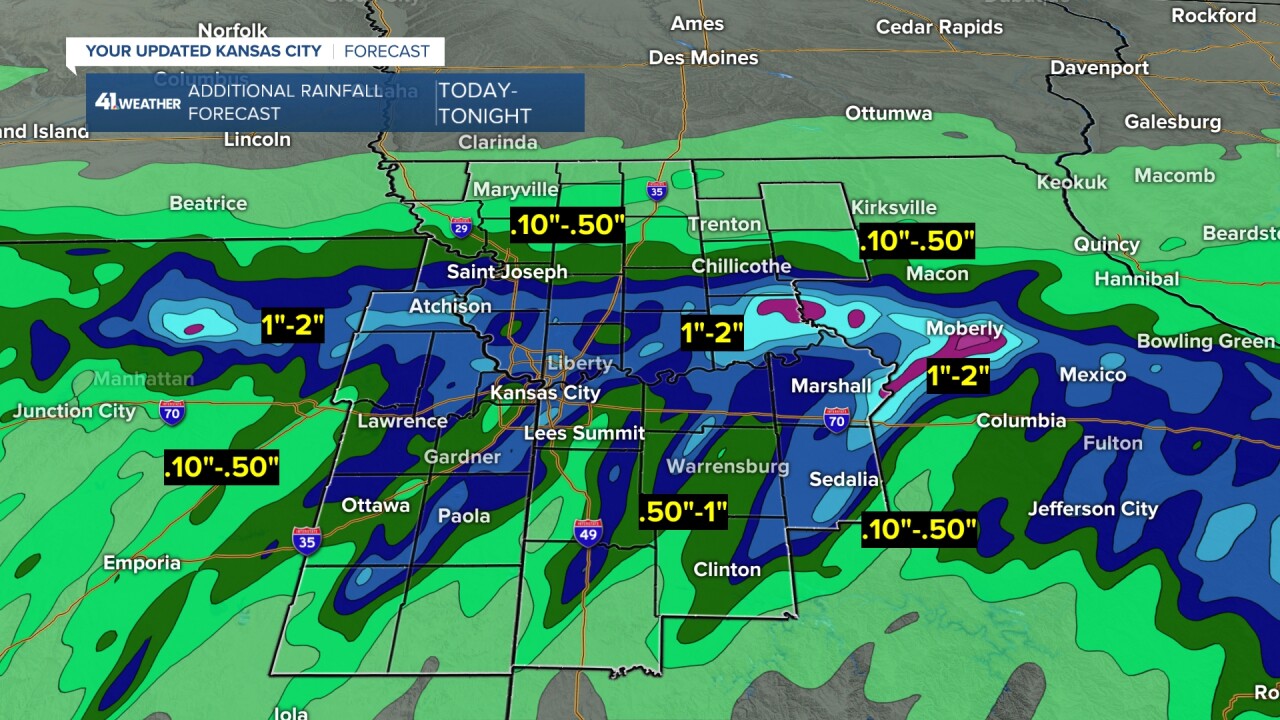
How much more rain can we expect?
Northern Missouri should end up with .10"-.50". An additional .50"-1" will occur across most locations, with a few spots seeing 1"-2".
Now, what is next?
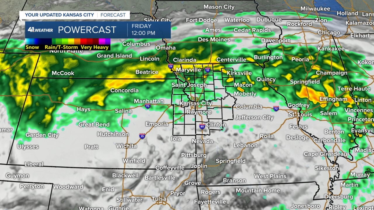
TODAY:
The heaviest rain will shift to northern Missouri and weaken as lighter showers/drizzle continue along the Interstate 70 corridor. Temperatures will drop to the upper 40s with a northeast wind at 10-20 mph.
TONIGHT:
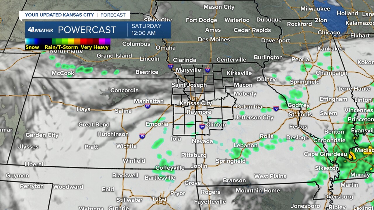
The rain showers/drizzle will end between 6 and 9 p.m., then we may see a clearing sky. If we do, areas of dense fog may form by Saturday morning as lows drop to the mid and upper-30s. The wind will drop to 5-10 mph from the north.
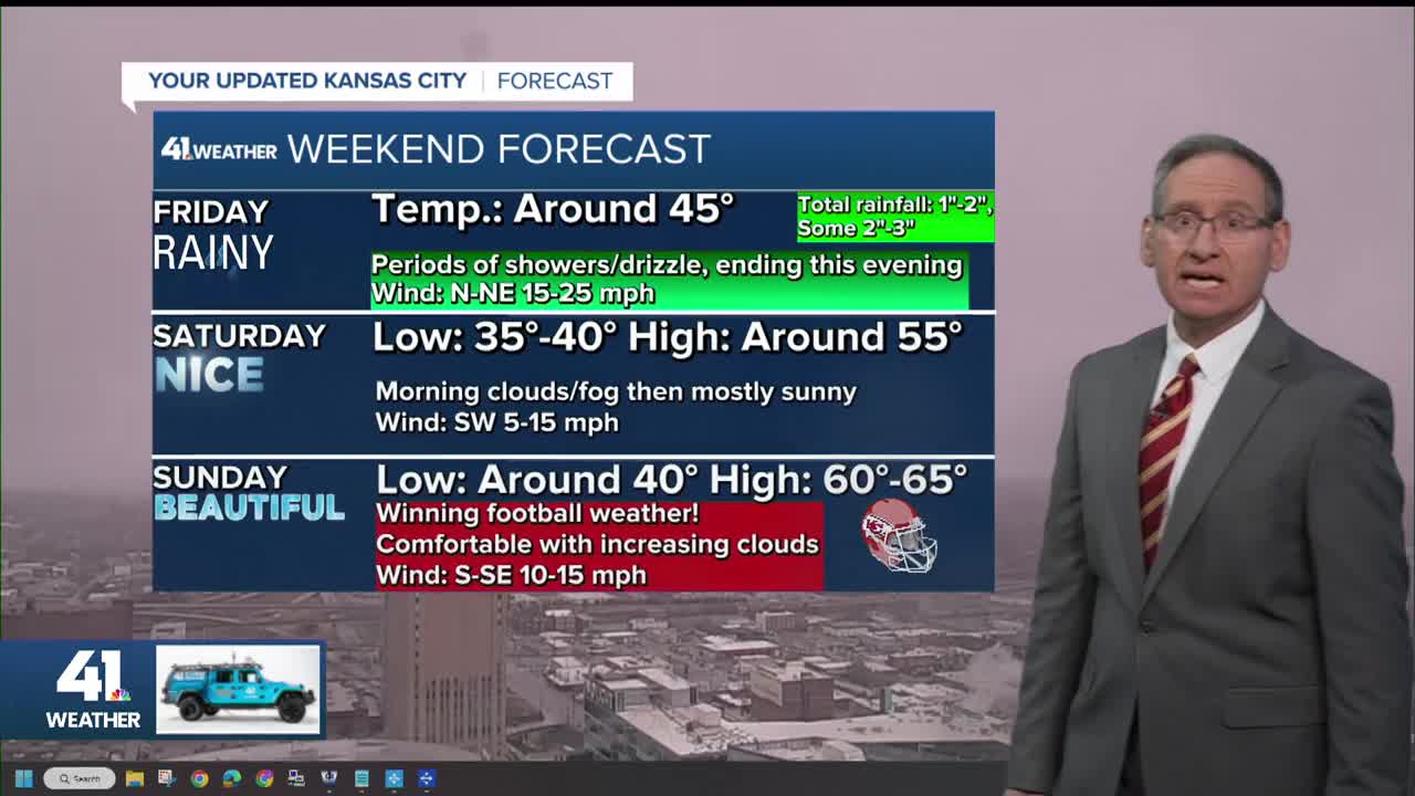
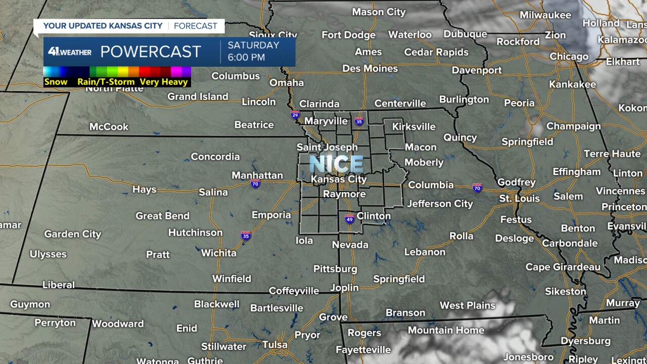
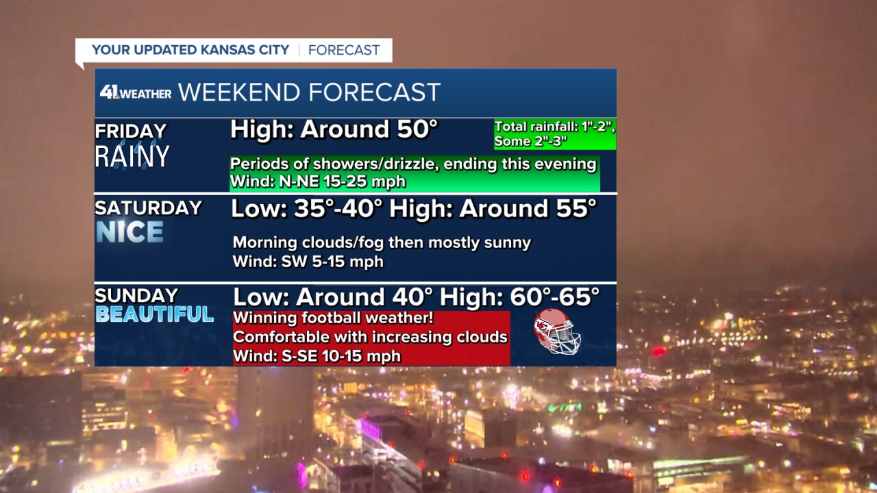
SATURDAY:
It will be a nice day with a light wind and highs in the 50s.
CHIEFS SUNDAY:
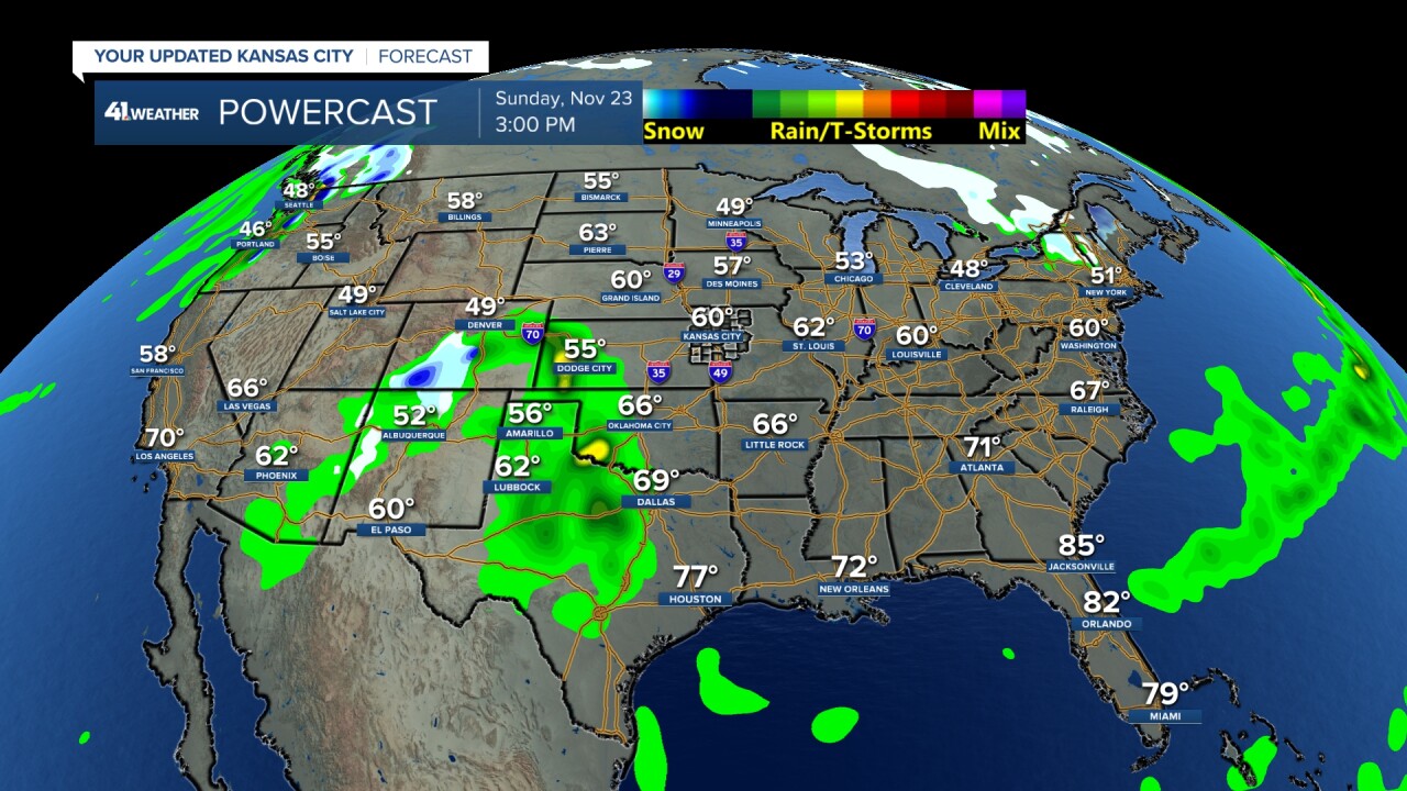
It will be a nice day with highs around 60. The day may start with fog. A rain system will be approaching from the southwest USA. So, if you are traveling, there will not be any huge issues as the storm system is not that strong. The Pacific Northwest will see a storm.
WEEKEND WEATHER SUMMARY:
Areas of dense fog are possible Saturday and Sunday mornings.
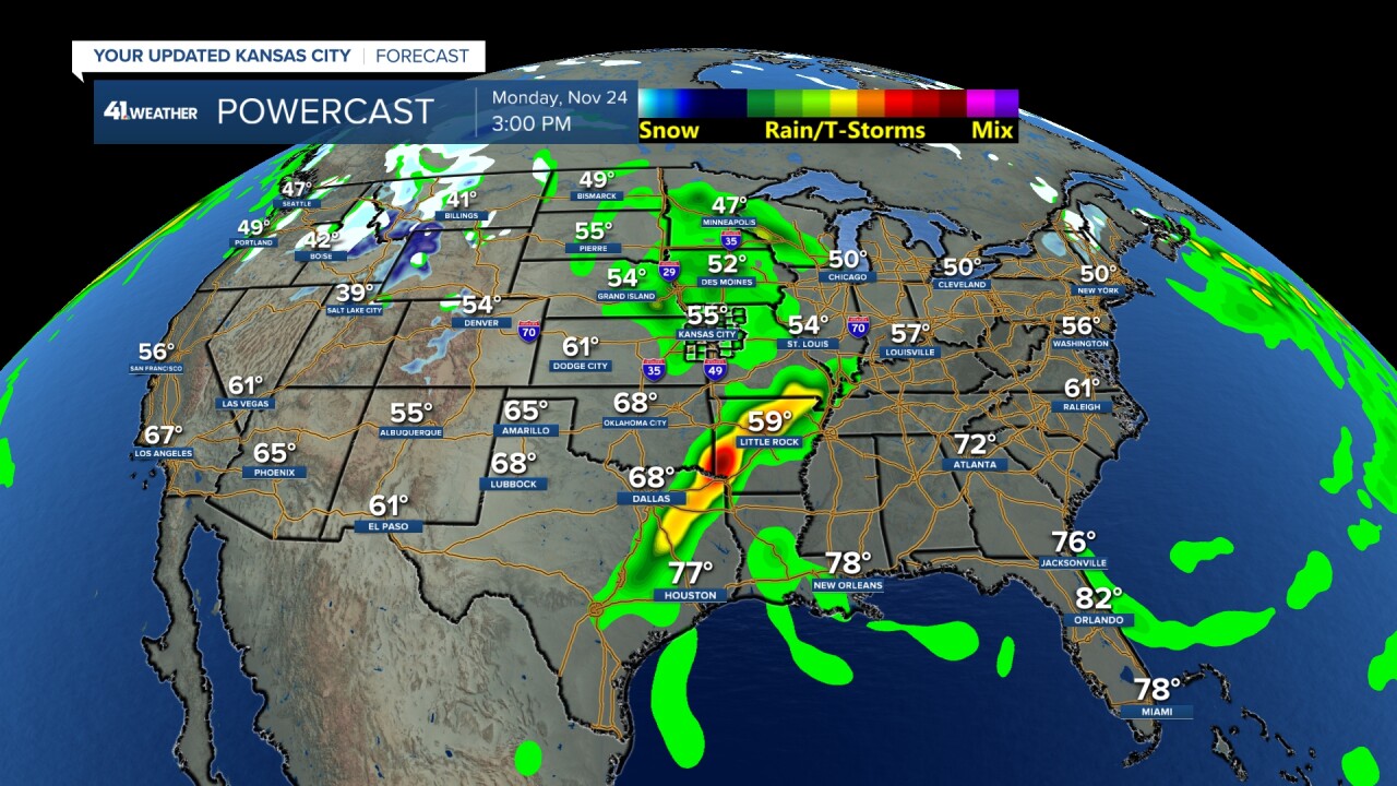
MONDAY:
The rain system will be tracking across the middle of the USA. There may be some severe weather from Arkansas to east Texas, but overall, this is not a big storm.
TUESDAY:
The system moves east, but again no big storm systems across the USA. There may be a brief rain/snow area across western Kansas/eastern Colorado as a blast of cold arrives. Keep this in mind if you are driving to Colorado Tuesday.

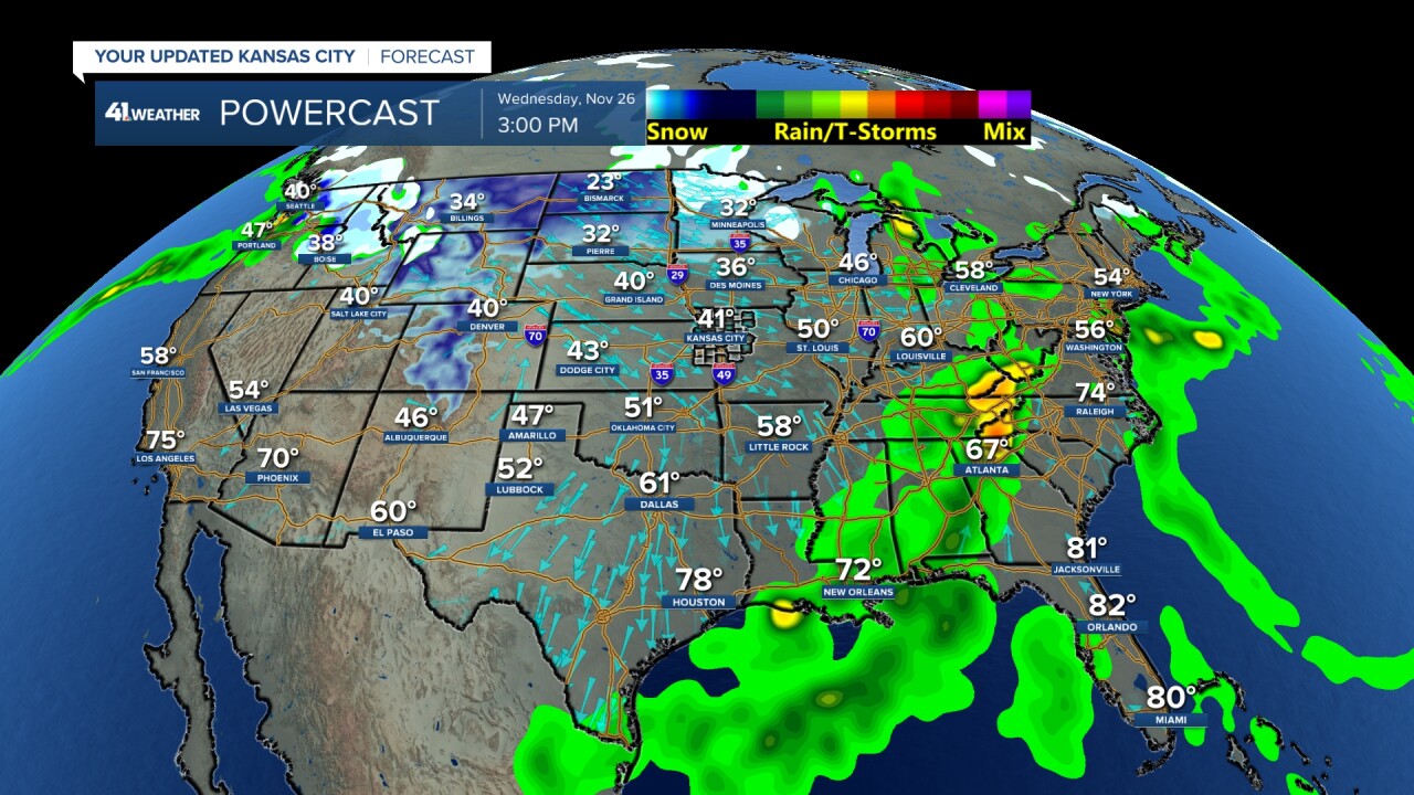
WEDNESDAY:
The big travel day will see rain/snow in the northwest USA, some snow in northern Minnesota and rain/thunderstorms from the eastern Midwest to southeast USA. But, overall there are no big storm systems.
We will see a blast of cold push through the middle of the USA, but we do not expect any precipitation.
THANKSGIVING DAY:
It will be dry for most of the USA. Arctic air will be sneaking into the northern Plains. It will be cold and dry around Kansas City with highs around 40°. Temperatures will drop to the 30s for the Plaza Lighting.
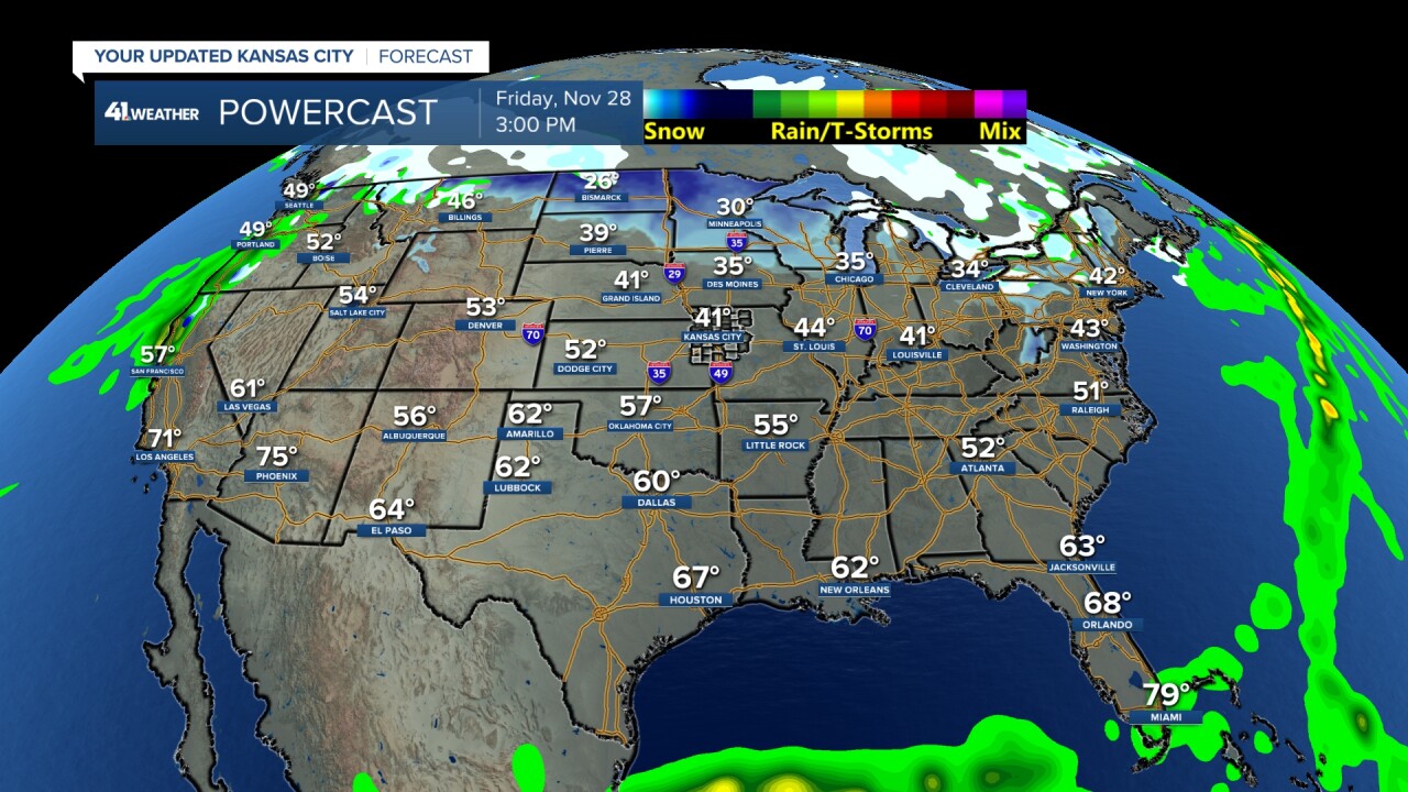
FRIDAY (11/28):
It looks about the same as Thanksgiving Day, mostly dry across the USA and cold/dry in Kansas City.
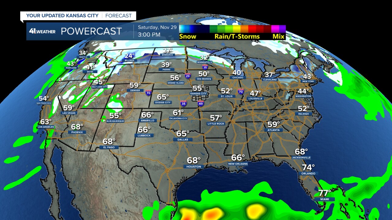
SATURDAY (11/29):
Rain and snow will increase across the western USA as we see a developing storm system. This storm will surge warm air north, so that we will see highs return to the 50s.
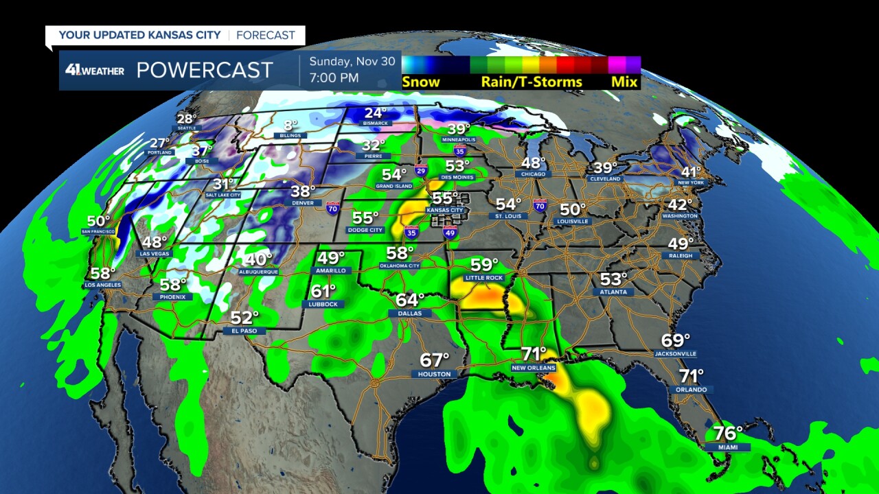
SUNDAY (11/30):
The storm in the western USA will be getting its act together. At this moment, it looks like rain/thunderstorms will increase in the middle of the USA with ice and snow in the northern Plains to upper Michigan. The western 1/2 of the USA will see rain/snow increase as Arctic air begins to head south. See the 8° in Montana?
The details are far from set, but this may impact travel back home.
Have a great weekend.
Stay healthy
GO CHIEFS!
