

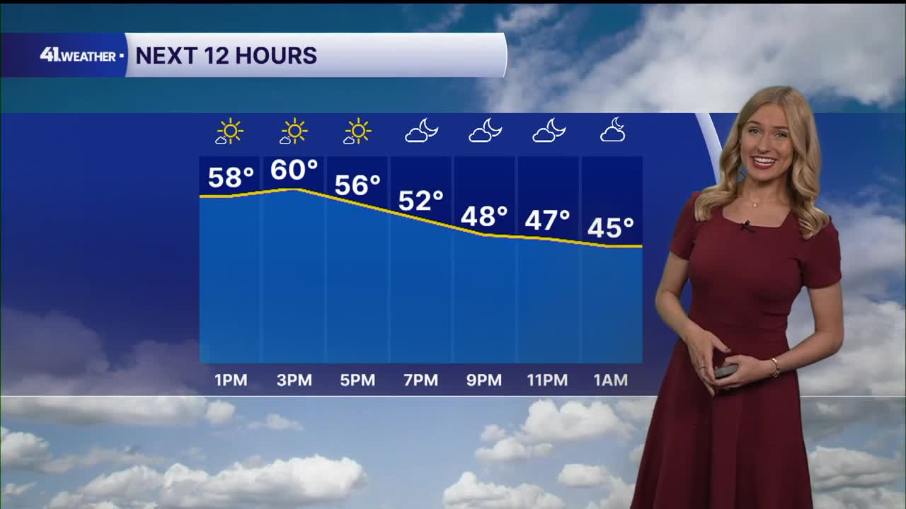


KANSAS CITY, Mo. — Enjoy the warm weather while it's here! After highs continually climb to near 70° by the end of the week, cooler weather and rain chances return on Saturday.
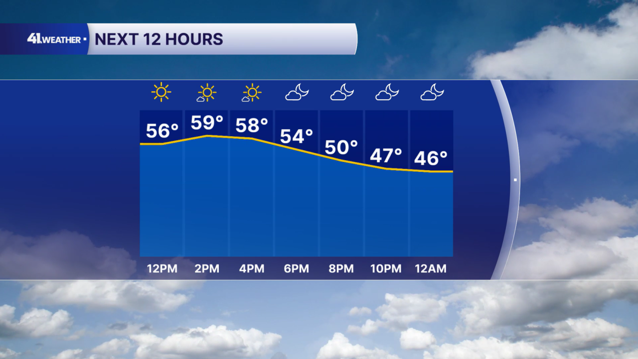
In the meantime — sunshine and highs near 60° are on the way Tuesday. Another pleasant November day!
A south wind will be pulling in much warmer air into our area. It may be a bit breezy at times, with winds gusting up to 20 mph during the afternoon and evening.
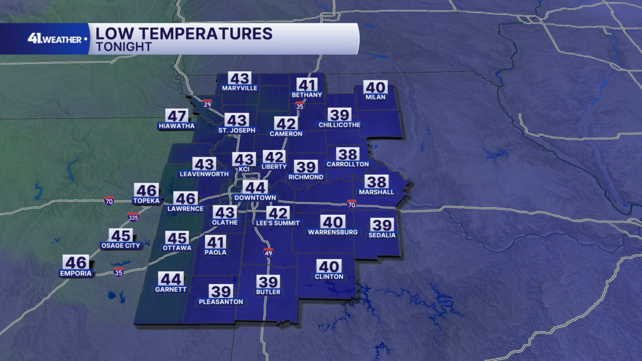
Conditions will stay breezy overnight, with a very mild cool down heading into Wednesday morning. Lows will range from the upper 30s to low 40s.
No threat of frost or a freeze is expected Wednesday morning, as well as for the remainder of the week.
Wednesday will be breezy, but otherwise warm and mild. A few clouds may be around to start the day with mostly sunny skies by the afternoon.
Highs will reach the low 60s, which is about 10 degrees above average for this time of year.
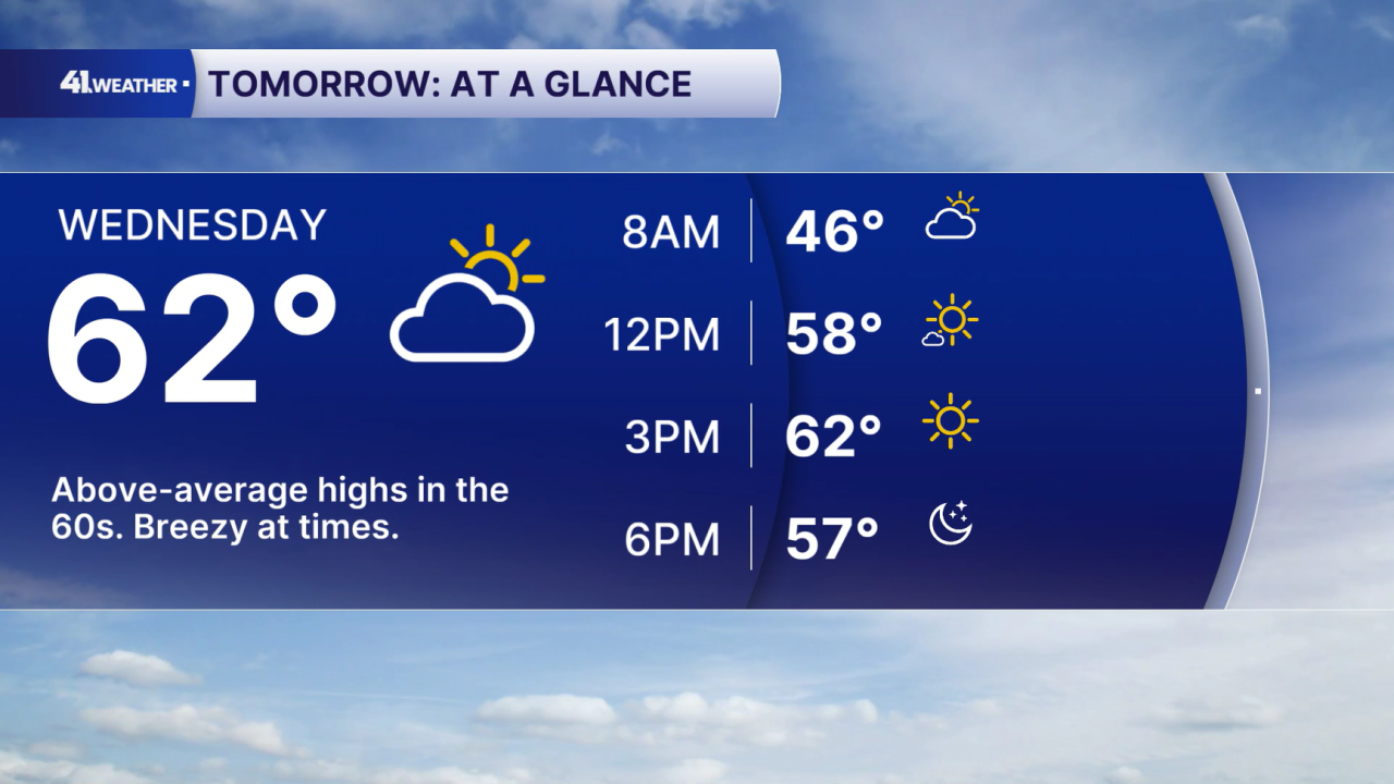
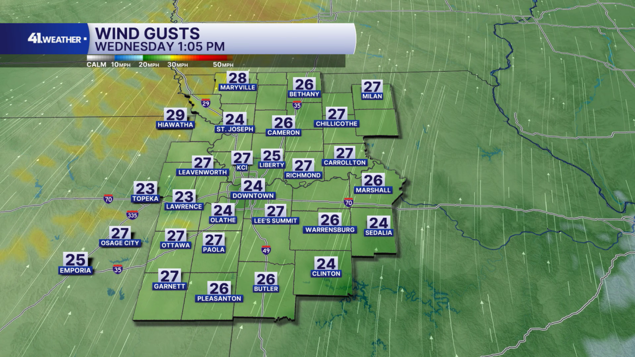
Strong winds out of the south are going to fuel our warm up on Wednesday. It will be breezy throughout the day with gusts up to 30 mph.
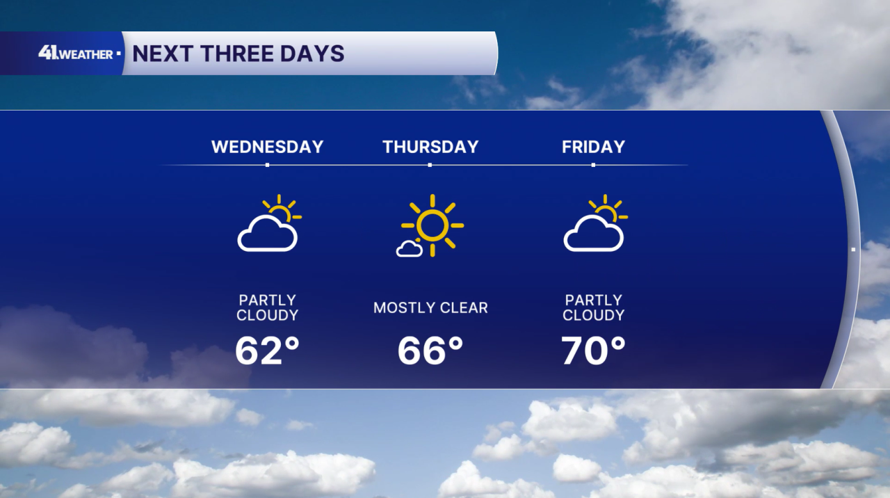
Kansas City's warming trend continues all the way through Friday, as highs reach near 70 with partly cloudy skies.
Enjoy the warm weather while it's here! Big changes are coming by Saturday.
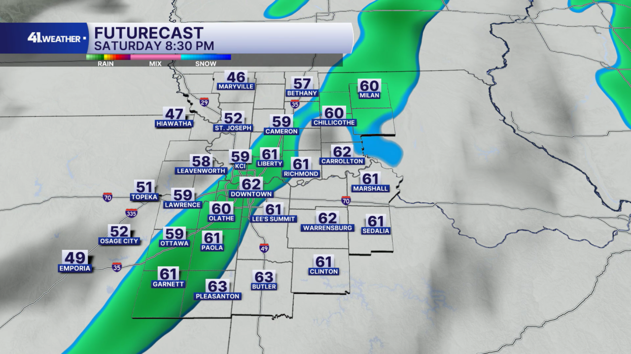
Our next cold front will arrive early Saturday morning, bringing cooler temperatures as well as rain chances lasting into the evening.
Otherwise, the day will be cloudy with highs in the mid 60s.
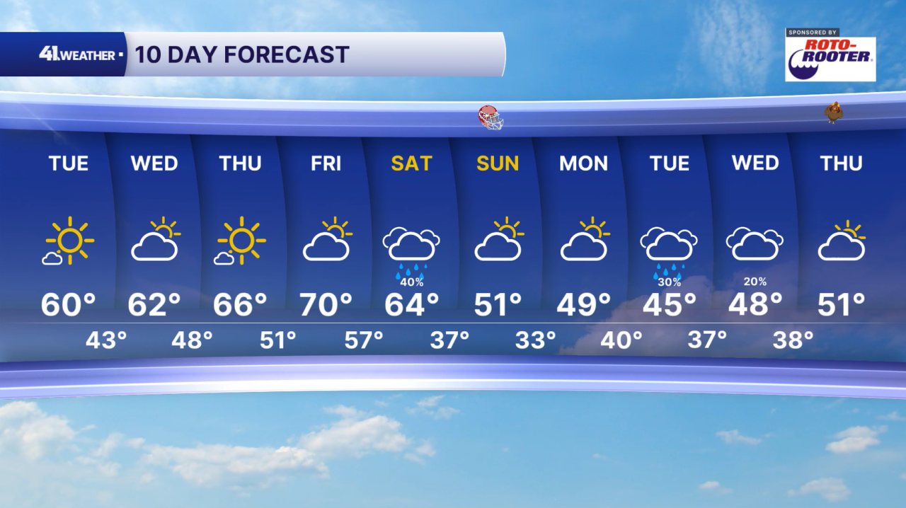
The second half of the weekend will be dry, but noticeably cooler. Temperatures will drop into the low 50s by Sunday, with morning lows starting off in the low to mid-30s Monday morning.
For next week, you can expect high temperatures in the mid to upper 40s with rain chances Tuesday into Wednesday.
At this point, Thanksgiving looks like it will be pretty mild. We'll have a clearer picture as we get closer.
Have a question about the forecast? I'd love to hear it! Reach out to me, and I'll answer your questions in this weather blog.

Enjoy the nice weather this week!
