


KANSAS CITY, Mo. — Good Wednesday bloggers,
We are still tracking two cold fronts this week. The 1st one arrives this evening, and the 2nd one arrives Friday morning.
The 1st front will bring some thunderstorms and some of those may be severe.
Let's go through this.
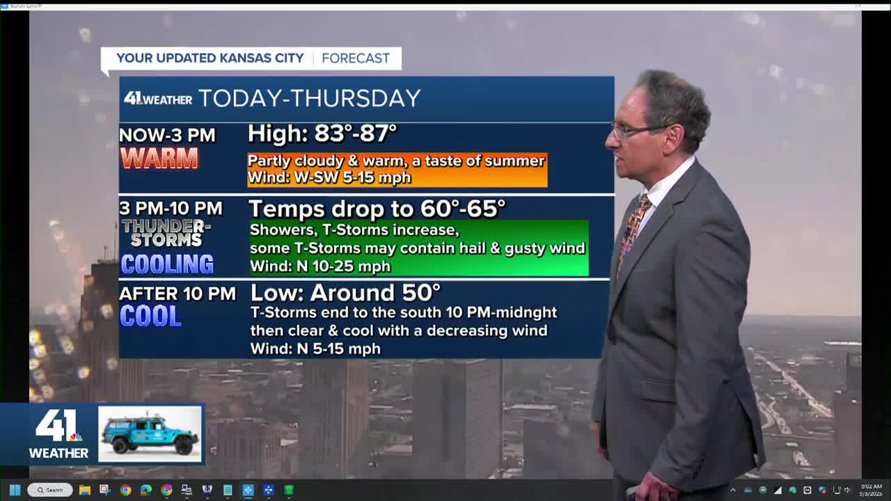
TODAY (Now to 4 p.m.):
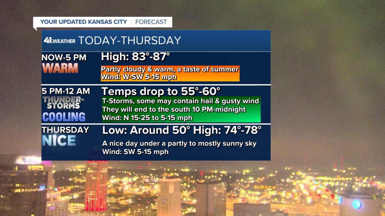
We will get a taste of summer as highs reach the mid to even upper 80s. Northern Missouri will see highs in the upper 70s as the front passes those locations before it has a chance to warm up. That also means the chance of thunderstorms in northern Missouri is very low as the front will go by before any thunderstorms form on it.
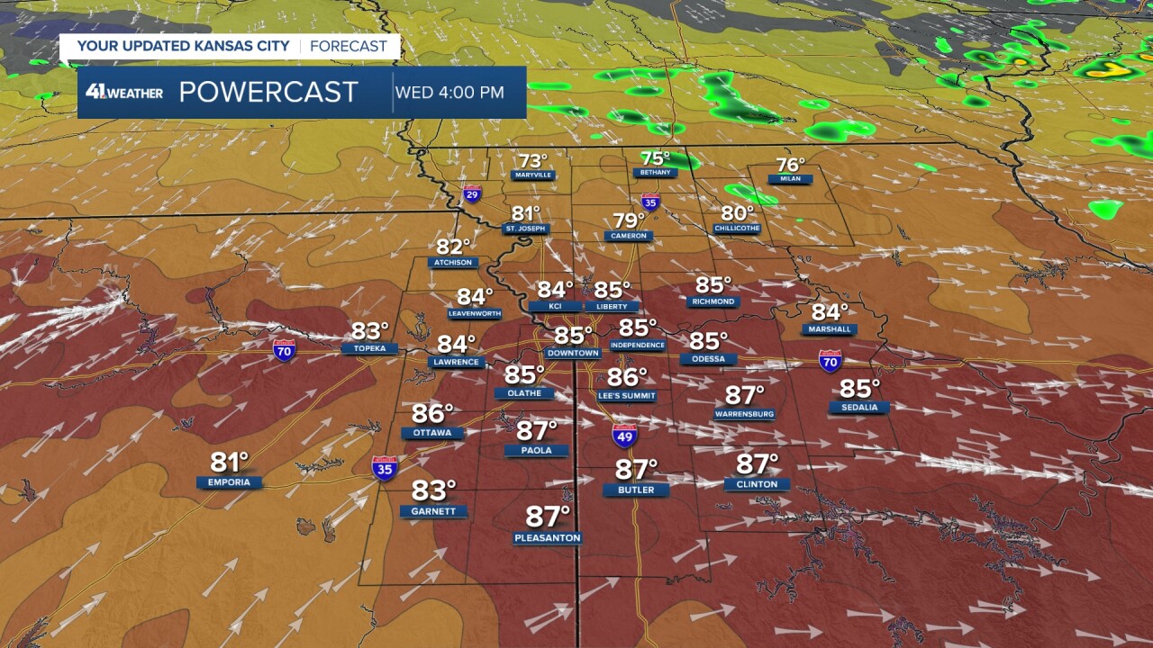
TODAY (4 p.m. to midnight):
Thunderstorms will form along and behind the front. It will not be a solid line, so some locations may not see much or any rain. A few locations may see as much as .50"-1" of rain.
Showers and thunderstorms will end from north to south between 10 p.m. and midnight.
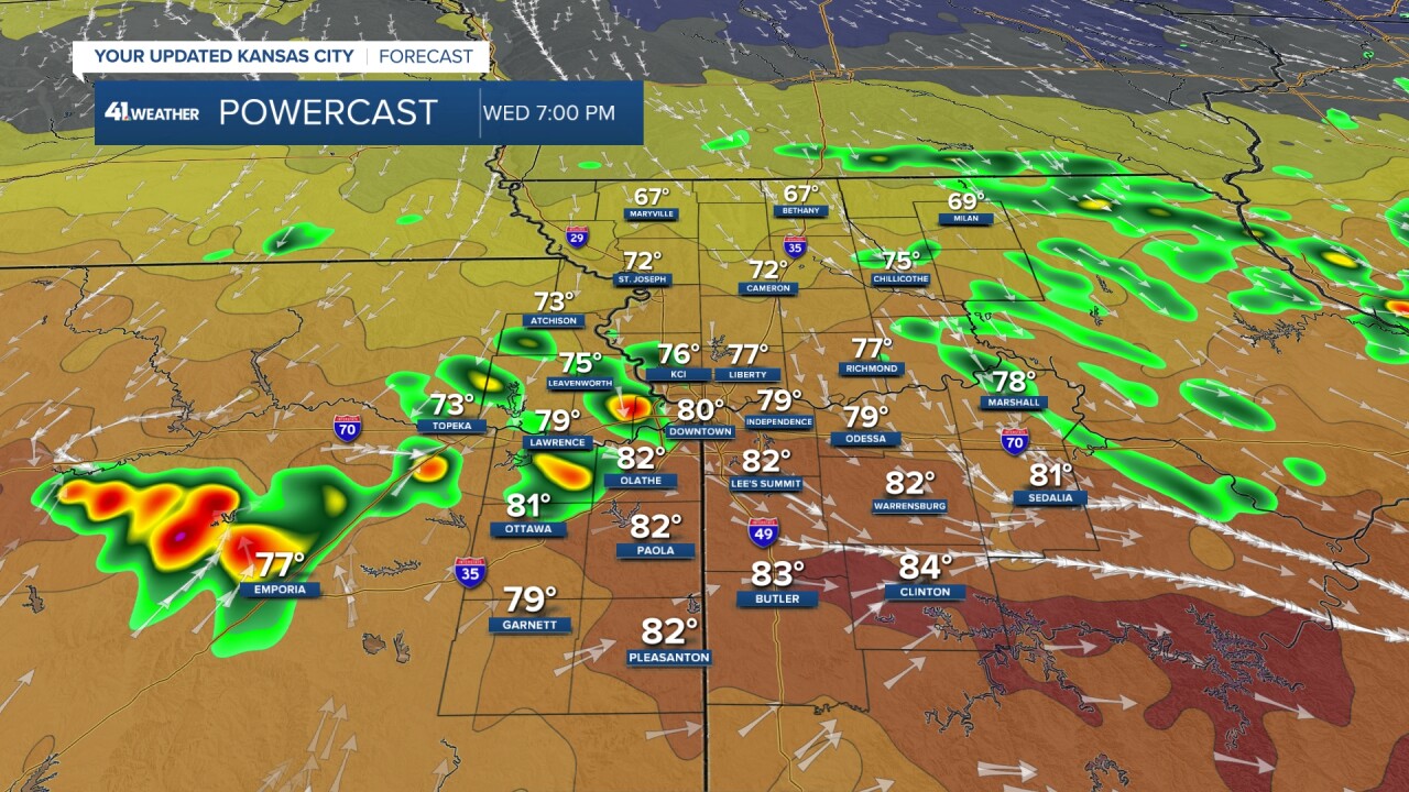

The thunderstorms that form along the front may contain quarter-sized hail and wind gusts over 58 mph. That would classify them as severe. We are in a level 2 of 5 risk, but this is not a big severe weather setup.


THURSDAY (Midnight at 7 a.m.):
Lows will drop to the upper 40s in northern Missouri to near 60° in southeast Kansas and southern Missouri as the front is not quite as strong as it looked the last few days. KC will drop to 50°-55°. It depends how many clouds hang on. The more clouds, the warmer it will be as clouds act like a blanket at night.
Again, as far as rainfall. Most locations will see a trace-.10", some locations may see .10"-.50" and a few locations will see .50"-1".

THURSDAY:
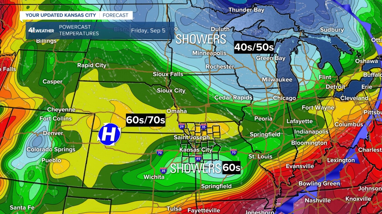
It will be a nice day with abundant sunshine as the wind turns back to the southwest ahead of the 2nd cold front. Highs will be in the 70s. The 2nd front is stronger, but has less moisture to work with. So, any rain will be light and scattered with the 2nd front that moves through early Friday.

FRIDAY:
The front will be surging south as a disturbance tracks from west to east behind the front. This system will bring thick clouds and areas of rain. Highs will be in the 60s where it is cloudy and raining. Highs will be around 70° where there are clouds with a little rain and some sun.
Right now, it looks like the cloudy, rain area will be south of Kansas City. This means Kansas City is closer to the 70° area. A slight shift north and Kansas City could see highs in the 60s. If we do see highs in the 60s and the high is 66° or lower we will tie/break a record low high temperature of 66° set in 1905. As of this moment, we feel it will fall short as we may see some sun and not much rain.
The weekend looks great with highs in the 70s and lows 45°-55°.
This last Saturday through Tuesday saw rain every one of those days. But amounts were piddly, mostly under .25". The meaningful rain occurred from northwest Missouri to eastern Kansas, west of Lawrence.
Hopefully, your yard or farm will get the rain it needs today as there is not much rain in the forecast the next 7-10 days.
Officially, at KCI, which is the official reporting station for Kansas City we are about average on rainfall for the year. But, most of the rain occurred in June and July. So, the topsoil has gotten dry.

WEATHER SUMMARY:
Have a great rest of your week
Stay healthy
