



KANSAS CITY, Mo. — Bring your plants inside, unplug your hose, protect your pipes, and keep your pets warm too!
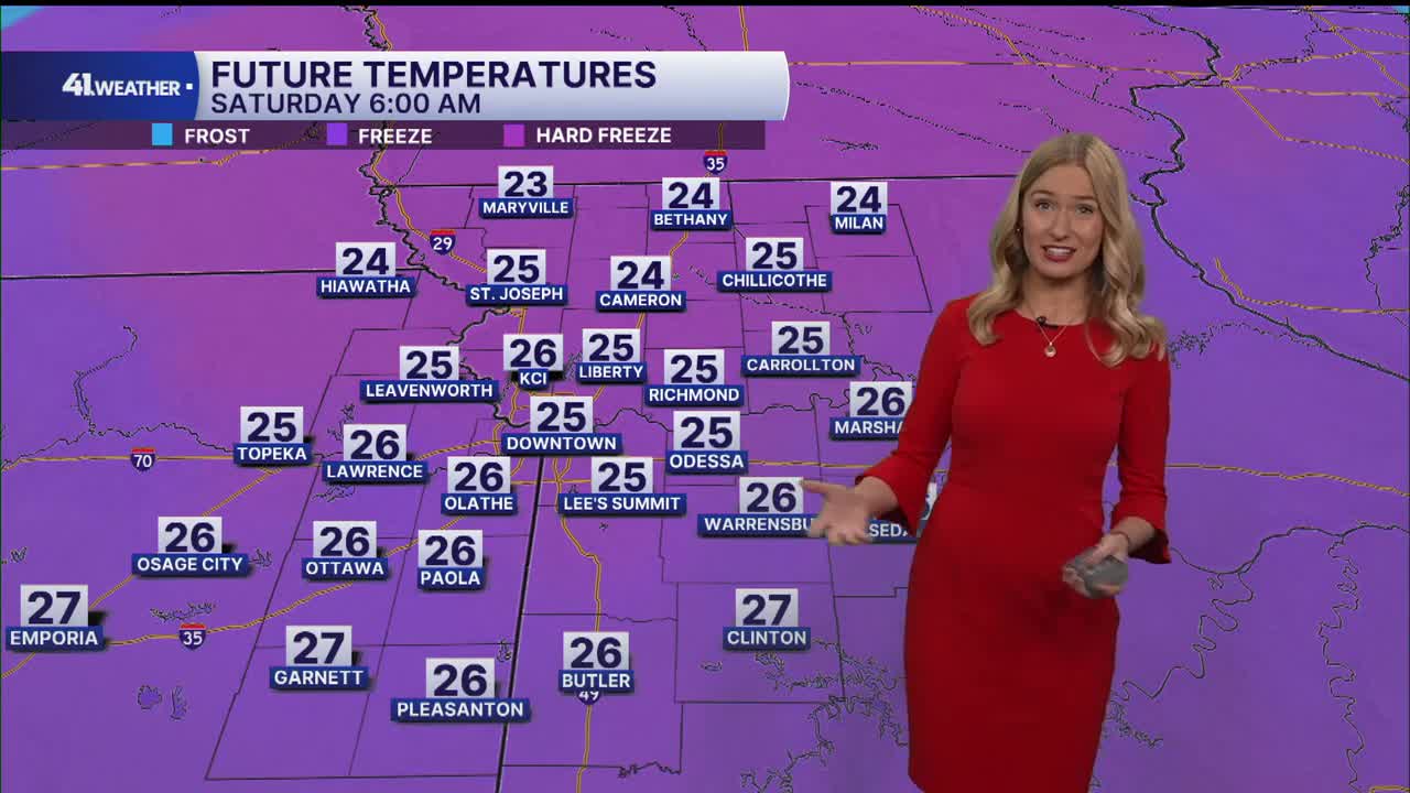
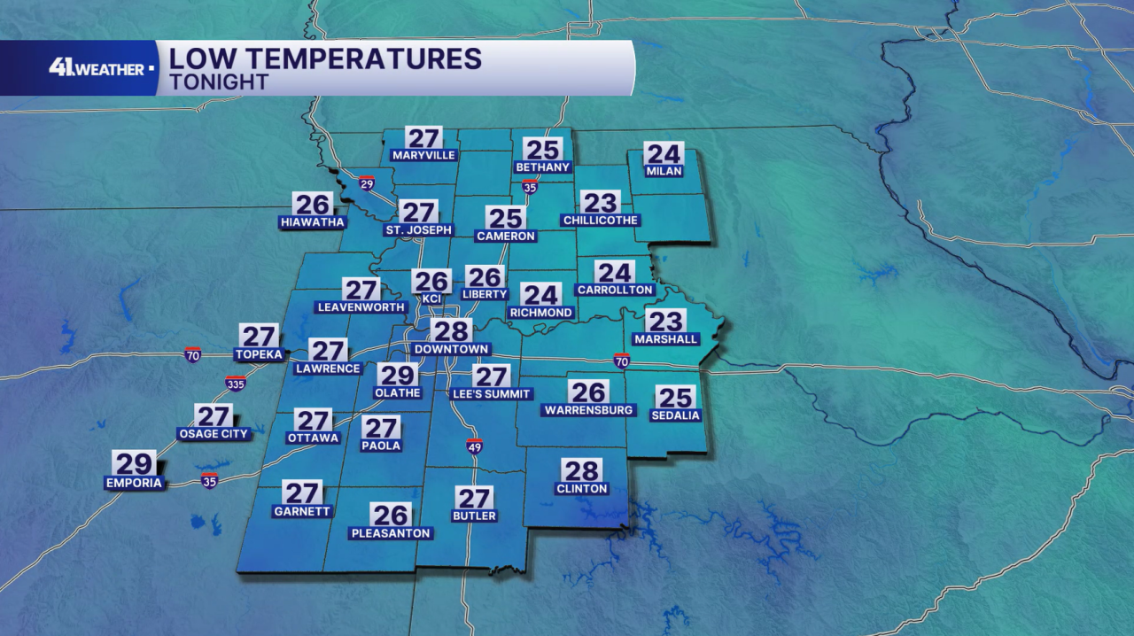
Kansas City is bracing for another cold night heading into Saturday, with the first hard freeze of the season expected for the area.
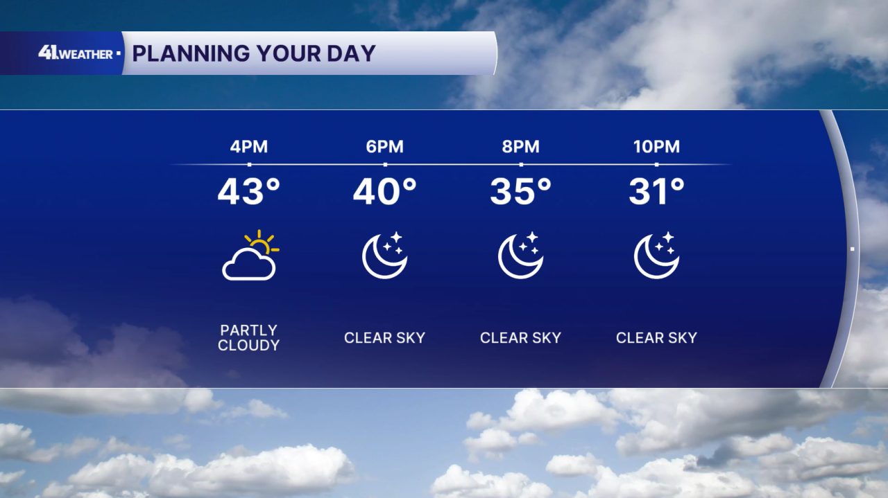
After starting off the day in the 20s and 30s, temperatures recovered into the 40s by the afternoon on Friday with sunshine returning by the end of the day.
After sunset, you can expect clear skies and a steep drop in temperatures.
Many places across the area will likely see the first hard freeze of the season Saturday morning. This typically marks the end of the growing season.
A hard freeze happens when the temperature falls below 28° for several hours. This can cause serious damage to plants and pipes if not properly protected. Please be mindful of your pets and their exposure to the cold, too!
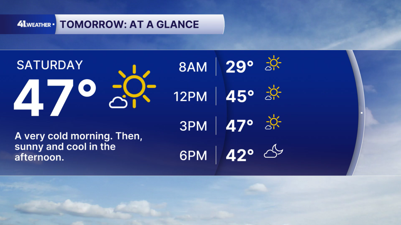
The rest of Saturday should feel very similar to Friday. You can expect sunny skies and highs in the mid to upper 40s.
We won't have much wind, so it shouldn't feel too uncomfortable throughout the day, especially in the sun.
Slightly warmer temperatures arrive by Sunday. You can expect a low near 30° in the morning and highs in the low 50s by the afternoon.
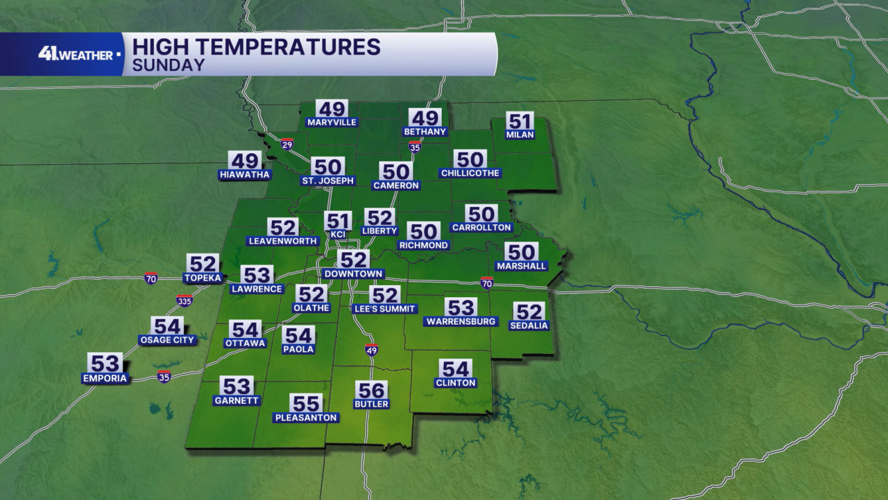
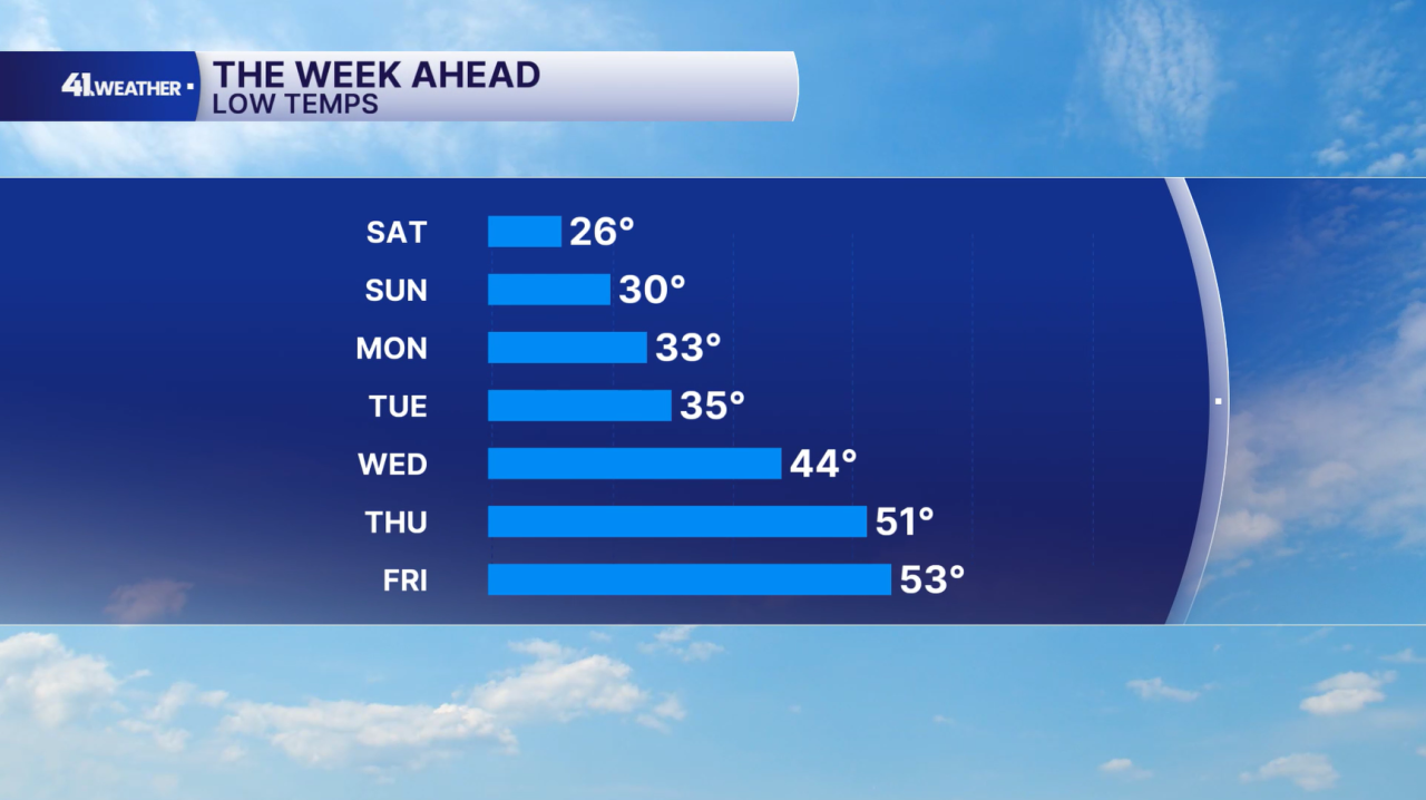
Morning lows will stay near the freezing mark Sunday and Monday. Tuesday we could see patchy frost, but after that our morning temperatures will stay above the frost/freeze threshold.
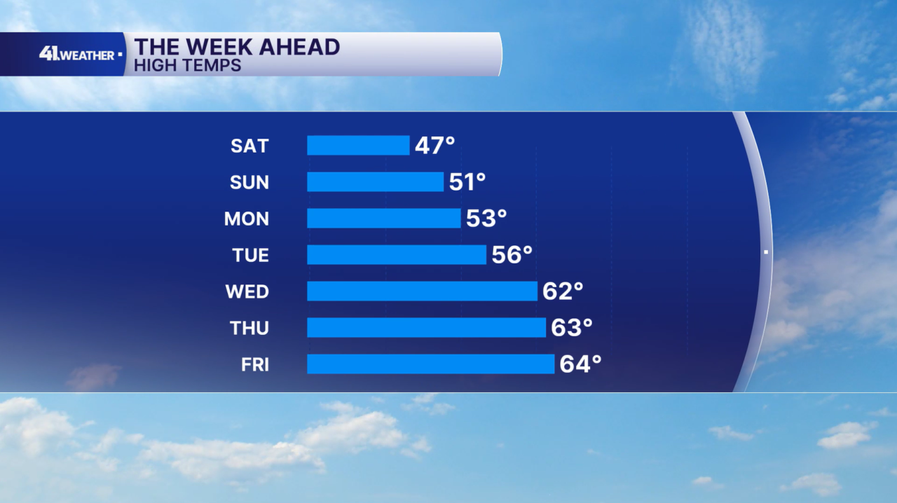
Our afternoon temperatures will continue to increase as well. Highs will return to near-average in the low to mid-50s Monday and Tuesday, and then reach well above average into the 60s by the end of the week.
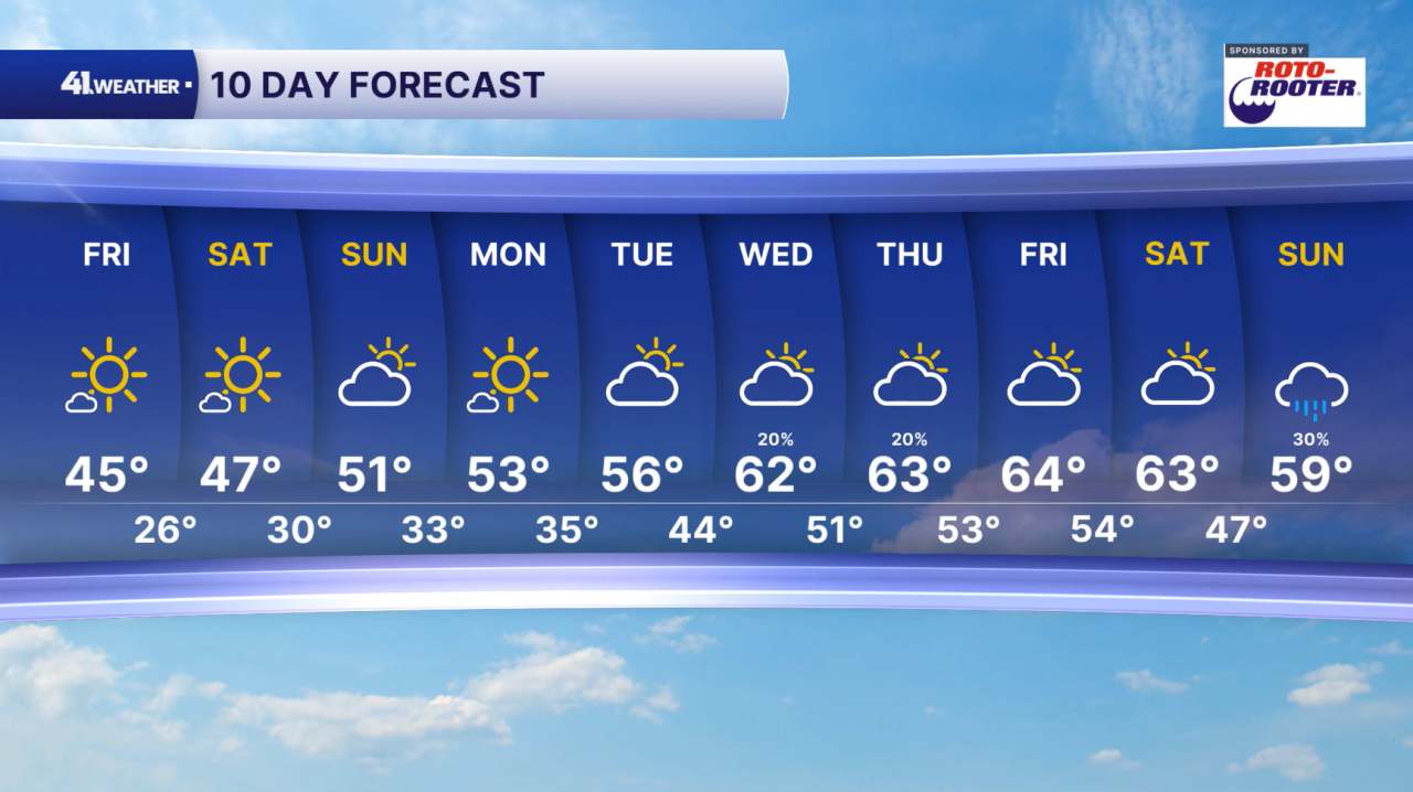
Rain chances are very slim over the next week. There's a slight chance of some rain Wednesday and Thursday, but most of our rain chances hold off until the end of the 10 Day Forecast.
Have a question about the forecast? I'd love to hear it! Reach out, and I'll answer your questions in this weather blog.

Stay warm this weekend!
