


KANSAS CITY, Mo. — Good Wednesday bloggers,
We are finally looking at a storm system that will bring widespread rainfall, ending our three-week dry spell. Now, the drought will continue, but every drop helps.
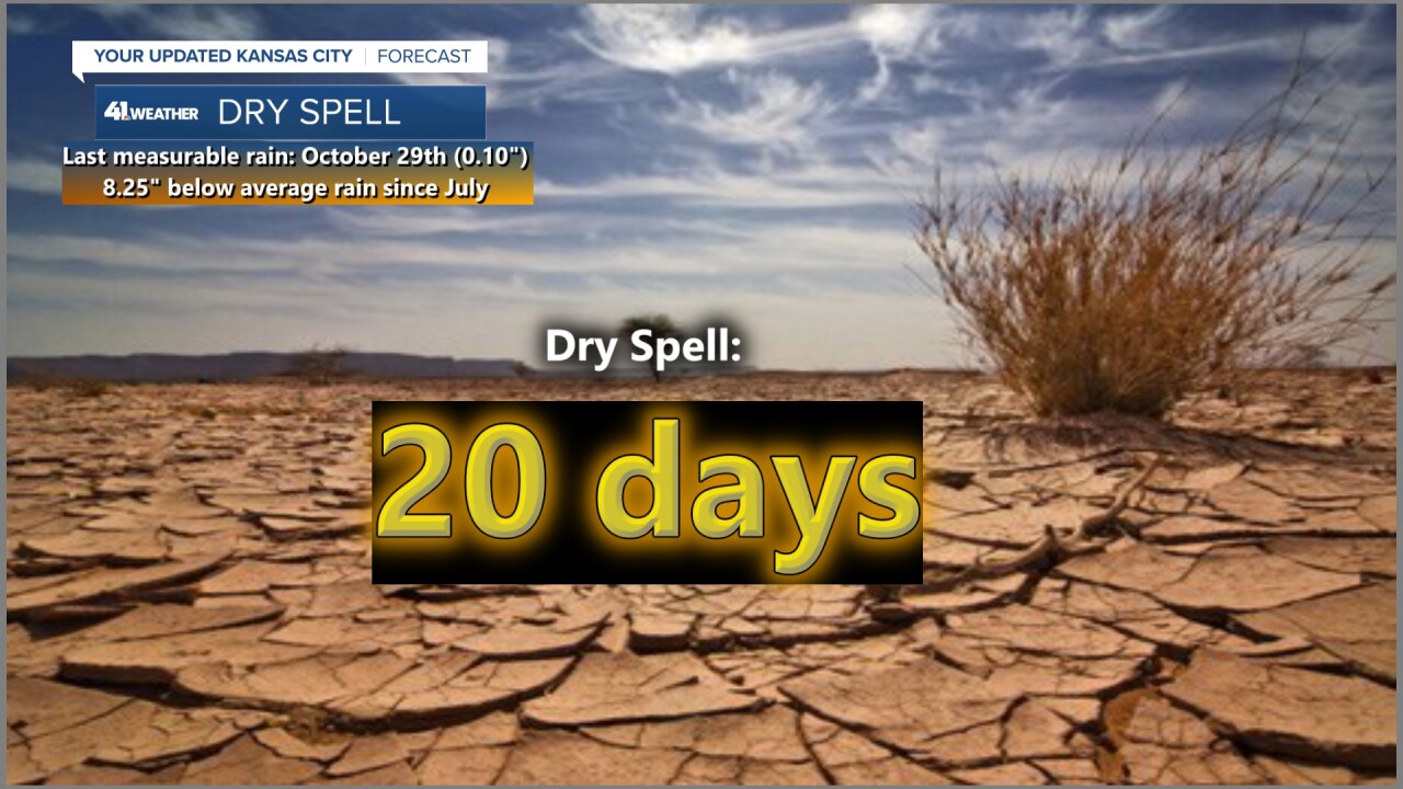
The storm system is now moving through the southwest USA, where it has brought over .50" to many desert locations, including Las Vegas. The November average in Las Vegas is under .10".

Let's go through the weather timeline.
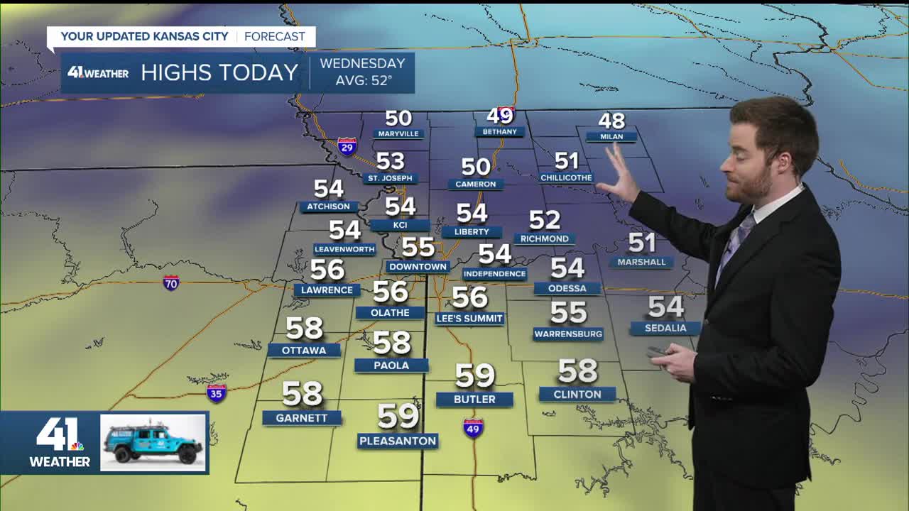
TODAY:
We will see low clouds and some fog this morning, followed by some sun shining through high and mid-level clouds. Highs will be in the 50s with a light east-southeast wind.

TONIGHT:
A disturbance will move in ahead of the main system and it will generate scattered showers and a few thunderstorms, mostly south of Kansas City, between 8 p.m. and 5 a.m. Lows will be in the mid to upper 40s.


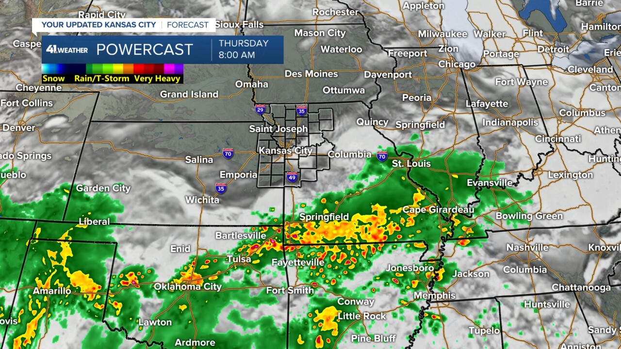
THURSDAY BEFORE 5 PM:
It will be mostly cloudy, dry and mild with highs around 60° as rain and thunderstorms increase from New Mexico to Kentucky about 200 miles south of Kansas City. The rain will be moving north toward us all day.
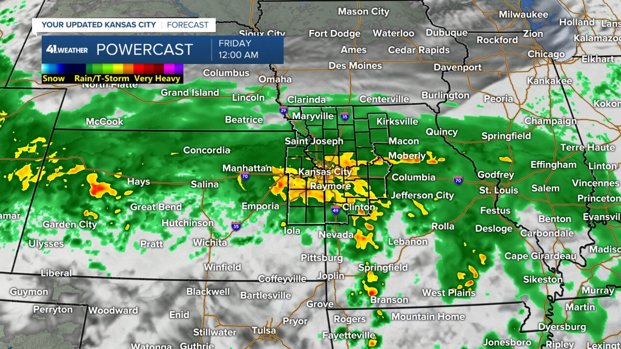
THURSDAY AFTER 5 PM-FRIDAY 7 AM:
The rain, and perhaps a thunderstorm, will head north and affect all locations centered around Interstate 70. We may see a period of heavier rain around midnight. Lows will be in the 40s as the wind picks up from the northeast at 10-20 mph.


FRIDAY 7 AM-7 PM:
We will see periods of rain and drizzle with highs around 50° along with a northeast wind at 10-25 mph. The main system will be weakening, but be centered near Kansas City by 4 p.m. Friday.

FRIDAY NIGHT-SATURDAY:
The rain will end Friday evening, followed by low clouds and some fog into Saturday morning with lows around 40°. The wind will diminish.
The sun will return Saturday with a light wind and highs in the 50s. Sunday will see sunshine with highs in the low 60s.
There is a chance of rain Monday-Tuesday before Thanksgiving. The holiday weekend is looking cold and dry with highs 35-45 and lows in the 20s. We will look at this more Thursday and Friday.
RAINFALL FORECAST:
When you look at the region, you can see widespread .10"-.50" rainfall with pockets of .50"-1" and 1"-2". You can also see the northern edge around the Kansas-Nebraska/Missouri-Iowa border.

When you zoom in to our area, you can see trace-.10" across far northern Missouri. .10"-.50" along highway 36 and southeast of Kansas City around Warrensburg, Clinton, and Sedalia, Missouri. .50"-1" is centered along I-70 with pockets of 1.00"-1.50".
Now, this heavier band can still shift north or south by 30-50 miles. But, at least we will all see rain. We average 2.00" of rain in all of November, so it is hard to get a lot of rain this time of year.

WEATHER TIMELINE SUMMARY:

Have a great rest of your week.
Stay healthy.
