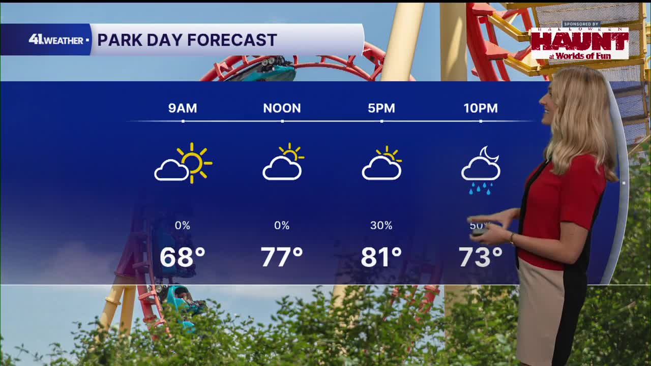


KANSAS CITY, Mo. — The remnants of Hurricane Polo are moving into the Kansas City area this week, causing heavy rainfall and flooding concerns.
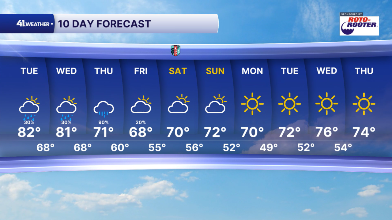
After temperatures break into the 80s Tuesday afternoon, rain chances will increase during the afternoon and evening, with showers and thunderstorms possible. Severe weather will not be a concern, but we could see heavy rainfall at times, flashes of lightning and thunder.
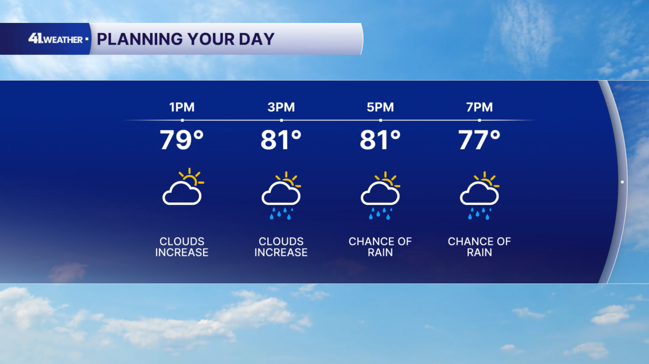
Rain chances continue overnight and into the daytime hours on Wednesday, but it won't rain all day. I do expect to see some dry periods throughout the day between spotty showers and thunderstorms. Highs will likely reach the 80s once again.
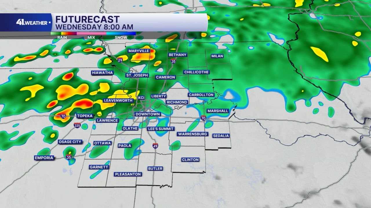
Our best chance of heavy, widespread rain holds off until Wednesday night and Thursday. This is the time when we'll have the greatest risk of flooding. Consistent rain may continue through Thursday evening. Luckily, we'll see drier conditions return heading into Friday. Temperatures will be a bit cooler on Thursday; highs in the low 70s expected.
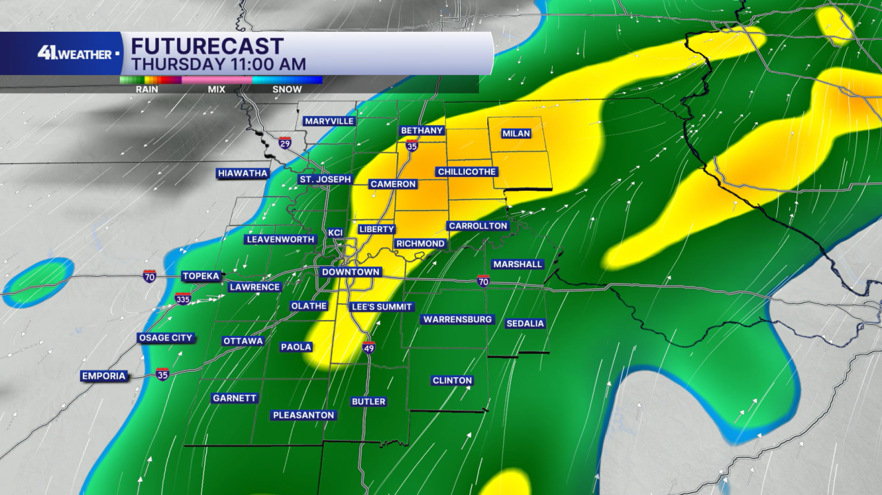
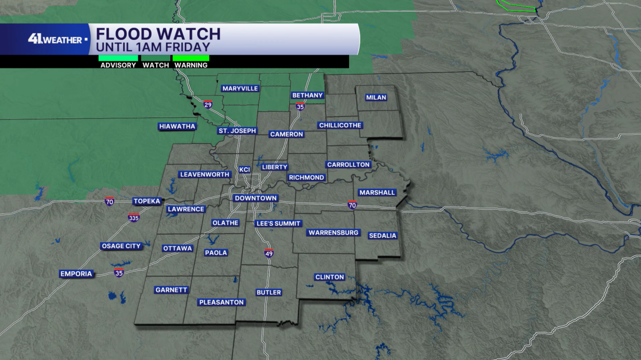
A flood watch is in effect until 1 a.m. Friday for counties northwest of Kansas City. I expect the watch to expand as we get later into the week.
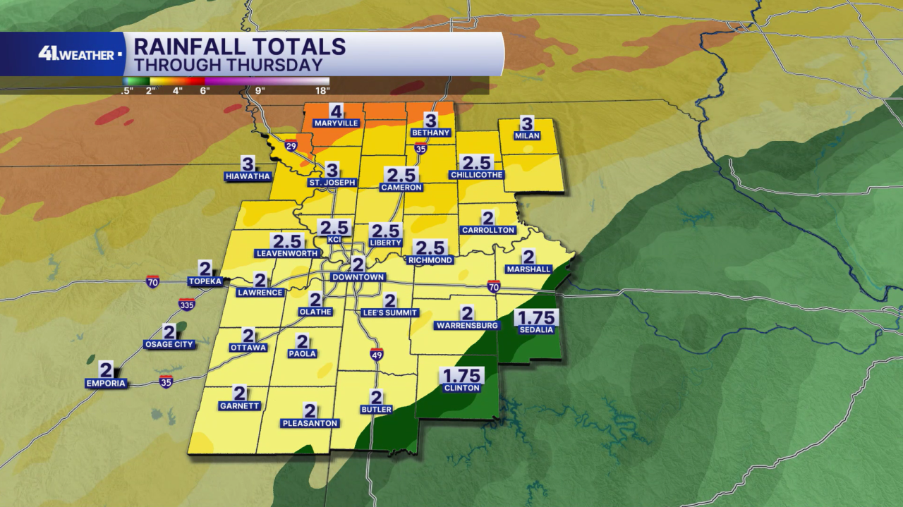
Up to 4" of rainfall is possible through Thursday, especially across northern Missouri. A widespread 2" to 3" is likely across the rest of the area.
The light at the end of the tunnel is dry conditions and cooler temperatures over the weekend. You can plan on mornings in the 50s and afternoons in the low 70s as we start October. It should be the perfect fall weekend!
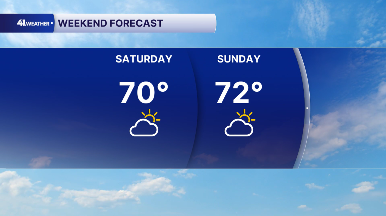
Ideal fall weather continues into next week, too. Highs in the 70s and sunshine!
Have a question about the forecast? I'd love to hear it! Reach out to me, and I'll answer your questions on this weather blog.

Stay dry out there! I hope you have a great day.
—