


KANSAS CITY, Mo. — Good Friday bloggers,
We had some rain overnight, but amounts were mostly trace-.25" with a few thin west-east bands of .25"-.75". The heaviest bands were from Burlington, Kansas, to Warsaw, Polo, and Moberly, Missouri.


Overall, there was not much rain. So, with a return to low humidity today and north winds gusting to 30-40 mph this morning and 20 mph this afternoon and the dry winter brush, there is a Fire Weather Warning. This means we should watch the outdoor burning as fires can start easily and spread fast.

Fire Weather watches and warnings cover much of the Plains and Southeast United States.

The satellite picture from early this morning shows our cold front squishing the heat dome to the south. The dome will be shifting to the southeast USA next week, and this opens the door to a more active weather pattern.

Let's go through this.
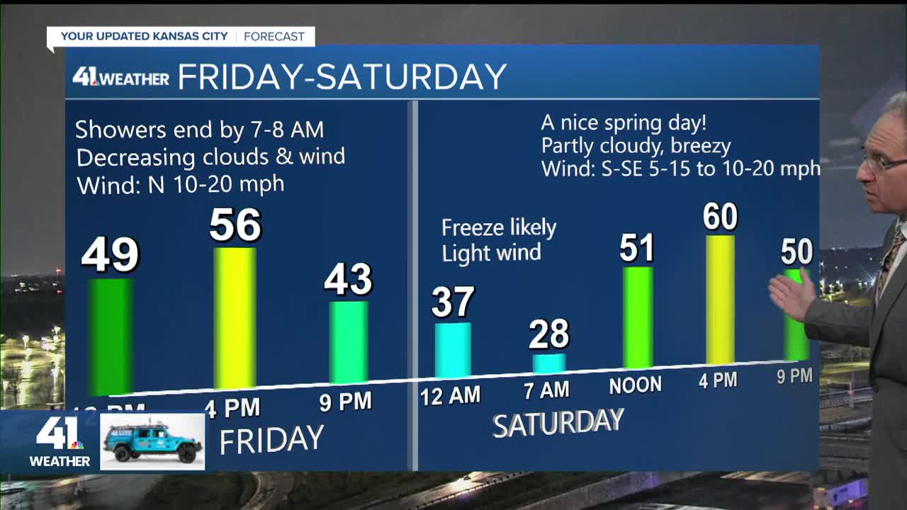
TODAY:
We will see increasing sunshine and decreasing wind with highs in the mid-50s. This is more like the end of March and not early August. The high Thursday was 93°, which ties the all-time March record high set back way back, last Saturday. The weather this March has been odd even for March.

TONIGHT:
A freeze is likely with lows 25°-30° as the sky will be mostly clear with a light wind. Regardless of the weather pattern, it is not really safe to plant outdoors until early May.
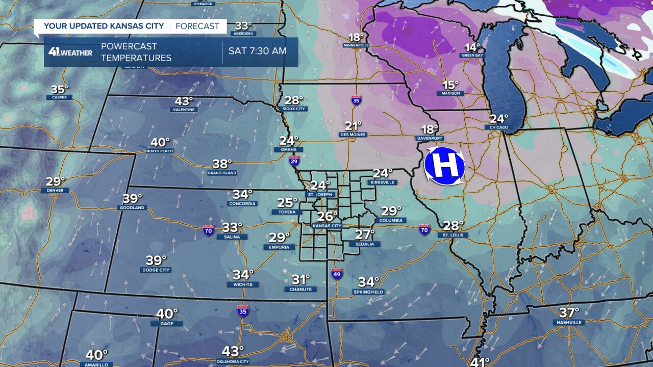
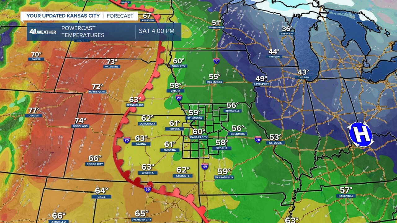
SATURDAY:
The surface high pressure will move to the east into the Tennessee Valley. The wind blows clockwise around high pressure, which means we will see a return to south winds and a warming trend. A warm front will be approaching from the west. Highs will be around 60° in Kansas City with 70s in the western plains.
Here is a summary of the weather today and Saturday.

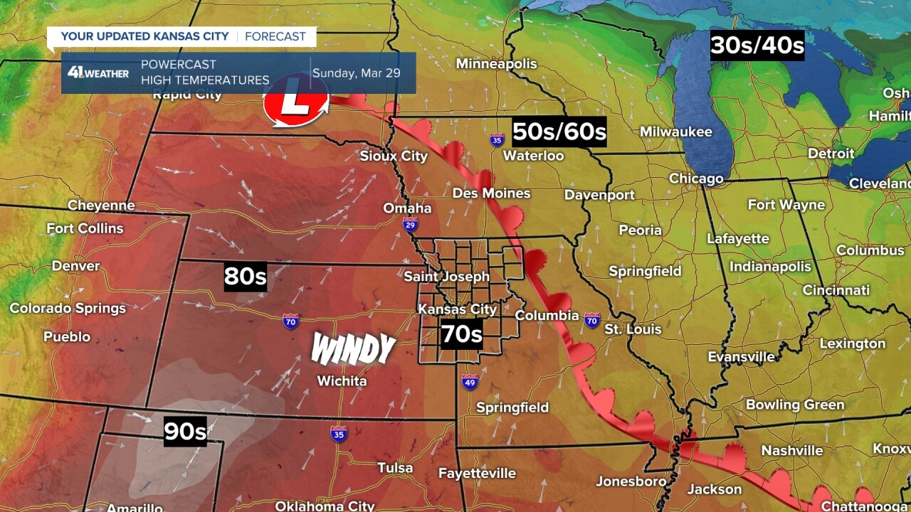
SUNDAY:
The wind will increase from the south to 15-25 mph as the warm front surges through. This will take our highs to the 70s. The 90s are showing up again in the southwest Plains.
MONDAY:
It will be windy with south winds gusting to 30-40 mph, highs in the 80s, and moderate humidity. We will see a lot of high and some mid-level clouds, which means most of the day, we will see filtered sunshine.

So, with the wind blowing out, very warm temperatures with moderate humidity and the fences 10 feet closer...Pitchers Beware! The ball will be carrying. Also, if you are tailgating, make sure the plasticware is secure.

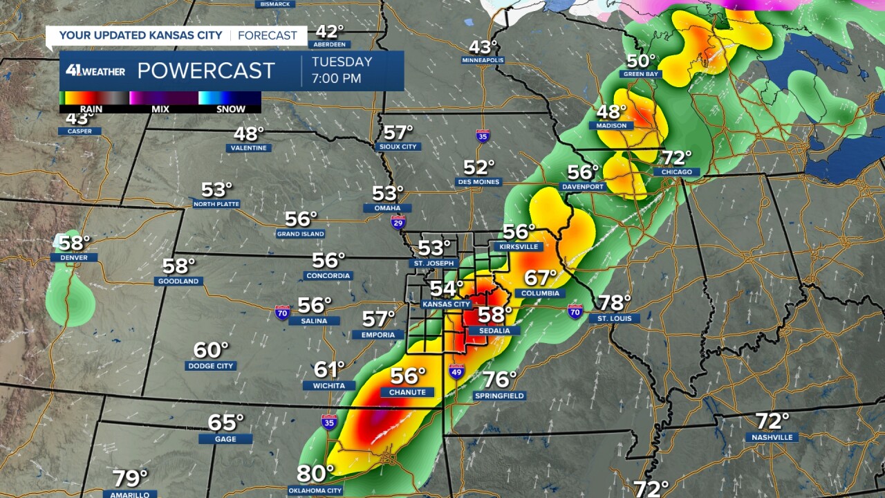
TUESDAY:
This is the day when we have our next chance of thunderstorms. Some may be severe.
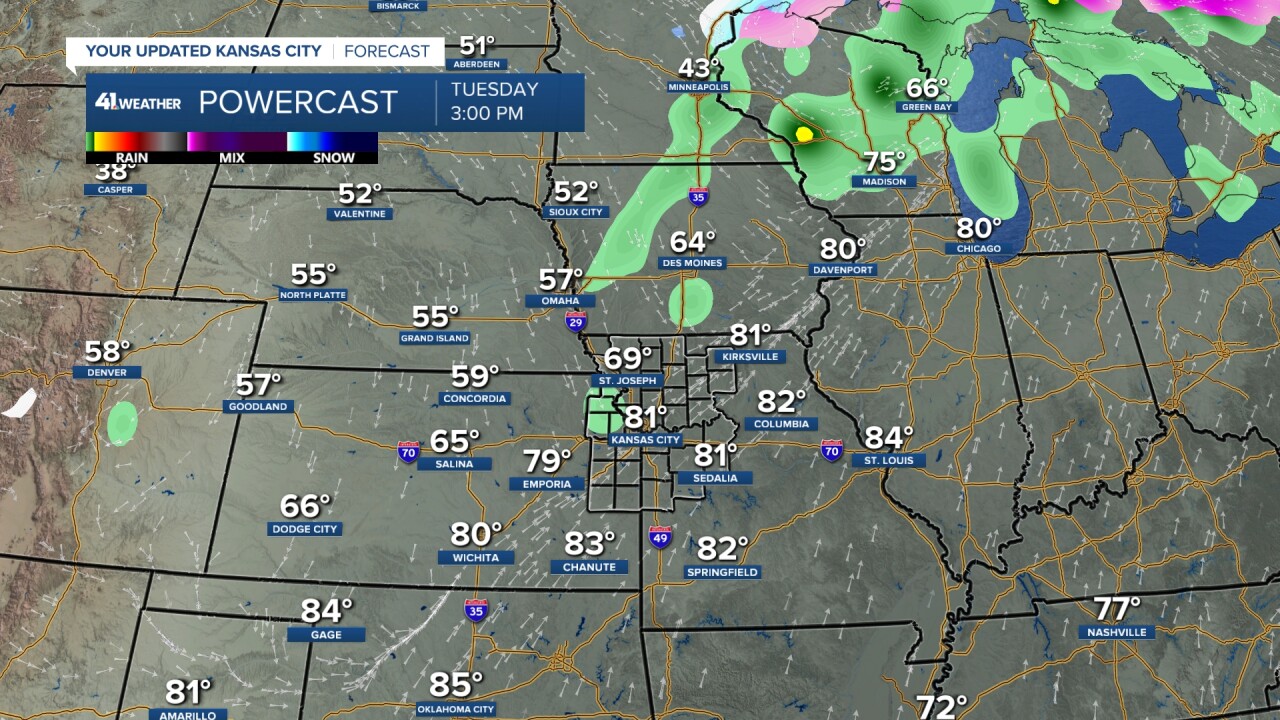
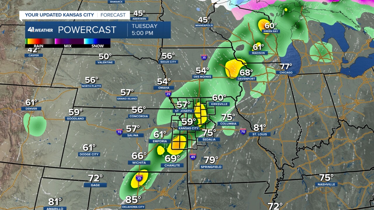
If you look close at the image below, the thunderstorms are behind the front. If this happens, it will lower the severe threat. We will continue to follow this through the weekend. This next chance of thunderstorms starts a 7-10 day period where we will see several chances of rain and thunderstorms. This time of year, severe weather is always on the table. Hopefully, it stays mostly off the table.
Have a great weekend
Stay healthy
