

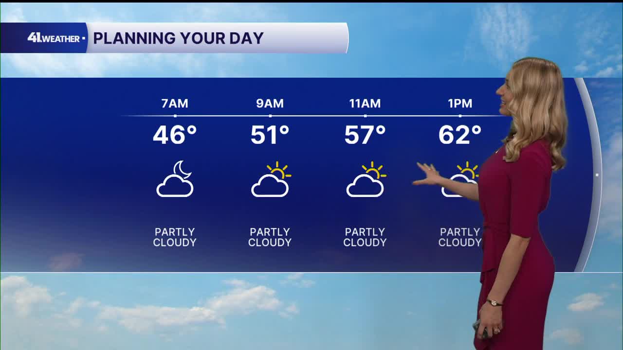


KANSAS CITY, Mo. — It's feeling like true fall weather stepping out the door Monday morning. By the end of the week, not so much.
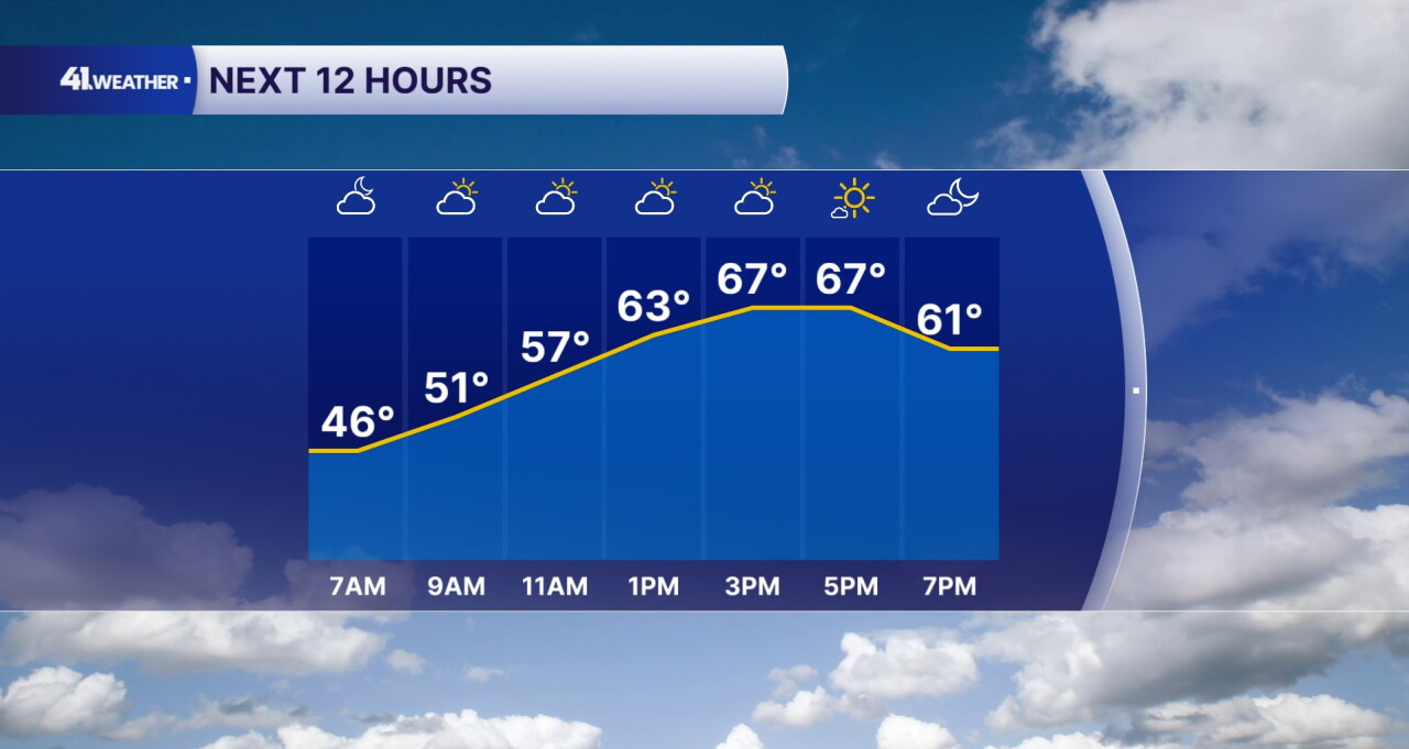
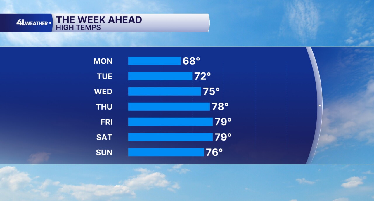
Highs will reach the upper 60s and low 70s Monday afternoon. It should feel pretty similar to Sunday, just with more cloud cover. A few sprinkles are possible with the clouds in place, but most of us are unlikely to see any rain today.
You can expect partly to mostly cloudy skies through the afternoon with some sun returning this evening.
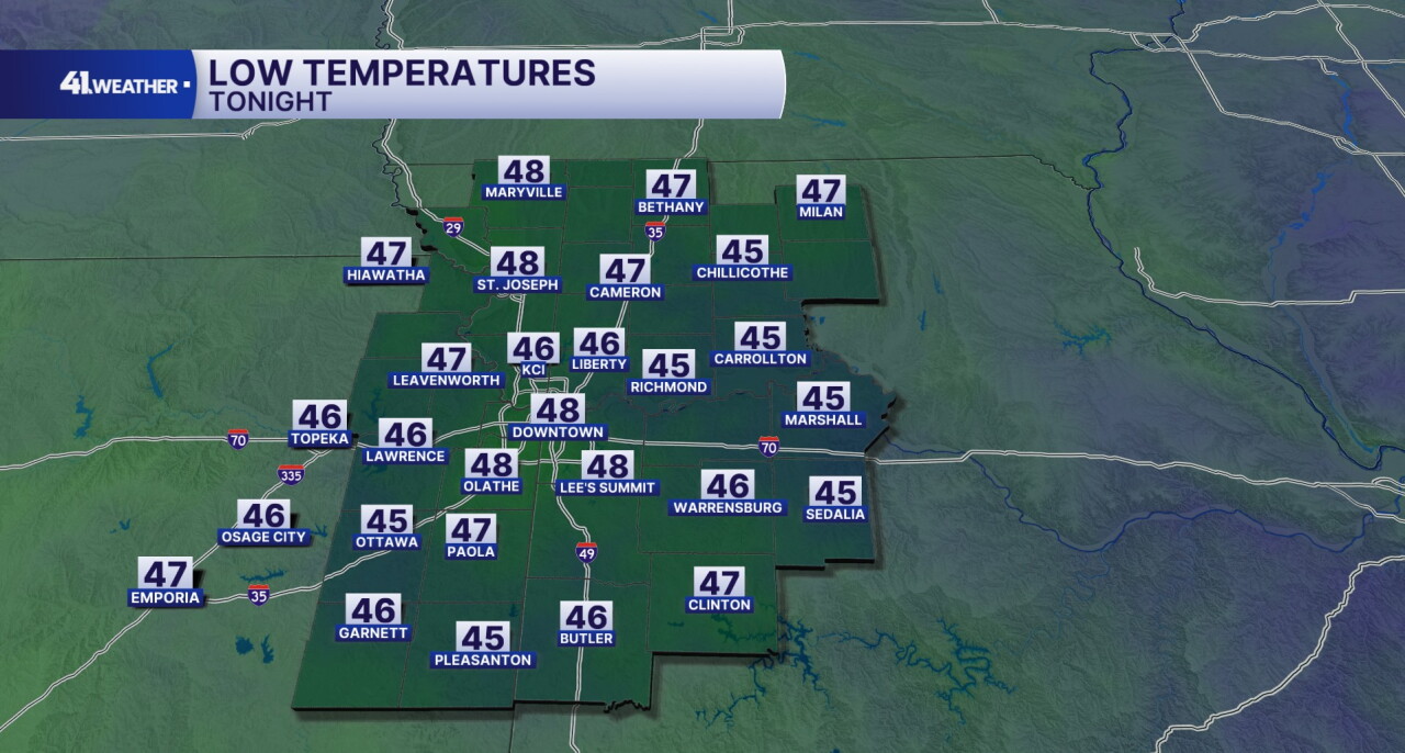
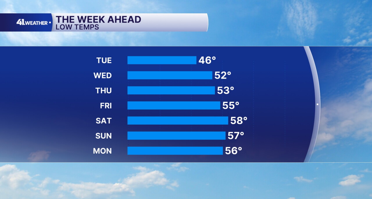
Calm conditions and partly cloudy skies continue overnight into Tuesday morning with lows in the mid to upper 40s. You can expect another crisp, fall-like morning to start off the day.
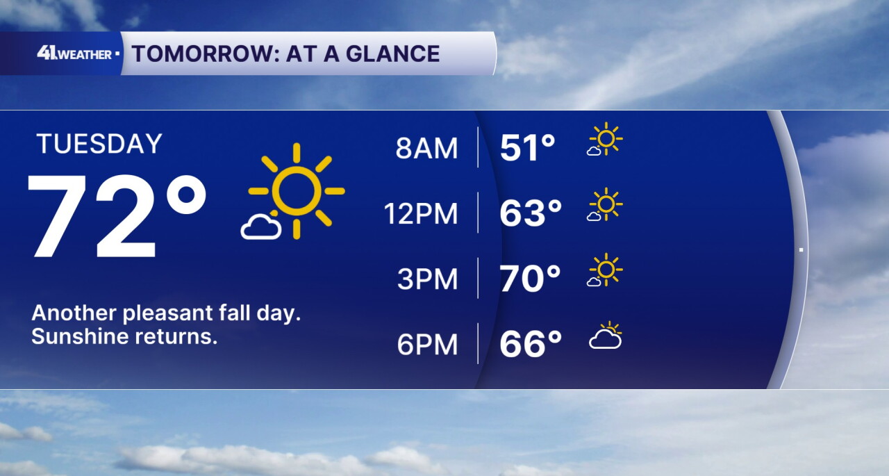
By the afternoon on Tuesday, highs reach the low 70s across the area. It should be a pleasant fall day with more sunshine compared to Monday. Another great day to head outside if you get the chance!
Temperatures will gradually increase each day throughout the workweek. You can plan on highs in the mid 70s on Wednesday, and in the upper 70s by Thursday.
Above average highs continue into the weekend with dry conditions.
You don't need to worry about protecting your plants from the cold for awhile. Temperatures will stay in the 40s and 50s this week, which eliminates the potential to see a frost/freeze. Lows will eventually reach the upper 50s heading into the weekend.
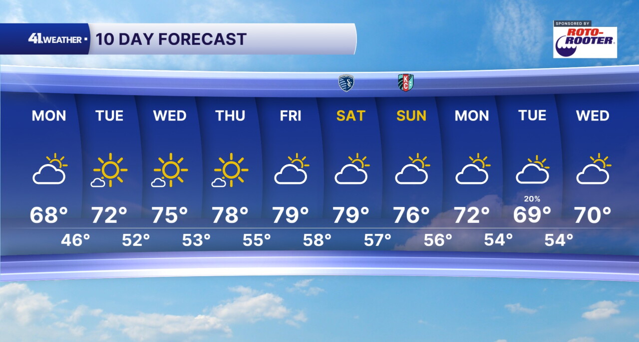
Dry conditions last all the way into next week. Although temperatures will be well above average for this time of year, it should feel pretty comfortable.
Our next cool down and rain chance holds off until early next week.
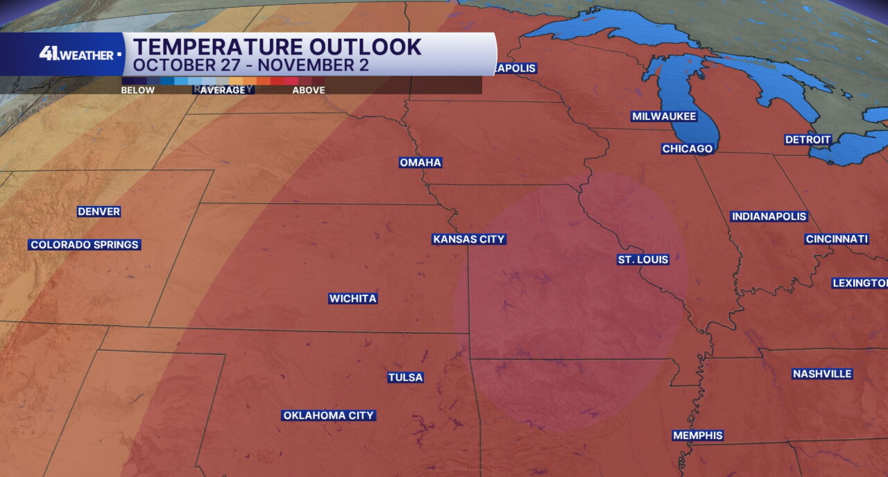
Temperatures are expected to be above average for the last week of the month for the week of October 27 - November 2. Mid to low-60s are considered average highs for late October and early November in the Kansas City area.
Have a question about the forecast? I'd love to hear it! Reach out to me and I'll answer your questions in this weather blog.

Have a great week!
