


KANSAS CITY, Mo. — Good Sunday bloggers,
We have been talking about a contest between heat and thunderstorms where our area is in a shifting transition zone.
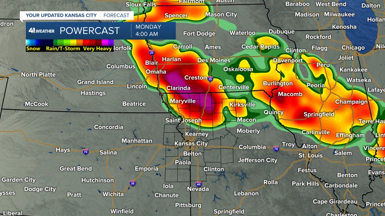
We have seen rain and thunderstorms all day, mostly along and north of Interstate 70. The 4 p.m. temperature map shows the heat vs. thunderstorms well. Temperatures are in the 70s and low 80s where it has been raining and in the 90s where it has not.

Tonight, we will see thunderstorms form in northern Missouri. Flash flooding and strong wind gusts are possible. They will then head south. How far south?
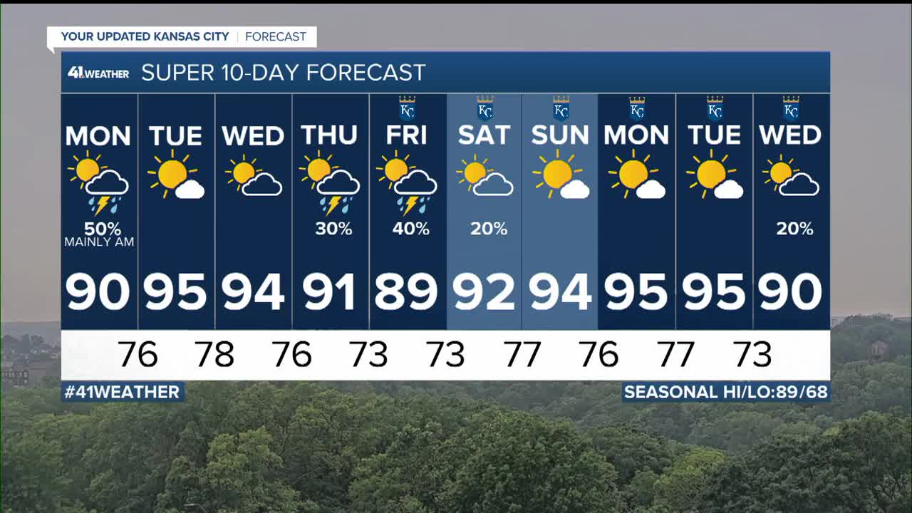
The answer based on the latest data is in the six- minute video below. Also, we look at the hottest days this week and track the heat vs. thunderstorms transition zone.
Have a great week
Stay healthy
Stay with KSHB 41 and we'll keep you advised.
