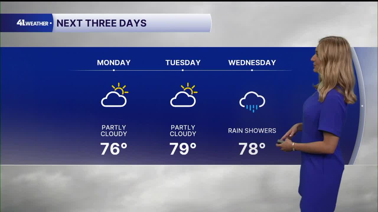


KANSAS CITY, Mo. — Mild weather has returned for Monday and Tuesday, with another round of heavy rainfall possible by midweek.
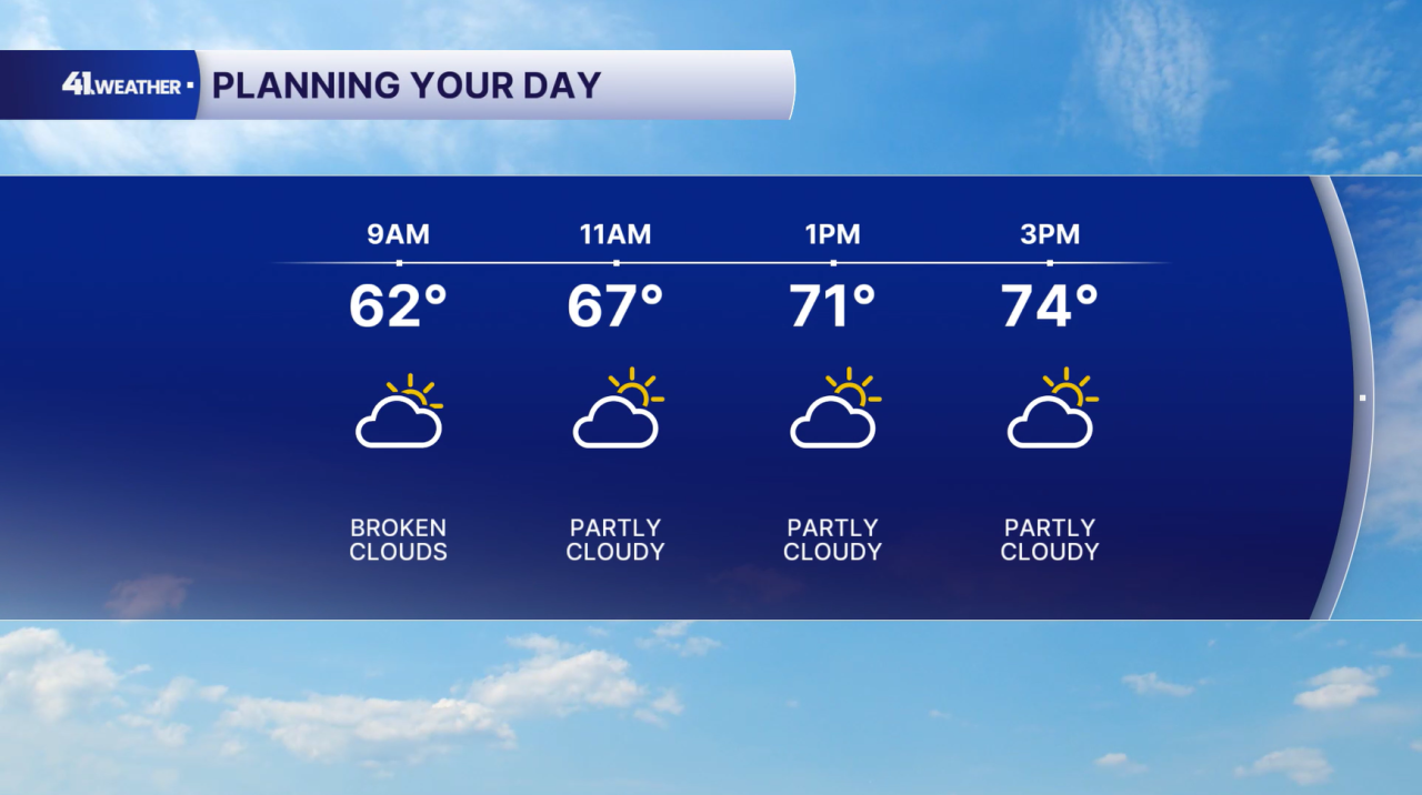
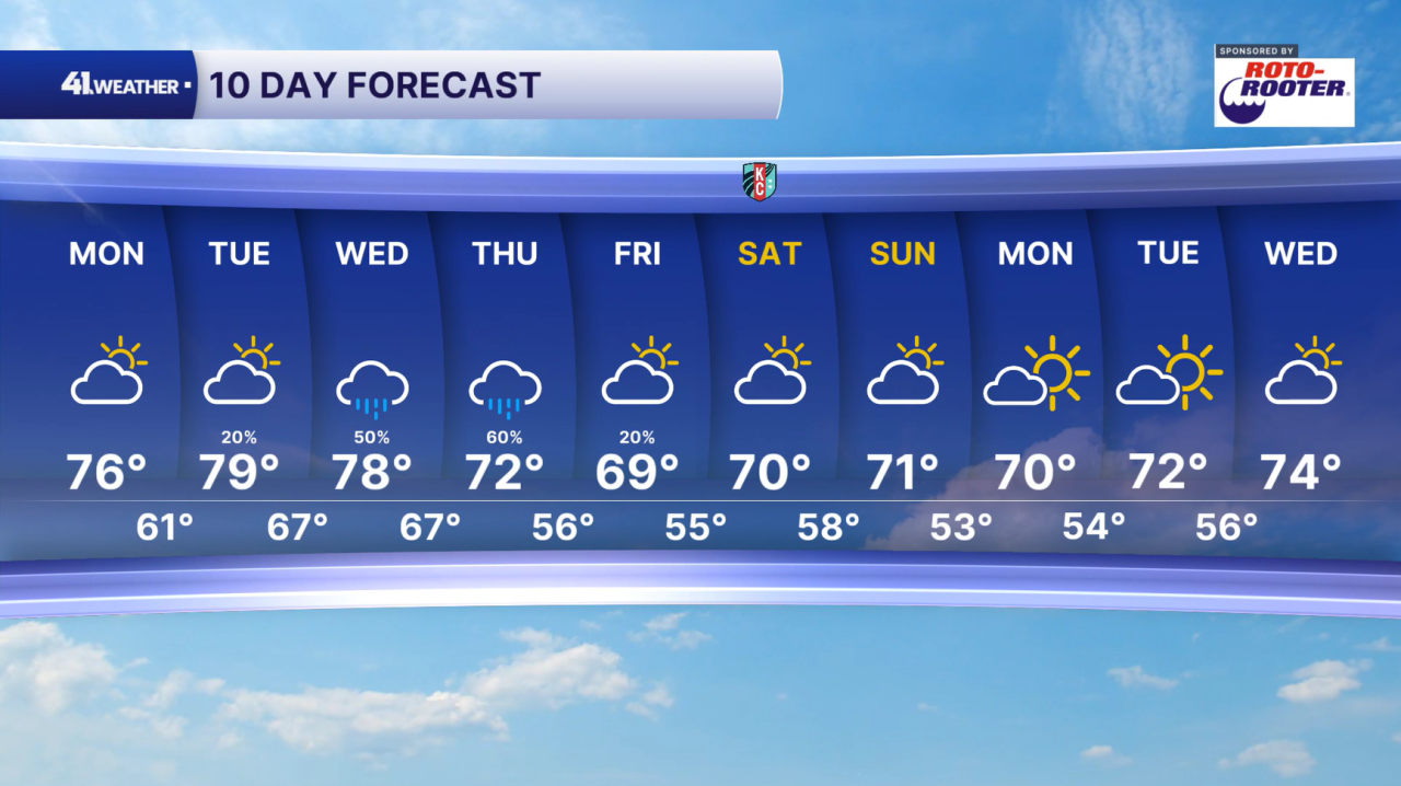
If you get the chance to spend time outdoors on Monday, I recommend it. Temperatures will be in the 60s for the morning hours, returning to the mid-70s into the afternoon. You can plan on partly cloudy skies and mild conditions throughout the day.
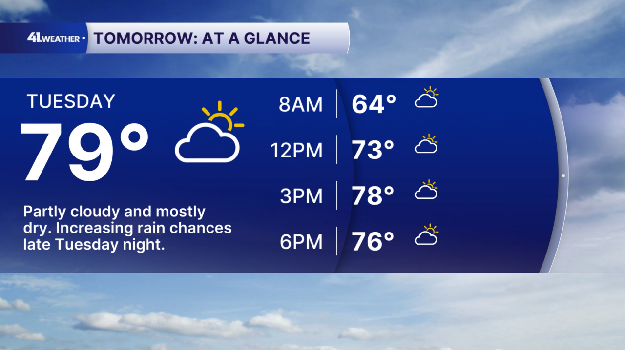
Tuesday will be very similar, just add a couple degrees. Highs will be closer to the upper 70s with partly cloudy skies once again. Rain chances hold off until late Tuesday night.
There's a chance of off-and-on showers Wednesday, but I do not expect rain to last all day. Consistent, widespread rain is more likely Wednesday night, continuing throughout the day on Thursday.
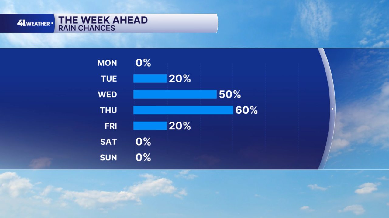
The rain on Thursday could become heavy at times. With multiple rounds of rain possible Wednesday and Thursday, flash flooding will be a concern. Outside of that, the chance of severe weather remains very low this week.
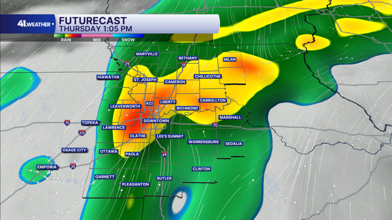
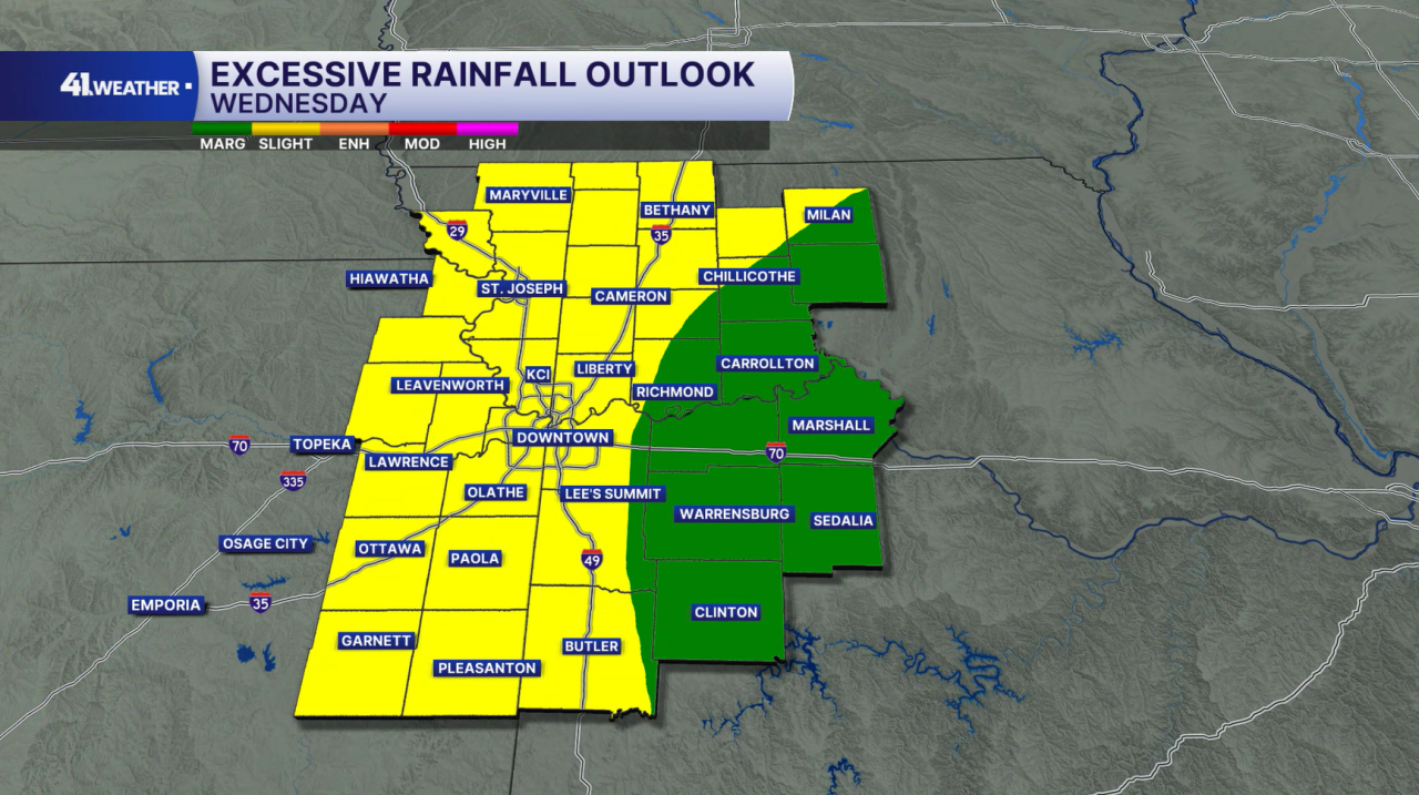
There is a 2/5 risk of excessive rainfall leading to flash flooding for much of the area on Wednesday and Thursday.
Drier conditions return on Friday with cooler temperatures. Over the weekend, you can plan on mornings in the 50s with afternoon temperatures in the upper 60s and low 70s. It should turn out to be the ideal fall weekend! Seasonable weather continues into next week.
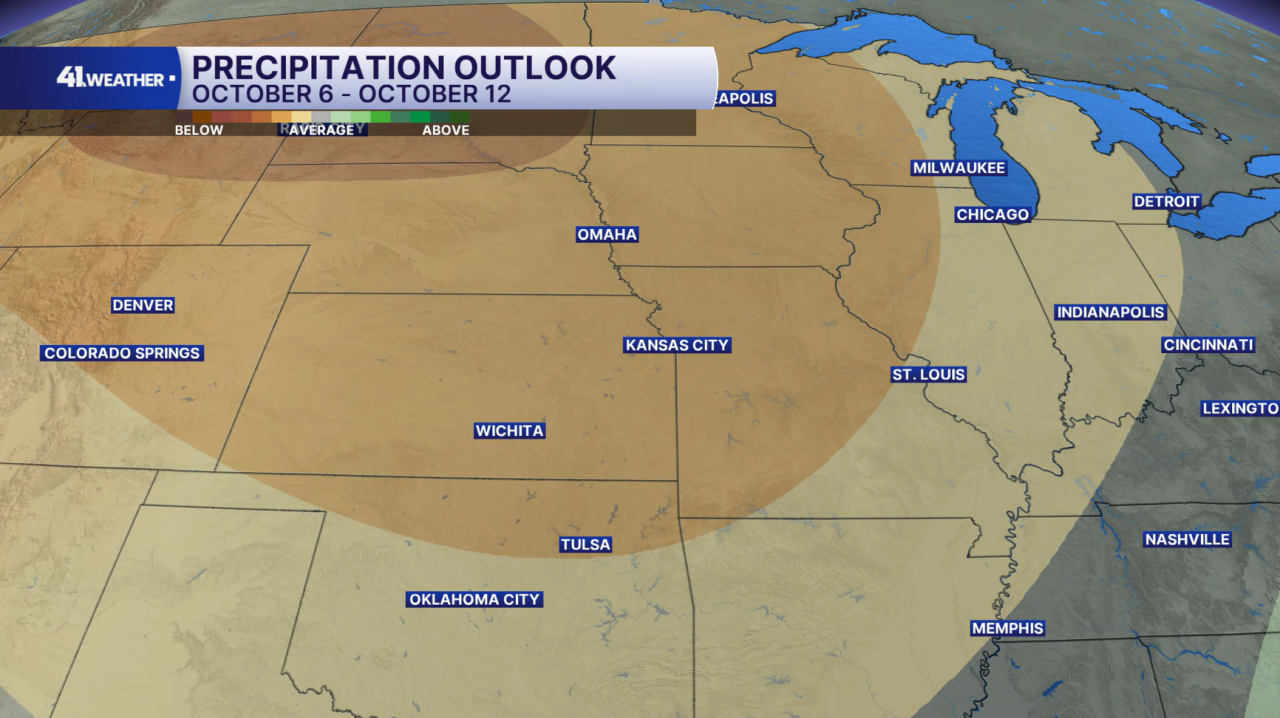
The soggy conditions Wednesday and Thursday won't last for long. Drier-than-average weather is expected for much of next week, as well as the stretch from Oct. 6–12.
Have a question about the forecast? I'd love to hear it! Reach out to me, and I'll answer your questions on this weather blog.

Enjoy the weather, and have an amazing week!
—