

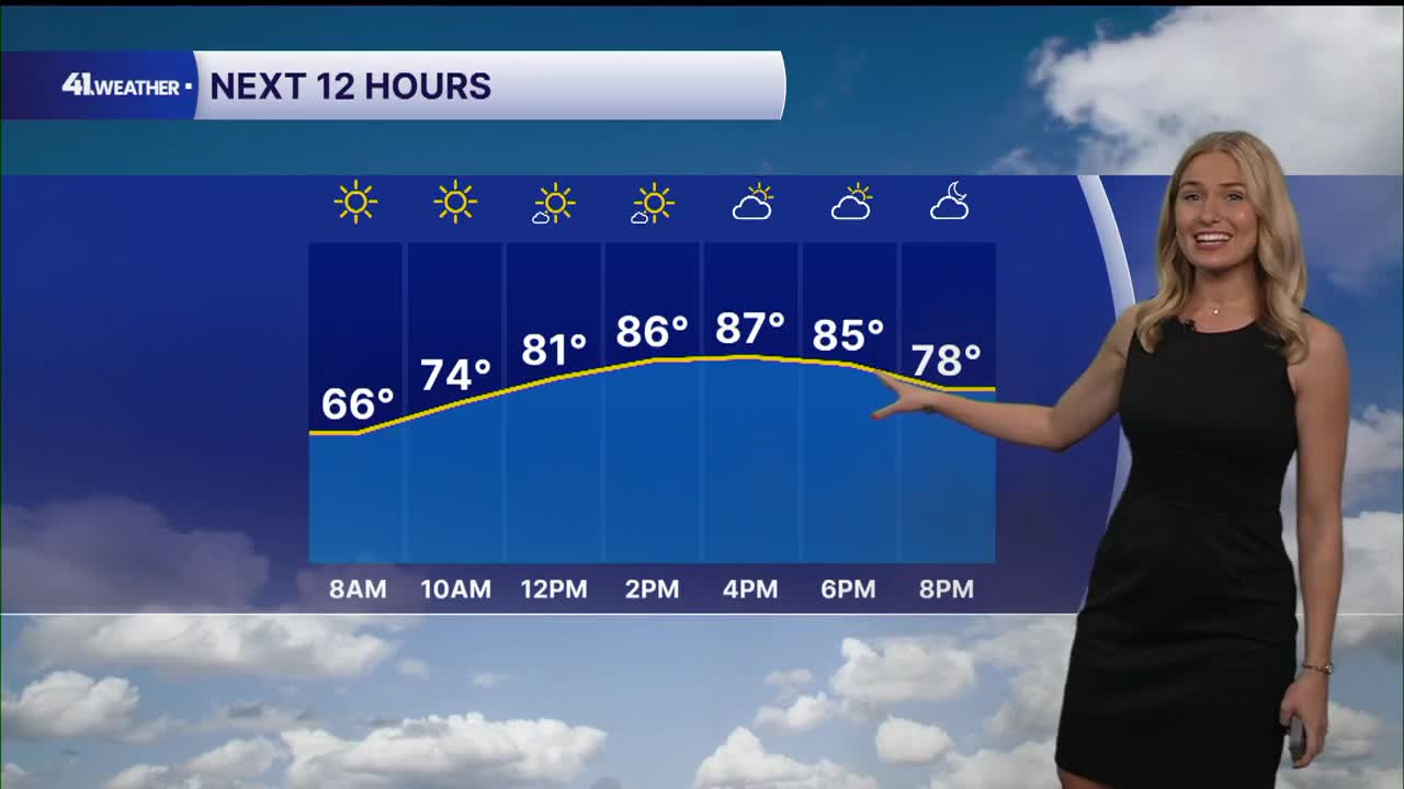


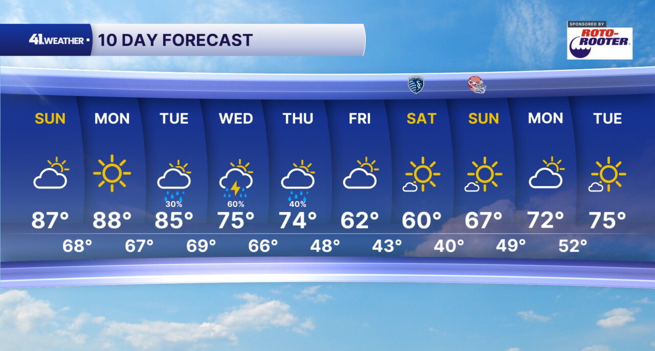
KANSAS CITY, Mo. — Summer-like temperatures aren't over yet. Highs in the 80s continue through Tuesday, followed by our next cold front.
Sunday will feel very similar to the last few days: very warm and dry. Sunshine will last through the morning, with clouds moving in from the west during the afternoon and evening. Despite the extra cloud cover, highs will still manage to reach the mid-to-upper 80s.
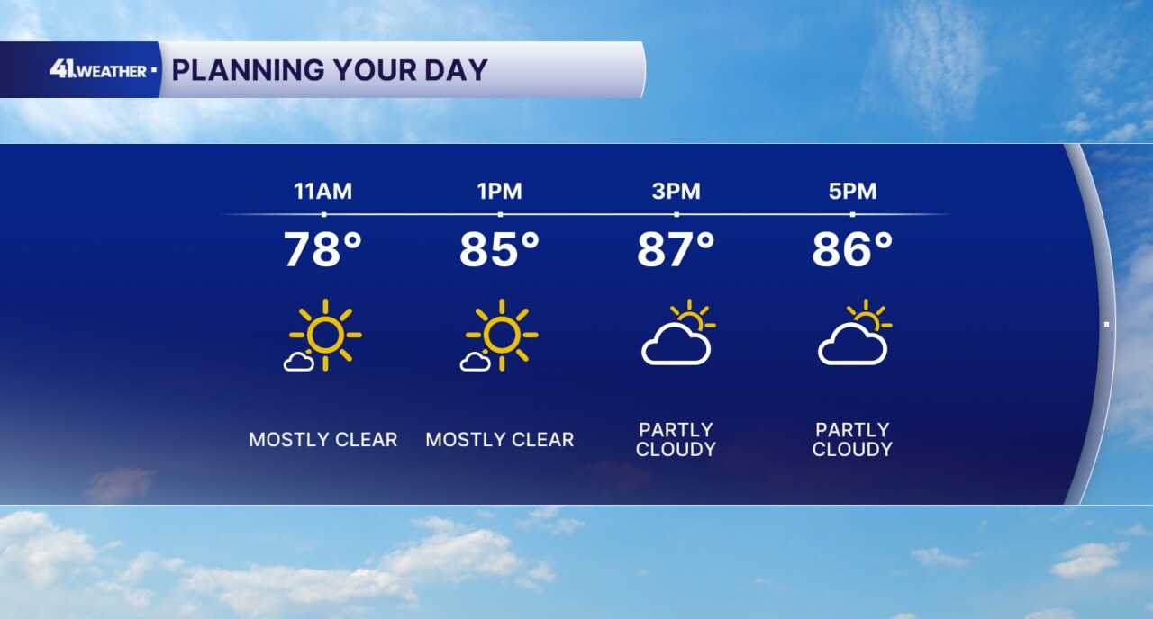
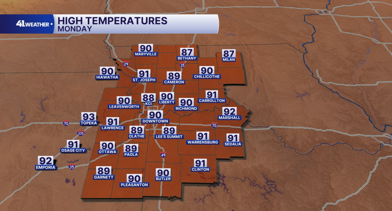
All-day sunshine returns Monday after morning lows in the upper 60s and low 70s. By the afternoon, it will be hot once again, with highs reaching the upper 80s and many places easily hitting 90°.
It'll also be pretty breezy on Monday. Hot, dry winds will gust up to 30 mph out of the southwest.
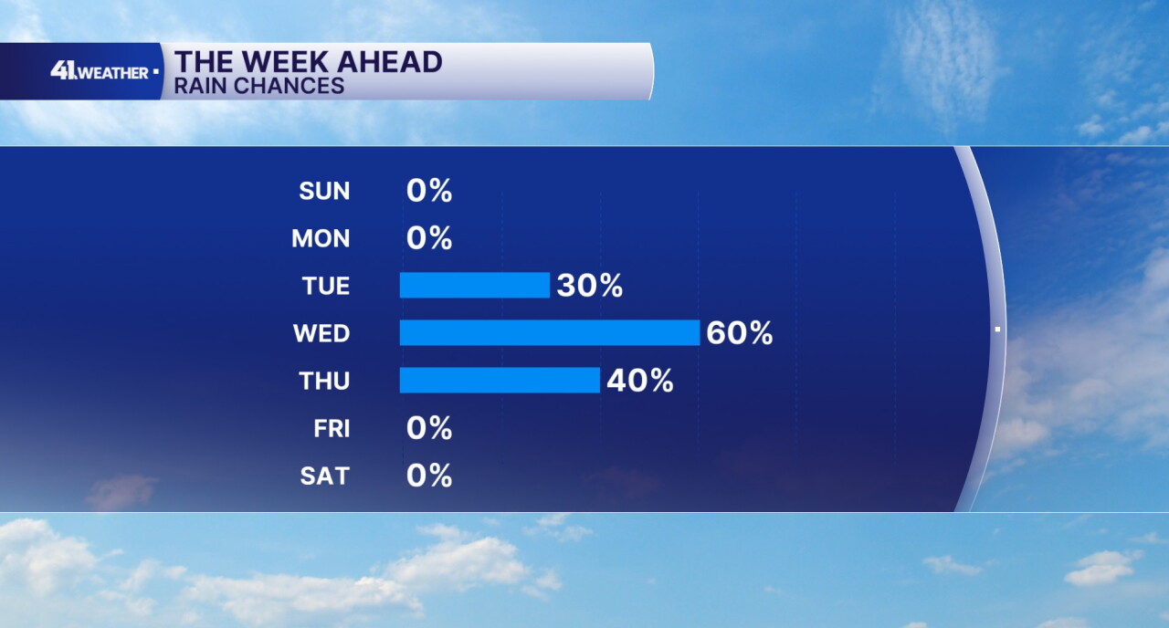
After reaching the mid-80s again on Tuesday, our next cold front will arrive late in the day. The exact timing is still somewhat uncertain; however, the front may spark a few storms as it moves in. There is currently a 1/5 (marginal) risk of severe weather on Tuesday, according to the Storm Prediction Center.
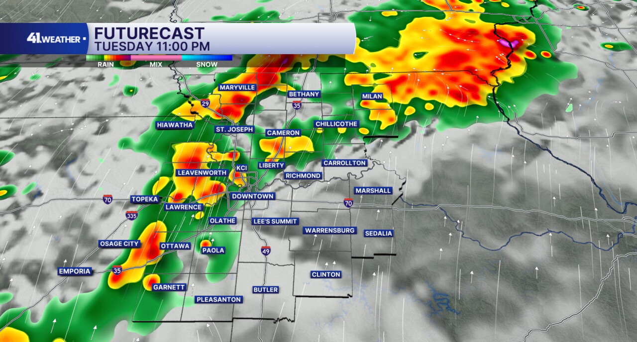
After that, rain chances continue overnight and throughout the day on Wednesday, lasting into Thursday as well. Highs will gradually drop throughout the week as cooler air moves in.
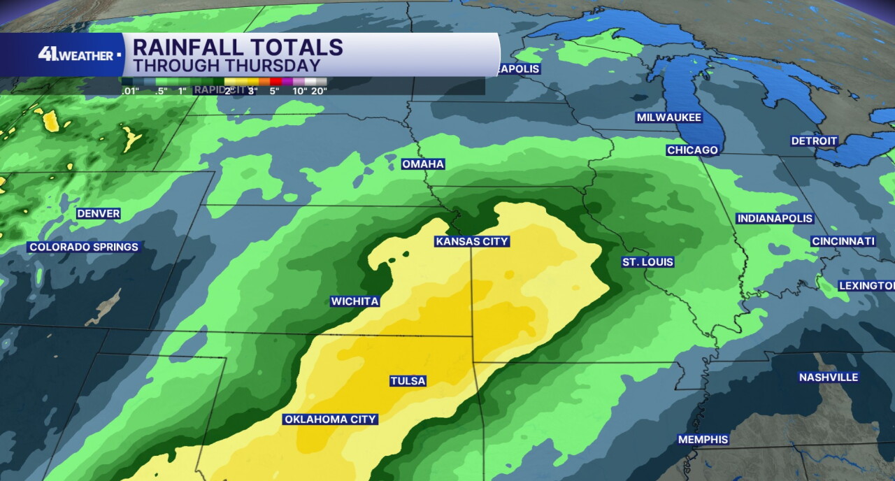
By the end of the week, Kansas City could see some pretty decent rain totals! I expect 1" to 2" for most of the area, with up to 3" south of Kansas City.
Rain chances should wrap up by Friday, with temperatures falling back into the low 60s. A pretty nice fall weekend is likely to follow with sunshine, highs in the 60s and dry air.
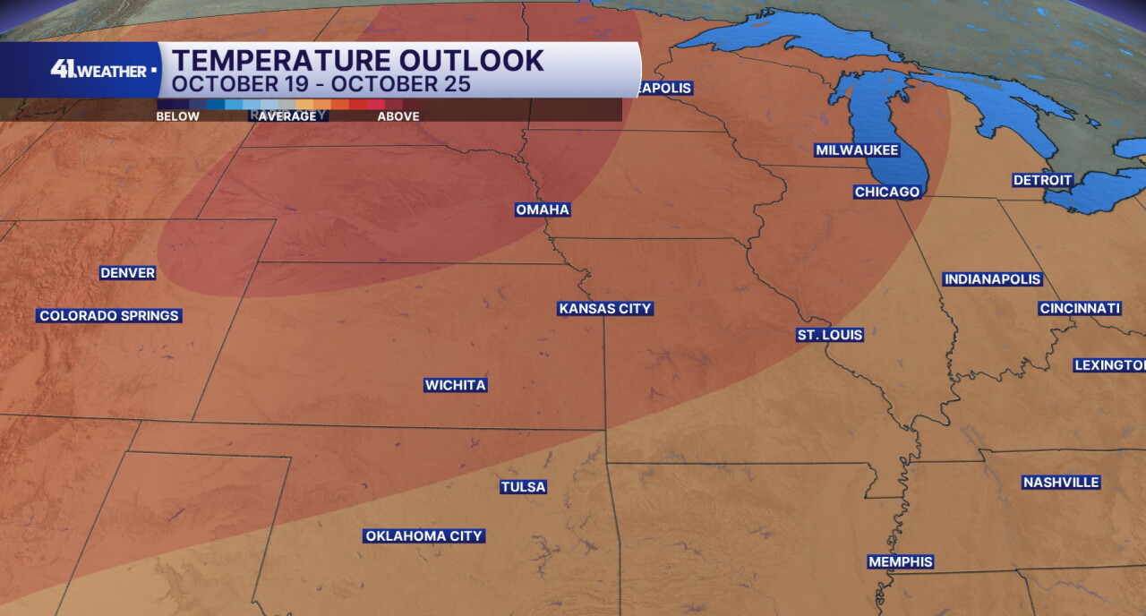
Warmer weather may return for the end of the month, with warmer-than-average temperatures expected for the week of Oct. 19-25.
Have a question about the forecast? I'd love to hear it! Reach out to me, and I'll answer your questions in this weather blog.

Enjoy the rest of your weekend!
—
