

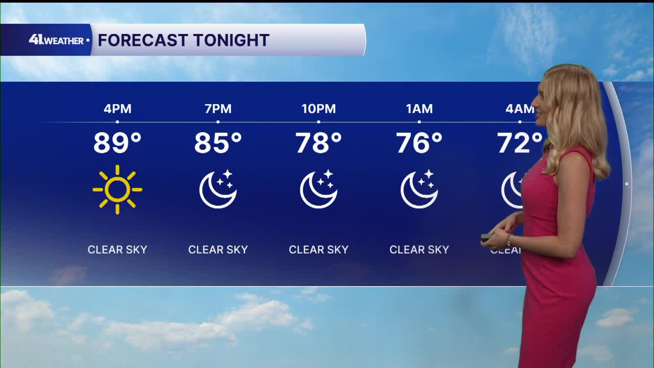


KANSAS CITY, Mo. — After near-record temperatures Monday, relief comes Tuesday with our next cold front, along with the potential for strong to severe storms.
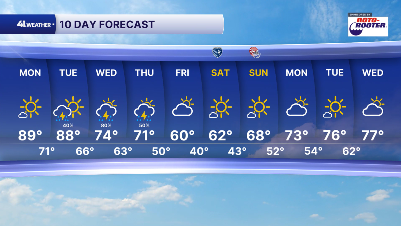
It's a hot start to the workweek in Kansas City with highs near 90°, which is about 20 degrees above average for this time of year! You can also expect sunny skies and breezy conditions throughout Monday, with winds gusting up to 30 mph out of the southwest.
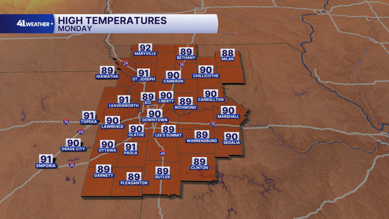
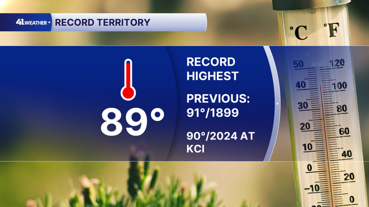
The Kansas City International Airport's record high for Oct. 12 is 90°, set recently in 2024. The record for downtown KC is 91°, set all the way back in 1899! Both are in jeopardy of being broken Monday afternoon.
Tuesday will be hot as well — at least for the first half of the day. Temperatures will start in the upper 60s and low 70s in the morning, followed by early afternoon highs in the mid- to upper 80s.
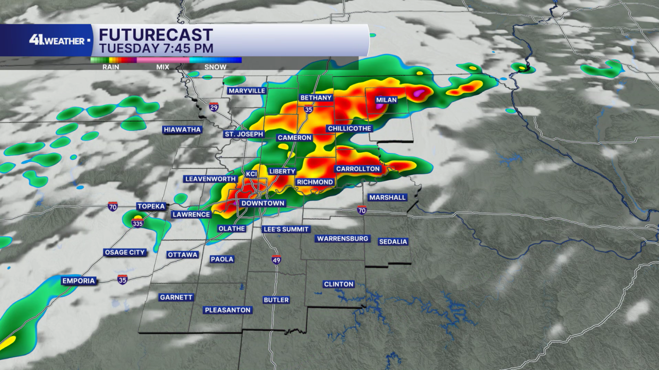
Storms will likely move in from the northwest in the late afternoon and evening hours with our next cold front.
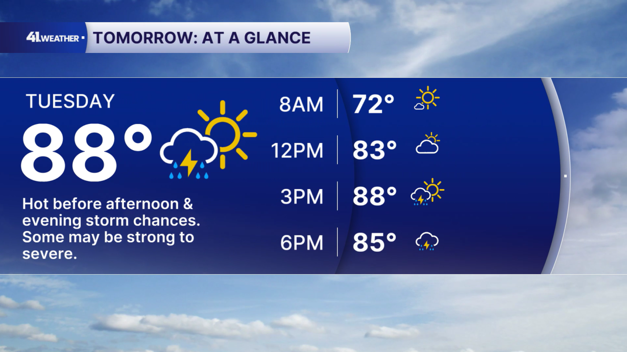
Stay weather aware on Tuesday, as these storms may arrive during the evening commute and after-school outdoor activities and sports practices.
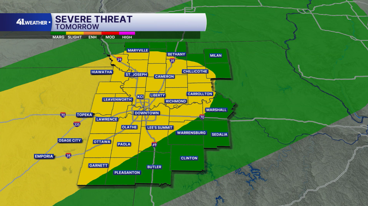
Some of these storms may be strong to severe. There is a 2/5 severe weather risk for the areas shaded in yellow on the map, with a 1/5 severe weather risk everywhere in green.
The primary severe weather concerns are damaging winds and hail.
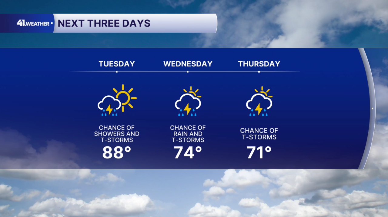
Storm chances will continue overnight Tuesday into Wednesday morning, and then off and on throughout Wednesday and Thursday.
The risk of severe weather will be much lower Wednesday and Thursday. Temperatures will be noticeably cooler in the 70s.
Dry conditions and cooler, drier air arrive Friday. We have a really nice weekend ahead with classic fall weather. You can expect chilly mornings in the low 40s followed by afternoon sunshine and highs in the 60s.
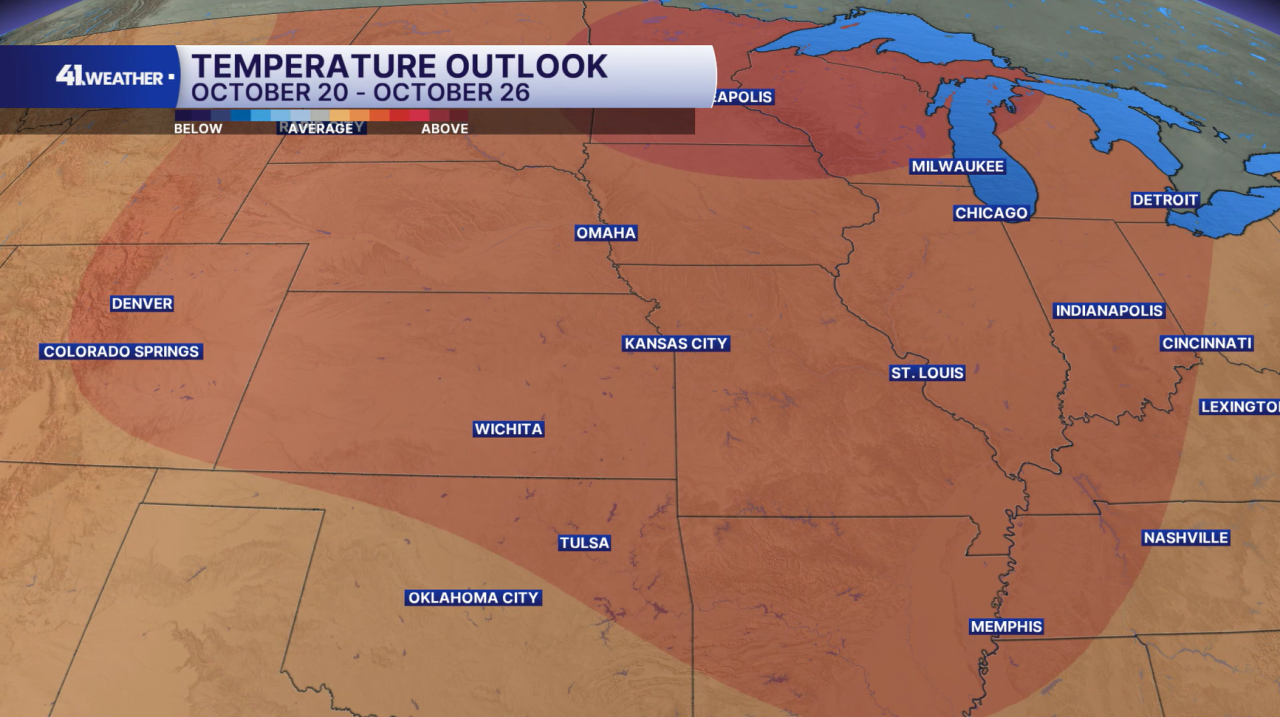
Warmer weather will likely soon make a return! For the week of Oct. 20–26, above-average temperatures are expected. Typical weather for this stretch includes highs in the mid- to low 60s and lows in the mid- to low 40s.
Have a question about the forecast? I'd love to hear it! Reach out to me, and I'll answer your questions in this weather blog.
Stay safe and have a great week!
—
