


KANSAS CITY, Mo. — Good Friday bloggers,
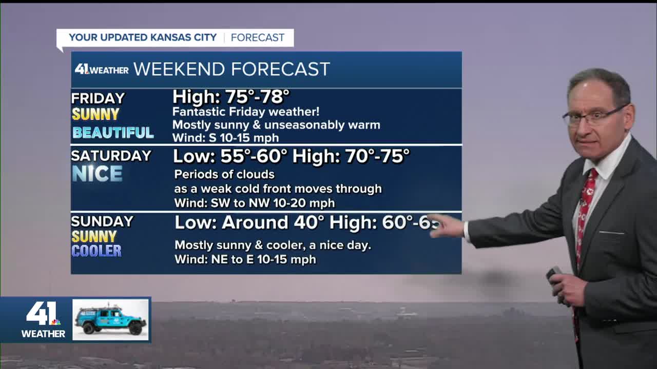
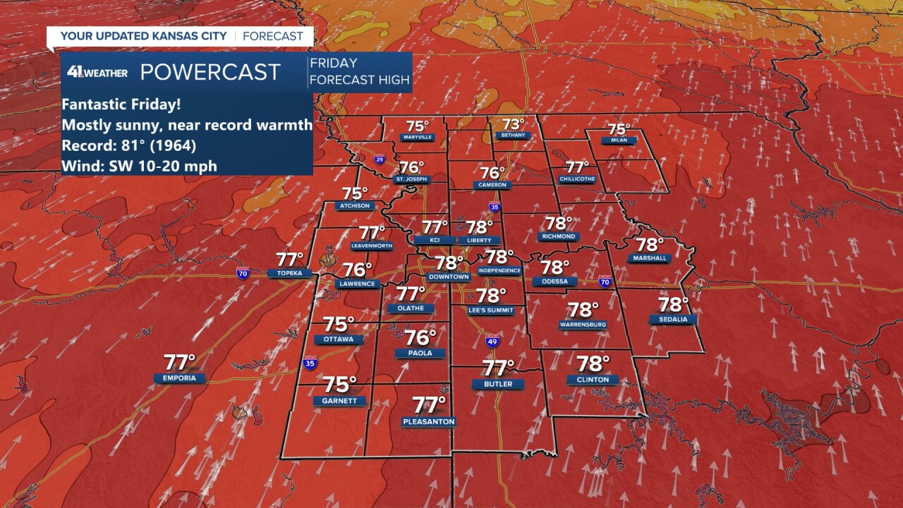
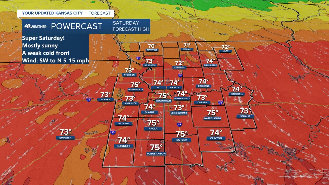
We are looking at some incredible weather for today and Saturday as highs will climb to the mid & upper 70s. Friday's record is 81° set in 1964. The record Saturday is 79° set in 1950.
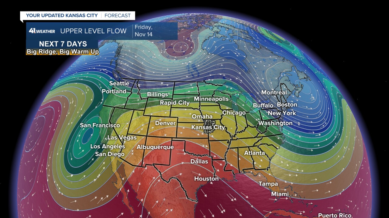
The great weather is brought to you by a non-storm, a ridge. The first storm system we are tracking is west of this ridge, bringing very heavy rain/flooding to California.
You can see the ridge on the satellite pic & in graphical form.

TODAY-SATURDAY:
We have a chance to get close to the record today as we see full sunshine. Saturday will fall short of the record as a weak cold front drifts in. If the front slows by one or two hours, then we could challenge the record.
If you are headed to Columbia, Missouri, for the Mississippi St. game, the weather looks great for the Saturday, 6:45 p.m. kick off.

SUNDAY:
We will see another nice day, but cooler with highs in the low 60s. That is still 10 degrees above average. The weather in Denver for the basically "must-win" game for the Chiefs looks nice as well. It will be dry with temperatures dropping from the 60s to 50s for the 3:25 p.m. kickoff. The wind will be mostly light as well.
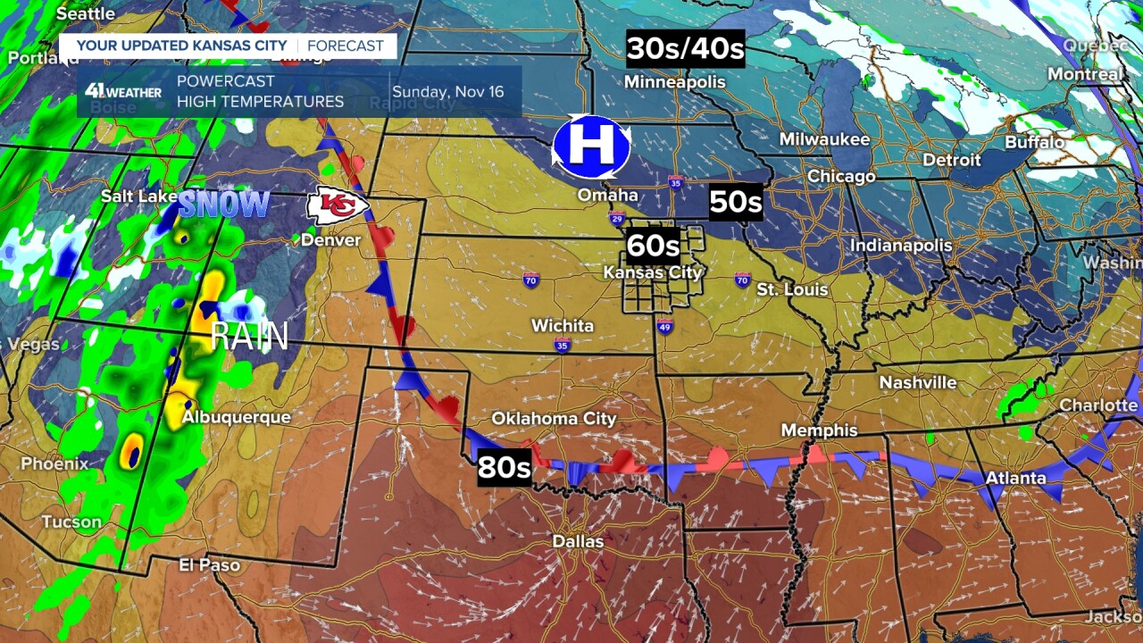
The great weather is great, but you know what I am going to say. We have seen too much great weather and we are now exactly eight inches below average rain since July and firmly in a severe (level 2 of 4) drought. We are currently in a 16-day dry spell with the last measurable rain being on Oct. 29, a whopping 0.10".

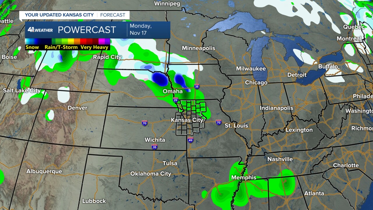
NEXT WEEK:
We are seeing changes in the weather pattern as the first in a series of systems pounds California today into the weekend with heavy rain and likely flooding. That system will track across our region Monday, weakening quite a bit. We may see a few rain showers Monday, with possibly some wet snow north of Interstate 80. Highs here will be in the 50s.
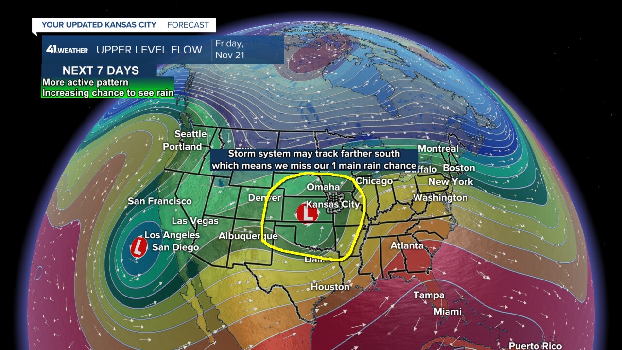
The second system to track will arrive at the end of next week after bringing more rain to California. If the system does what is shown below, we will see some decent rain. BUT, there is some data that has this system tracking much farther south. If that happens, we miss our one main rain chance the next seven days, and our dry spell will surge toward 30 days.
So, the rainfall forecast, assuming we get the storm next week, is for amounts to be in the .50"-1" range. This is 25%-50% of the entire November average, which is 2.00".
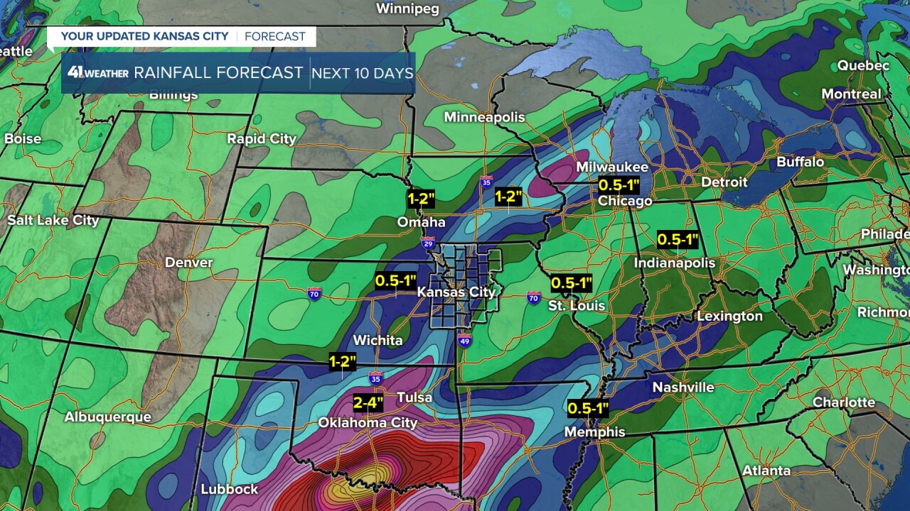
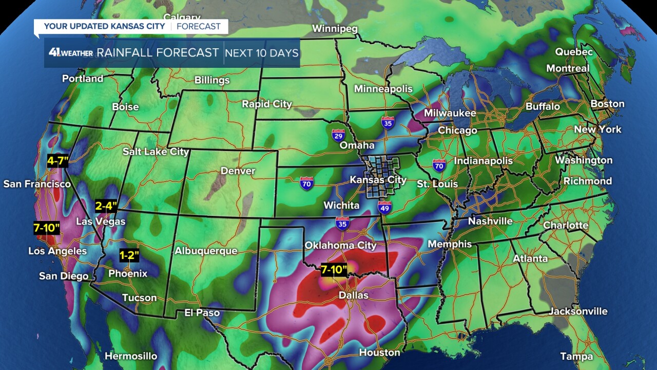
Very heavy rain and flooding are possible across the southern Plains and southwest USA. The next 10 days may see 4"-10" of rain in parts of Oklahoma and Texas to Arizona, southern Nevada and much of California.
Hopefully, on Monday, we are talking about rain by the end of the week & not rain missing.
Have a great weekend.
Stay healthy
