

Good Sunday bloggers,
The first of four days of severe weather began on Saturday. Look at the satellite picture from Saturday at 11:55 p.m. All of the complexes of thunderstorms combined into one massive anvil.
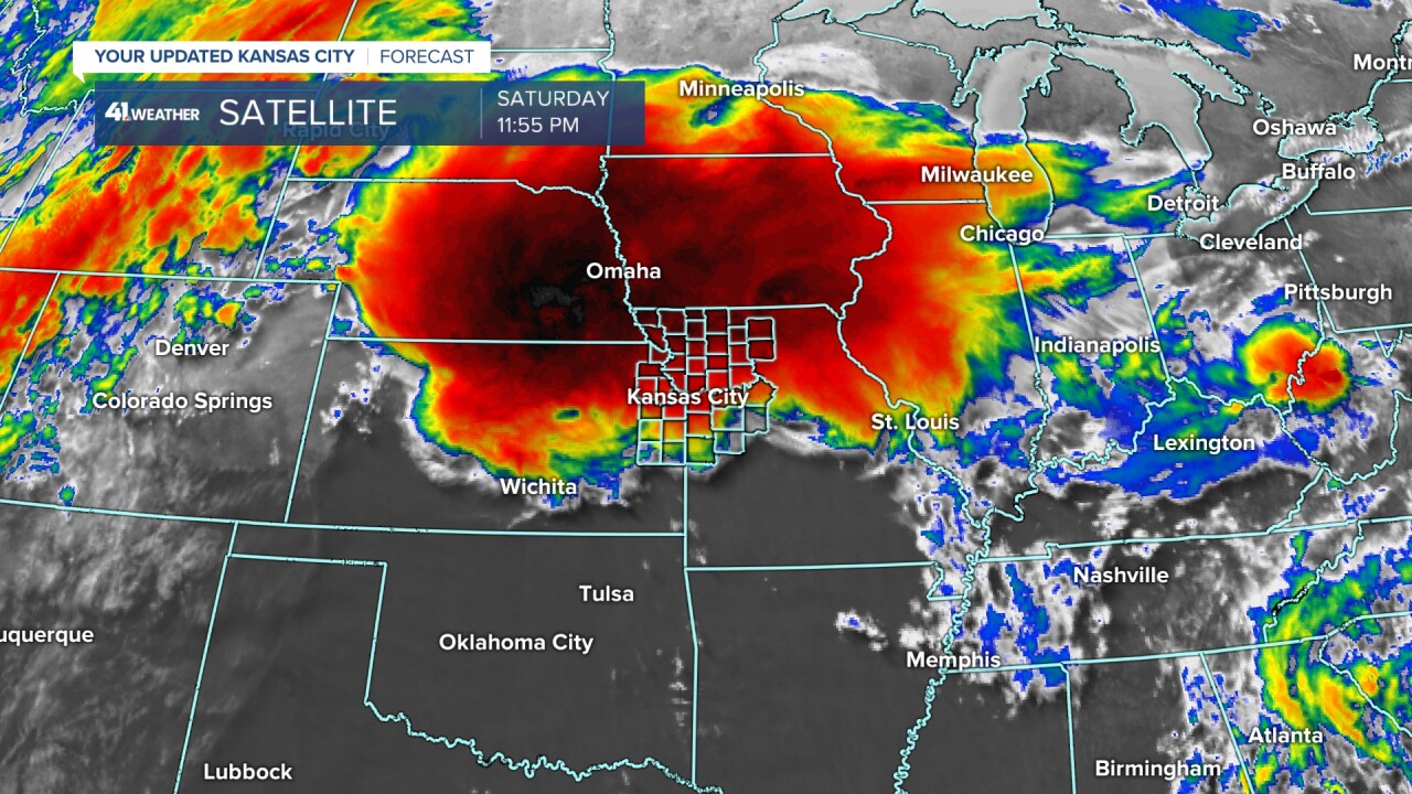
There were countless reports of wind, hail and flash flooding across Nebraska, Iowa, northern Missouri, to western Kansas, south to west Texas.
There were only two tornado reports so far. There was one in southeast Nebraska and one in southwest Iowa.

There may very well have been a tornado near Chula, Missouri, which is north of Chillicothe, Missouri. But, as you can see across northern Missouri, it was wind, hail and flash flooding.

Here is a pic from Glenn Graham near Chula, Missouri. It certainly has the potential to be a tornado, but may also be blowing dust from strong winds. There are plenty of tornadoes that have debris with no visible funnel, but you do need a lowering. It is not clear-cut in this photo. Regardless, there was damage in the area.

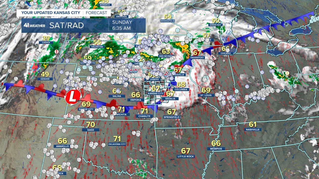
Flash flooding kills more people per year than tornadoes and lightning, and there were significant flash flooding issues around Trenton, Missouri, where 8-9" of rain fell last night. This is almost 200% of the May average. And May is the wettest month of the year on average.

Now that we have recapped day 1 of the severe weather, what about days two, three and four? Let's go through this.
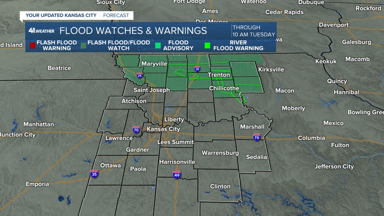
There is a Flood Watch in northern Missouri until 10 a.m. Tuesday, yes Tuesday. There are a lot more rounds of thunderstorms to track.
SUNDAY MORNING:
The overnight thunderstorms have left a front sitting across Kansas and Missouri. This front will lift north today and be the focus for new thunderstorms to the northwest of KC.

The big trough in the western USA is setting up, sending waves of energy into the Plains and Midwest. These waves will be interacting with the wavering front mentioned above.

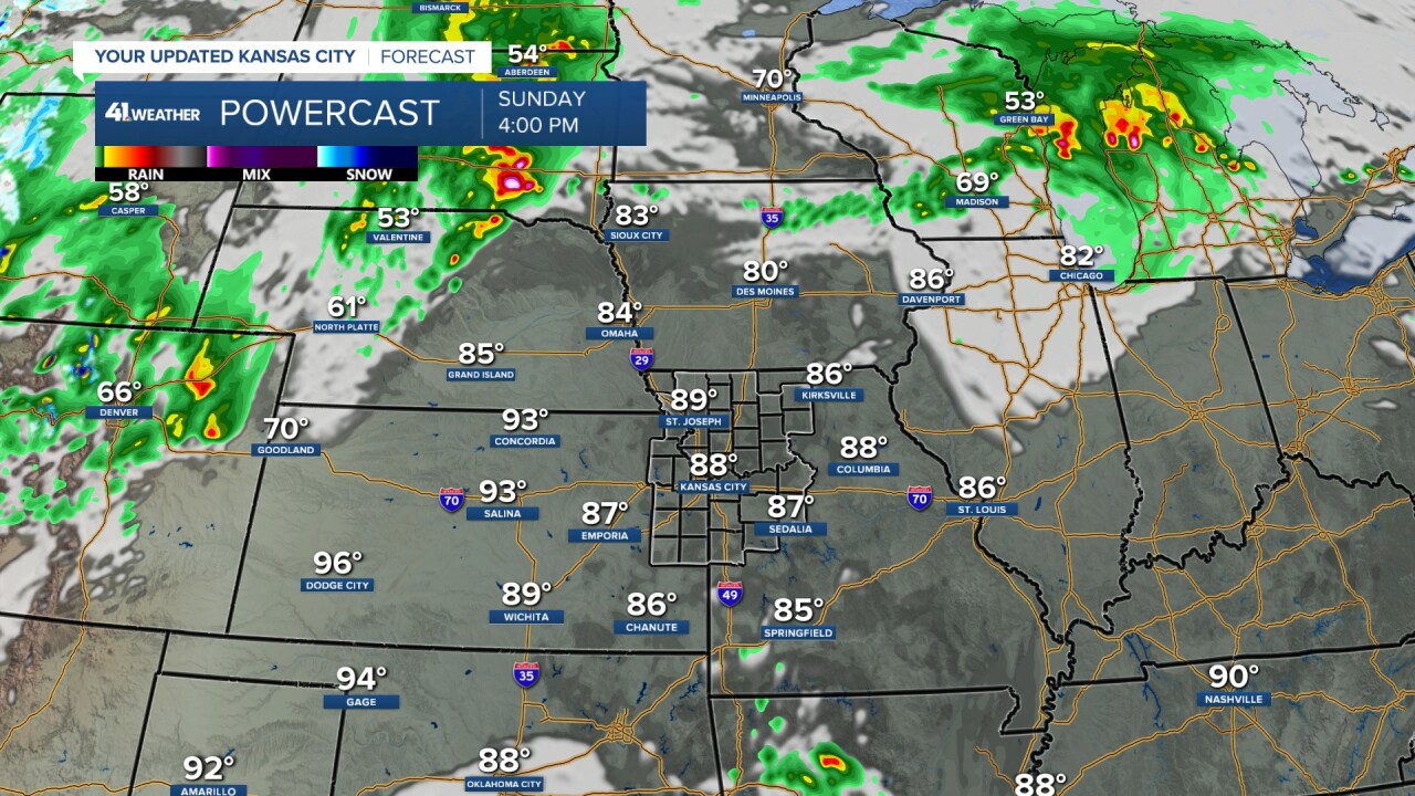
SUNDAY AFTERNOON:
The main severe threat is again from western Kansas to western Iowa. Anything that forms out to the west and northwest will have a better chance of reaching KC tonight. We are at a level 1/2 of 5 risk, less to the east, as whatever rolls in tonight will weaken as it heads east.

SUNDAY (1-5 p.m.):
It will become partly cloudy, windy, very warm and humid today with south winds 15-30, gust 40 mph. Highs will reach the mid to upper 80s.
SUNDAY (5 p.m.-midnight):
A line of thunderstorms, likely severe, will form from northern Kansas to southern Minnesota. All forms of severe weather are possible with this line. The line could be farther east by midnight than is shown.
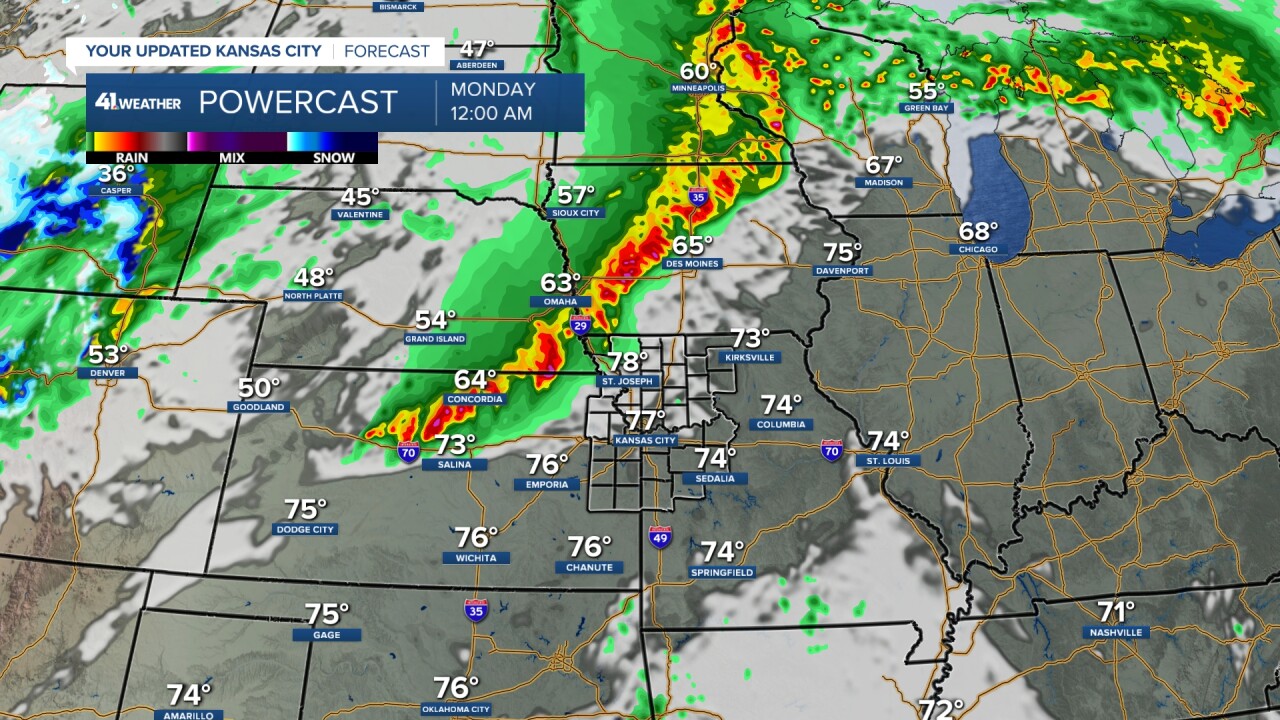
SUNDAY NIGHT-MONDAY MORNING (Midnight-7 a.m.):
The thunderstorms will evolve into an MCS (Mesoscale Convective System) as they track east and southeast into northern Missouri and northeast Kansas. They may still stay north of KC, but there is a trend in the data for them to arrive sometime after midnight or as early as 10 PM. Hail and wind are the main threats, along with flash flooding.
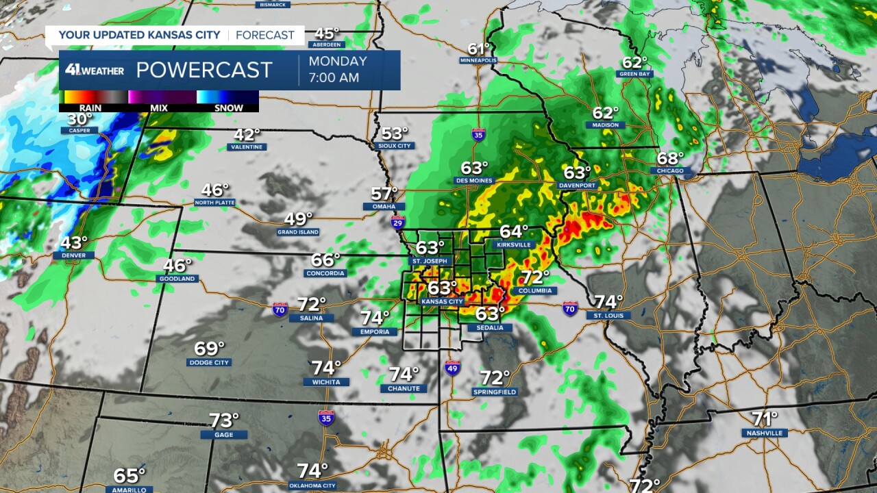
MONDAY (7 a.m.-4 p.m.):
The morning MCS will track into southeast Missouri, Illinois and Indiana. The MCS may lay down an outflow boundary near or southwest of KC. This boundary would connect to the main surface features out west. This boundary creates the conditions where the wind can turn more significantly with height. In other words, directional wind shear. This parameter is the one that enhances tornado threats. So, when you have this boundary connected to a surface low, you can get quite a bit of directional wind shear.
By 4 p.m., you can see thunderstorms are starting to form in central Kansas.
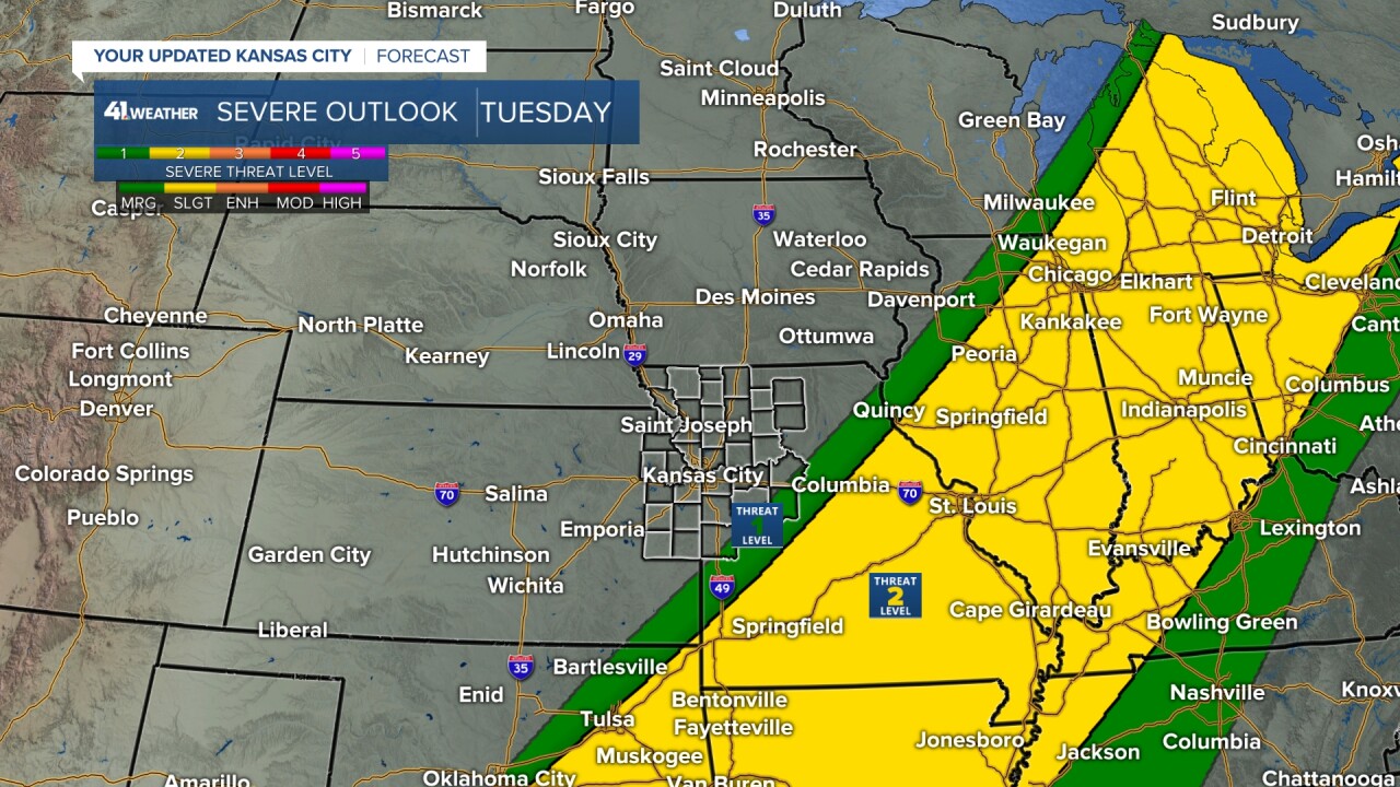
The Storm Prediction Center agrees as well, putting our area in a rare level 4 of 5 risk northwest to a level 2 of 5 southeast.
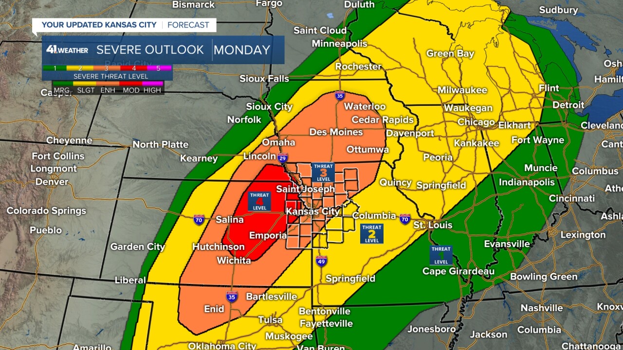
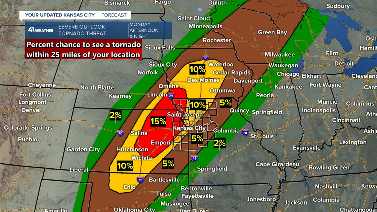
This is a map breaking down the tornado threat in the above risk. The individual threats are broken down into the percent chance of seeing the threat within 25 miles of your location. So, the chance of a tornado within 25 miles of your location Monday afternoon and night ranges from 15% west of KC to 2%-5% to the east. Yes, 15% is not a high chance, but when you consider the chance of seeing a tornado within 25 miles of your location on most days is 0%, 15% is rather high.
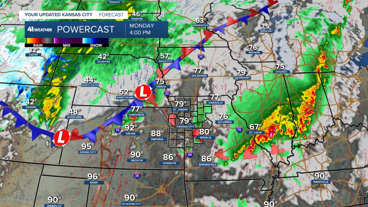
MONDAY (4-8 p.m.):
A line of severe thunderstorms will form from central Kansas to western Iowa. This line will be capable of all forms of severe weather and flash flooding. The tornado threat is with the smaller spin-ups along the line and bigger ones if there are any cells ahead of the line and/or on the line. The thunderstorms that could produce tornadoes on the line, not the smaller spin-ups, would occur if the line is broken and there is one big cell in the break.
The line will be pushing east slowly as the thunderstorms track faster to the northeast along the line. This is where flash flooding becomes an issue as rainfall rates will easily be 1"-2" per hour.

MONDAY NIGHT (8 p.m.-2 a.m.):
This is when the line will likely reach I-35. It will be trying to weaken after 10 PM as the heat of the day lessens. But that is far from set yet.
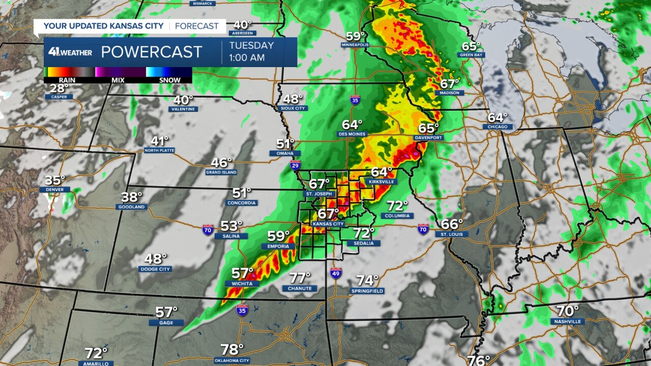
TUESDAY:
Any thunderstorms will exit by 7 AM and there may be some lingering rain during the morning with lows in the 50s. The threat of severe weather shifts to eastern Oklahoma-Michigan, closer to I-44.
We will see highs in the 60s Tuesday.
RAINFALL FORECAST TODAY-TUESDAY:
The heaviest rain looks to occur across northeast Kansas, northwest Missouri, southeast Nebraska, and into much of Iowa. Amounts will be 1"-4" with some locations seeing 4"-7" or more.
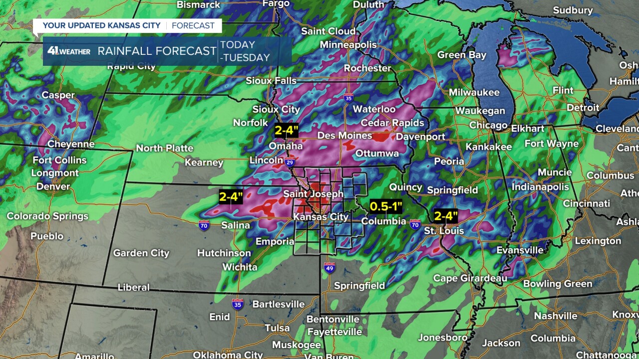
When we zoom in, you can see the heaviest is along and west of I-35, where 1"-4" with some locations seeing 4"-7" or more of rain. Locations to the southeast will see .25"-2" of rain. The location of the heaviest rain can still shift north or south by 50-80 miles, as it will depend on how far south the thunderstorm events tonight and Monday/Monday night can make it.

Here is a summary of the weather today through Monday.

Have a great rest of your weekend and week ahead! Stay healthy!
Stay with KSHB 41, and we'll keep you advised.
—
