


Good Monday, bloggers,
Over the weekend, we got rid of the unseasonably warm air, but we have not rid ourselves of the drought.
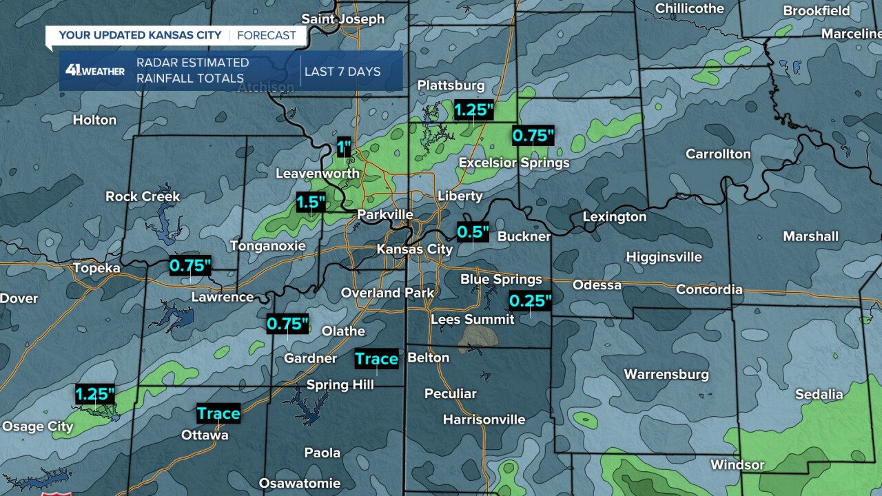
Rainfall was mostly in the trace-0.50" category around Kansas City. But there were two bands about 5-10 miles wide that saw rainfall between 1" and 2".
Tonganoxie, Kansas, to Plattsburg, Missouri, saw 1"-2", and there was a second band from Osage City, Kansas, to just northwest of Gardner, Kansas.
There was some severe weather Friday night from around Lansing, Kansas, to Smithville, Missouri. There were trees down along with some quarter-sized hail.
When you expand the view, it is about the same story, except when you look across southern Missouri.
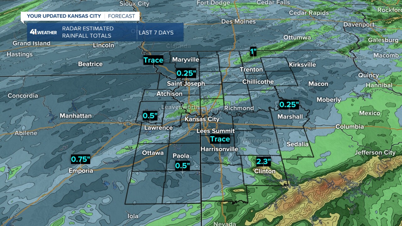
Rainfall was widespread in the 1"-3" category from northeast Oklahoma to southern Illinois along and north of Interstate 44.
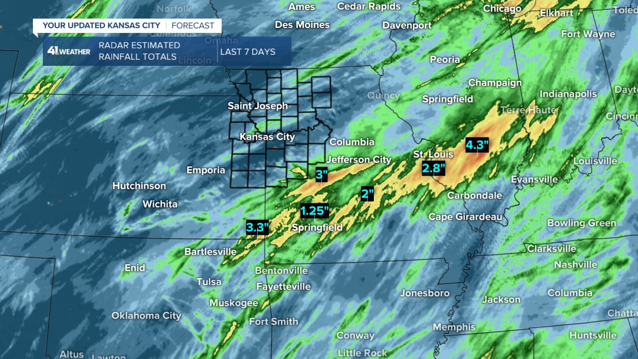
This was great news as the heaviest rain occurred over the driest areas, where drought conditions are mostly in the severe to extreme category (Levels 3, 4 of 5).
I do not think there was one flash flood warning during the Saturday heavy rain. If there was, I blinked and missed it.

Now, what is next? We still need rain.
We are tracking one system this week that will produce rain, but the track is critical. So let's go through this.
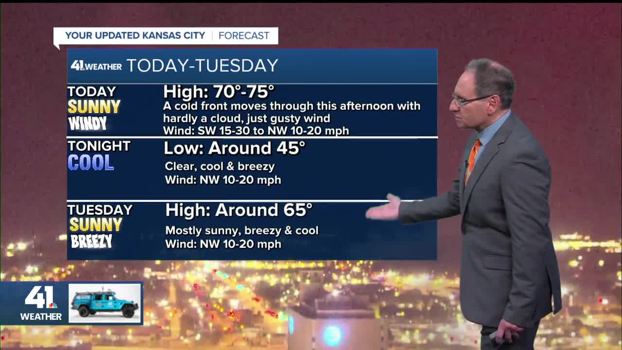
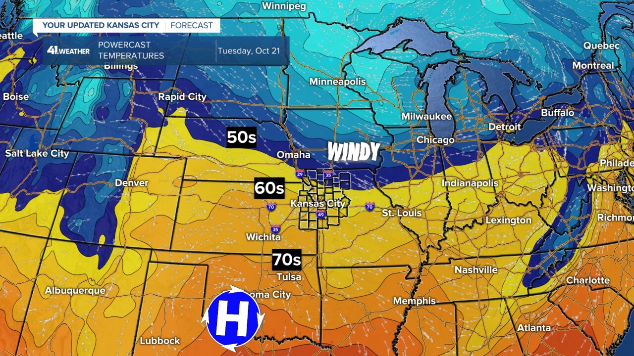
TODAY:
A cold front will push through today around noon with hardly a cloud but plenty of wind.
This creates rapid drying conditions as we will see 100% sunshine and southwest wind 15-30 mph shifting to the northwest at 10-20 mph, along with humidity in the 35% to 45%.
Highs will jump to the 70s by noon, before the front moves through. It is not a strong front, so temperatures will drift back to the upper 60s after the front.

TUESDAY:
It will be a nice fall day with 100% sunshine, northwest wind at 10-20 mph and highs in the mid-60s.
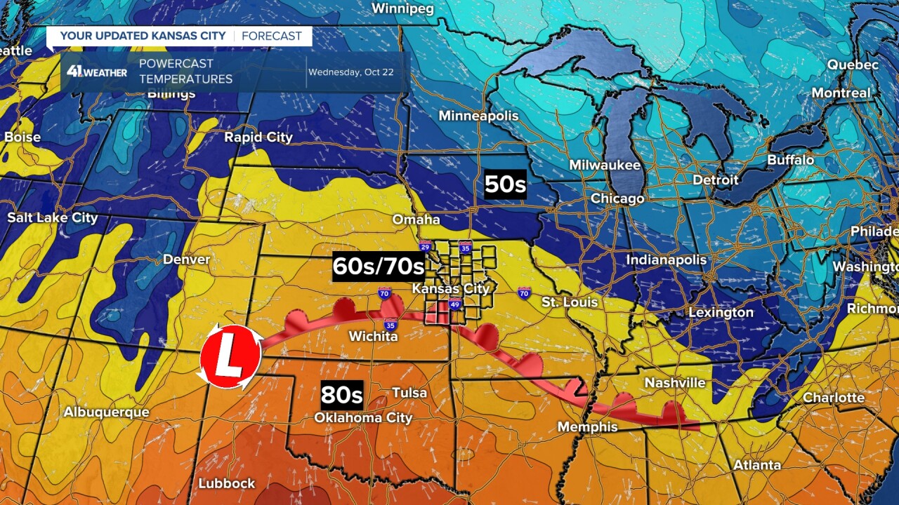
WEDNESDAY:
It will still be sunny, but a low-pressure system will form in the southwest Plains with a warm front extending to the east.
This is happening as the one storm system we are tracking approaches.
Highs will be 65°-70°.
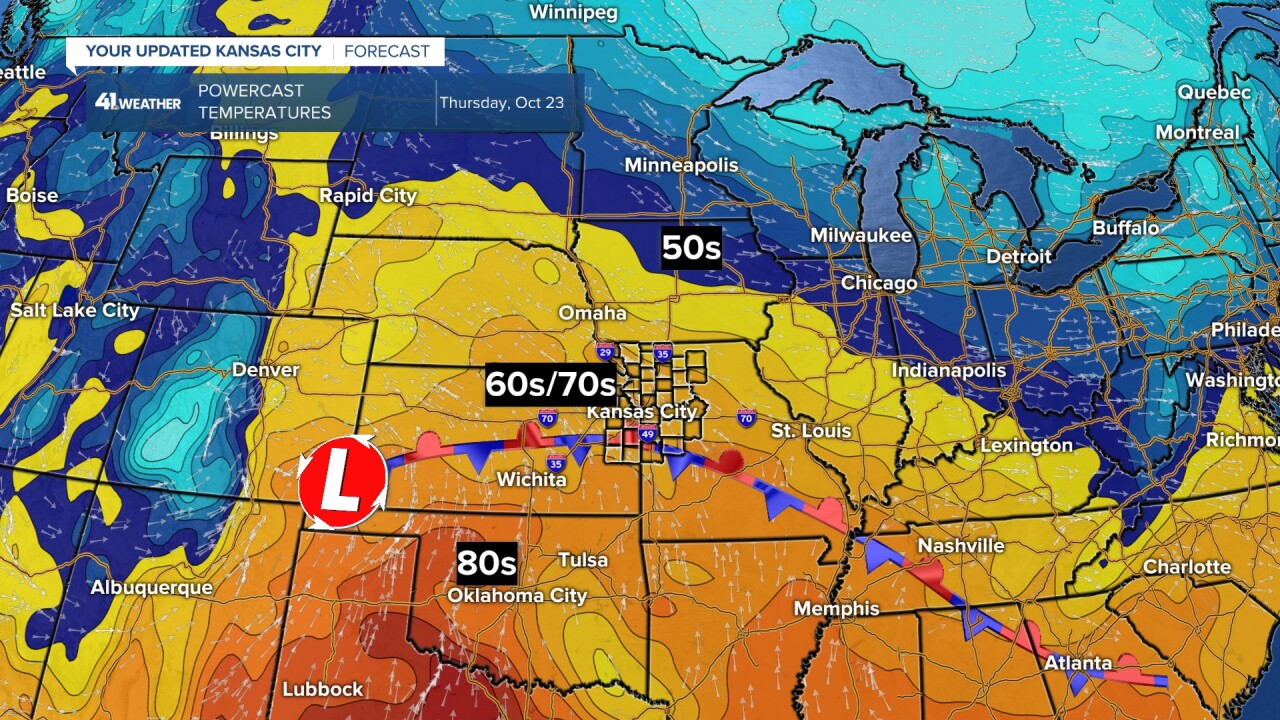
THURSDAY:
The low and front will still be sitting in place as Gulf moisture increases. Clouds will increase with highs around 70°.
THURSDAY NIGHT-FRIDAY:
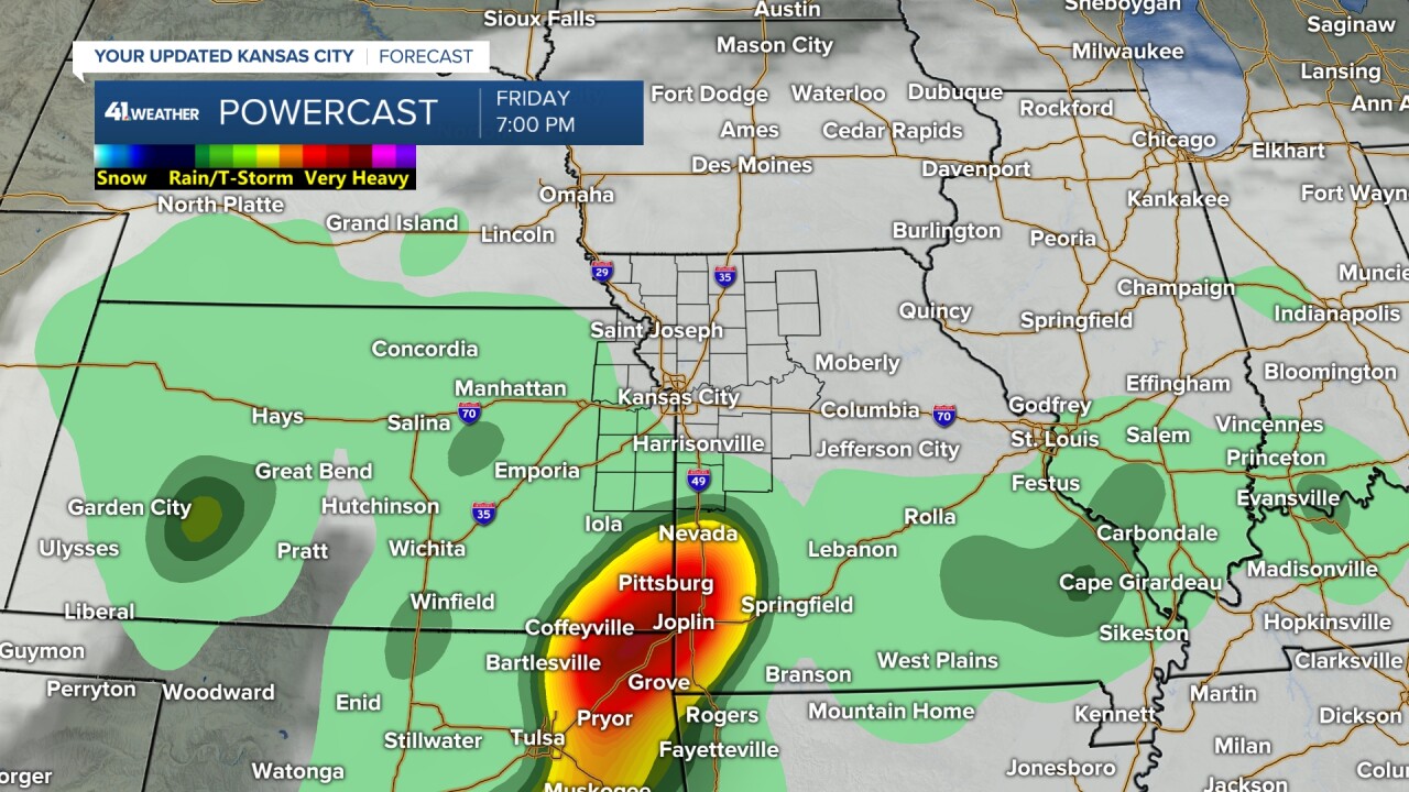
The storm system will track into the Plains from the southwest. A band of heavier rain will move into eastern Kansas and western Missouri.
But notice from St. Joseph, Missouri, and north, there is no rain. There are some models that have this system tracking 100 miles farther south.
So there is no guarantee the Kansas City area sees decent rain. This system does have the potential to bring around 1" of rain.

This system is not that strong and will be in a weakening phase. Regardless whether we get into the decent rain Thursday night, Friday-Saturday will be mostly cloudy with a few rain showers.
Lows will be in the 50s with highs in the 50s and low 60s.
Have a great week ahead.
Stay healthy.
—
