


Good Tuesday, bloggers,
Before we get to the weather, we will talk about some astronomy. We have the Perseid meteor peaking tonight and Wednesday night, and also Jupiter and Venus are very close together in the morning sky.
PERSEID METEOR SHOWER:
The Perseid meteor shower is caused by the Earth traveling through the tail of comet Swift-Tuttle. The tail is made of rocks, and when those rocks hit the atmosphere and fall toward Earth, they burn up, causing a flash.
The peak is tonight and Wednesday night. The clouds should not be a big issue, but the moon may be an issue as it will be near 90% illuminated tonight and 80% Wednesday night. This will prevent you from seeing the small meteors.
If you go out to see the meteor shower tonight or Wednesday night, try to find a location that blocks the moon, like a tree, and you may see more meteors.
The evening of Aug. 16, the moon rises after midnight, so it will be dark at that time to see more meteors even though it is past peak. The sky should be clear enough Saturday night.

JUPITER/VENUS:
The next few mornings in the eastern sky, these planets will be around 1° apart. We caught them on our skyview this morning, pretty cool.

Now, to things closer to where we live, the weather.
We are tracking one last chance to see a few thunderstorms, then a return of the heat and out-of-control humidity.
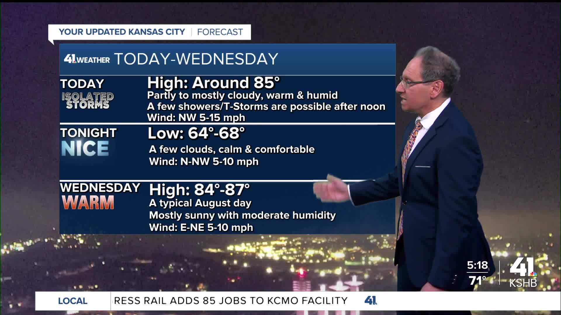
TODAY:
There is a small disturbance this morning west of Salina. It is producing a small area of heavy thunderstorms. There was a flash flood warning between Salina and Hays this morning.
This disturbance will track toward us this afternoon but weaken. So we do have a chance to see a few thunderstorms this afternoon.

Highs today will be around 85° under a partly to mostly cloudy sky. Again, a few thunderstorms are possible between noon and 8 p.m.

WEDNESDAY-THURSDAY:
These will be nice summer days. We will see more sunshine with highs in the mid to upper 80s. The humidity will be moderate.


FRIDAY-SATURDAY:
These look to be the hottest days of the next 10 days as highs climb to the mid-90s. But, as we have seen this summer, due to all the rain, it is not the heat but the humidity.
Highs in the mid-90s in mid-August are nothing unusual. But the extreme humidity, while not unusual, is a bit rare to have return every time it gets hot.
The wet summer is solely responsible for that. So heat index values Friday and Saturday will be 105° to 115°.


SUNDAY-MONDAY:
A cold front will be drifting in. This will increase the chance of thunderstorms and decrease the temperature. Highs behind the front may be only in the 60s and 70s.
Now, two things. One, we will not get that cool when the front pushes through, as the cooler air will moderate. Two, new data is suggesting this front will be weaker and may take until Tuesday or Wednesday to get here. If the slower solution is right, we will see the hot air last into Sunday and Monday.


Have a great rest of your week.
Stay healthy.
—
